|
Petrified Forest Of Lesbos
The Lesvos Petrified Forest is a petrified wood forest on the island of Lesbos, Greece. The forest was formed from the fossilized remains of plants and trees, which can be found in many localities on the western part of Lesbos Island. Finds now include a 19.5 metre tree complete with some roots and branches and leaves, as well as, 150 fossilised logs. The area enclosed by the villages of Eressos, Antissa and Sigri is very dense in fossilized tree trunks, and forms the area designated as the Petrified Forest of Lesbos, which is managed by the Natural History Museum of the Lesvos Petrified Forest, and has been designated as a protected natural monument. Isolated plant fossils can be found in many other parts of the island, including the villages of Molyvos, Polichnitos, Plomari and Akrasi. The forest is a major geosite of Lesvos Geopark. Formation The petrified forest was formed by successive volcanic eruptions which took place between 17 and 20 million years ago, covering a ... [...More Info...] [...Related Items...] OR: [Wikipedia] [Google] [Baidu] |
Polichnitos
Polichnitos ( el, Πολίχνιτος) is a town and a former municipality on the island of Lesbos, North Aegean, Greece Greece,, or , romanized: ', officially the Hellenic Republic, is a country in Southeast Europe. It is situated on the southern tip of the Balkans, and is located at the crossroads of Europe, Asia, and Africa. Greece shares land borders wi .... Since the 2019 local government reform it is part of the municipality West Lesbos, of which it is a municipal unit. Population 4,234 (2001). The municipal unit is located in the central south coast of the island, adjacent to the south side of the Bay of Kalloni. It has a land area of 172.629 km2. Its municipal seat is in the town of Polichnítos (pop. 2,102). The next largest villages are Vrísa (617), Vasiliká (400), and Lisvóri (408). References External linksLocal website Populated places in Lesbos {{NorthAegean-geo-stub ... [...More Info...] [...Related Items...] OR: [Wikipedia] [Google] [Baidu] |
Petrified Forests
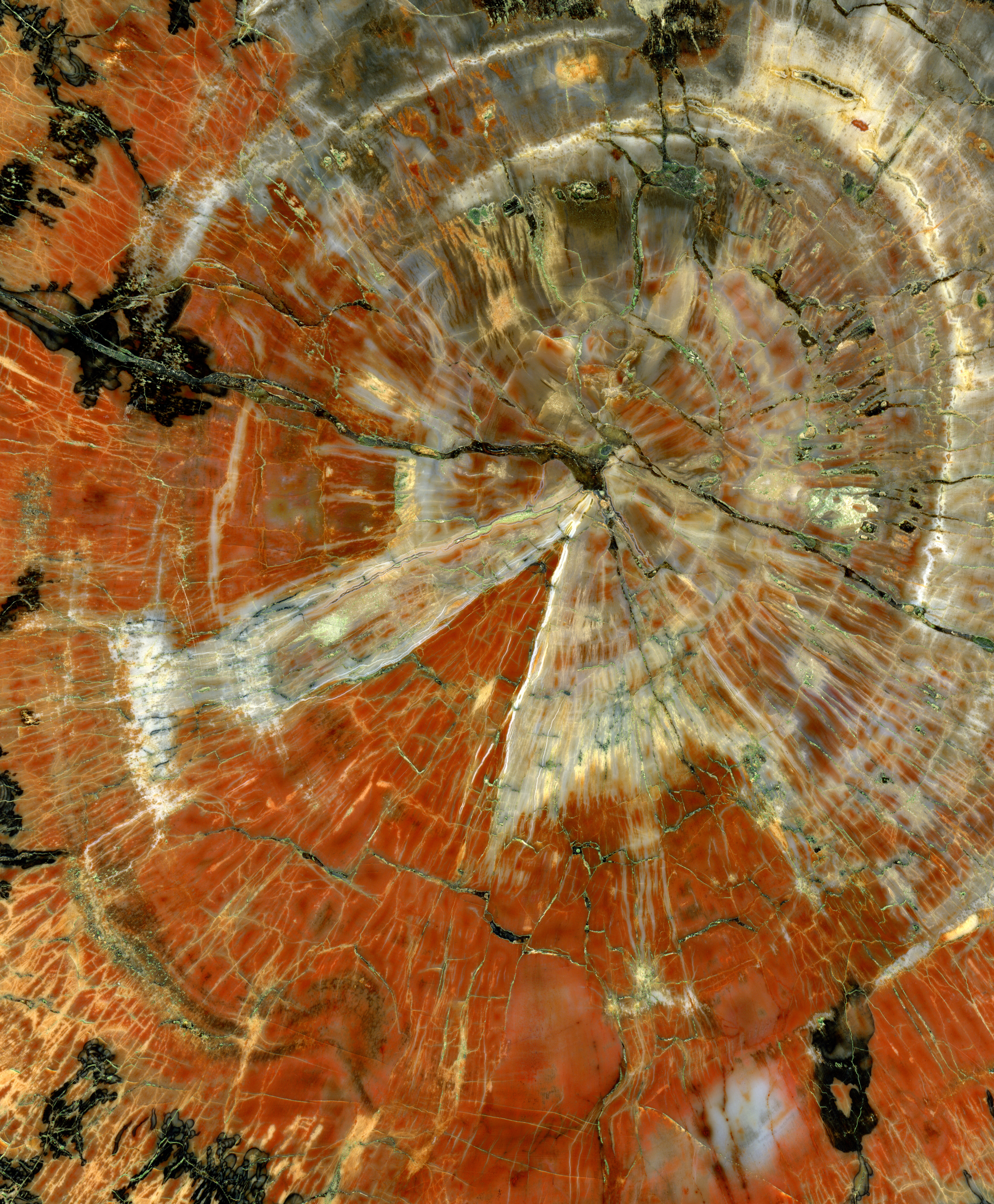
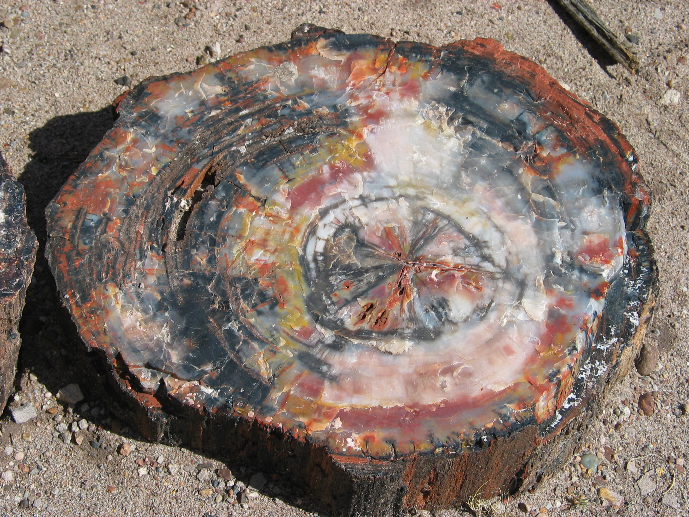
Petrified wood, also known as petrified tree (from Ancient Greek meaning 'rock' or 'stone'; literally 'wood turned into stone'), is the name given to a special type of '' fossilized wood'', the fossilized remains of terrestrial vegetation. '' Petrifaction'' is the result of a tree or tree-like plants having been replaced by stone via a mineralization process that often includes permineralization and replacement. The organic materials making up cell walls have been replicated with minerals (mostly silica in the form of opal, chalcedony, or quartz). In some instances, the original structure of the stem tissue may be partially retained. Unlike other plant fossils, which are typically impressions or compressions, petrified wood is a three-dimensional representation of the original organic material. The petrifaction process occurs underground, when wood becomes buried in water-saturated sediment or volcanic ash. The presence of water reduces the availability of oxygen which inhi ... [...More Info...] [...Related Items...] OR: [Wikipedia] [Google] [Baidu] |
Tourist Attractions In The North Aegean
Tourism is travel for pleasure or business; also the theory and practice of touring, the business of attracting, accommodating, and entertaining tourists, and the business of operating tours. The World Tourism Organization defines tourism more generally, in terms which go "beyond the common perception of tourism as being limited to holiday activity only", as people "travelling to and staying in places outside their usual environment for not more than one consecutive year for leisure and not less than 24 hours, business and other purposes". Tourism can be domestic (within the traveller's own country) or international, and international tourism has both incoming and outgoing implications on a country's balance of payments. Tourism numbers declined as a result of a strong economic slowdown (the late-2000s recession) between the second half of 2008 and the end of 2009, and in consequence of the outbreak of the 2009 H1N1 influenza virus, but slowly recovered until the COVID-19 ... [...More Info...] [...Related Items...] OR: [Wikipedia] [Google] [Baidu] |
Parks In Greece
A park is an area of natural, semi-natural or planted space set aside for human enjoyment and recreation or for the protection of wildlife or natural habitats. Urban parks are green spaces set aside for recreation inside towns and cities. National parks and country parks are green spaces used for recreation in the countryside. State parks and provincial parks are administered by sub-national government states and agencies. Parks may consist of grassy areas, rocks, soil and trees, but may also contain buildings and other artifacts such as monuments, fountains or playground structures. Many parks have fields for playing sports such as baseball and football, and paved areas for games such as basketball. Many parks have trails for walking, biking and other activities. Some parks are built adjacent to bodies of water or watercourses and may comprise a beach or boat dock area. Urban parks often have benches for sitting and may contain picnic tables and barbecue grills. The ... [...More Info...] [...Related Items...] OR: [Wikipedia] [Google] [Baidu] |
Forests Of Greece
A forest is an area of land dominated by trees. Hundreds of definitions of forest are used throughout the world, incorporating factors such as tree density, tree height, land use, legal standing, and ecological function. The United Nations' Food and Agriculture Organization (FAO) defines a forest as, "Land spanning more than 0.5 hectares with trees higher than 5 meters and a canopy cover of more than 10 percent, or trees able to reach these thresholds ''in situ''. It does not include land that is predominantly under agricultural or urban use." Using this definition, '' Global Forest Resources Assessment 2020'' (FRA 2020) found that forests covered , or approximately 31 percent of the world's land area in 2020. Forests are the predominant terrestrial ecosystem of Earth, and are found around the globe. More than half of the world's forests are found in only five countries (Brazil, Canada, China, Russia, and the United States). The largest share of forests (45 percent) are in th ... [...More Info...] [...Related Items...] OR: [Wikipedia] [Google] [Baidu] |
Petrified Forest Of Evia
In geology, petrifaction or petrification () is the process by which organic material becomes a fossil through the replacement of the original material and the filling of the original pore spaces with minerals. Petrified wood typifies this process, but all organisms, from bacteria to vertebrates, can become petrified (although harder, more durable matter such as bone, beaks, and shells survive the process better than softer remains such as muscle tissue, feathers, or skin). Petrifaction takes place through a combination of two similar processes: permineralization and replacement. These processes create replicas of the original specimen that are similar down to the microscopic level. Processes Permineralization One of the processes involved in petrifaction is permineralization. The fossils created through this process tend to contain a large amount of the original material of the specimen. This process occurs when groundwater containing dissolved minerals (most commonly ... [...More Info...] [...Related Items...] OR: [Wikipedia] [Google] [Baidu] |
Petrified Forest National Park
Petrified Forest National Park is an American national park in Navajo County, Arizona, Navajo and Apache County, Arizona, Apache counties in northeastern Arizona. Named for its large deposits of petrified wood, the park covers about , encompassing semi-desert shrub steppe as well as highly eroded and colorful badlands. The park's headquarters is about east of Holbrook, Arizona, Holbrook along Interstate 40 (I-40), which parallels the BNSF Railway's Southern Transcon, the Puerco River, and historic U.S. Route 66, all crossing the park roughly east–west. The site, the northern part of which extends into the Painted Desert, Arizona, Painted Desert, was declared a National monument (United States), national monument in 1906 and a national park in 1962. The park received 644,922 recreational visitors in 2018. Averaging about in elevation, the park has a dry windy climate with temperatures that vary from summer highs of about to winter lows well below freezing. More than 400 specie ... [...More Info...] [...Related Items...] OR: [Wikipedia] [Google] [Baidu] |
International Union Of Geological Sciences
The International Union of Geological Sciences (IUGS) is an international non-governmental organization devoted to international cooperation in the field of geology. About The IUGS was founded in 1961 and is a Scientific Union member of the International Science Council (ISC), formerly the International Council for Science (ICSU), which it recognizes as the co-ordinating body for the international organization of science. Currently geologists from 121 countries (and regions) are represented in the IUGS. A broad range of scientific topics are covered by its commission, task groups, joint programmes and affiliated organizations. IUGS promotes and encourages the study of geological problems, especially those of worldwide significance, and supports and facilitates international and inter-disciplinary co-operation in the earth sciences. The Union's Secretariat is currently located at the Chinese Academy of Geological Sciences in Beijing, China. Activities IUGS is a joint partner wit ... [...More Info...] [...Related Items...] OR: [Wikipedia] [Google] [Baidu] |
UNESCO
The United Nations Educational, Scientific and Cultural Organization is a specialized agency of the United Nations (UN) aimed at promoting world peace and security through international cooperation in education, arts, sciences and culture. It has 193 member states and 12 associate members, as well as partners in the non-governmental, intergovernmental and private sector. Headquartered at the World Heritage Centre in Paris, France, UNESCO has 53 regional field offices and 199 national commissions that facilitate its global mandate. UNESCO was founded in 1945 as the successor to the League of Nations's International Committee on Intellectual Cooperation.English summary). Its constitution establishes the agency's goals, governing structure, and operating framework. UNESCO's founding mission, which was shaped by the Second World War, is to advance peace, sustainable development and human rights by facilitating collaboration and dialogue among nations. It pursues this objectiv ... [...More Info...] [...Related Items...] OR: [Wikipedia] [Google] [Baidu] |
Lesvos Geopark
Lesbos or Lesvos ( el, Λέσβος, Lésvos ) is a Greek island located in the northeastern Aegean Sea. It has an area of with approximately of coastline, making it the third largest island in Greece. It is separated from Asia Minor by the narrow Mytilini Strait. On the southeastern coast lies the island's capital and largest city, Mytilene, whose name is also used as a moniker for the island. The regional unit of Lesbos, with the seat in Mytilene, comprises the islands of Lesbos, Chios, Ikaria, Lemnos, and Samos. Mytilene is also the capital of the larger North Aegean region. The population of the island is 83,068, a third of whom live in the capital, while the remainder is distributed in small towns and villages. The largest are Plomari, Kalloni, the Gera Villages, Agiassos, Eresos, and Molyvos (the ancient Mythimna). According to later Greek writers, Mytilene was founded in the 11th century BC by the family Penthilidae, who arrived from Thessaly and ruled the city-state u ... [...More Info...] [...Related Items...] OR: [Wikipedia] [Google] [Baidu] |
Plomari
Plomari ( el, Πλωμάρι) is a town and a former municipality on the island of Lesbos, North Aegean, Greece. Since the 2019 local government reform it is part of the municipality Mytilene, of which it is a municipal unit. It is the only sizable coastal settlement in the south, and the second largest town on Lesbos. The municipal unit of Plomari is the southernmost on Lesbos island and has a land area of 122.452 km2 and a 2011 census population of 5,602. Its largest towns or villages are Plomári, the former municipal seat (pop. 2,996), Plagiá (529), Palaiochóri (314), Megalochóri (325), and Akrási (214). Description Plomari is located due south of Mount Olympos. It offers scenic appeal as well as the presence of its famous ouzo-distilling industry. Brands can be sampled at the traditional kafenia. The local festival (or "panigiri") season kicks off in mid-July with an ouzo festival, and culminates towards the end month in celebrations honouring Agios Haralambos ... [...More Info...] [...Related Items...] OR: [Wikipedia] [Google] [Baidu] |


