|
Penton Hook Lock
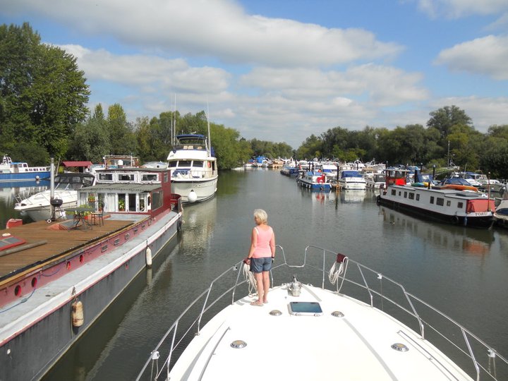
Penton Hook Lock is the sixth lowest lock of forty four on the non-tidal reaches of the River Thames in England. It faces an island which was until its construction a pronounced meander (a hook) and is on the site of its seasonal cutoff. It is against the left bank marking the church parish medieval border of Laleham and Staines upon Thames in Surrey for many centuries. Until 1965 their county was Middlesex. At it is the third longest lock on the river. A bend 1000 yards (900 metres) upstream of the lock, Silvery Sands, hosts Staines Regatta in the sport of rowing annually. On the opposite bank in Thorpe is Penton Hook Marina which occupies lakes once land used for gravel extraction. History Problems were long caused in erosion and to navigation by floodwaters topping the neck of the meander (a seasonal meander cutoff). The Corporation promoted the funding of the lock with formalised weirs in 1809, and Parliament passed its enabling act 1814.'Staines: Introducti ... [...More Info...] [...Related Items...] OR: [Wikipedia] [Google] [Baidu] |
River Thames
The River Thames ( ), known alternatively in parts as the The Isis, River Isis, is a river that flows through southern England including London. At , it is the longest river entirely in England and the Longest rivers of the United Kingdom, second-longest in the United Kingdom, after the River Severn. The river rises at Thames Head in Gloucestershire, and flows into the North Sea near Tilbury, Essex and Gravesend, Kent, via the Thames Estuary. From the west it flows through Oxford (where it is sometimes called the Isis), Reading, Berkshire, Reading, Henley-on-Thames and Windsor, Berkshire, Windsor. The Thames also drains the whole of Greater London. In August 2022, the source of the river moved five miles to beyond Somerford Keynes due to the heatwave in July 2022. The lower reaches of the river are called the Tideway, derived from its long tidal reach up to Teddington Lock. Its tidal section includes most of its London stretch and has a rise and fall of . From Oxford to th ... [...More Info...] [...Related Items...] OR: [Wikipedia] [Google] [Baidu] |
Penton Hook Marina
Penton Hook Marina is the largest inland marina in Britain. It is situated on the River Thames in Surrey between Staines and Chertsey on the western bank of the river and is close to Thorpe Park. It is on the reach above Chertsey Lock and opposite Penton Hook Island. The marina is set in 80 acres of what were previously disused gravel pits. It has approximately 600 berths. The marina is downstream from Runnymede where King John signed ''Magna Carta (Medieval Latin for "Great Charter of Freedoms"), commonly called (also ''Magna Charta''; "Great Charter"), is a royal charter of rights agreed to by King John of England at Runnymede, near Windsor, on 15 June 1215. First drafted by the ...''. References Marinas in England Geography of the River Thames {{Surrey-geo-stub ... [...More Info...] [...Related Items...] OR: [Wikipedia] [Google] [Baidu] |
Norman Conquest
The Norman Conquest (or the Conquest) was the 11th-century invasion and occupation of England by an army made up of thousands of Norman, Breton, Flemish, and French troops, all led by the Duke of Normandy, later styled William the Conqueror. William's claim to the English throne derived from his familial relationship with the childless Anglo-Saxon king Edward the Confessor, who may have encouraged William's hopes for the throne. Edward died in January 1066 and was succeeded by his brother-in-law Harold Godwinson. The Norwegian king Harald Hardrada invaded northern England in September 1066 and was victorious at the Battle of Fulford on 20 September, but Godwinson's army defeated and killed Hardrada at the Battle of Stamford Bridge on 25 September. Three days later on 28 September, William's invasion force of thousands of men and hundreds of ships landed at Pevensey in Sussex in southern England. Harold marched south to oppose him, leaving a significant portion of his ... [...More Info...] [...Related Items...] OR: [Wikipedia] [Google] [Baidu] |
Windsor, Berkshire
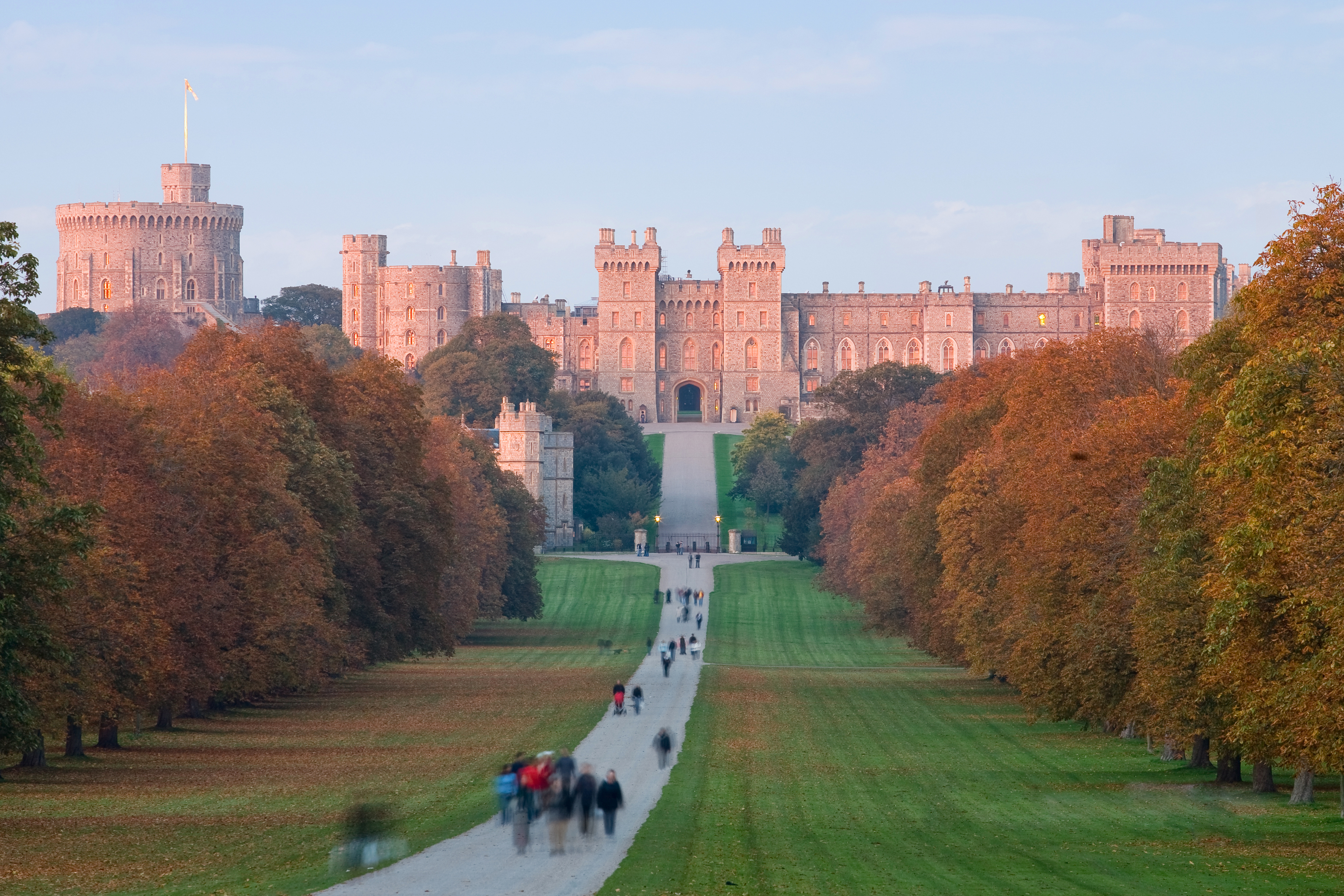
Windsor is a historic market town and unparished area in the Royal Borough of Windsor and Maidenhead in Berkshire, England. It is the site of Windsor Castle, one of the official residences of the British monarch. The town is situated west of Charing Cross, central London, southeast of Maidenhead, and east of the county town of Reading. It is immediately south of the River Thames, which forms its boundary with its smaller, ancient twin town of Eton. The village of Old Windsor, just over to the south, predates what is now called Windsor by around 300 years; in the past Windsor was formally referred to as New Windsor to distinguish the two. Etymology ''Windlesora'' is first mentioned in the ''Anglo-Saxon Chronicle.'' (The settlement had an earlier name but this is unknown.) The name originates from old English ''Windles-ore'' or ''winch by the riverside''.South S.R., ''The Book of Windsor'', Barracuda Books, 1977. By 1110, meetings of the Great Council, which had previousl ... [...More Info...] [...Related Items...] OR: [Wikipedia] [Google] [Baidu] |
Maidenhead
Maidenhead is a market town in the Royal Borough of Windsor and Maidenhead in the county of Berkshire, England, on the southwestern bank of the River Thames. It had an estimated population of 70,374 and forms part of the border with southern Buckinghamshire. The town is situated west of Charing Cross, London and east-northeast of the county town of Reading, Berkshire, Reading. The town differs from the Maidenhead (UK Parliament constituency), Parliamentary constituency of Maidenhead, which includes a number of outer suburbs and villages (including parts of Wokingham and Reading) such as Twyford, Berkshire, Twyford, Charvil, Remenham, Ruscombe and Wargrave. History The antiquary John Leland (antiquary), John Leland claimed that the area around Maidenhead's present town centre was a small Roman settlement called Alaunodunum. He stated that it had all but disappeared by the end of the Roman occupation. Although his source is unknown, there is documented and physical evidence ... [...More Info...] [...Related Items...] OR: [Wikipedia] [Google] [Baidu] |
Jubilee River
The Jubilee River is a hydraulic channel in southern England. It is long and is on average wide. It was constructed in the late 1990s and early 2000s to take overflow from the River Thames and so alleviate flooding to areas in and around the towns of Maidenhead, Windsor, and Eton in the counties of Berkshire and Buckinghamshire. It achieves this by taking water from the left (at this point eastern) bank of the Thames upstream of Boulter's Lock near Maidenhead and returning it via the north bank downstream of Eton. Although successful in its stated aims, residents of villages downstream, such as Wraysbury, claim it has increased flooding in those locations. Construction Parts of the towns of Windsor, Eton and Maidenhead are prone to flooding, because they are built on the flood plain of the River Thames. The concept of a parallel channel which could take water from the Thames above Maidenhead and return it below Windsor was conceived in the 1980s, and became known as the Maid ... [...More Info...] [...Related Items...] OR: [Wikipedia] [Google] [Baidu] |
Bunding
Bunding, also called a bund wall, is a constructed retaining wall around storage "where potentially polluting substances are handled, processed or stored, for the purposes of containing any unintended escape of material from that area until such time as a remedial action can be taken."EPA Guidance Note on Storage and Transfer of Materials for Scheduled Activities page 7 Liquid containment The term can also refer to , but it is frequently used to describe liquid containment facilities that prevent leaks and spillage from s and |
Laleham Burway
Laleham Burway is a tract of water-meadow and former water-meadow between the River Thames and Abbey River in the far north of Chertsey in Surrey. Its uses are varied. Part is Laleham Golf Club. Semi-permanent park homes in the west forms residential development along with a brief row of houses with gardens against the Thames. A reservoir and water works is on the island. From at least the year 1278 its historic bulky northern definition formed part of the dominant estate of Laleham across the river, its manor, to which it was linked by a ferry until the early 20th century. Its owner in period from the mid-19th until the early 20th century was thus the Earl of Lucan; however when its manor house was sold to become Laleham Abbey, a short-lived nunnery, its tenants had taken it over or it was sold for public works. The southern part of the effective island sharing the name of the Burway or Laleham Burway was the Abbey Mead. It was kept since the seventh century among many square ... [...More Info...] [...Related Items...] OR: [Wikipedia] [Google] [Baidu] |
Spate
Spate is a surname, and may refer to: * Clive Spate (born 1952), British game show contestant * Oskar Spate (1911–2000), geographer * Virginia Spate (1937–2022), Australian art historian * Ute Späte (born 1961), German chess master Spate may also refer to a flood. See also * Pate (other) * Spade (other) A spade is a digging and gardening tool. Spade or Spades may also refer to: Cards * Spades (card game), a trick-taking card game *Spades (suit), one of the four French suits commonly used in playing cards Music * '' The Spade'', a 2011 studio al ... * Spat (other) {{surname ... [...More Info...] [...Related Items...] OR: [Wikipedia] [Google] [Baidu] |
Leat
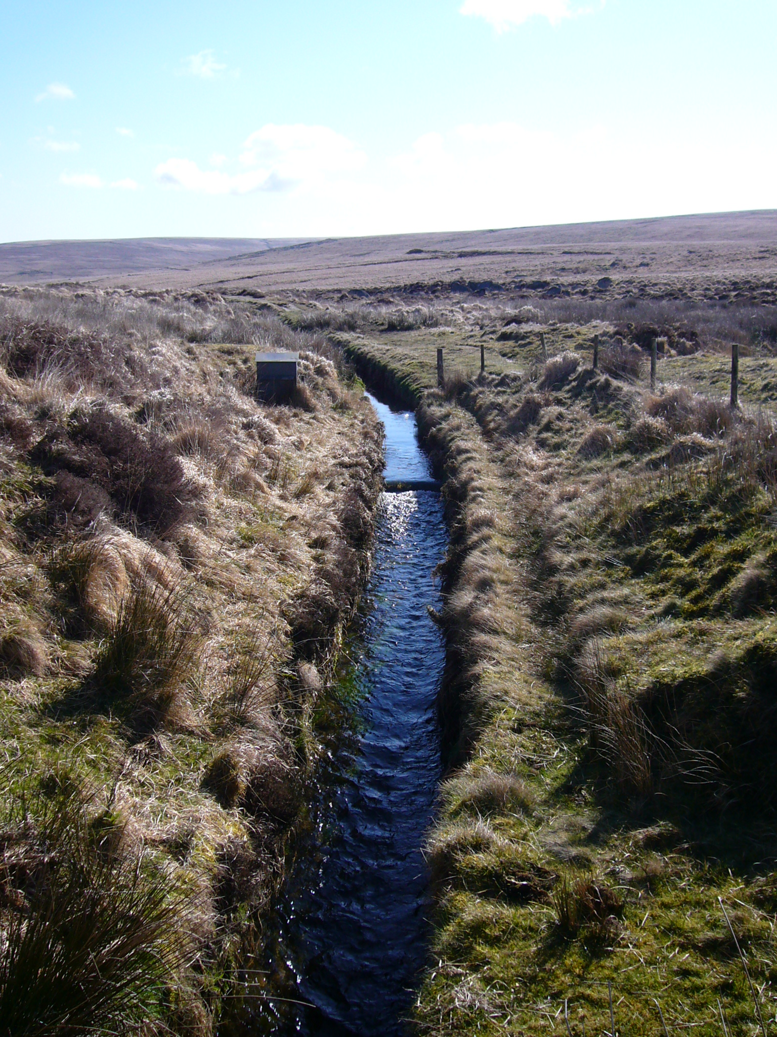
A leat (; also lete or leet, or millstream) is the name, common in the south and west of England and in Wales, for an artificial watercourse or aqueduct dug into the ground, especially one supplying water to a watermill or its mill pond. Other common uses for leats include delivery of water for hydraulic mining and mineral concentration, for irrigation, to serve a dye works or other industrial plant, and provision of drinking water to a farm or household or as a catchment cut-off to improve the yield of a reservoir. According to the ''Oxford English Dictionary'', ''leat'' is cognate with ''let'' in the sense of "allow to pass through". Other names for the same thing include ''fleam'' (probably a leat supplying water to a mill that did not have a millpool). In parts of northern England, for example around Sheffield, the equivalent word is ''goit''. In southern England, a leat used to supply water for water-meadow irrigation is often called a ''carrier'', ''top carrier'', or ' ... [...More Info...] [...Related Items...] OR: [Wikipedia] [Google] [Baidu] |


