|
Pennsylvania Furnace, Pennsylvania
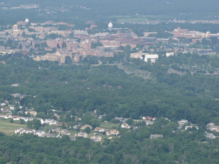
Pennsylvania Furnace is an unincorporated community located in Franklin Township, Huntingdon County and in Ferguson Township, Centre County, Pennsylvania, United States. The community is located along Pennsylvania Route 45, southwest of State College. Pennsylvania Furnace has a post office, located in Centre County, with ZIP code 16865. See also * Warwick Furnace Farms * Samuel Van Leer Captain Samuel Van Leer (January 7, 1747 – October 15, 1825) was a military officer from Pennsylvania who served as a captain in the Continental Army during the American Revolutionary War and as lieutenant in the Chester County Light Horse Volu ... References Unincorporated communities in Huntingdon County, Pennsylvania Unincorporated communities in Pennsylvania {{HuntingdonCountyPA-geo-stub ... [...More Info...] [...Related Items...] OR: [Wikipedia] [Google] [Baidu] |
List Of Sovereign States
The following is a list providing an overview of sovereign states around the world with information on their status and recognition of their sovereignty. The 206 listed states can be divided into three categories based on membership within the United Nations System: 193 UN member states, 2 UN General Assembly non-member observer states, and 11 other states. The ''sovereignty dispute'' column indicates states having undisputed sovereignty (188 states, of which there are 187 UN member states and 1 UN General Assembly non-member observer state), states having disputed sovereignty (16 states, of which there are 6 UN member states, 1 UN General Assembly non-member observer state, and 9 de facto states), and states having a special political status (2 states, both in free association with New Zealand). Compiling a list such as this can be a complicated and controversial process, as there is no definition that is binding on all the members of the community of nations concerni ... [...More Info...] [...Related Items...] OR: [Wikipedia] [Google] [Baidu] |
Geographic Names Information System
The Geographic Names Information System (GNIS) is a database of name and locative information about more than two million physical and cultural features throughout the United States and its territories, Antarctica, and the associated states of the Marshall Islands, Federated States of Micronesia, and Palau. It is a type of gazetteer. It was developed by the United States Geological Survey (USGS) in cooperation with the United States Board on Geographic Names (BGN) to promote the standardization of feature names. Data were collected in two phases. Although a third phase was considered, which would have handled name changes where local usages differed from maps, it was never begun. The database is part of a system that includes topographic map names and bibliographic references. The names of books and historic maps that confirm the feature or place name are cited. Variant names, alternatives to official federal names for a feature, are also recorded. Each feature receives a per ... [...More Info...] [...Related Items...] OR: [Wikipedia] [Google] [Baidu] |
Samuel Van Leer
Captain Samuel Van Leer (January 7, 1747 – October 15, 1825) was a military officer from Pennsylvania who served as a captain in the Continental Army during the American Revolutionary War and as lieutenant in the Chester County Light Horse Volunteers from 1781 to 1785. After his retirement from the military, he owned the Reading Furnace ironworks. He was a member of the influential Van Leer family. His father Bernardhus Van Leer was an early settler of the Province of Pennsylvania. He married the sister of American Revolutionary War General Anthony Wayne. His son Isaac Van Leer was a U.S. Congressman. Early life Van Leer was born in 1747 in Marple Township, Province of Pennsylvania, British America to Mary (Branson) and Bernardhus Van Leer. His maternal grandfather is William Branson who was an ironworks pioneer and owned the historical home Warrenpoint. In 1770, Samuel married Hannah Wayne, daughter to Isaac Wayne and sister to Anthony Wayne. American Revolutionary War Van ... [...More Info...] [...Related Items...] OR: [Wikipedia] [Google] [Baidu] |
Warwick Furnace Farms
Warwick Furnace Farms is a historic district in northern Chester County, Pennsylvania that includes the ruins of an early iron furnace owned by Anna Rutter Nutt, widow of Samuel Nutt. The ironmaster's house and workers' houses, as well as a historic farmhouse and barns now used in the operation of a working farm. Anna Rutter Nutt was the daughter of Thomas Rutter, who erected the first ironwork in Pennsylvania. Samuel Nutt bought the original tracts of land for a Coventry with partners William Branson and Mordecai Lincoln, the great great grandfather of Abraham Lincoln. The furnace was managed by George Taylor when the first Franklin Stoves were cast here. The furnace operated through the 1860s and supplied the iron used in the iron-clad ship the USS Monitor during the Civil War.M. Bennett, M. Busenkell, F.L. Edmunds, E. Morris, K. Murphy, and V. Stoudt, 1976, NRHP Nomination Form for Warwick Furnace Farm/ref> The 786 acre historic district was listed by the National Register of ... [...More Info...] [...Related Items...] OR: [Wikipedia] [Google] [Baidu] |
United States Postal Service
The United States Postal Service (USPS), also known as the Post Office, U.S. Mail, or Postal Service, is an independent agency of the executive branch of the United States federal government responsible for providing postal service in the U.S., including its insular areas and associated states. It is one of the few government agencies explicitly authorized by the U.S. Constitution. The USPS, as of 2021, has 516,636 career employees and 136,531 non-career employees. The USPS traces its roots to 1775 during the Second Continental Congress, when Benjamin Franklin was appointed the first postmaster general; he also served a similar position for the colonies of the Kingdom of Great Britain. The Post Office Department was created in 1792 with the passage of the Postal Service Act. It was elevated to a cabinet-level department in 1872, and was transformed by the Postal Reorganization Act of 1970 into the U.S. Postal Service as an independent agency. Since the early 1980s, m ... [...More Info...] [...Related Items...] OR: [Wikipedia] [Google] [Baidu] |
Post Office
A post office is a public facility and a retailer that provides mail services, such as accepting letters and parcels, providing post office boxes, and selling postage stamps, packaging, and stationery. Post offices may offer additional services, which vary by country. These include providing and accepting government forms (such as passport applications), and processing government services and fees (such as road tax, postal savings, or bank fees). The chief administrator of a post office is called a postmaster. Before the advent of postal codes and the post office, postal systems would route items to a specific post office for receipt or delivery. During the 19th century in the United States, this often led to smaller communities being renamed after their post offices, particularly after the Post Office Department began to require that post office names not be duplicated within a state. Name The term "post-office" has been in use since the 1650s, shortly after the legali ... [...More Info...] [...Related Items...] OR: [Wikipedia] [Google] [Baidu] |
State College, Pennsylvania
State College is a home rule municipality in Centre County in the Commonwealth of Pennsylvania. It is a college town, dominated economically, culturally and demographically by the presence of the University Park campus of the Pennsylvania State University (Penn State). State College is the largest designated borough in Pennsylvania. It is the principal borough of the six municipalities that make up the State College area, the largest settlement in Centre County and one of the principal cities of the greater State College-DuBois Combined Statistical Area with a combined population of 236,577 as of the 2010 U.S. census. In the 2010 census, the borough population was 42,034 with approximately 105,000 living in the borough plus the surrounding townships often referred to locally as the "Centre Region". Many of these Centre Region communities also carry a "State College, PA" address although they are not part of the borough of State College. "Happy Valley" and "Lion Country" are ... [...More Info...] [...Related Items...] OR: [Wikipedia] [Google] [Baidu] |
Pennsylvania Route 45
Pennsylvania Route 45 (PA 45) is an state highway located in central Pennsylvania, United States. PA 45 is called the Purple Heart Highway. The western terminus of the route is at PA 453 in Morris Township near the community of Water Street. The eastern terminus is at PA 642 west of the small town of Mooresburg. Route description Huntingdon and Centre counties PA 45 begins at an intersection with PA 453 and the western terminus of PA 45 Truck in Morris Township, Huntingdon County, heading northeast on two-lane undivided Spruce Creek Road. The road passes through farmland with some homes a short distance to the west of Short Mountain. The route crosses into Spruce Creek Township and heads into forested areas, curving northwest to run parallel to Norfolk Southern's Pittsburgh Line and the Little Juniata River which are both located northeast of the road. PA 45 turns northeast and comes to a one-lane underpass that carries the route under Norfolk Southern's Pittsburgh Line ... [...More Info...] [...Related Items...] OR: [Wikipedia] [Google] [Baidu] |
Unincorporated Area
An unincorporated area is a region that is not governed by a local municipal corporation. Widespread unincorporated communities and areas are a distinguishing feature of the United States and Canada. Most other countries of the world either have no unincorporated areas at all or these are very rare: typically remote, outlying, sparsely populated or List of uninhabited regions, uninhabited areas. By country Argentina In Argentina, the provinces of Chubut Province, Chubut, Córdoba Province (Argentina), Córdoba, Entre Ríos Province, Entre Ríos, Formosa Province, Formosa, Neuquén Province, Neuquén, Río Negro Province, Río Negro, San Luis Province, San Luis, Santa Cruz Province, Argentina, Santa Cruz, Santiago del Estero Province, Santiago del Estero, Tierra del Fuego Province, Argentina, Tierra del Fuego, and Tucumán Province, Tucumán have areas that are outside any municipality or commune. Australia Unlike many other countries, Australia has only local government in Aus ... [...More Info...] [...Related Items...] OR: [Wikipedia] [Google] [Baidu] |
Area Code 814
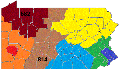
Area codes 814 and 582 are telephone area codes in the North American Numbering Plan (NANP) for the northwestern and central portions of the Commonwealth of Pennsylvania. Cities served by the area code include Altoona, Bradford, DuBois, Erie, Meadville, Oil City, Titusville, Johnstown, St. Marys, and Warren as well as the boroughs of State College, Brockway, Clearfield, Huntingdon, Mount Union, Bedford, Clarion, Punxsutawney, Tyrone, Ebensburg, Coudersport, Ridgway and Brookville. Area code 814 is the original area code assigned to the numbering plan area in 1947 and area code 582 was activated in the service area as an additional code to form an overlay plan with a starting date of October 3, 2020. History Area code 814 is one of the original North American area codes established in 1947. Its numbering plan area (NPA) is the largest in the state. It is the only one of Pennsylvania's original four NPAs that still has its original boundaries. The largest cities in the ... [...More Info...] [...Related Items...] OR: [Wikipedia] [Google] [Baidu] |
Pennsylvania
Pennsylvania (; ( Pennsylvania Dutch: )), officially the Commonwealth of Pennsylvania, is a state spanning the Mid-Atlantic, Northeastern, Appalachian, and Great Lakes regions of the United States. It borders Delaware to its southeast, Maryland to its south, West Virginia to its southwest, Ohio to its west, Lake Erie and the Canadian province of Ontario to its northwest, New York to its north, and the Delaware River and New Jersey to its east. Pennsylvania is the fifth-most populous state in the nation with over 13 million residents as of 2020. It is the 33rd-largest state by area and ranks ninth among all states in population density. The southeastern Delaware Valley metropolitan area comprises and surrounds Philadelphia, the state's largest and nation's sixth most populous city. Another 2.37 million reside in Greater Pittsburgh in the southwest, centered around Pittsburgh, the state's second-largest and Western Pennsylvania's largest city. The state's su ... [...More Info...] [...Related Items...] OR: [Wikipedia] [Google] [Baidu] |


