|
Pengelly
Pengelly ( kw, Penn-gelli) is a hamlet in north Cornwall, England, United Kingdom, part of the village and civil parish of Delabole which was until April 2021 in the parish of St Teath St Teath (; kw, Eglostedha) is a civil parish and village in north Cornwall, England, in the United Kingdom. Geography The village is situated approximately three miles (5 km) southwest of Camelford and seven miles (11 km) northeast o .... Once Pengelly was a settlement separate from the neighbouring hamlets of Medrose and Rockhead, but the three were merged with the introduction of the railway and the new village adopted the name Delabole. There are also places called Pengelly in the parishes of Breage, Crowan and St Ewe; the meaning of Pengelly is "end/top of a grove".Weatherhill, Craig (2009). ''A Concise Dictionary of Cornish Place-Names''. Westport, Co. Mayo: Evertype. ; p. 52. References *Philip's Navigator Britain (page 17) Hamlets in Cornwall {{Cornwall-geo ... [...More Info...] [...Related Items...] OR: [Wikipedia] [Google] [Baidu] |
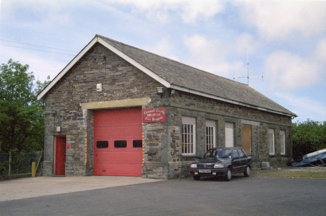
Delabole Fire Station - Geograph
Delabole ( kw, Delyow Boll) is a large village and civil parish in north Cornwall, England, UK. It is situated approximately two miles (3 km) west of Camelford. The village of Delabole came into existence in the early 20th-century; it is named after the #Delabole Quarry, Delabole Quarry. Three hamlets: Pengelly, Meadrose (pronounced "médroze") and Rockhead, and the hamlet of Delabole south of the quarry are shown on the earliest one-inch Ordnance Survey map of 1813. When the North Cornwall Railway#Delabole, railway arrived, the station was named Delabole railway station, Delabole after the quarry, and the three hamlets were absorbed into Delabole. It is said to be the third highest village in Cornwall. HMS Vulture II (Treligga Aerodrome), Treligga military airfield and HMS Vulture II, an aerial bombing and gunnery range, were situated west of the village. Delabole lies within the Cornwall Area of Outstanding Natural Beauty (AONB). Toponymy The name Delabole derives from ... [...More Info...] [...Related Items...] OR: [Wikipedia] [Google] [Baidu] |
Delabole
Delabole ( kw, Delyow Boll) is a large village and civil parish in north Cornwall, England, UK. It is situated approximately two miles (3 km) west of Camelford. The village of Delabole came into existence in the early 20th-century; it is named after the Delabole Quarry. Three hamlets: Pengelly, Meadrose (pronounced "médroze") and Rockhead, and the hamlet of Delabole south of the quarry are shown on the earliest one-inch Ordnance Survey map of 1813. When the railway arrived, the station was named Delabole after the quarry, and the three hamlets were absorbed into Delabole. It is said to be the third highest village in Cornwall. Treligga military airfield and HMS Vulture II, an aerial bombing and gunnery range, were situated west of the village. Delabole lies within the Cornwall Area of Outstanding Natural Beauty (AONB). Toponymy The name Delabole derives from the Cornish language, as do the names of the hamlets of Pengelly and Medrose which comprise today's village. Del ... [...More Info...] [...Related Items...] OR: [Wikipedia] [Google] [Baidu] |
Cornwall
Cornwall (; kw, Kernow ) is a historic county and ceremonial county in South West England. It is recognised as one of the Celtic nations, and is the homeland of the Cornish people. Cornwall is bordered to the north and west by the Atlantic Ocean, to the south by the English Channel, and to the east by the county of Devon, with the River Tamar forming the border between them. Cornwall forms the westernmost part of the South West Peninsula of the island of Great Britain. The southwesternmost point is Land's End and the southernmost Lizard Point. Cornwall has a population of and an area of . The county has been administered since 2009 by the unitary authority, Cornwall Council. The ceremonial county of Cornwall also includes the Isles of Scilly, which are administered separately. The administrative centre of Cornwall is Truro, its only city. Cornwall was formerly a Brythonic kingdom and subsequently a royal duchy. It is the cultural and ethnic origin of the Cornish dias ... [...More Info...] [...Related Items...] OR: [Wikipedia] [Google] [Baidu] |
St Teath
St Teath (; kw, Eglostedha) is a civil parish and village in north Cornwall, England, in the United Kingdom. Geography The village is situated approximately three miles (5 km) southwest of Camelford and seven miles (11 km) northeast of Wadebridge. The hamlet of Whitewell lies to the west. The parish population at the 2011 census was 2628. An electoral ward also exists which includes Delabole and St Breward; the population for this ward at the same census was 3,957. History Parish church The parish church is dedicated to Saint Tetha the Virgin, a 5th-century companion of Saint Breaca and supposed daughter of King Brychan Brycheiniog in Wales. The church is a Grade I protected building consisting of a Norman core and 15th-century expansions. It is large, with a nave and two aisles. The church was collegiate until 1545 when the two prebends were abolished. The church was renovated in 1879, reopening 6 November by the Bishop of Truro, Edward Benson. There is a Corn ... [...More Info...] [...Related Items...] OR: [Wikipedia] [Google] [Baidu] |


