|
Pellenz
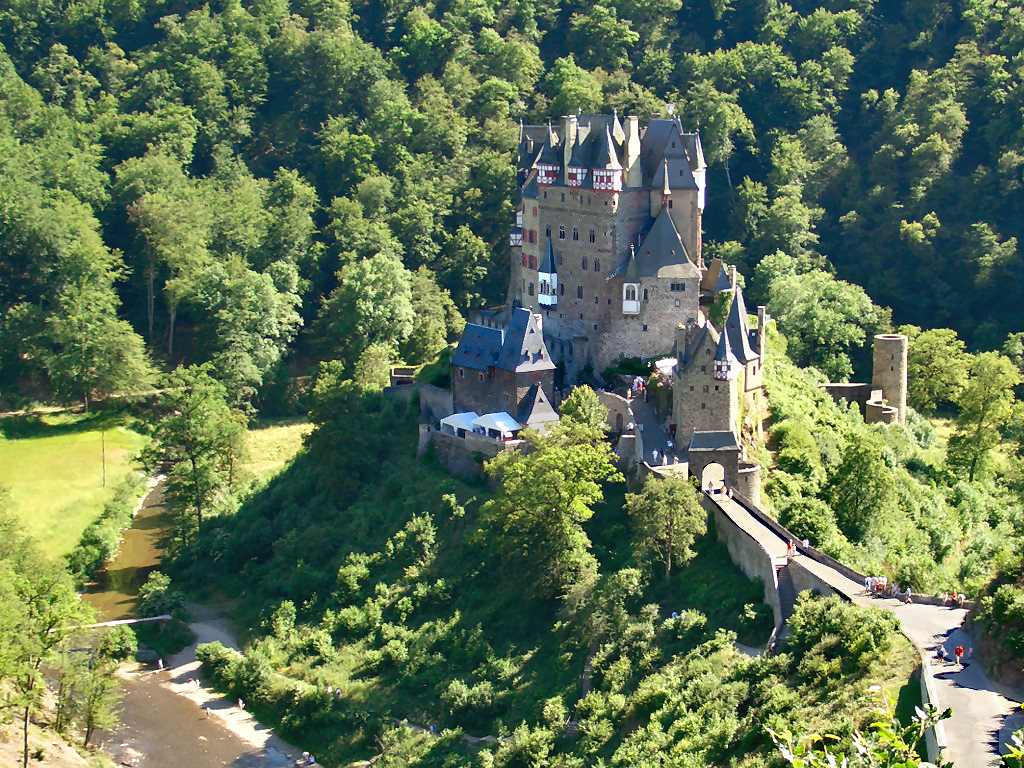
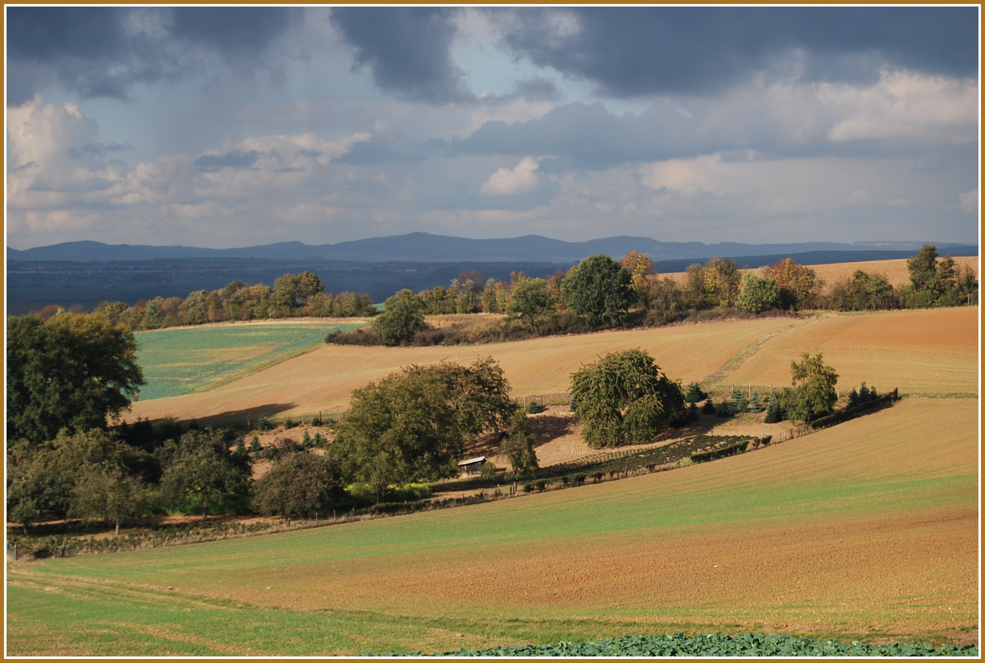
The Pellenz is a hill country in the northwestern part of the Middle Rhine Basin in Germany between Mayen in the southwest and Andernach in the northeast. In addition Pellenz is the name of a ''Verbandsgemeinde'' in the state of Rhineland-Palatinate, which covers the north of the landscape of Pellenz and has had its seat since May 2017 in the village of Plaidt (prior to that it was run from Andernach). Geography The settlements of the Pellenz comprise the mainly industrial villages of Ochtendung, Kruft, Nickenich, Plaidt and Kretz (Pellenz Volcanoes or ''Pellenzvulkane'', east) and Niedermendig (today Mendig), Kottenheim, Thür (Pellenz Basin or ''Pellenzsenke'', west) and the Polch which projects into the region of Maifeld (Pellenz Heights or ''Pellenzhöhe'', south). The region lies alongside the A 61 and A 48 motorways and the Pellenz-Eifel Railway. The little river of the Nette flows through the rolling countryside which descends gently from west to eas ... [...More Info...] [...Related Items...] OR: [Wikipedia] [Google] [Baidu] |
Middle Rhine Basin
The Middle Rhine Basin (german: Mittelrheinische Becken) is the central landscape region of the Middle Rhine in Germany and, along with the Limburg Basin, forms one of the biggest intra-montane lowland regions within the Rhenish Massif. The basin is divided into the valley bottom of the Neuwied Basin, the Neuwied Basin Perimeter east of the Rhine and the Lower Moselle Valley west of the Rhine in the south, and the Maifeld-Pellenz Hills in the north. The basin is bounded on the east of the Rhine in the northeast and east by the slopes of the Westerwald and, on the west of the Rhine, from north to southwest by the Eifel mountains, and in the southeast by the valley of the Moselle above Moselkern. Its mild winters and dry climate enable intensive agriculture, which is why the landscape has few woods. Natural regions The Handbook of Natural Region Divisions of Germany groups the Middle Rhine Basin within major unit group 29, the Middle Rhine Region, but classifies it as a major unit ... [...More Info...] [...Related Items...] OR: [Wikipedia] [Google] [Baidu] |
Verbandsgemeinde Pellenz ...
Pellenz is a ''Verbandsgemeinde'' ("collective municipality") in the district Mayen-Koblenz, in Rhineland-Palatinate, Germany. It is situated north-east of Mayen, and south of Andernach. The seat of the municipality was in Andernach, which was not part of the municipality itself and is now in Plaidt since 2017. The ''Verbandsgemeinde'' Pellenz consists of the following ''Ortsgemeinden'' ("local municipalities"): # Kretz # Kruft # Nickenich # Plaidt # Saffig External linkspellenz.de {{Authority control Pellenz The Pellenz is a hill country in the northwestern part of the Middle Rhine Basin in Germany between Mayen in the southwest and Andernach in the northeast. In addition Pellenz is the name of a ''Verbandsgemeinde'' in the state of Rhineland-Palat ... [...More Info...] [...Related Items...] OR: [Wikipedia] [Google] [Baidu] |
Maifeld
The Maifeld is a landscape (a natural region sub-unit) of the Middle Rhine Basin on its western perimeter with the Eifel mountains, southwest of the city of Koblenz. It is known for its gently rolling hills. Location The plain, which lies at about 400 metres above sea level, is divided into the Upper Maifeld (''Obermaifeld'') south of Mayen in the west, and the rather larger Lower Maifeld (''Niedermaifeld'') area which adjoins it to the east, southwest of Koblenz. It is comparatively sharply bounded by the rivers Moselle (southeast) and Elz (southwest), while the River Nette in the northwest only forms an approximate boundary. Its name is probably derived from the Franks, who held assemblies here. Use The Maifeld is almost exclusively used for large-scale grain production. Only a few large farms, which are often hidden between the undulating fields, manage this region. The soils are especially fertile. Towns in the Maifeld are Polch (seat of the Verbandsgemeinde of Maifel ... [...More Info...] [...Related Items...] OR: [Wikipedia] [Google] [Baidu] |
Mayen Koblenz
Mayen-Koblenz is a district (''Kreis'') in the north of Rhineland-Palatinate, Germany. Neighboring districts are (from north clockwise) Ahrweiler, Neuwied, Westerwaldkreis, district-free Koblenz, Rhein-Lahn, Rhein-Hunsrück, Cochem-Zell, and Vulkaneifel. History The district was created in 1973 when the two districts, Mayen and Koblenz, were merged. The district has been 'twinned' with the Borough of Waverley in Surrey in southern England since 1982. Geography The two main rivers of the district are the Rhine and the Moselle, which join at the ''Deutsches Eck'' in Koblenz. In the west of the district are the Eifel mountains. These also include the large lake, the ''Laacher See'', a volcanic caldera formed 12000 years ago. Coat of arms The coat of arms combine the elements of the two precursor districts. The tree, a ''Maie'', is taken from the Mayen district. The wavy line represents the two rivers Rhine and Moselle. The crown is a reference to the fact that in Rhens the Councils ... [...More Info...] [...Related Items...] OR: [Wikipedia] [Google] [Baidu] |
Mayen-Koblenz
Mayen-Koblenz is a district (''Kreis'') in the north of Rhineland-Palatinate, Germany. Neighboring districts are (from north clockwise) Ahrweiler (district), Ahrweiler, Neuwied (district), Neuwied, Westerwaldkreis, district-free Koblenz, Rhein-Lahn, Rhein-Hunsrück, Cochem-Zell, and Vulkaneifel. History The district was created in 1973 when the two districts, Mayen and Koblenz, were merged. The district has been 'twinned' with the Borough of Waverley, Surrey, Waverley in Surrey in southern England since 1982. Geography The two main rivers of the district are the Rhine and the Moselle (river), Moselle, which join at the ''Deutsches Eck'' in Koblenz. In the west of the district are the Eifel mountains. These also include the large lake, the ''Laacher See'', a volcanic caldera formed 12000 years ago. Coat of arms The coat of arms combine the elements of the two precursor districts. The tree, a ''Maie'', is taken from the Mayen district. The wavy line represents the two rivers Rhine ... [...More Info...] [...Related Items...] OR: [Wikipedia] [Google] [Baidu] |
Eifelquerbahn
The Cross Eifel Railway (German: ''Eifelquerbahn'') is a non-electrified railway line between Andernach and Gerolstein in the Eifel in the German state of Rhineland-Palatinate. From Andernach to Mayen Ost (East), it is classified as main line and it has two tracks as far as Mendig. Services on the Cross Eifel Railway currently operate about every 30 minutes between Andernach and Mayen Ost and continue to Kaisersesch hourly as part of the Lahn-Eifel-Bahn service. The rail service between Andernach and Kaisersesch operated for a long time under the name of ''Pellenz-Eifel-Bahn'' (the Pellenz is a hilly area between Andernach and Mayen) and the section between Kaisersesch and Gerolstein was for a time operated as the ''Vulkan Eifel-Bahn''. This service was discontinued in 2013. History The Cross Eifel Railway was opened in several stages, with the first section opening from Andernach to Niedermendig on 1 April 1878. The second section opened from Niedermendig to Mayen Ost ... [...More Info...] [...Related Items...] OR: [Wikipedia] [Google] [Baidu] |
Kruft
Kruft is a municipality in the district of Mayen-Koblenz in Rhineland-Palatinate, western Germany. It is home to Laach Castle, a ''burgstall'' and former spur castle by the Laacher See Laacher See (), also known as Lake Laach or Laach Lake, is a volcanic caldera lake with a diameter of in Rhineland-Palatinate, Germany, about northwest of Koblenz, south of Bonn, and west of Andernach. It is in the Eifel mountain range, and ... lake. References Municipalities in Rhineland-Palatinate Mayen-Koblenz {{MayenKoblenz-geo-stub ... [...More Info...] [...Related Items...] OR: [Wikipedia] [Google] [Baidu] |
Kretz, Rhineland-Palatinate
Kretz is a municipality in the district of Mayen-Koblenz in Rhineland-Palatinate, western Germany Germany,, officially the Federal Republic of Germany, is a country in Central Europe. It is the second most populous country in Europe after Russia, and the most populous member state of the European Union. Germany is situated betwe .... References Municipalities in Rhineland-Palatinate Mayen-Koblenz {{MayenKoblenz-geo-stub ... [...More Info...] [...Related Items...] OR: [Wikipedia] [Google] [Baidu] |
Nickenich
Nickenich is a municipality in the district of Mayen-Koblenz in Rhineland-Palatinate, western Germany. File:Nickenich Tumulus 3.jpg, Tumulus A tumulus (plural tumuli) is a mound of earth and stones raised over a grave or graves. Tumuli are also known as barrows, burial mounds or '' kurgans'', and may be found throughout much of the world. A cairn, which is a mound of stones ... File:Nickenich Kirche.jpg, Church File:Nickenich Straßenpartie 2.jpg, Street References Mayen-Koblenz {{MayenKoblenz-geo-stub ... [...More Info...] [...Related Items...] OR: [Wikipedia] [Google] [Baidu] |
Plaidt
Plaidt is a municipality in the district of Mayen-Koblenz in Rhineland-Palatinate, western Germany Germany,, officially the Federal Republic of Germany, is a country in Central Europe. It is the second most populous country in Europe after Russia, and the most populous member state of the European Union. Germany is situated betwe .... References Mayen-Koblenz {{MayenKoblenz-geo-stub ... [...More Info...] [...Related Items...] OR: [Wikipedia] [Google] [Baidu] |
Mayen
Mayen is a town in the Mayen-Koblenz District of the Rhineland-Palatinate Federal State of Germany, in the eastern part of the Volcanic Eifel Region. As well as the main town, additional settlements include Alzheim, Kürrenberg, Hausen-Betzing, Hausen and Nitztal. Mayen is the administrative centre of the Vordereifel ‘Collective Municipality’, although it is not part of the municipality. Geography To the west, as well as to the north and south-west of Mayen, is the country landscape of the Eifel. To the east, the landscape flattens out, running towards the Koblenz-Neuwied Basin, which is divided into the northern section of the Pellenz and the southern section of the Maifeld. This area is geographically considered to be part of the Eifel. Mayen is often called ‘The Gateway to the Eifel’. The small river Nette runs through the town, flowing from the Eifel towards Weißenthurm on the Rhine. History Even in Roman times, Mayen (Lat. ''Megina'') was an important economic c ... [...More Info...] [...Related Items...] OR: [Wikipedia] [Google] [Baidu] |
Rhine
), Surselva, Graubünden, Switzerland , source1_coordinates= , source1_elevation = , source2 = Rein Posteriur/Hinterrhein , source2_location = Paradies Glacier, Graubünden, Switzerland , source2_coordinates= , source2_elevation = , source_confluence = Reichenau , source_confluence_location = Tamins, Graubünden, Switzerland , source_confluence_coordinates= , source_confluence_elevation = , mouth = North Sea , mouth_location = Netherlands , mouth_coordinates = , mouth_elevation = , progression = , river_system = , basin_size = , tributaries_left = , tributaries_right = , custom_label = , custom_data = , extra = The Rhine ; french: Rhin ; nl, Rijn ; wa, Rén ; li, Rien; rm, label= Sursilvan, Rein, rm, label= Sutsilvan and Surmiran, Ragn, rm, label=Rumantsch Grischun, Vallader and Puter, Rain; it, Reno ; gsw, Rhi(n), inclu ... [...More Info...] [...Related Items...] OR: [Wikipedia] [Google] [Baidu] |


.jpg)

