|
Pelican Point (Adelaide)
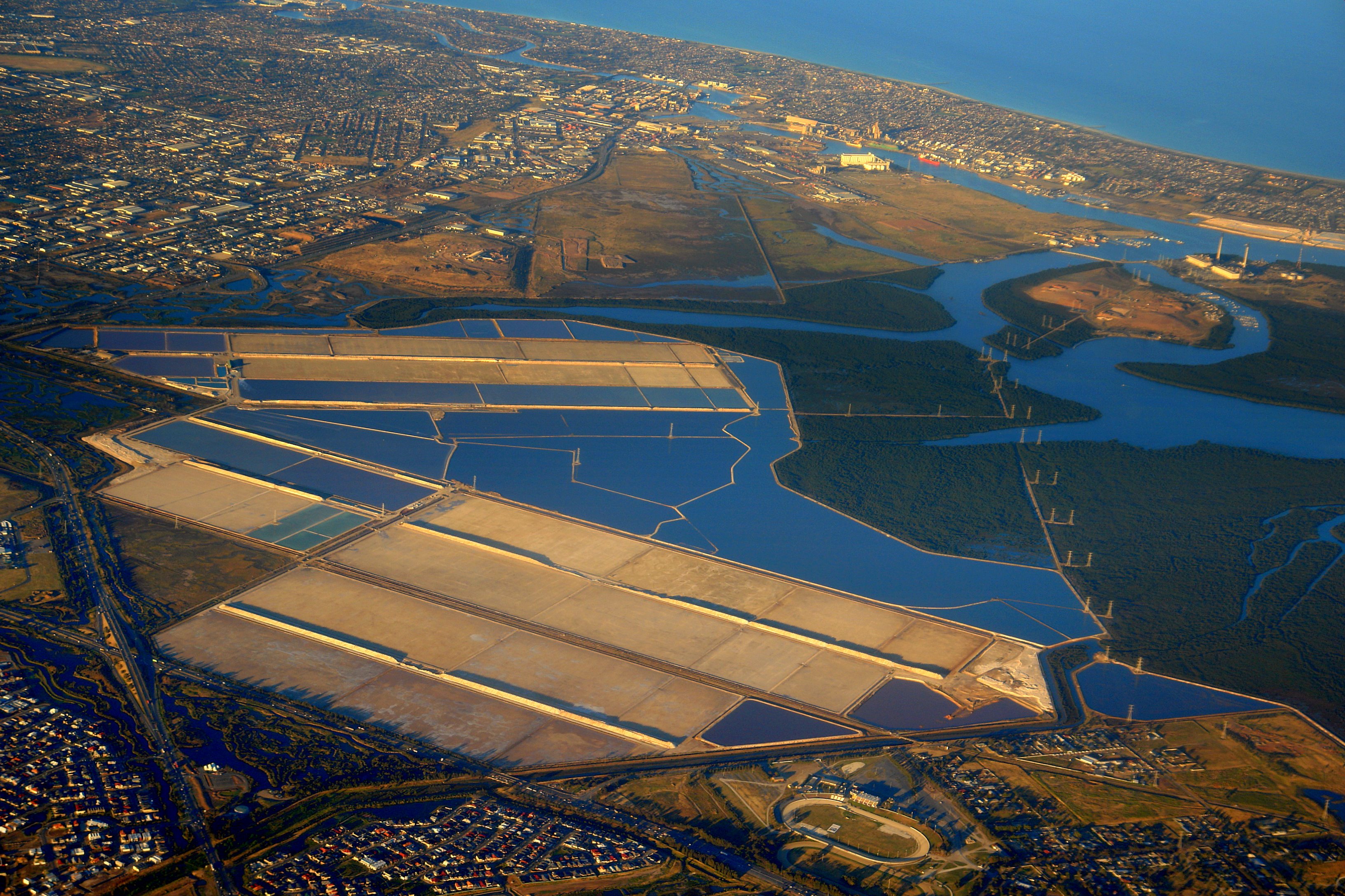
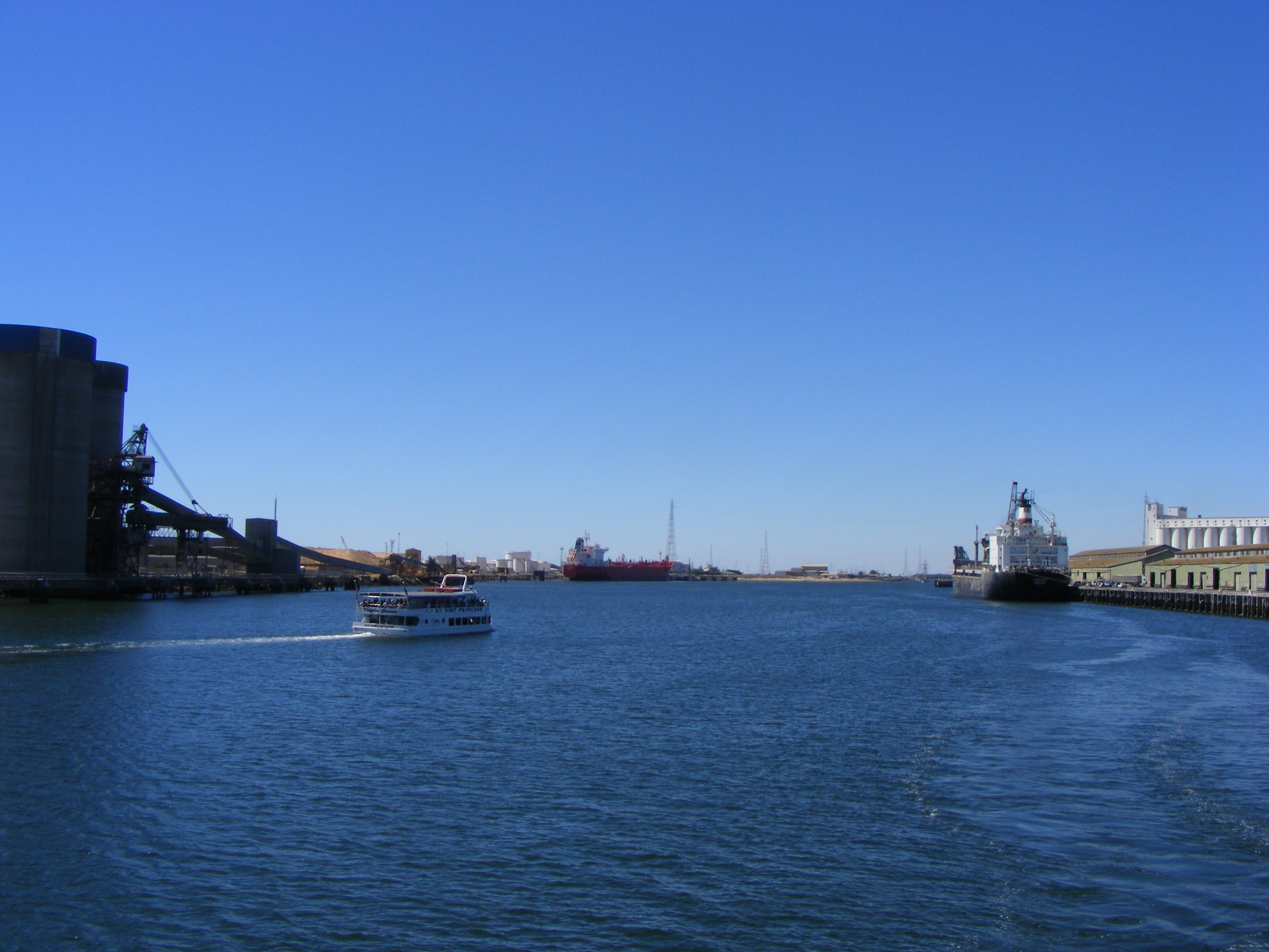
Pelican Point is at the northern tip of Lefevre Peninsula, adjacent to the Port River shipping channel and the container terminal and associated infrastructure at Outer Harbor. A non-residential area, it is undergoing considerable industrial development, which is expected to continue as other projects, such as the Port River Expressway, come to fruition. Light Passage, named after founder of Adelaide Colonel William Light, lies in the Port Adelaide River between Pelican Point and Torrens Island. There is a ship's graveyard A ship graveyard or ship cemetery is a location where the hulls of scrapped ships are left to decay and disintegrate, or left in reserve. Such a practice is now less common due to waste regulations and so some dry docks where ships are bro ... site at the northern end of Mutton Cove Conservation Reserve, Mutton Cove, near Pelican Point, there being a steel hulk of a steamship on the beach. See also * Pelican Point Power Station References H ... [...More Info...] [...Related Items...] OR: [Wikipedia] [Google] [Baidu] |
South Australia
South Australia (commonly abbreviated as SA) is a state in the southern central part of Australia. It covers some of the most arid parts of the country. With a total land area of , it is the fourth-largest of Australia's states and territories by area, and second smallest state by population. It has a total of 1.8 million people. Its population is the second most highly centralised in Australia, after Western Australia, with more than 77 percent of South Australians living in the capital Adelaide, or its environs. Other population centres in the state are relatively small; Mount Gambier, the second-largest centre, has a population of 33,233. South Australia shares borders with all of the other mainland states, as well as the Northern Territory; it is bordered to the west by Western Australia, to the north by the Northern Territory, to the north-east by Queensland, to the east by New South Wales, to the south-east by Victoria, and to the south by the Great Australian Bight.M ... [...More Info...] [...Related Items...] OR: [Wikipedia] [Google] [Baidu] |
Pelican Point Power Station
The Pelican Point Power Station is located at Pelican Point, 20 km from the centre of Adelaide, South Australia on the Lefevre Peninsula. It is operated by Engie (previously known as GDF Suez Australian Energy), which owns 72 per cent of the power station. Mitsui owns the remaining 28 per cent. It burns natural gas in a combined cycle power station, comprising two 160 MW gas turbines and one 165 MW steam turbine, to generate up to 485 MW of electricity. Construction began in 1999. The plant has two GT13E2 gas turbines manufactured by ABB (now Alstom). The plant, including steam turbine and heat recovery steam generator (HRSG), was manufactured and constructed by ABB. Fuel is supplied via either the SEAGas pipeline, which runs from the Iona Gas Plant in Victoria to the Pelican Point power station, or the Moomba Adelaide Pipeline System (MAPS), which supplies gas from Moomba to Adelaide. Environmental protests In 1999, the proposed development of the Pelican Point Power ... [...More Info...] [...Related Items...] OR: [Wikipedia] [Google] [Baidu] |
Lefevre Peninsula
The Lefevre Peninsula is a peninsula located in the Australian state of South Australia located about northwest of the Adelaide city centre. It is a narrow sand spit of about running north from its connection to the mainland. The name given to the peninsula by the traditional owners of the area, the Kaurna people, was Mudlangga, meaning "nose-place" in the Kaurna language. Location and extent Lefevre Peninsula, with a population of approximately 30,000 residents, is located on the east coast of Gulf St Vincent about north-west of the Adelaide city centre. The peninsula is bounded to the west by Gulf St Vincent and to the north and the east by the Port River. The southern boundary of the “topographical peninsula” has been determined by the Surveyor General of South Australia as being Recreation Road in the suburb of Semaphore Park as “an examination of old plans indicate that boats could have navigated the Port Adelaide River to approximately this point”. Descriptio ... [...More Info...] [...Related Items...] OR: [Wikipedia] [Google] [Baidu] |
Port River
The Port River (officially known as the Port Adelaide River) is part of a tidal estuary located north of the Adelaide city centre in the Australian state of South Australia. It has been used as a shipping channel since the beginning of European settlement of South Australia in 1836, when Colonel Light selected the site to use as a port. Before colonisation, the Port River region and the estuary area were known as Yerta Bulti (or Yertabulti) by the Kaurna people, and used extensively as a source of food and plant materials to fashion artefacts used in daily life. The Port River dolphins are a popular tourist attraction. Geography The Port River is the western branch of the largest tidal estuary on the eastern side of Gulf St Vincent. The whole estuarine area, sometimes called the Port River estuary, includes Barker Inlet, Torrens Island, Garden Island, and to a greater or lesser extent touches the suburbs of St Kilda, Bolivar, Dry Creek, Port Adelaide, New Port, and (up ... [...More Info...] [...Related Items...] OR: [Wikipedia] [Google] [Baidu] |
Container Terminal
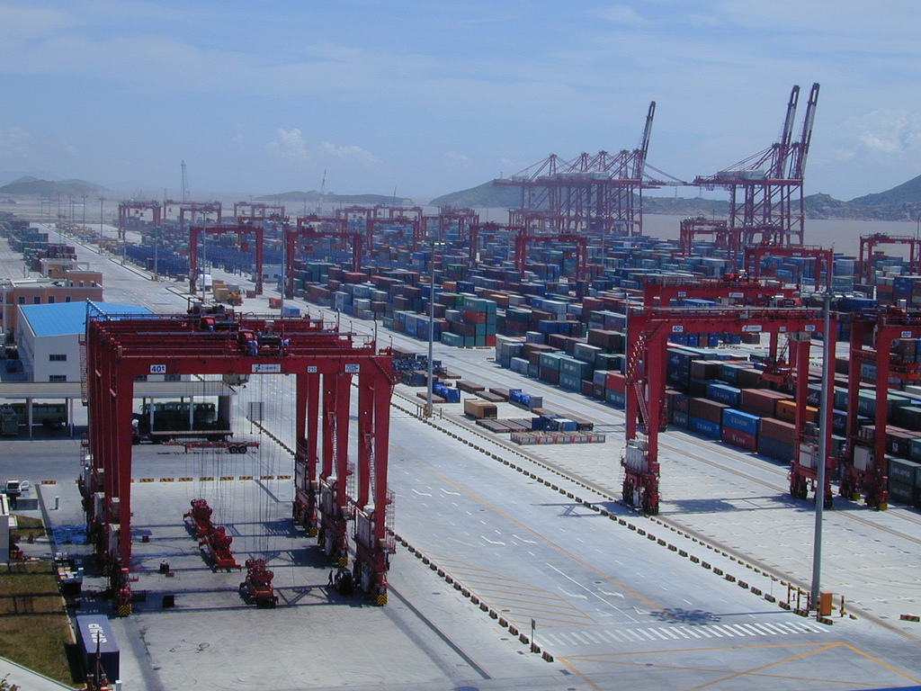
A container port or container terminal is a facility where cargo containers are transshipped between different transport vehicles, for onward transportation. The transshipment may be between container ships and land vehicles, for example trains or trucks, in which case the terminal is described as a ''maritime container port''. Alternatively, the transshipment may be between land vehicles, typically between train and truck, in which case the terminal is described as an ''inland container port''. In November 1932, the first inland container port in the world was opened by the Pennsylvania Railroad company in Enola, Pennsylvania. Port Newark-Elizabeth on the Newark Bay in the Port of New York and New Jersey is considered the world's first maritime container port. On April 26, 1956, the Ideal X was rigged for an experiment to use standardized cargo containers that were stacked and then unloaded to a compatible truck chassis at Port Newark. The concept had been developed by the M ... [...More Info...] [...Related Items...] OR: [Wikipedia] [Google] [Baidu] |
Outer Harbor, South Australia
Outer Harbor is a suburb in the Australian state of South Australia located at the northern tip of the Lefevre Peninsula about north-west of the Adelaide city centre. Description Outer Harbor is essentially an industrial suburb, consisting mainly of shipping and transport related infrastructure. Administratively, it lies in the City of Port Adelaide Enfield. It includes the headland of Pelican Point. It is bounded to the east by Osborne, the southwest by North Haven and in every other direction by the Port River. Light Passage, named after founder of Adelaide Colonel William Light, lies in the Port River between Pelican Point and Torrens Island. Population In the 12 people were recorded as residing in Outer Harbor and the adjoining part of the suburb of Osborne. Transport The primary form of public transport in Outer Harbor is the Outer Harbor railway line which connects the area to the centre of the City of Adelaide. The terminus of this line is the Outer Harbor station, ... [...More Info...] [...Related Items...] OR: [Wikipedia] [Google] [Baidu] |
Department Of Planning, Transport And Infrastructure
The Department for Infrastructure and Transport (DIT), formerly the Department of Planning, Transport and Infrastructure (DPTI), is a large department of the government of South Australia. The website was renamed , but without a formal announcement of change of name or change in documentation about its governance or functionality. Ministerial responsibility The minister responsible for all aspects of the department's operations in the Marshall government was Stephan Knoll, Minister for Transport, Infrastructure and Local Government, and Minister for Planning. He served from March 2018, until his resignation in the wake of an expenses scandal on 26 July 2020. The Urban Renewal Authority, trading as Renewal SA, was within the minister's portfolio responsibilities until 28 July 2020, when it was moved to that of the treasurer, Rob Lucas. Corey Wingard Corey Luke Wingard is a former Australian politician. He was a Liberal member of the South Australian House of Assembly fr ... [...More Info...] [...Related Items...] OR: [Wikipedia] [Google] [Baidu] |
Port River Expressway
Port River Expressway is a freeway-grade road. The expressway links Port Adelaide and the LeFevre Peninsula across the north-western suburbs of Adelaide to major interstate routes via North-South Motorway. The expressway is only grade-separated at the North-South Motorway, Hanson Road and Eastern Parade interchanges; the following two intersections are at grade with traffic signals installed. This has led to the route being labelled as the A9, instead of the more common M label associated with freeways and expressways in South Australia. Construction The Port River Expressway was built in three stages: *Stage 1 - Was opened for traffic on 19 July 2005. It consists of a four-lane expressway link between Francis Street and the then South Road, Adelaide, now North-South Motorway; with an overpass at each of the junctions of the North-South Motorway, Hanson Road and Eastern Parade. *Stage 2 - Consists of a four lane high-level, opening road bridge across the Port River between Do ... [...More Info...] [...Related Items...] OR: [Wikipedia] [Google] [Baidu] |
William Light
William Light (27 April 1786 – 6 October 1839), also known as Colonel Light, was a British- Malayan naval and army officer. He was the first Surveyor-General of the new British Province of South Australia, known for choosing the site of the colony's capital, Adelaide, and for designing the layout of its streets, six city squares, gardens and the figure-eight Adelaide Park Lands, in a plan later sometimes referred to as Light's Vision. He was the eldest son of Captain Francis Light, founder of Penang, and Martina Rozells. Early life Light was born in Kuala Kedah, Kedah (now in Malaysia) on 27 April 1786, the eldest son of Captain Francis Light, founder and Superintendent of Penang, and Martinha Rozells, who was of Portuguese or French, and Siamese or Malay descent. He was thus legally classed as Eurasian, an ethnic designation which granted the designated a middle position between the natives and the Europeans. He was baptised on 31 December 1786, Georgetown, Penang. ... [...More Info...] [...Related Items...] OR: [Wikipedia] [Google] [Baidu] |
Port Adelaide River
The Port River (officially known as the Port Adelaide River) is part of a tidal estuary located north of the Adelaide city centre in the Australian state of South Australia. It has been used as a shipping channel since the beginning of European settlement of South Australia in 1836, when Colonel Light selected the site to use as a port. Before colonisation, the Port River region and the estuary area were known as Yerta Bulti (or Yertabulti) by the Kaurna people, and used extensively as a source of food and plant materials to fashion artefacts used in daily life. The Port River dolphins are a popular tourist attraction. Geography The Port River is the western branch of the largest tidal estuary on the eastern side of Gulf St Vincent. The whole estuarine area, sometimes called the Port River estuary, includes Barker Inlet, Torrens Island, Garden Island, and to a greater or lesser extent touches the suburbs of St Kilda, Bolivar, Dry Creek, Port Adelaide, New Port, and (up ... [...More Info...] [...Related Items...] OR: [Wikipedia] [Google] [Baidu] |
Torrens Island
Torrens Island is an island in the Australian state of South Australia located in the Adelaide metropolitan area in the Port River Estuary about northwest of the Adelaide city centre. Since European settlement of Adelaide in 1836, it has been used for a number of purposes. Geographical features An island in the Port River Estuary between the Port River to the west and Barker Inlet to the east, Torrens Island is located about north-west of Adelaide. Light Passage, named after founder of Adelaide Colonel William Light, lies in the Port River between Pelican Point and Torrens Island. Torrens Island is separated from the smaller Garden Island to the south by the Angas Inlet, but is connected to the mainland by a causeway and a bridge over the North Arm. History European discovery and use According to the ''Australian Dictionary of Biography'', Governor George Gawler in 1837 named the site after Robert Torrens senior, who was chairman of the South Australian Colonisation ... [...More Info...] [...Related Items...] OR: [Wikipedia] [Google] [Baidu] |
Ship's Graveyard
A ship graveyard or ship cemetery is a location where the hulls of scrapped ships are left to decay and disintegrate, or left in reserve. Such a practice is now less common due to waste regulations and so some dry docks where ships are broken (to recycle their metal and remove dangerous materials like asbestos) are also known as ship graveyards. By analogy, the phrase can also refer to an area with many shipwrecks which have not been removed by human agency, instead being left to disintegrate naturally. These can form in places where navigation is difficult or dangerous (such as the Seven Stones, off Cornwall, or Blackpool, on the Irish Sea); or where many ships have been deliberately scuttled together ( as with the German High Seas Fleet at Scapa Flow); or where many ships have been sunk in battle (such as Ironbottom Sound, in the Pacific). The majority of the ships in the world are constructed in the developed countries. Ships last about 25-30 years, after which they be ... [...More Info...] [...Related Items...] OR: [Wikipedia] [Google] [Baidu] |


