|
Pelham Parkway
The Bronx and Pelham Parkway, also known formally as the Bronx–Pelham Parkway but called Pelham Parkway in everyday use, is a parkway in the borough of the Bronx in New York City. The road begins in Bronx Park at the Bronx River Parkway and U.S. Route 1 (US 1) and ends at Interstate 95 (I-95), the New England Thruway, in Pelham Bay Park, hence the roadway's name. The parkway is designated as New York State Route 907F (NY 907F), an unsigned reference route, by the New York State Department of Transportation (NYSDOT). Despite the parkway moniker, Pelham Parkway is partially limited access and partially a local street, with two main roadways (one in each direction), and two service roads during the local street section. Like other parkways in New York City, commercial traffic is not permitted, however it can use the paralleling service roads. The parkway is maintained by the New York City Department of Transportation. The residential neighborhood that surrounds the p ... [...More Info...] [...Related Items...] OR: [Wikipedia] [Google] [Baidu] |
New York City Department Of Transportation
The New York City Department of Transportation (NYCDOT) is the agency of the government of New York City responsible for the management of much of New York City's transportation infrastructure. Ydanis Rodriguez is the Commissioner of the Department of Transportation, and was appointed by Mayor Eric Adams on January 1, 2022. Former Commissioners have included Polly Trottenberg, Janette Sadik-Khan, and Iris Weinshall Responsibilities The Department of Transportation's responsibilities include day-to-day maintenance of the city's streets, highways, bridges, sidewalks, street signs, traffic signals, and street lights. DOT supervises street resurfacing, pothole repair, parking meter installation and maintenance, and municipal parking facility management. DOT also operates the Staten Island Ferry. DOT is the exclusive provider of day-to-day operations and maintenance on state-maintained roads and highways in city limits, while major repairs and capital improvements on state-owned r ... [...More Info...] [...Related Items...] OR: [Wikipedia] [Google] [Baidu] |
East Coast Greenway
The East Coast Greenway is a pedestrian and bicycle route between Maine and Florida along the East Coast of the United States. In 2020, the Greenway received over 50 million visits. The nonprofit East Coast Greenway Alliance was created in 1991. Its goal is for the entire route to use off-road, shared-use paths; , over of the route (35%) meets this criteria. History In 1991, a group of cyclists and long-distance trail enthusiasts met in New York City and formed a national non-profit organization, the East Coast Greenway Alliance (ECGA), to plan and promote a greenway linking existing and planned trails into a contiguous "spine route" between Atlantic coast cities. In summer 1992, the ECGA sent nine cyclists from Boston, New York City, Vermont, and Washington, D.C., on a 30-day "exploratory" cycle tour. In 1993, tours went along the route to explore options and promote the idea of the greenway. In 1994, the first promotional tour took place from Maine to Washington, D.C. "E ... [...More Info...] [...Related Items...] OR: [Wikipedia] [Google] [Baidu] |
Northeast Corridor
The Northeast Corridor (NEC) is an electrified railroad line in the Northeast megalopolis of the United States. Owned primarily by Amtrak, it runs from Boston through Providence, New Haven, Stamford, New York City, Philadelphia, Wilmington, and Baltimore to Washington, D.C. The NEC closely parallels Interstate 95 for most of its length, and is the busiest passenger rail line in the United States both by ridership and by service frequency as of 2013. The NEC carries more than 2,200 trains daily. The corridor is used by many Amtrak trains, including the high-speed Acela, intercity trains and several long-distance trains. Most of the corridor also has frequent commuter rail service, operated by the MBTA, Shore Line East, Hartford Line, Metro-North Railroad, Long Island Rail Road, New Jersey Transit, SEPTA and MARC. While large through freights have not run on the NEC since the early 1980s, several companies continue to run smaller local freights over some select few sec ... [...More Info...] [...Related Items...] OR: [Wikipedia] [Google] [Baidu] |
Pelham Parkway Station (IRT Dyre Avenue Line)
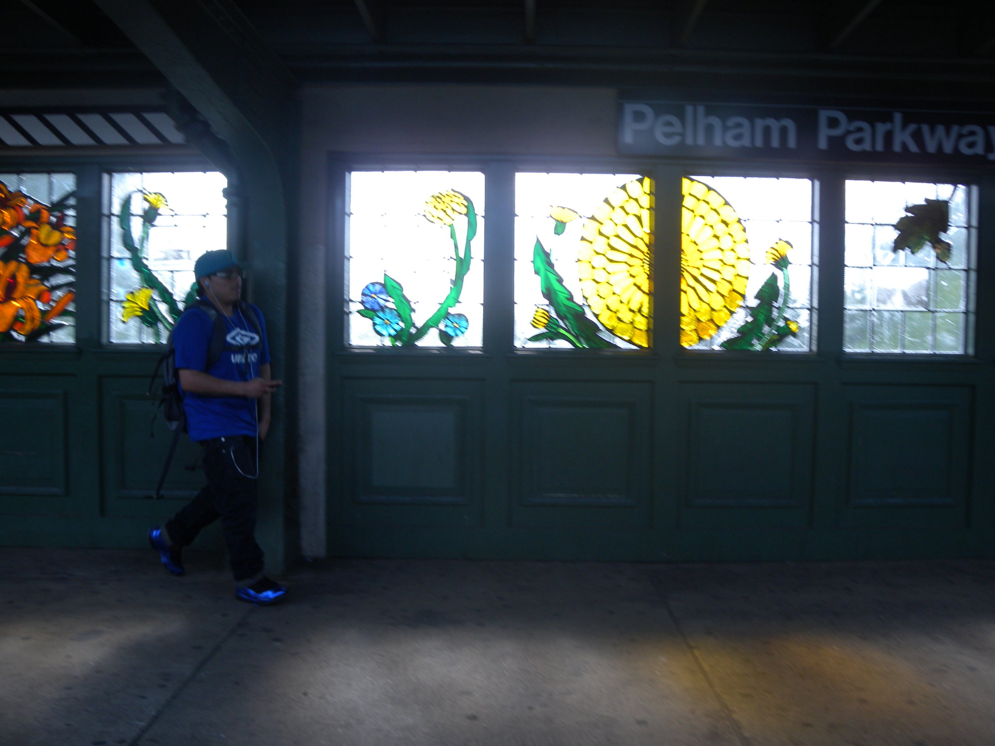
The Pelham Parkway station is a station on the IRT Dyre Avenue Line of the New York City Subway. Located at the intersection of Pelham Parkway North and the Esplanade (erroneously signed as "Esplanade Avenue" in the station) in the Bronx, it is served by the 5 train at all times. This station was built as part of the New York, Westchester and Boston Railway (NYW&B), and opened in 1912. This station closed in 1937 with the NYW&B, but reopened in 1941 as a subway station after the portion of the line in the Bronx was purchased by New York City. History Early history Pelham Parkway station opened on May 29, 1912 as an express station of the New York, Westchester and Boston Railway (NYW&B). This station was closed on December 12, 1937 when the NYW&B went bankrupt. The New York City Board of Transportation (BOT) bought the NYW&B within the Bronx north of East 180th Street in April 1940 for $1.8 million and rehabilitated the line. On May 15, 1941, a shuttle service was imple ... [...More Info...] [...Related Items...] OR: [Wikipedia] [Google] [Baidu] |
IRT Dyre Avenue Line
The IRT Dyre Avenue Line (formerly the IND Dyre Avenue–East 174th Street Line) is a New York City Subway rapid transit line, part of the A Division. It is a branch of the IRT White Plains Road Line in the northeastern section of the Bronx, north of East 180th Street. As of 2013, it has a daily ridership of 34,802. The line is the only remaining portion of the New York, Westchester and Boston Railway (NYW&B). The NYW&B opened in 1912, providing service from the Harlem River to White Plains and New Rochelle (eventually to Port Chester). Service ended in 1937, and the line within New York City was acquired by the city in 1940, with shuttle service between Dyre Avenue and East 180th Street beginning the following year with IRT elevated cars. Through-service to Manhattan began in 1957, and the stations on the line were upgraded. Extent and service The following services use part or all of the IRT Dyre Avenue Line: It is served by the 5 train, which makes all stops. The lin ... [...More Info...] [...Related Items...] OR: [Wikipedia] [Google] [Baidu] |
Jacobi Medical Center
Jacobi Medical Center (NYC Health + Hospitals/Jacobi) is a municipal hospital operated by NYC Health + Hospitals in affiliation with the Albert Einstein College of Medicine. The facility is located in the Morris Park neighborhood of the Bronx, New York City. It is named in honor of German physician Abraham Jacobi, who is regarded as the ''father of American pediatrics''. Founded in 1955 as Bronx Municipal Hospital Center, the hospital opened concurrent with the opening of the Albert Einstein College of Medicine. This was the first time a medical school and municipal hospital entered into a formal affiliation agreement at the same time they were both built—and their relationship continues to this day. Jacobi is a primary clerkship site for 3rd- and 4th-year medical students from the Albert Einstein College of Medicine. Jacobi offers residency training programs in Internal Medicine, Pediatrics and Radiology. It also offers many joint residency programs with Montefiore Medical Cen ... [...More Info...] [...Related Items...] OR: [Wikipedia] [Google] [Baidu] |
White Plains Road
White Plains Road is a major north-south thoroughfare which runs the length of the New York City borough of the Bronx. It runs from Castle Hill and Clason Point in the south to Wakefield in the north, where it crosses the city line and becomes West 1st Street of Mount Vernon, New York. The Bronx River Parkway lies to its west and parallels much of its route. Between Magenta Street & 217th Street, White Plains Road is very wide due to the presence of the Gun Hill Road station house in the road's median. Historically, the route ran through an alignment through Mount Vernon by way of modern First Street, Lincoln Avenue (and Clinton Street), where it continued along modern North Columbus Ave. The route further continued with the current alignment Hussey Road across the Cross County Parkway, merging again with current North Columbus Avenue (modern NY 22-Columbus Avenue was known as "Central Blvd" into the 1960s between current Hussey Road and the Cross County Parkway, as the r ... [...More Info...] [...Related Items...] OR: [Wikipedia] [Google] [Baidu] |
Pelham Parkway (IRT White Plains Road Line)
The Pelham Parkway station is a local station on the IRT White Plains Road Line of the New York City Subway. Located in the Bronx at the intersection of Pelham Parkway and White Plains Road, it is served by the 2 train at all times and by the 5 train during rush hours in the peak direction. History This station was built under the Dual Contracts. It opened on March 3, 1917, as part of an extension of the IRT White Plains Road Line from East 177th Street–East Tremont Avenue to East 219th Street–White Plains Road, providing the Bronx communities of Williamsbridge and Wakefield with access to rapid transit service. Service on the new portion of the line was operated as a four-car shuttle from 177th Street due to the power conditions at the time. The city government took over the IRT's operations on June 12, 1940. This station was added to the National Register of Historic Places on March 30, 2005. It was renovated in 2007 at a cost of $18.85 million. At the same time, a ... [...More Info...] [...Related Items...] OR: [Wikipedia] [Google] [Baidu] |
IRT White Plains Road Line
The White Plains Road Line is a rapid transit line of the A Division of the New York City Subway serving the central Bronx. It is mostly elevated and served both subway and elevated trains until 1952. The original part of the line, the part opened as part of the first subway was called the West Farms Division, and the extension north to 241st Street as part of the Dual Contracts was called the White Plains Road Line. Eventually, however, the two parts came to be known as the White Plains Road Line. It is currently being used by the 2 at all times and the 5 at all times except late nights. During rush hours in the peak direction, the 5 runs express between East 180th Street and Third Avenue–149th Street. During late nights, the 5 runs as a shuttle between Eastchester–Dyre Avenue and East 180th Street. Extent and service The following services use part or all of the IRT White Plains Road Line: The IRT White Plains Road Line begins at the Wakefield–241st Street ter ... [...More Info...] [...Related Items...] OR: [Wikipedia] [Google] [Baidu] |
New York City Subway
The New York City Subway is a rapid transit system owned by the government of New York City and leased to the New York City Transit Authority, an affiliate agency of the state-run Metropolitan Transportation Authority (MTA). Opened on October 27, 1904, the New York City Subway is one of the world's oldest public transit systems, one of the most-used, and the one with the most stations, with 472 stations in operation (424 if stations connected by transfers are counted as single stations). Stations are located throughout the boroughs of Manhattan, Brooklyn, Queens, and the Bronx. The system has operated 24/7 service every day of the year throughout most of its history, barring emergencies and disasters. By annual ridership, the New York City Subway is the busiest rapid transit system in both the Western Hemisphere and the Western world, as well as the seventh-busiest rapid transit rail system in the world. In , the subway delivered rides, or about per weekday as of . On Octo ... [...More Info...] [...Related Items...] OR: [Wikipedia] [Google] [Baidu] |
Bronx And Pelham Parkway
The Bronx and Pelham Parkway, also known formally as the Bronx–Pelham Parkway but called Pelham Parkway in everyday use, is a parkway in the borough of the Bronx in New York City. The road begins in Bronx Park at the Bronx River Parkway and U.S. Route 1 (US 1) and ends at Interstate 95 (I-95), the New England Thruway, in Pelham Bay Park, hence the roadway's name. The parkway is designated as New York State Route 907F (NY 907F), an unsigned reference route, by the New York State Department of Transportation (NYSDOT). Despite the parkway moniker, Pelham Parkway is partially limited access and partially a local street, with two main roadways (one in each direction), and two service roads during the local street section. Like other parkways in New York City, commercial traffic is not permitted, however it can use the paralleling service roads. The parkway is maintained by the New York City Department of Transportation. The residential neighborhood that surrounds the pa ... [...More Info...] [...Related Items...] OR: [Wikipedia] [Google] [Baidu] |
Boston Post Road
The Boston Post Road was a system of mail-delivery routes between New York City and Boston, Massachusetts that evolved into one of the first major highways in the United States. The three major alignments were the Lower Post Road (now U.S. Route 1 (US 1) along the shore via Providence, Rhode Island), the Upper Post Road (now US 5 and US 20 from New Haven, Connecticut by way of Springfield, Massachusetts), and the Middle Post Road (which diverged from the Upper Road in Hartford, Connecticut and ran northeastward to Boston via Pomfret, Connecticut). In some towns, the area near the Boston Post Road has been placed on the National Register of Historic Places, since it was often the first road in the area, and some buildings of historical significance were built along it. The Boston Post Road Historic District, including part of the road in Rye, New York, has been designated a National Historic Landmark. The Post Road is also famous for milestones that dat ... [...More Info...] [...Related Items...] OR: [Wikipedia] [Google] [Baidu] |


