|
Paudhur
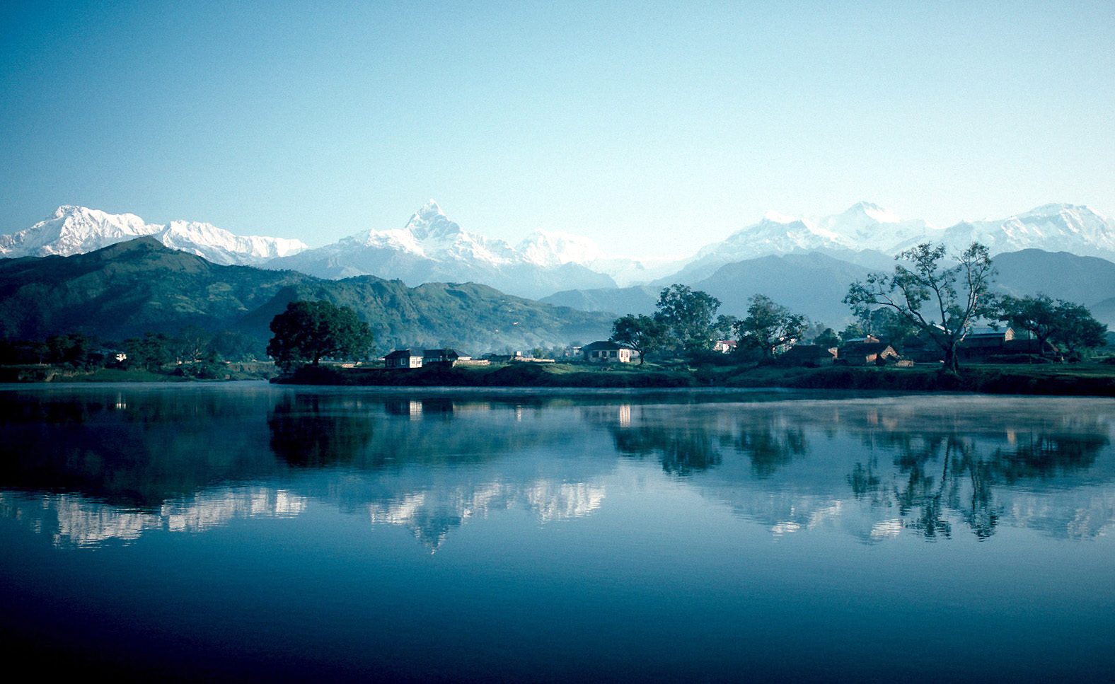
 Paundur (पाउँदुर) Paundur (पाउँदुर)is a central village in Kaski district of of Nepal. It lies about 28 km west of the Pokhara valley and 38 km east of |
Provinces Of Nepal
The provinces of Nepal ( ne, नेपालका प्रदेशहरू, translit=Nepālkā Pradeśharū) were formed on 20 September 2015 in accordance with Schedule 4 of the Constitution of Nepal. The seven provinces were formed by grouping the existing districts. The current system of seven provinces replaced an earlier system where Nepal was divided into 14 administrative zones which were grouped into five development regions. History A committee was formed to restructure administrative divisions of Nepal on 23 December 1956 and in two weeks, a report was submitted to the government. In accordance with The ''Report On Reconstruction Of Districts Of Nepal, 2013'' (), the country was first divided into total 7 ''Kshetras'' (area). # (Unnamed) # Madesh Kshetra # Bagmati Kshetra # Gandaki Kshetra # Lumbini Kshetra # Karnali Kshetra # Mahakali Kshetra In 1962, all ''Kshetras'' were dissolved and the country was restructured into 75 development districts; those distr ... [...More Info...] [...Related Items...] OR: [Wikipedia] [Google] [Baidu] |
List Of Districts Of Nepal
Districts in Nepal are second level of administrative divisions after provinces. Districts are subdivided in municipalities and rural municipalities. There are seven provinces and 77 districts in Nepal. After the state's reconstruction of administrative divisions, Nawalparasi District and Rukum District were divided into Parasi District (officially Nawalparasi (West of Bardaghat Susta) District) and Nawalpur District (officially Nawalparasi (East of Bardaghat Susta) District), and Eastern Rukum District and Western Rukum District respectively. District official include: * Chief District Officer, an official under Ministry of Home Affairs is appointed by the government as the highest administrative officer in a district. The C.D.O is responsible for proper inspection of all the departments in a district such as health, education, security and all other government offices. * District Coordination Committee acts as an executive to the District Assembly. The DCC coordinates wi ... [...More Info...] [...Related Items...] OR: [Wikipedia] [Google] [Baidu] |
Gandaki Province
Gandaki Province ( ne, गण्डकी प्रदेश ) ), is one of the seven federal provinces established by the current constitution of Nepal which was promulgated on 20 September 2015. Pokhara is the province's capital city. It borders the Tibet Autonomous Region of China to the north, Bagmati Province to the east, Karnali Province to the west, and Lumbini Province and Bihar of India to the south. The total area of the province is 21,504 km2 - about 14.57% of the country's total area. According to the latest census, the population of the province was 2,403,757. The newly elected Provincial Assembly adopted Gandaki Province as the permanent name by replacing its initial name Province no. 4 in July 2018. Krishna Chandra Nepali is the present chief minister of Gandaki Province Etymology Gandaki Province was named after the river Gandaki. Gandaki is a major river in the province. This river has Important links with historical Hindu civilization. The Gandaki river ... [...More Info...] [...Related Items...] OR: [Wikipedia] [Google] [Baidu] |
Kaski District
Kaski District ( ne, कास्की जिल्ला, ), a part of Gandaki Province, is one of the seventy-seven districts of Nepal. The name is disambiguated from Kaskikot, the ancient Kaski Kingdom. The district, with Pokhara as its district headquarter, covers an area of 2,017 square km and had a total population of 492,098 according to 2011 Census. This district lies at the centroid point of the country. The altitude of Kaski district ranges from 450 meters the lowest land to 8091 meters the highest point in the Himalaya range. Kaski District politically has One Metropolitan City, 4 Gaupalika and 3 electoral sectors. The district covers parts of the Annapurna mountain range, and the picturesque scene of the mountains can be observed from most parts of the district. It is one of the best tourist destinations of Nepal. The district is full of rivers such as Seti Gandaki, Modi and Madi along with other rivulets. The district headquarters Pokhara lies about 750 m above t ... [...More Info...] [...Related Items...] OR: [Wikipedia] [Google] [Baidu] |
Nepal Time
Nepal Standard Time (NPT) is the time zone for Nepal. With a time offset from Coordinated Universal Time (UTC) of UTC+05:45 all over Nepal, it is one of only three time zones with a 45-minute offset from UTC.The others are Chatham Island Standard Time, with an offset of UTC+12:45, and the unofficial Australian Central Western Time, with an offset of UTC+08:45. NPT is an approximation of Kathmandu mean time, which is 5:41:16 ahead of UTC. The standard meridian passes through the peak of Gaurishankar mountain about east of Kathmandu. Nepal used local solar time until 1920, in Kathmandu UTC+05:41:16. In 1920, Nepal adopted Indian Standard Time Indian Standard Time (IST), sometimes also called India Standard Time, is the time zone observed throughout India, with a time offset of UTC+05:30. India does not observe daylight saving time or other seasonal adjustments. In military and ..., UTC+05:30. In 1986 Nepal advanced their clocks by 15 minutes, giving them a t ... [...More Info...] [...Related Items...] OR: [Wikipedia] [Google] [Baidu] |
Wheat Farming In Nepal
Wheat is a grass widely cultivated for its seed, a cereal grain that is a worldwide staple food. The many species of wheat together make up the genus ''Triticum'' ; the most widely grown is common wheat (''T. aestivum''). The archaeological record suggests that wheat was first cultivated in the regions of the Fertile Crescent around 9600 BCE. Botanically, the wheat kernel is a type of fruit called a caryopsis. Wheat is grown on more land area than any other food crop (, 2014). World trade in wheat is greater than for all other crops combined. In 2020, world production of wheat was , making it the second most-produced cereal after maize. Since 1960, world production of wheat and other grain crops has tripled and is expected to grow further through the middle of the 21st century. Global demand for wheat is increasing due to the unique viscoelastic and adhesive properties of gluten proteins, which facilitate the production of processed foods, whose consumption is increas ... [...More Info...] [...Related Items...] OR: [Wikipedia] [Google] [Baidu] |
Pokhara
Pokhara ( ne, पोखरा, ) is a metropolis, metropolitan city in Nepal, which serves as the capital of Gandaki Province. It is the List of cities in Nepal, second most populous city of Nepal after Kathmandu, with 518,452 inhabitants living in 101,669 households in 2021 Nepal census, 2021. It is the country's largest metropolitan city in terms of area. The city also serves as the headquarters of Kaski District. Pokhara is located west of the capital, Kathmandu. The city is on the shore of Phewa Lake, and sits at an elevation of approximately 822m. The Annapurna Range, with three out of the ten highest peaks in the world—Dhaulagiri, Annapurna, Annapurna I and Manaslu—is within of the valley. Pokhara is considered the tourism capital of Nepal, being a base for trekkers undertaking the Annapurna Circuit through the Annapurna Conservation Area region of the Annapurna ranges in the Himalayas. The city is also home to many of the elite Gurkha soldiers, soldiers native to So ... [...More Info...] [...Related Items...] OR: [Wikipedia] [Google] [Baidu] |
Kusma, Nepal
Kushma is a small village and the headquarter of Parbat District in Nepal. Kushma municipality was formed by merging thirteen village development committees Pang, Khurkot, Durlung, Shivalaya, Chuwa, Katuwa Chaupari, Pipaltari and Pakuwa on 18 May 2014. This city lies in the western part of Nepal just about 57 km from Pokhara and 12 km from Baglung. Kushma falls under Western Development Region and Dhaulagiri Zone of Nepal. It is located at 28°13'06N 83°40'45E at an altitude of 1294 meters. Kusma Bazaar straddling a narrow and high strip of land between the banks of Kaligandaki and Modi is the main market centre of the municipality. A bridge joins Kushma with Gyadichour located on the other side of the deep Modi river canyon. History From early times Kusma has been an important stop for travellers from Baglung on their way to Pokhara, Palpa and Butwal. Businesses catering to these travelers started to spring up leading to the establishment of a small ... [...More Info...] [...Related Items...] OR: [Wikipedia] [Google] [Baidu] |
Nepal
Nepal (; ne, :ne:नेपाल, नेपाल ), formerly the Federal Democratic Republic of Nepal ( ne, सङ्घीय लोकतान्त्रिक गणतन्त्र नेपाल ), is a landlocked country in South Asia. It is mainly situated in the Himalayas, but also includes parts of the Indo-Gangetic Plain, bordering the Tibet Autonomous Region of China China–Nepal border, to the north, and India India–Nepal border, in the south, east, and west, while it is narrowly separated from Bangladesh by the Siliguri Corridor, and from Bhutan by the States and union territories of India, Indian state of Sikkim. Nepal has a Geography of Nepal, diverse geography, including Terai, fertile plains, subalpine forested hills, and eight of the world's ten List of highest mountains#List, tallest mountains, including Mount Everest, the highest point on Earth. Nepal is a multi-ethnic, multi-lingual, multi-religious and multi-cultural state, with Nepali langua ... [...More Info...] [...Related Items...] OR: [Wikipedia] [Google] [Baidu] |
Annapurna Range Visible From Kaskikot
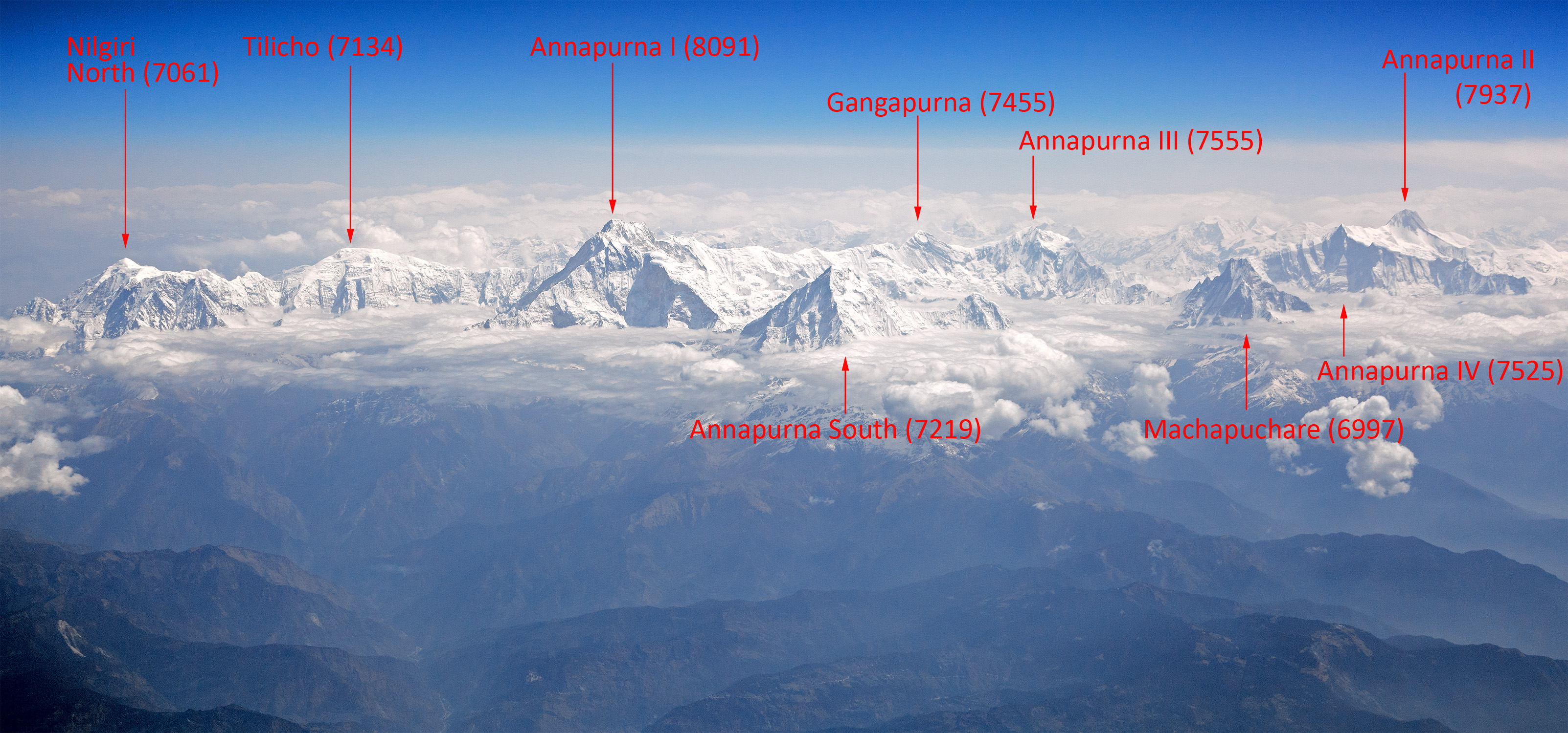
Annapurna (; ne, अन्नपूर्ण) is a mountain situated in the Annapurna mountain range of Gandaki Province, north-central Nepal. It is the tenth highest mountain in the world at above sea level and is well known for the difficulty and danger involved in its ascent. Maurice Herzog led a French expedition to its summit through the north face in 1950, making it the first eight-thousand meter peak ever successfully climbed. The entire massif and surrounding area are protected within the Annapurna Conservation Area, the first and largest conservation area in Nepal. The Annapurna Conservation Area is home to several world-class treks, including Annapurna Sanctuary and Annapurna Circuit. For decades, Annapurna I Main held the highest fatality-to-summit rate of all principal eight-thousander summits; it has, however, seen great climbing successes in recent years, with the fatality rate falling from 32% to just under 20% from 2012 to 2022. This figure places it ju ... [...More Info...] [...Related Items...] OR: [Wikipedia] [Google] [Baidu] |
Annapurna Massif
Annapurna (; ne, अन्नपूर्ण) is a massif in the Himalayas in north-central Nepal that includes one peak over , thirteen peaks over , and sixteen more over . The massif is long, and is bounded by the Kali Gandaki Gorge on the west, the Marshyangdi River on the north and east, and by Pokhara Valley on the south. At the western end, the massif encloses a high basin called the Annapurna Sanctuary. The highest peak of the massif, Annapurna I Main, is the tenth highest mountain in the world at above sea level. Maurice Herzog led a French expedition to its summit through the north face in 1950, making it the first eight-thousand meter peak ever successfully climbed. The name for the range comes from the Hindu deity Annapurna meaning ''the giver of food and nourishment'' due to the evergreen flowing rivers originating from this mountain range which generates greenery and supports vegetation year round on the lower plains. She is also believed to be one of the dau ... [...More Info...] [...Related Items...] OR: [Wikipedia] [Google] [Baidu] |


