|
Parc Naturel Régional Du Vercors
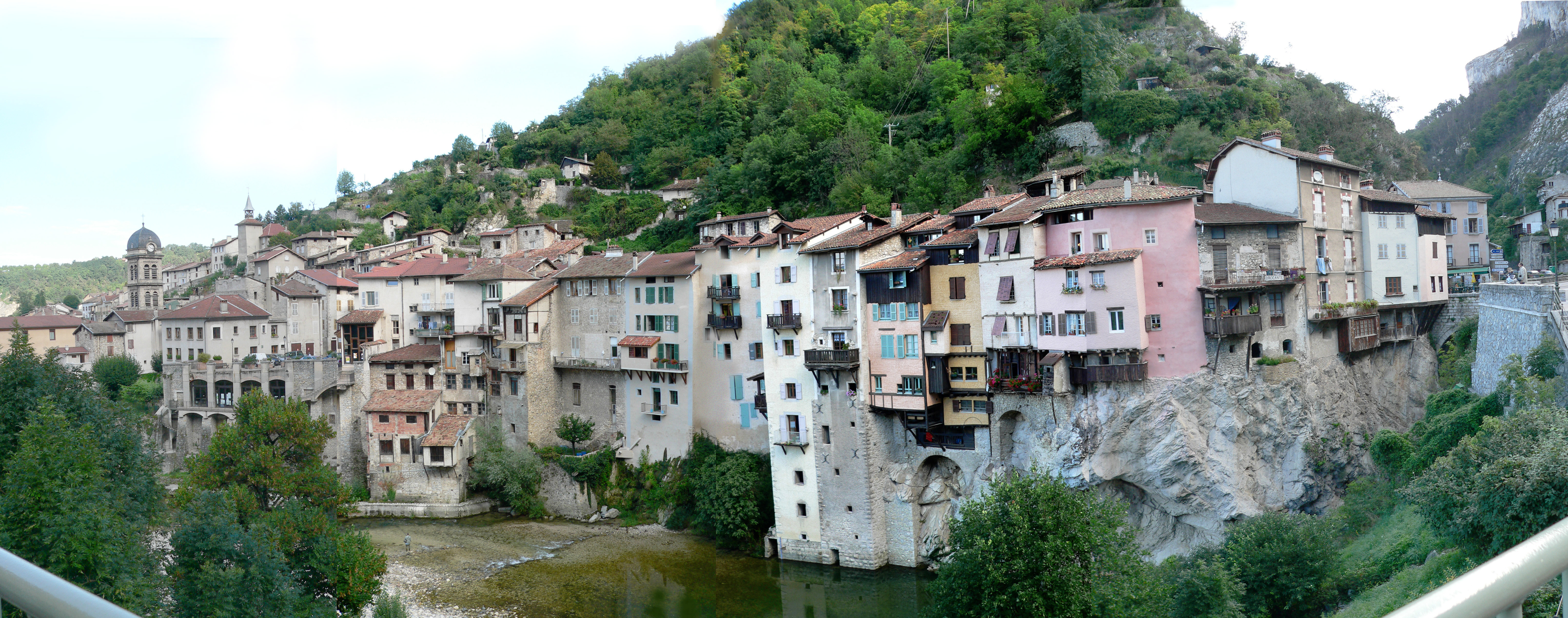
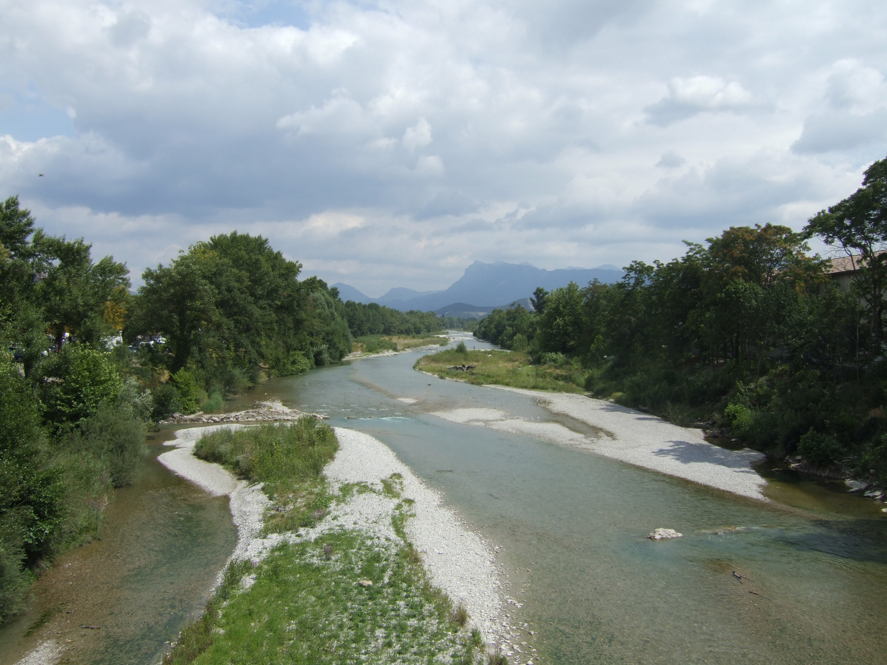
The Vercors Regional Natural Park (French: ''Parc naturel régional du Vercors'') is a protected area of forested mountains in the Rhône-Alpes region of southeastern France. Geography Set upon a limestone plateau south of Grenoble, the park extends into the French Western Alps. It spans two departments, Drôme and Isère, and covers a total area of . The plateau's main elevation reaches while the eastern Alpine mountain ridge tops with Le Grand Veymont (2341m). The Vercors area is peppered with caves. During World War II, it served as a safe and defensible position for the French Resistance: ''Forteresse de la Résistance''. The area now contains around three hundred monuments to the Resistance, including a memorial center and the preserved remains of a destroyed village. In modern times, Vercors has become a popular tourist destination frequented for skiing, hiking and spelunking. Several small communes dot the landscape, supported principally by forestry, shepherding and ... [...More Info...] [...Related Items...] OR: [Wikipedia] [Google] [Baidu] |
Rhône-Alpes
Rhône-Alpes () was an administrative region of France. Since 1 January 2016, it is part of the new region Auvergne-Rhône-Alpes. It is located on the eastern border of the country, towards the south. The region was named after the river Rhône and the Alps mountain range. Its capital, Lyon, is the second-largest metropolitan area in France after Paris. Rhône-Alpes has the sixth-largest economy of any European region. Geography Rhône-Alpes is located in the southeast of France. The neighboring (pre-2016) regions are Bourgogne (Burgundy) and Franche-Comté to the north, Auvergne to the west, Languedoc-Roussillon to the southwest, and Provence-Alpes-Côte d'Azur to the south. The eastern part of the region is in the Alps, and borders Switzerland and Italy. The highest peak is Mont Blanc, on the French-Italian border. The central part of the region comprises the river valleys of the Rhône and the Saône. The confluence of these two rivers is at Lyon. The western part of the regi ... [...More Info...] [...Related Items...] OR: [Wikipedia] [Google] [Baidu] |
Beaufort-sur-Gervanne
Beaufort-sur-Gervanne (; Vivaro-Alpine dialect, Vivaro-Alpine: ''Beufòrt de Gervana'') is a Communes of France, commune in the Drôme Departments of France, department in southeastern France. Population See also *Communes of the Drôme department *Parc naturel régional du Vercors References Communes of Drôme {{Drôme-geo-stub ... [...More Info...] [...Related Items...] OR: [Wikipedia] [Google] [Baidu] |
Crest, Drôme
Crest () is a commune in the Drôme department in the Auvergne-Rhône-Alpes region of Southeastern France. In 2017, it had a population of 8,505. Population Its inhabitants are called ''Crestois''. Sights * The Tour de Crest, one of the highest medieval keeps in France - 52 m. Its height dominates the town. The tower was part of a castle which guarded one of the entrances to the Pre-Alps in Drôme. The site offers a large panoramic view. There are various exhibitions in the castle plus information about the Tour's past including the fact that it has served as a prison in the past. The Tour holds two spectacular carved wooden doors one of which is believed to depict the original castle. Image:France_Drome_Crest_1.jpg Image:Crest 08 2006 092.jpg *Saint-Sauveur Church *Monument to the resistance to the coup d'état of 2 December 1851 in Provence. There is an artisanal chocolate manufacturer in the town with a chocolate museum attached. The museum has a model of the tour in c ... [...More Info...] [...Related Items...] OR: [Wikipedia] [Google] [Baidu] |
Corrençon-en-Vercors
Corrençon-en-Vercors (, literally ''Corrençon in Vercors'') is a commune in the Isère department in southeastern France. Population See also *Communes of the Isère department *Parc naturel régional du Vercors The Vercors Regional Natural Park (French: ''Parc naturel régional du Vercors'') is a protected area of forested mountains in the Rhône-Alpes region of southeastern France. Geography Set upon a limestone plateau south of Grenoble, the park ext ... References External links Official site Communes of Isère Isère communes articles needing translation from French Wikipedia {{Isère-geo-stub ... [...More Info...] [...Related Items...] OR: [Wikipedia] [Google] [Baidu] |
Combovin
Combovin () is a commune in the Drôme department in southeastern France. Population See also *Communes of the Drôme department *Parc naturel régional du Vercors The Vercors Regional Natural Park (French: ''Parc naturel régional du Vercors'') is a protected area of forested mountains in the Rhône-Alpes region of southeastern France. Geography Set upon a limestone plateau south of Grenoble, the park ext ... References Communes of Drôme {{Drôme-geo-stub ... [...More Info...] [...Related Items...] OR: [Wikipedia] [Google] [Baidu] |
Cognin-les-Gorges
Cognin-les-Gorges () is a commune in the Isère department in southeastern France. Population See also *Communes of the Isère department *Parc naturel régional du Vercors The Vercors Regional Natural Park (French: ''Parc naturel régional du Vercors'') is a protected area of forested mountains in the Rhône-Alpes region of southeastern France. Geography Set upon a limestone plateau south of Grenoble, the park ext ... References Communes of Isère Isère communes articles needing translation from French Wikipedia {{Isère-geo-stub ... [...More Info...] [...Related Items...] OR: [Wikipedia] [Google] [Baidu] |
Clelles
Clelles (; oc, Clèlas) is a commune in the Isère department in southeastern France. Population See also *Communes of the Isère department * Col de la Croix Haute *Parc naturel régional du Vercors The Vercors Regional Natural Park (French: ''Parc naturel régional du Vercors'') is a protected area of forested mountains in the Rhône-Alpes region of southeastern France. Geography Set upon a limestone plateau south of Grenoble, the park ext ... References Communes of Isère Isère communes articles needing translation from French Wikipedia {{Isère-geo-stub ... [...More Info...] [...Related Items...] OR: [Wikipedia] [Google] [Baidu] |
Choranche
Choranche (; oc, Chaurança) is a commune in the Isère department in southeastern France. Famous is . The grottoes were discovered end the 19th Century and hide a unique sight of fine stalactites. Population See also *Communes of the Isère department *Parc naturel régional du Vercors The Vercors Regional Natural Park (French: ''Parc naturel régional du Vercors'') is a protected area of forested mountains in the Rhône-Alpes region of southeastern France. Geography Set upon a limestone plateau south of Grenoble, the park ext ... References Communes of Isère {{Isère-geo-stub ... [...More Info...] [...Related Items...] OR: [Wikipedia] [Google] [Baidu] |
Chichilianne
Chichilianne () is a commune in the Isère department in southeastern France. Population See also *Communes of the Isère department *Parc naturel régional du Vercors The Vercors Regional Natural Park (French: ''Parc naturel régional du Vercors'') is a protected area of forested mountains in the Rhône-Alpes region of southeastern France. Geography Set upon a limestone plateau south of Grenoble, the park ext ... References Communes of Isère {{Isère-geo-stub ... [...More Info...] [...Related Items...] OR: [Wikipedia] [Google] [Baidu] |
Châtillon-en-Diois
Châtillon-en-Diois is a commune in the Drôme department in southeastern France. On 1 January 2019, the former commune Treschenu-Creyers was merged into Châtillon-en-Diois. 21 November 2018 Population See also * *Parc naturel régional du Vercors
The Vercors Regional Natural Park (French: ''Parc naturel régional du Vercors'') is a protected area of forested mountains in ...
[...More Info...] [...Related Items...] OR: [Wikipedia] [Google] [Baidu] |
Châtelus, Isère
Châtelus is a commune in the Isère department in southeastern France. Population See also *Communes of the Isère department *Parc naturel régional du Vercors The Vercors Regional Natural Park (French: ''Parc naturel régional du Vercors'') is a protected area of forested mountains in the Rhône-Alpes region of southeastern France. Geography Set upon a limestone plateau south of Grenoble, the park ext ... References Communes of Isère {{Isère-geo-stub ... [...More Info...] [...Related Items...] OR: [Wikipedia] [Google] [Baidu] |
Château-Bernard
Château-Bernard () is a commune in the Isère department in southeastern France. Population See also *Communes of the Isère department *Parc naturel régional du Vercors The Vercors Regional Natural Park (French: ''Parc naturel régional du Vercors'') is a protected area of forested mountains in the Rhône-Alpes region of southeastern France. Geography Set upon a limestone plateau south of Grenoble, the park ext ... References Communes of Isère {{Isère-geo-stub ... [...More Info...] [...Related Items...] OR: [Wikipedia] [Google] [Baidu] |

