|
Palliser Health Region
Palliser Health Region is the governing body for healthcare regulation in an area of the Canadian province of Alberta. The area region includes the communities of: * Bassano * Bow Island * Brooks * Empress * Medicine Hat * Oyen Oyen is a town in east-central Alberta, Canada near the Saskatchewan boundary and north of Medicine Hat. It is on Highway 41, south of its junction with Highway 9. Early name, Bishopburg, was changed in 1912 to honour Andrew Oyen, an early s ... References *''Ministry of Health and Wellness Annual Report: 2008/2009'' (N.p.: Alberta Ministry of Health and Wellness, ca. 2009), pp. 27-42, at https://web.archive.org/web/20150924025400/http://www.health.alberta.ca/documents/Annual-Report-09-Palliser.pdf . *Global Air Rescue website, at http://www.globalairrescue.com/hospitals/air-ambulance-palliser-health-region-corporate-office.php . *Business & Industry Clinic website, at http://businessindustryclinic.ca/about-us/our-history/ . *Palliser Health Region ... [...More Info...] [...Related Items...] OR: [Wikipedia] [Google] [Baidu] |
Health Regions Of Canada
Health regions, also called health authorities, are a governance model used by Canada's provincial and territorial governments to administer and deliver public health care to all Canadian residents. Health care is designated a provincial responsibility under the separation of powers in Canada's federal system. Most health regions or health authorities are organized along geographic boundaries, however, some are organized along operational lines. Atlantic region New Brunswick * Vitalité Health Network * Horizon Health Network Newfoundland and Labrador * Central Health * Eastern Health * Labrador-Grenfell Health * Western Health Nova Scotia * IWK Health Centre * Nova Scotia Health Authority Prince Edward Island * Health PEI is the single health authority for the province British Columbia * Northern Health * Interior Health * Island Health * Vancouver Coastal Health * Fraser Health * First Nations Health Authority (not regional) * Provincial Health Services Authority (not r ... [...More Info...] [...Related Items...] OR: [Wikipedia] [Google] [Baidu] |
Healthcare
Health care or healthcare is the improvement of health via the prevention, diagnosis, treatment, amelioration or cure of disease, illness, injury, and other physical and mental impairments in people. Health care is delivered by health professionals and allied health fields. Medicine, dentistry, pharmacy, midwifery, nursing, optometry, audiology, psychology, occupational therapy, physical therapy, athletic training, and other health professions all constitute health care. It includes work done in providing primary care, secondary care, and tertiary care, as well as in public health. Access to health care may vary across countries, communities, and individuals, influenced by social and economic conditions as well as health policies. Providing health care services means "the timely use of personal health services to achieve the best possible health outcomes". Factors to consider in terms of health care access include financial limitations (such as insurance coverage), geo ... [...More Info...] [...Related Items...] OR: [Wikipedia] [Google] [Baidu] |
Canadian Province
Within the geographical areas of Canada, the ten provinces and three territories are sub-national administrative divisions under the jurisdiction of the Canadian Constitution. In the 1867 Canadian Confederation, three provinces of British North America—New Brunswick, Nova Scotia, and the Province of Canada (which upon Confederation was divided into Ontario and Quebec)—united to form a federation, becoming a fully independent country over the next century. Over its history, Canada's international borders have changed several times as it has added territories and provinces, making it the world's second-largest country by area. The major difference between a Canadian province and a territory is that provinces receive their power and authority from the ''Constitution Act, 1867'' (formerly called the ''British North America Act, 1867''), whereas territorial governments are creatures of statute with powers delegated to them by the Parliament of Canada. The powers flowing from th ... [...More Info...] [...Related Items...] OR: [Wikipedia] [Google] [Baidu] |
Alberta
Alberta ( ) is one of the thirteen provinces and territories of Canada. It is part of Western Canada and is one of the three prairie provinces. Alberta is bordered by British Columbia to the west, Saskatchewan to the east, the Northwest Territories (NWT) to the north, and the U.S. state of Montana to the south. It is one of the only two landlocked provinces in Canada (Saskatchewan being the other). The eastern part of the province is occupied by the Great Plains, while the western part borders the Rocky Mountains. The province has a predominantly continental climate but experiences quick temperature changes due to air aridity. Seasonal temperature swings are less pronounced in western Alberta due to occasional Chinook winds. Alberta is the fourth largest province by area at , and the fourth most populous, being home to 4,262,635 people. Alberta's capital is Edmonton, while Calgary is its largest city. The two are Alberta's largest census metropolitan areas. More tha ... [...More Info...] [...Related Items...] OR: [Wikipedia] [Google] [Baidu] |
Bassano, Alberta
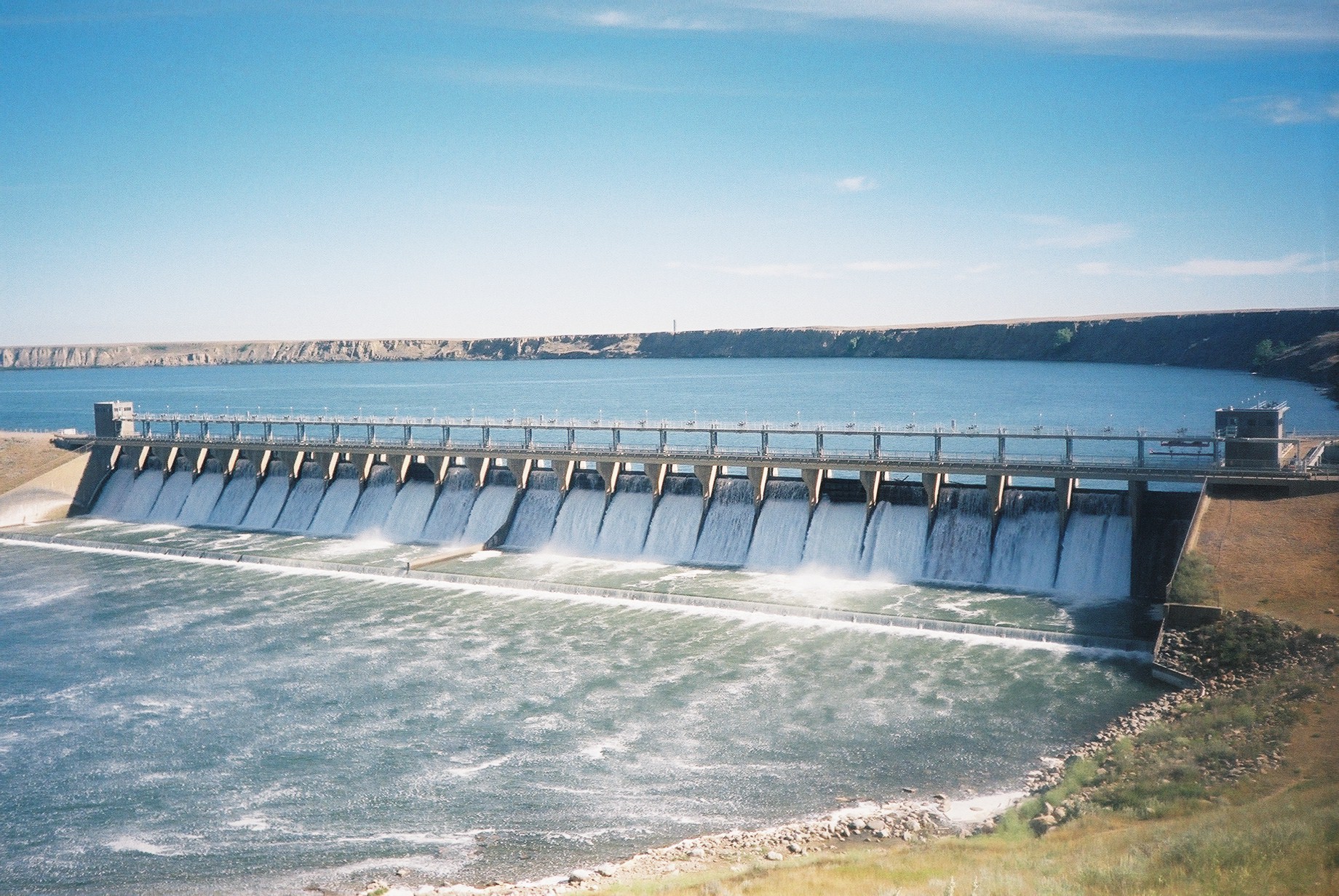
Bassano ( ) is a town in Alberta, Canada. It is located on the Trans-Canada Highway approximately southeast of Calgary and northwest of Medicine Hat. It is also on the main line of the Canadian Pacific Railway. A short distance south of the town is the Bassano Dam (originally "Horse Shoe Bend Dam"), serves as a diversion structure which routes water through a canal into Lake Newell, Lake Newell Reservoir which supplies water to the majority of the County of Newell for purposes like irrigation, recreation, and the County's drinking water. The Bassano Dam holds the record for highest temperature in Alberta which is . The community has the name of Marquis de Bassano, a railroad promoter. Demographics In the 2021 Canadian census, 2021 Census of Population conducted by Statistics Canada, the Town of Bassano had a population of 1,216 living in 540 of its 595 total private dwellings, a change of from its 2016 population of 1,206. With a land area of , it had a population density ... [...More Info...] [...Related Items...] OR: [Wikipedia] [Google] [Baidu] |
Bow Island, Alberta
Bow Island () is a town in Alberta, Canada. It is located on Highway 3 in southern Alberta, approximately north of the United States border, southeast of Calgary and southwest of Medicine Hat. History The community of Bow Island received its first post-colonial families in 1900. In February 1910, the Village of Bow Island was formed, and by March 1912 the village was declared the Town of Bow Island. The naming of Bow Island brings many stories to the forefront, but the most prominent one is that the communities of Grassy Lake, approximately to the west, and Bow Island had their respective names mixed up. An island named "Bow Island" is located north of Grassy Lake near the confluence of the Bow River and the Oldman River, while a low depressional area named "Grassy Lake" is located south of Bow Island. Bow Island was one of the first towns in Alberta to have natural gas wells and operated them until the franchise was sold to a private company. In the early 1950s, ... [...More Info...] [...Related Items...] OR: [Wikipedia] [Google] [Baidu] |
Brooks, Alberta
Brooks is a city in southeast Alberta, Canada that is surrounded by the County of Newell. It is located on Highway 1 (Trans-Canada Highway) and the Canadian Pacific Railway, approximately southeast of Calgary, and northwest of Medicine Hat. The city has an elevation of . History The area that is now Brooks was used as a bison-hunting ground for the Blackfoot and Crow. After Treaty 7 was signed in 1877, homesteaders moved into the area to begin farming. Before 1904, the area still did not have a name. Through a contest sponsored by the Postmaster General, the area was named after Noel Edgell Brooks, a Canadian Pacific Railway Divisional Engineer from Calgary. Brooks was incorporated as a village on July 14, 1910, and then as a town on September 8, 1911. Its population in the 1911 Census of Canada was 486. In the 1996 Census, the population of Brooks reached 10,093 making it eligible for city status. Brooks incorporated as a city on September 1, 2005 when its official pop ... [...More Info...] [...Related Items...] OR: [Wikipedia] [Google] [Baidu] |
Empress, Alberta
Empress is a village in southern Alberta, Canada that is adjacent to the provincial boundary between Alberta and Saskatchewan. It is north of Medicine Hat. The village was named, in 1913, for Queen Victoria, who was also Empress of India. In the past it was known as the "Hub of the West", connecting major cities together by the Canadian Pacific Railway. It is located on the southern bank above the Red Deer River, northwest of the confluence of Red Deer River and South Saskatchewan River, at an elevation of . It is connected to Buffalo Trail by Highway 899 and Highway 562. Demographics In the 2021 Census of Population conducted by Statistics Canada, the Village of Empress had a population of 148 living in 69 of its 112 total private dwellings, a change of from its 2016 population of 135. With a land area of , it had a population density of in 2021. The population of the Village of Empress according to its 2017 municipal census is 160. In the 2016 Census of Population ... [...More Info...] [...Related Items...] OR: [Wikipedia] [Google] [Baidu] |
Medicine Hat, Alberta
Medicine Hat is a city in southeast Alberta, Canada. It is located along the South Saskatchewan River. It is approximately east of Lethbridge and southeast of Calgary. This city and the adjacent Town of Redcliff to the northwest are within Cypress County. Medicine Hat was the sixth-largest city in Alberta in 2016 with a population of 63,230. It is also the sunniest place in Canada according to Environment and Climate Change Canada, averaging 2,544 hours of sunshine a year. Started as a railway town, today Medicine Hat is served by the Trans-Canada Highway ( Highway 1) and the eastern terminus of the Crowsnest Highway ( Highway 3). Nearby communities considered part of the Medicine Hat area include the Town of Redcliff (abutting the city's northwest boundary) and the hamlets of Desert Blume, Dunmore, Irvine, Seven Persons, and Veinerville. The Cypress Hills (including Cypress Hills Interprovincial Park) is a relatively short distance (by car) to the southeast of ... [...More Info...] [...Related Items...] OR: [Wikipedia] [Google] [Baidu] |
Oyen, Alberta
Oyen is a town in east-central Alberta, Canada near the Saskatchewan boundary and north of Medicine Hat. It is on Highway 41, south of its junction with Highway 9. Early name, Bishopburg, was changed in 1912 to honour Andrew Oyen, an early settler who sold his homestead for the townsite. Oyen is the service centre for a large but sparsely populated dryland farming area. In the surrounding area wheat, barley, and canola are important crops, and beef cattle are raised. Geography Climate Oyen experiences a semi-arid climate (Köppen climate classification ''BSk''). Winters are long, cold and dry, while summers are short and warm. Precipitation is low, with an annual average of 322 mm, and is heavily concentrated in the warmer months. Oyen's precipitation is narrowly below being a humid continental climate, a type it closely resembles in terms of yearly temperatures. Demographics In the 2021 Census of Population conducted by Statistics Canada, the Town of Oyen had ... [...More Info...] [...Related Items...] OR: [Wikipedia] [Google] [Baidu] |


