|
Purisima Creek (San Mateo County)
Purisima Creek is an U.S. Geological Survey. National Hydrography Dataset high-resolution flowline dataThe National Map accessed March 15, 2011 stream in San Mateo County, California which rises north of Sierra Morena, a mountain in the Santa Cruz Mountains, and flows westward to the Pacific Ocean south-southeast of Miramontes Point. Much of its watershed has been incorporated in the Purisima Creek Redwoods Open Space Preserve. History The first European land exploration of Alta California, the Spanish Portolà expedition, passed through the area on its way north, camping near the creek on October 27, 1769. They stopped for the night at an abandoned Torose village at the northern side of the stream, close to the coast. The guides told them that the villagers had moved into the mountains. The stream was named Saint Ives. "...where we came upon an empty village; those belonging to the preceding place said they had moved into the mountains. We were accompanied by four heathens b ... [...More Info...] [...Related Items...] OR: [Wikipedia] [Google] [Baidu] |
Grabtown Gulch
Grabtown Gulch is a valley in San Mateo County, California. It contains a stream which is a tributary of Purisima Creek. 09-20-07 Background Grabtown Gulch (Purissima Redwoods OSP): Gulch below the site of the trading center and of Grabtown on Tunitas Road, originally called Gilbert's Camp in the 1880s. The origin of the name is attributed to the tendency of its inhabitants to lay claim to land and/or anything of value that wasn't nailed down.References See also * |
List Of Watercourses In The San Francisco Bay Area
These watercourses (rivers, creeks, sloughs, etc.) in the San Francisco Bay Area are grouped according to the bodies of water they flow into. Tributaries are listed under the watercourses they feed, sorted by the elevation of the confluence so that tributaries entering nearest the sea appear first. Numbers in parentheses are Geographic Names Information System feature identifiers. Pacific Coast north of the Golden Gate Sonoma Coast Watercourses which feed into the Pacific Ocean in Sonoma County north of Bodega Head, listed from north to south: The Gualala River and its tributaries *Gualala River (253221) ** North Fork (229679) – flows from Mendocino County. ** South Fork (235010) ***Big Pepperwood Creek (219227) – flows from Mendocino County. ***Rockpile Creek (231751) – flows from Mendocino County. ***Buckeye Creek (220029) ****Little Creek (227239) ****North Fork Buckeye Creek (229647) *****Osser Creek (230143) *****Roy Creek (231987) ****Soda Springs Creek ( ... [...More Info...] [...Related Items...] OR: [Wikipedia] [Google] [Baidu] |
Purissima, California
Purissima is a ghost town in southwestern San Mateo County, California, United States, near the junction of State Route 1 and Verde Road. ''Purísima'' means "purest" in Spanish and is most commonly used in Spanish to refer to ''La Purísima Concepción'' (the Immaculate Conception) of the Virgin Mary (note historical misspelling in English resulting in double "s", or the result of the Holstein pronunciation with use of the "ẝ" being mistaken as ß "ss", or perhaps spelling comes from the local Portuguese influence, where the spelling from ''A Puríssima Conceição'' would be correct). Purissima is the name of the town used as the setting for Ross Macdonald's 1958 crime fiction novel 'The Doomsters'. History Located on José María Alviso's Rancho Cañada de Verde y Arroyo de la Purisima in a rural area four miles (6 km) south of Half Moon Bay, the village was one of the earliest settlements on the San Mateo County coast. The first European mention of the area was no ... [...More Info...] [...Related Items...] OR: [Wikipedia] [Google] [Baidu] |
San Joaquin County
San Joaquin County (; Spanish language, Spanish: ''San Joaquín'', meaning "Joachim, St. Joachim"), officially the County of San Joaquin, is a county (United States), county in the U.S. state of California. As of the 2020 United States Census, 2020 census, the population was 779,233. The county seat is Stockton, California, Stockton. San Joaquin County comprises the Stockton, California, Stockton–Lodi, California, Lodi–Tracy, California, Tracy metropolitan statistical area within the regional San Jose, California, San Jose–San Francisco–Oakland, California, Oakland San Jose–San Francisco–Oakland, CA Combined Statistical Area, combined statistical area. The county is located in Northern California's California Central Valley, Central Valley just east of the very highly populated nine-county San Francisco Bay Area region and is separated from the Bay Area by the Diablo Range of low mountains with its Altamont Pass. One of the smaller counties by area in California, it ... [...More Info...] [...Related Items...] OR: [Wikipedia] [Google] [Baidu] |
Tule Elk
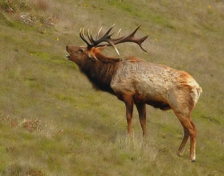
The tule elk (''Cervus canadensis nannodes'') is a subspecies of elk found only in California, ranging from the grasslands and marshlands of the Central Valley to the grassy hills on the coast. The subspecies name derives from the tule (), a species of sedge native to freshwater marshes on which the Tule elk feeds. When the Europeans first arrived, an estimated 500,000 tule elk roamed these regions, but by 1870 they were thought to be extirpated. However, in 1874–1875 a single breeding pair was discovered in the tule marshes of Buena Vista Lake in the southern San Joaquin Valley. Conservation measures were taken to protect the species in the 1970s. Today, the wild population exceeds 4,000. Tule elk can reliably be found in Carrizo Plain National Monument, Point Reyes National Seashore, portions of the Owens Valley from Lone Pine to Bishop, on Coyote Ridge in Santa Clara Valley, San Jose, California and in Pacheco State Park and areas surrounding San Luis Reservoir near Los ... [...More Info...] [...Related Items...] OR: [Wikipedia] [Google] [Baidu] |
California Academy Of Sciences
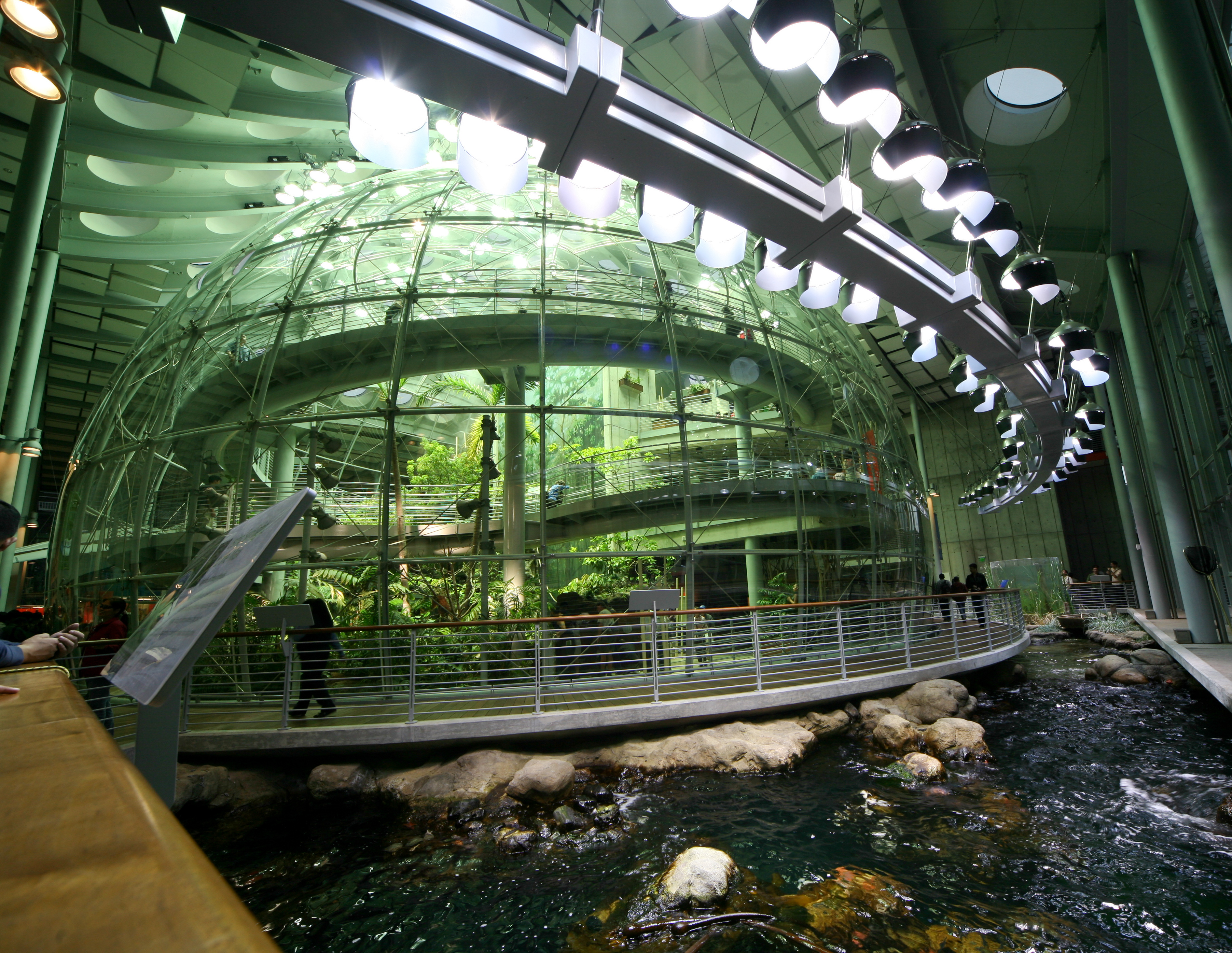
The California Academy of Sciences is a research institute and natural history museum in San Francisco, California, that is among the largest museums of natural history in the world, housing over 46 million specimens. The Academy began in 1853 as a learned society and still carries out a large amount of original research. The institution is located at the Golden Gate Park in San Francisco. Completely rebuilt in 2008, the Academy's primary building in Golden Gate Park covers . In early 2020, before the COVID-19 pandemic, the California Academy of Sciences had around 500 employees and an annual revenue of about $33 million. Governance The California Academy of Sciences, California's oldest operating museum and research institution for the natural sciences, is governed by a forty-one member Board of Trustees who are nominated and chosen by the California Academy of Sciences Fellows. The Academy Fellows are, in turn, " minated by their colleagues and appointed by the Board of Tr ... [...More Info...] [...Related Items...] OR: [Wikipedia] [Google] [Baidu] |
Soda Gulch
Soda Gulch is a valley in San Mateo County, California. It contains a small stream which is a tributary of Purisima Creek. 09-20-07 References See also *List of watercourses in the San Francisco Bay Area
These watercourses (rivers, creeks, sloughs, etc.) in the San Francisco Bay Area are grouped according to the bodies of water they flow into. Tributaries are listed under the watercourses they feed, sorted by the elevation of the confluence so tha ...
[...More Info...] [...Related Items...] OR: [Wikipedia] [Google] [Baidu] |
Whittemore Gulch
Whittemore Gulch is a valley in San Mateo County, California. It contains a small stream which is a tributary of Purisima Creek. 09-20-07 References See also *List of watercourses in the San Francisco Bay Area
These watercourses (rivers, creeks, sloughs, etc.) in the San Francisco Bay Area are grouped according to the bodies of water they flow into. Tributaries are listed under the watercourses they feed, sorted by the elevation of the confluence so tha ...
[...More Info...] [...Related Items...] OR: [Wikipedia] [Google] [Baidu] |


