|
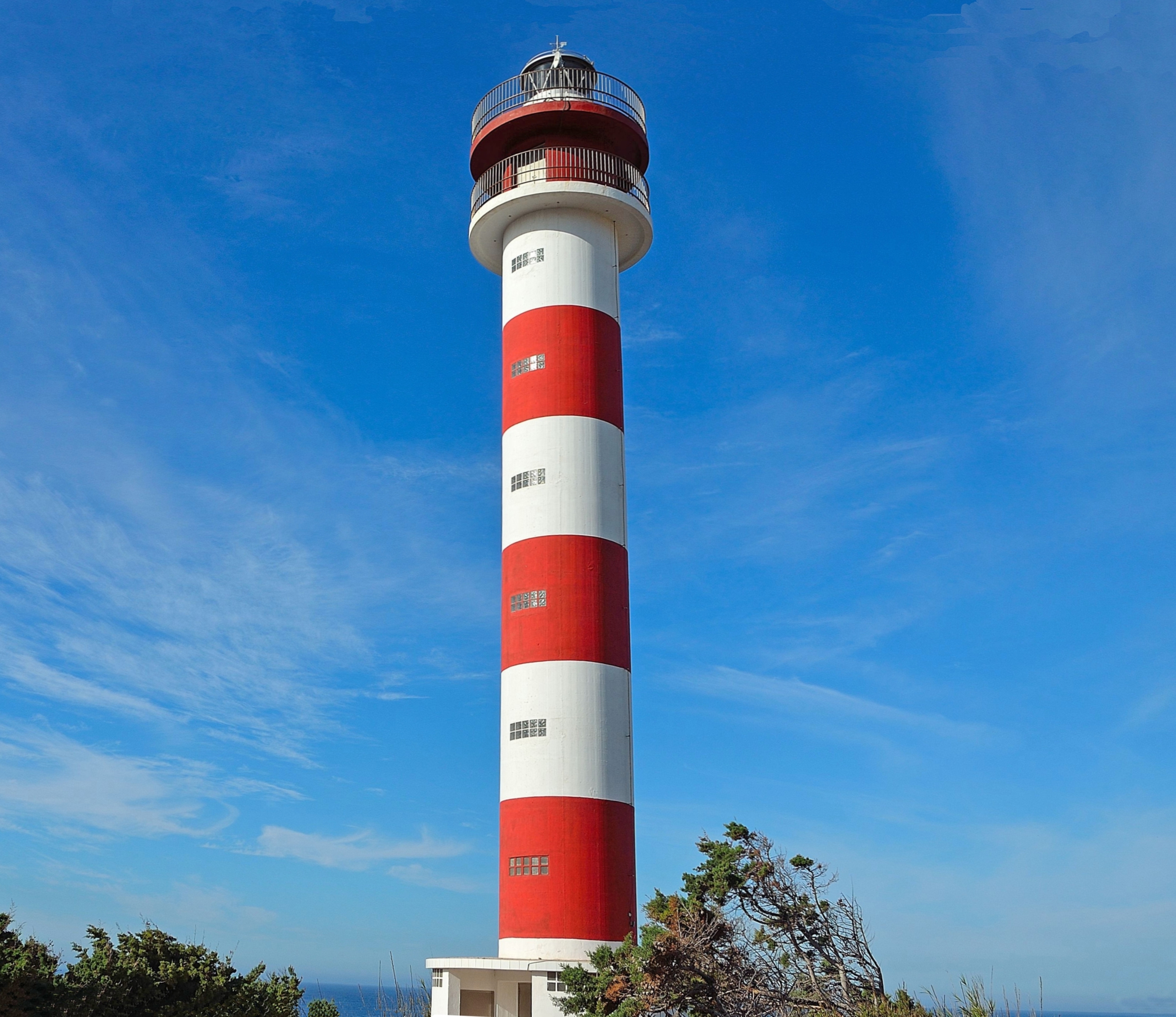
Punta Orchilla Lighthouse
The Punta Orchilla Lighthouse ( es, Faro de Punta Orchilla) is an active lighthouse on the Canary island of El Hierro in the municipality of El Pinar. The need for a lighthouse on the island was highlighted in the second maritime lighting plan for the Canaries, and it first became operational in 1933. Punta de la Orchilla Punta de la Orchilla on the south-western side of El Hierro, is a significant location in terms of the Canaries, as it is one of the most westerly points in the archipelago. A meridian memorial close to the lighthouse, is a reminder that historically it was considered to be a prime meridian for early map makers, and was known as the Ferro Meridian, at the western extremity of the known world. The name comes from the Orchil lichen that grows on the rocky lava slopes in the area, inland from the point is a 238 m peak called Orchilla. The isolated locality of the Punta de la Orchilla means that it has been described as "probably Spain's most remote lig ... [...More Info...] [...Related Items...] OR: [Wikipedia] [Google] [Baidu] |
El Pinar, Canary Islands
El Pinar (Spanish: ''El Pinar de El Hierro'') is a Spanish municipality on the island of El Hierro (nicknamed ''Isla del Meridiano'', the "Meridian Island"), Canary Islands. It was created in 2007. Sites of interest At the western end of El Pinar is the Punta Orchilla lighthouse which was completed in 1933. See also *Pico de Malpaso Pico de Malpaso (English: "difficult step peak") is the highest point on the island of El Hierro in the Canary Islands, Spain. Geography The summit rises at the centre of the island on the border between Frontera and El Pinar de El Hierro mu ... References Municipalities in El Hierro {{Spain-stub ... [...More Info...] [...Related Items...] OR: [Wikipedia] [Google] [Baidu] |
Orchil
Orcein, also archil, orchil, lacmus and C.I. Natural Red 28, are names for dyes extracted from several species of lichen, commonly known as "orchella weeds", found in various parts of the world. A major source is the archil lichen, ''Roccella tinctoria''. Orcinol is extracted from such lichens. It is then converted to orcein by ammonia and air. In traditional dye-making methods, urine was used as the ammonia source. If the conversion is carried out in the presence of potassium carbonate, calcium hydroxide, and calcium sulfate (in the form of potash, lime, and gypsum in traditional dye-making methods), the result is litmus, a more complex molecule. The manufacture was described by Cocq in 1812 and in the UK in 1874. Edmund Roberts noted orchilla as a principal export of the Cape Verde islands, superior to the same kind of "moss" found in Italy or the Canary Islands, that in 1832 was yielding an annual revenue of $200,000. Commercial archil is either a powder (called cudbear) or a p ... [...More Info...] [...Related Items...] OR: [Wikipedia] [Google] [Baidu] |
Bien De Interés Cultural Landmarks In The Province Of Santa Cruz De Tenerife
Bien may refer to: * Bien (newspaper) * Basic Income Earth Network BASIC (Beginners' All-purpose Symbolic Instruction Code) is a family of general-purpose, high-level programming languages designed for ease of use. The original version was created by John G. Kemeny and Thomas E. Kurtz at Dartmouth College ... * Bień, Poland {{disambiguation ... [...More Info...] [...Related Items...] OR: [Wikipedia] [Google] [Baidu] |
OpenStreetMap
OpenStreetMap (OSM) is a free, open geographic database updated and maintained by a community of volunteers via open collaboration. Contributors collect data from surveys, trace from aerial imagery and also import from other freely licensed geodata sources. OpenStreetMap is freely licensed under the Open Database License and as a result commonly used to make electronic maps, inform turn-by-turn navigation, assist in humanitarian aid and data visualisation. OpenStreetMap uses its own topology to store geographical features which can then be exported into other GIS file formats. The OpenStreetMap website itself is an online map, geodata search engine and editor. In 2004, OpenStreetMap was created by Steve Coast in response to the Ordnance Survey, the United Kingdom's national mapping agency, failing to release its data to the public and under free licences. Initially, maps were created only via GPS traces, but it was quickly populated by importing public domain geographical ... [...More Info...] [...Related Items...] OR: [Wikipedia] [Google] [Baidu] |
List Of Lighthouses In The Canary Islands ...
This is a list of lighthouses in the Canary Islands. The Spanish archipelago lies to the west of Africa, in the Atlantic Ocean. Lighthouses Map See also * List of lighthouses in Spain * List of lighthouses in the Balearic Islands References External links * {{DEFAULTSORT:Canary Islands * Lists of lighthouses in Spain Lighthouses A lighthouse is a tower, building, or other type of physical structure designed to emit light from a system of lamps and lenses and to serve as a beacon for navigational aid, for maritime pilots at sea or on inland waterways. Lighthouses mar ... [...More Info...] [...Related Items...] OR: [Wikipedia] [Google] [Baidu] |
List Of Lighthouses In Spain
This is a list of lighthouses in Spain. Lighthouses By autonomous communities * List of lighthouses in the Balearic Islands * List of lighthouses in the Canary Islands See also * Lists of lighthouses and lightvessels * List of tallest lighthouses References External links {{Architecture of Spain Lists of lighthouses in Spain, ... [...More Info...] [...Related Items...] OR: [Wikipedia] [Google] [Baidu] |


