|
Prince Edward Fracture Zone
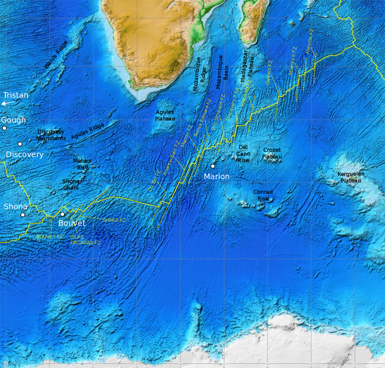
The Prince Edward Fracture Zone (PEFZ) is one of the fracture zones located on the Southwest Indian Ridge in the Indian Ocean between Africa and Antarctica. The PEFZ is located west of Prince Edward Islands. The history of seafloor spreading between Africa and Antarctica since the breakup of Gondwana can be traced using magnetic anomaly lineations between the Mozambique Channel The Mozambique Channel (french: Canal du Mozambique, mg, Lakandranon'i Mozambika, pt, Canal de Moçambique) is an arm of the Indian Ocean located between the Southeast African countries of Madagascar and Mozambique. The channel is about long ... and the seafloor of Dronning Maud Land. Before the 1980s it was assumed that this spreading occurred continuously for 80 million years, from the Cretaceous to present, along the fracture zones flanking the mid-ocean ridge. In the mid-80s new magnetic lineations discovered near the PEFZ made it clear that a change in the spreading direction occurred 74–5 ... [...More Info...] [...Related Items...] OR: [Wikipedia] [Google] [Baidu] |
Southwest Indian Ridge ETOPO1
The points of the compass are a set of horizontal, radially arrayed compass directions (or azimuths) used in navigation and cartography. A compass rose is primarily composed of four cardinal directions—north, east, south, and west—each separated by 90 degrees, and secondarily divided by four ordinal (intercardinal) directions—northeast, southeast, southwest, and northwest—each located halfway between two cardinal directions. Some disciplines such as meteorology and navigation further divide the compass with additional azimuths. Within European tradition, a fully defined compass has 32 'points' (and any finer subdivisions are described in fractions of points). Compass points are valuable in that they allow a user to refer to a specific azimuth in a colloquial fashion, without having to compute or remember degrees. Designations The names of the compass point directions follow these rules: 8-wind compass rose * The four cardinal directions are north (N), east (E), ... [...More Info...] [...Related Items...] OR: [Wikipedia] [Google] [Baidu] |
Fracture Zone
A fracture zone is a linear feature on the ocean floor—often hundreds, even thousands of kilometers long—resulting from the action of offset mid-ocean ridge axis segments. They are a consequence of plate tectonics. Lithospheric plates on either side of an active transform fault move in opposite directions; here, strike-slip activity occurs. Fracture zones extend past the transform faults, away from the ridge axis; seismically inactive (because both plate segments are moving in the same direction), they display evidence of past transform fault activity, primarily in the different ages of the crust on opposite sides of the zone. In actual usage, many transform faults aligned with fracture zones are often loosely referred to as "fracture zones" although technically, they are not. Structure and formation Mid-ocean ridges are divergent plate boundaries. As the plates on either side of an offset mid-ocean ridge move, a transform fault forms at the offset between the two ridges ... [...More Info...] [...Related Items...] OR: [Wikipedia] [Google] [Baidu] |
Southwest Indian Ridge
The Southwest Indian Ridge (SWIR) is a mid-ocean ridge located along the floors of the south-west Indian Ocean and south-east Atlantic Ocean. A divergent tectonic plate boundary separating the Somali Plate to the north from the Antarctic Plate to the south, the SWIR is characterised by ultra-slow spreading rates (only exceeding those of the Gakkel Ridge in the Arctic) combined with a fast lengthening of its axis between the two flanking triple junctions, Rodrigues () in the Indian Ocean and Bouvet () in the Atlantic Ocean. Geological setting Spreading rates The spreading rate along the SWIR varies: the transition between slow (30 mm/yr) and ultra-slow (15 mm/yr) spreading occur at magnetic anomaly C6C (ca. 24 Ma). This occurs between 54°–67°E, the deepest, and perhaps coldest and most melt-poor, part of Earth's mid-ocean ridge system. Crustal thickness decreases quickly as spreading rates drop below c. 20 mm/yr and in the SWIR there is an absence of ... [...More Info...] [...Related Items...] OR: [Wikipedia] [Google] [Baidu] |
Indian Ocean
The Indian Ocean is the third-largest of the world's five oceanic divisions, covering or ~19.8% of the water on Earth's surface. It is bounded by Asia to the north, Africa to the west and Australia to the east. To the south it is bounded by the Southern Ocean or Antarctica, depending on the definition in use. Along its core, the Indian Ocean has some large marginal or regional seas such as the Arabian Sea, Laccadive Sea, Bay of Bengal, and Andaman Sea. Etymology The Indian Ocean has been known by its present name since at least 1515 when the Latin form ''Oceanus Orientalis Indicus'' ("Indian Eastern Ocean") is attested, named after Indian subcontinent, India, which projects into it. It was earlier known as the ''Eastern Ocean'', a term that was still in use during the mid-18th century (see map), as opposed to the ''Western Ocean'' (Atlantic Ocean, Atlantic) before the Pacific Ocean, Pacific was surmised. Conversely, Ming treasure voyages, Chinese explorers in the Indian Oce ... [...More Info...] [...Related Items...] OR: [Wikipedia] [Google] [Baidu] |
Prince Edward Islands
The Prince Edward Islands are two small uninhabited islands in the sub-Antarctic Indian Ocean that are part of South Africa. The islands are named Marion Island (named after Marc-Joseph Marion du Fresne, 1724–1772) and Prince Edward Island (named after Prince Edward, Duke of Kent and Strathearn, 1767–1820). The islands in the group have been declared Special Nature Reserves under the South African Environmental Management: Protected Areas Act, No. 57 of 2003, and activities on the islands are therefore restricted to research and conservation management. Further protection was granted when the area was declared a marine protected area in 2013. The only human inhabitants of the islands are the staff of a meteorological and biological research station run by the South African National Antarctic Programme on Marion Island. History The islands were discovered on 4 March 1663 by Barent Barentszoon Lam of the Dutch East India Company ship ''Maerseveen'' and were named ''Dina' ... [...More Info...] [...Related Items...] OR: [Wikipedia] [Google] [Baidu] |
Gondwana
Gondwana () was a large landmass, often referred to as a supercontinent, that formed during the late Neoproterozoic (about 550 million years ago) and began to break up during the Jurassic period (about 180 million years ago). The final stages of break-up, involving the separation of Antarctica from South America (forming the Drake Passage) and Australia, occurred during the Paleogene. Gondwana was not considered a supercontinent by the earliest definition, since the landmasses of Baltica, Laurentia, and Siberia were separated from it. To differentiate it from the Indian region of the same name (see ), it is also commonly called Gondwanaland. Gondwana was formed by the accretion of several cratons. Eventually, Gondwana became the largest piece of continental crust of the Palaeozoic Era, covering an area of about , about one-fifth of the Earth's surface. During the Carboniferous Period, it merged with Laurasia to form a larger supercontinent called Pangaea. Gondwana (and Pan ... [...More Info...] [...Related Items...] OR: [Wikipedia] [Google] [Baidu] |
Magnetic Anomaly
In geophysics, a magnetic anomaly is a local variation in the Earth's magnetic field resulting from variations in the chemistry or magnetism of the rocks. Mapping of variation over an area is valuable in detecting structures obscured by overlying material. The magnetic variation (geomagnetic reversals) in successive bands of ocean floor parallel with mid-ocean ridges was important evidence for seafloor spreading, a concept central to the theory of plate tectonics. Measurement Magnetic anomalies are generally a small fraction of the magnetic field. The total field ranges from 25,000 to 65,000 nanoteslas (nT). To measure anomalies, magnetometers need a sensitivity of 10 nT or less. There are three main types of magnetometer used to measure magnetic anomalies: # The fluxgate magnetometer was developed during World War II to detect submarines. It measures the component along a particular axis of the sensor, so it needs to be oriented. On land, it is often oriented vertically, wh ... [...More Info...] [...Related Items...] OR: [Wikipedia] [Google] [Baidu] |
Mozambique Channel
The Mozambique Channel (french: Canal du Mozambique, mg, Lakandranon'i Mozambika, pt, Canal de Moçambique) is an arm of the Indian Ocean located between the Southeast African countries of Madagascar and Mozambique. The channel is about long and across at its narrowest point, and reaches a depth of about off the coast of Mozambique. A warm current, the Mozambique Current, flows in a southward direction in the channel, leading into the Agulhas Current off the east coast of Southern Africa. Extent The International Hydrographic Organization (IHO) defines the limits of the Mozambique Channel as follows: ::''On the North.'' A line from the estuary of the River Rovuma () to Ras Habu, the northernmost point of Ile Grande Comore, the northernmost of the Comore (Comoro) Islands, to Cap d'Ambre (Cape Amber), the northern extremity of Madagascar (). ::''On the East.'' The west coast of Madagascar. ::''On the South.'' A line from Cap Sainte-Marie, the southern extremity of Mad ... [...More Info...] [...Related Items...] OR: [Wikipedia] [Google] [Baidu] |
Dronning Maud Land
Queen Maud Land ( no, Dronning Maud Land) is a roughly region of Antarctica claimed by Norway as a dependent territory. It borders the claimed British Antarctic Territory 20° west and the Australian Antarctic Territory 45° east. In addition, a small unclaimed area from 1939 was annexed in June 2015. Positioned in East Antarctica, it makes out about one-fifth of the continent, and is named after the Norwegian queen Maud of Wales (1869–1938). In 1930, the Norwegian Hjalmar Riiser-Larsen was the first person known to have set foot in the territory. On 14 January 1939, the territory was claimed by Norway. On 23 June 1961, Queen Maud Land became part of the Antarctic Treaty System, making it a demilitarised zone. It is one of two Antarctic claims made by Norway, the other being Peter I Island. They are administered by the Polar Affairs Department of the Norwegian Ministry of Justice and Public Security in Oslo. Most of the territory is covered by the east Antarctic ic ... [...More Info...] [...Related Items...] OR: [Wikipedia] [Google] [Baidu] |
Fracture Zones
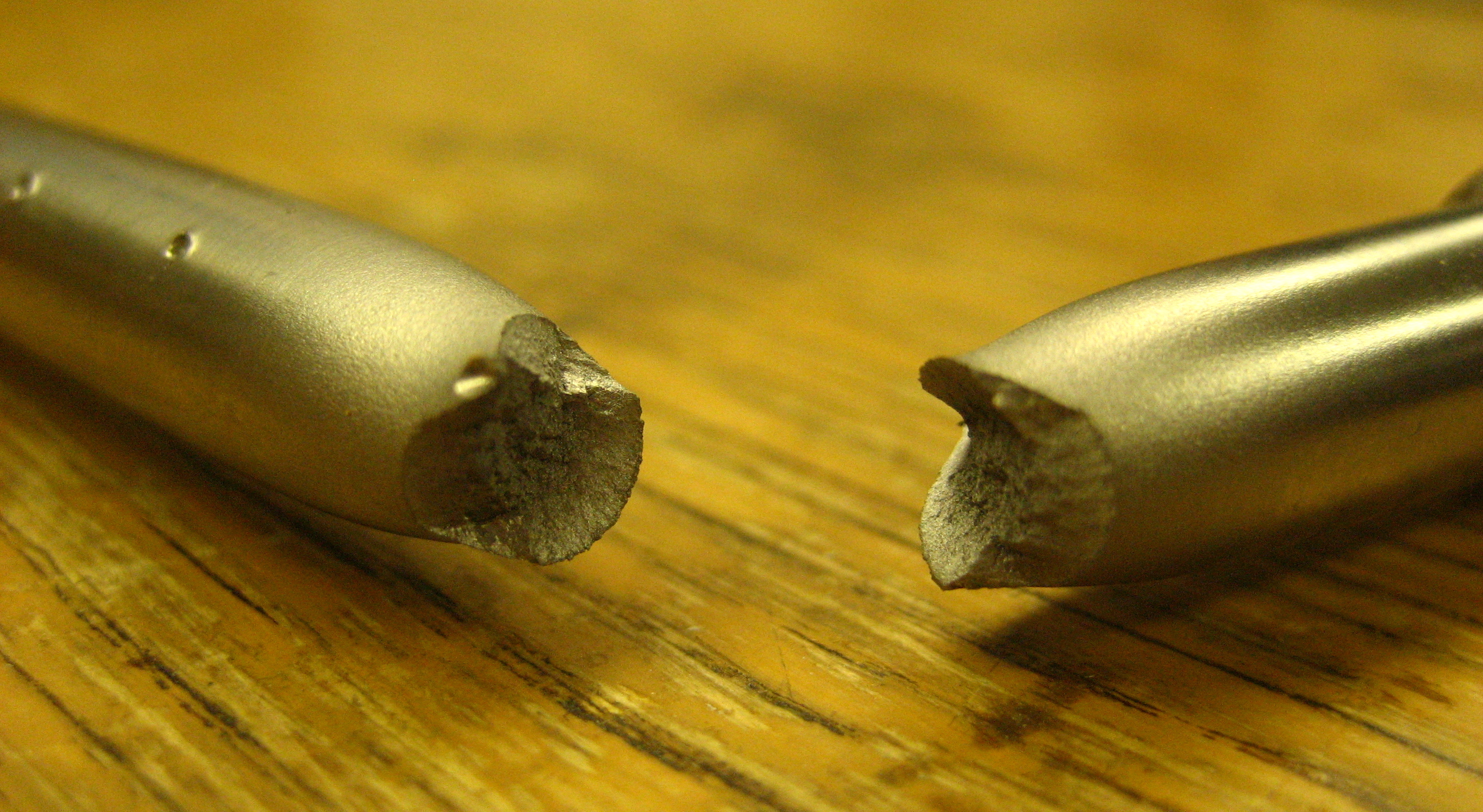
Fracture is the separation of an object or material into two or more pieces under the action of stress. The fracture of a solid usually occurs due to the development of certain displacement discontinuity surfaces within the solid. If a displacement develops perpendicular to the surface, it is called a normal tensile crack or simply a crack; if a displacement develops tangentially, it is called a shear crack, slip band or dislocation. Brittle fractures occur with no apparent deformation before fracture. Ductile fractures occur after visible deformation. Fracture strength, or breaking strength, is the stress when a specimen fails or fractures. The detailed understanding of how a fracture occurs and develops in materials is the object of fracture mechanics. Strength Fracture strength, also known as breaking strength, is the stress at which a specimen fails via fracture. This is usually determined for a given specimen by a tensile test, which charts the stress–strain c ... [...More Info...] [...Related Items...] OR: [Wikipedia] [Google] [Baidu] |


