|
Prestolee
Prestolee is a small village in Kearsley, within the Metropolitan Borough of Bolton, in Greater Manchester, England. It lies on the River Irwell and is one of a cluster of villages between Bolton and Kearsley, which includes Stoneclough and Ringley. Historically part of Lancashire, during the Middle Ages, Prestolee was a chapelry within the ancient ecclesiastical parish of Prestwich-cum-Oldham. Prestolee is surrounded almost completely by water and is effectively an island, with the River Irwell to the north, west and south and the Manchester, Bolton & Bury Canal to the northeast. There is one road (Bridge Street) that provides vehicle access over the River Irwell. Prestolee Road also allows access to the village via a small canal bridge but the road is not metalled and not practical for most vehicles. Pedestrian access from the north is facilitated by using Prestolee Aqueduct, or the nearby Pack Horse Bridge. Many countryside walks radiate from Prestolee with particular focu ... [...More Info...] [...Related Items...] OR: [Wikipedia] [Google] [Baidu] |
Manchester, Bolton & Bury Canal
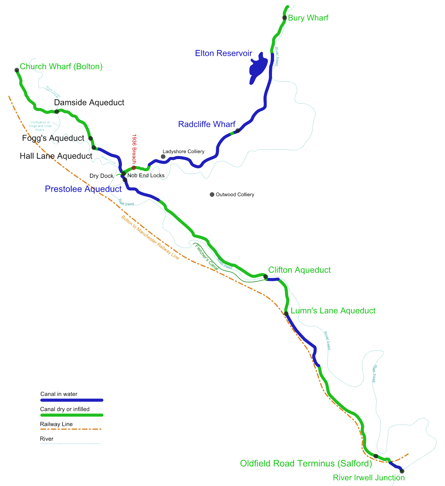
The Manchester Bolton & Bury Canal is a disused canal in Greater Manchester, England, built to link Bolton and Bury with Manchester. The canal, when fully opened, was long. It was accessed via a junction with the River Irwell in Salford. Seventeen locks were required to climb to the summit as it passed through Pendleton, heading northwest to Prestolee before it split northwest to Bolton and northeast to Bury. Between Bolton and Bury the canal was level and required no locks. Six aqueducts were built to allow the canal to cross the rivers Irwell and Tonge and several minor roads. The canal was commissioned in 1791 by local landowners and businessmen and built between 1791 and 1808, during the Golden Age of canal building, at a cost of £127,700 (£ today). Originally designed for narrow gauge boats, during its construction the canal was altered into a broad gauge canal to allow an ultimately unrealised connection with the Leeds and Liverpool Canal. The canal compa ... [...More Info...] [...Related Items...] OR: [Wikipedia] [Google] [Baidu] |
Prestolee Aqueduct
Prestolee Aqueduct is a stone-built aqueduct in Prestolee, Kearsley in the Metropolitan Borough of Bolton, Greater Manchester, England. The four-arch structure was constructed in 1793 to carry the Manchester, Bolton and Bury Canal across the River Irwell. It is now preserved as a Grade II listed building. The aqueduct is one of two remaining major structures on the canal, the other being the Clifton Aqueduct. A third major aqueduct, Damside Aqueduct, was demolished in the 1950s. As of 2007, the aqueduct still carried water, although it was not navigable as adjoining sections of the canal are in need of restoration. See also *List of aqueducts *List of canal aqueducts in the United Kingdom This list of canal aqueducts in the United Kingdom covers Navigable aqueduct, aqueducts that have articles in Wikipedia. The actual number of canal aqueducts is much greater. See also *:Aqueducts in the United Kingdom *Navigable aqueduct *C ... References External linksPrestole ... [...More Info...] [...Related Items...] OR: [Wikipedia] [Google] [Baidu] |
Kearsley Mill
Kearsley Mill is a , late period cotton mill located in the small village of Prestolee in Kearsley, Greater Manchester, part of the historic county of Lancashire. A near complete example of Edwardian mill architecture, the building now functions as headquarters for a number of businesses and is still used in the continued manufacturing and distribution of textiles by Richard Haworth Ltd Est (1876), part of the Ruia Group. The mill is a Grade II listed building. Location Kearsley Mill is one of over 100 mills which were built in Lancashire when industry was booming in the 19th and early 20th century. The confluence of the River Croal and Irwell in the valley of Prestolee and Ringley created the ideal location for early industry to develop, as described in 1911, ‘a busy industrial place. There are collieries, iron foundries, paper mills, powerloom mills, spindle works, and chemical works; bricks and tiles are made and cotton-spinning carried on’. Architecture Mills of this ... [...More Info...] [...Related Items...] OR: [Wikipedia] [Google] [Baidu] |
Stoneclough
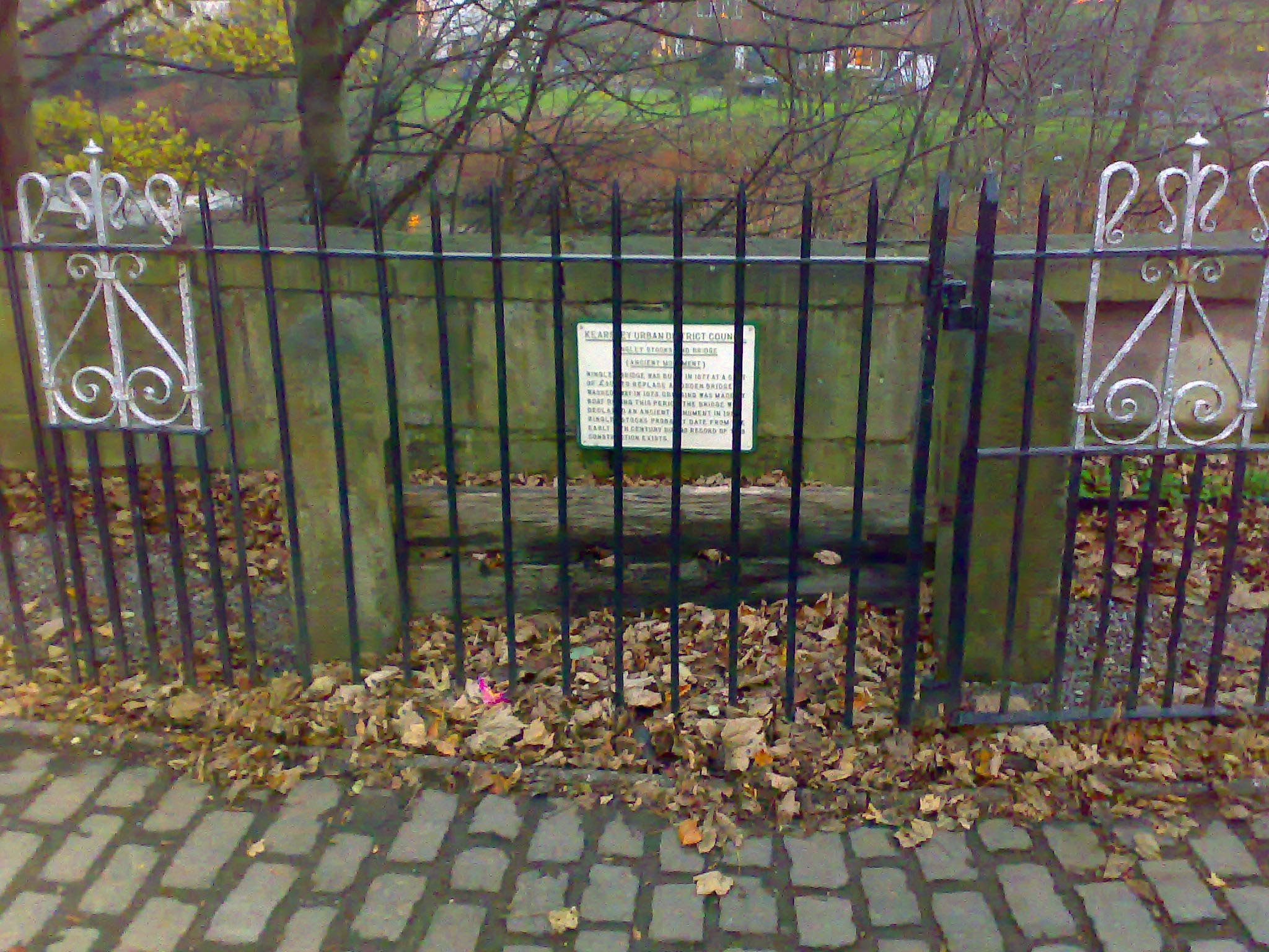
Stoneclough is a suburban area of Kearsley in the Metropolitan Borough of Bolton, Greater Manchester, England. It is located south-east of Bolton, south-west of Bury and north-west of Manchester. It is located on the banks of the River Irwell to the southeast of Bolton. Historically part of Lancashire, there are a number of listed buildings and recognised ancient monuments in the villages including Ringley Old Bridge, the village stocks, Kearsley Mill, St Saviour's Church and clock tower and the large stone railway bridge on the Manchester to Bolton railway line. The disused Manchester, Bolton and Bury Canal also passes through this area. Stoneclough is mostly residential, housing has replaced most of the old industry. These industrial sites included the Kearsley Paper Works owned by Robert Fletcher and Sons and Kearsley Power Station located on Hulme Road. These have been demolished. Toponymy The Stoneclough means stony ravine from the Old English words ''stan'' me ... [...More Info...] [...Related Items...] OR: [Wikipedia] [Google] [Baidu] |
Kearsley
Kearsley ( ) is a town in the Metropolitan Borough of Bolton, Greater Manchester, England. The population at the 2011 census was 14,212. Historically part of Lancashire, it lies northwest of Manchester, southwest of Bury and south of Bolton. It is bounded to the west by Walkden, the east by Whitefield, the north by Farnworth and the south by Clifton. Kearsley was a township in the ancient ecclesiastical parish of Deane, in the Hundred of Salford. Kearsley Urban District was a local government authority from 1894 until 1974. In 1933, part of Clifton was added to Kearsley Urban District. Part of Outwood, Radcliffe became part of Kearsley in line with the 1933 Lancashire Review. History Kearsley lay within the historic county boundaries of Lancashire and was industrialised by 1752 when James Brindley solved drainage problems at the Wet Earth Colliery on the borders of Kearsley and Clifton. In 1780, a mill was built at the point where the River Croal meets the River Irw ... [...More Info...] [...Related Items...] OR: [Wikipedia] [Google] [Baidu] |
River Irwell
The River Irwell ( ) is a tributary of the River Mersey in north west England. It rises at Irwell Springs on Deerplay Moor, approximately north of Bacup and flows southwards for to meet the Mersey near Irlam. The Irwell marks the boundary between Manchester and Salford, and its lower reaches have been canalised and now form part of the Manchester Ship Canal. In the 17th and 18th centuries, the Irwell's lower reaches were a trading route that became part of the Mersey and Irwell Navigation. In the 19th century, the river's course downstream of Manchester was permanently altered by the construction of the Manchester Ship Canal which opened in 1896. The canal turned Manchester and Salford into a major inland seaport and led to the development of Trafford Park which became the largest industrial estate in Europe. Further changes were made in the 20th and 21st centuries to prevent flooding in Manchester and Salford, including the construction of the Anaconda Cut in 1970 and the Ri ... [...More Info...] [...Related Items...] OR: [Wikipedia] [Google] [Baidu] |
Greater Manchester
Greater Manchester is a metropolitan county and combined authority, combined authority area in North West England, with a population of 2.8 million; comprising ten metropolitan boroughs: City of Manchester, Manchester, City of Salford, Salford, Metropolitan Borough of Bolton, Bolton, Metropolitan Borough of Bury, Bury, Metropolitan Borough of Oldham, Oldham, Metropolitan Borough of Rochdale, Rochdale, Metropolitan Borough of Stockport, Stockport, Tameside, Trafford and Metropolitan Borough of Wigan, Wigan. The county was created on 1 April 1974, as a result of the Local Government Act 1972, and designated a functional Manchester City Region, city region on 1 April 2011. Greater Manchester is formed of parts of the Historic counties of England, historic counties of Cheshire, Lancashire and the West Riding of Yorkshire. Greater Manchester spans , which roughly covers the territory of the Greater Manchester Built-up Area, the List of urban areas in the United Kingdom, second most ... [...More Info...] [...Related Items...] OR: [Wikipedia] [Google] [Baidu] |
Prestwich-cum-Oldham
Prestwich-cum-Oldham (also known as Prestwich with Oldham) was an ancient ecclesiastical parish of the hundred of Salford, within the historic county boundaries of Lancashire, England. With the Parish Church of St Mary the Virgin, Prestwich as its centre, this parish encompassed a total of ten townships, and within them, several smaller chapelries. Prestwich-cum-Oldham was divided into two non-contiguous sections: the townships of Great Heaton, Little Heaton, Pilkington, and Prestwich on the west; Alkrington, Tonge, Chadderton, Crompton, Oldham and Royton on the east. The parish of Middleton divided these two portions of Prestwich-cum-Oldham from north to south. The parish covered and was noted in 1851 to have a population of 94,470, and again in 1861, to have 117,987. [...More Info...] [...Related Items...] OR: [Wikipedia] [Google] [Baidu] |
Primary School
A primary school (in Ireland, the United Kingdom, Australia, Trinidad and Tobago, Jamaica, and South Africa), junior school (in Australia), elementary school or grade school (in North America and the Philippines) is a school for primary education of children who are four to eleven years of age. Primary schooling follows pre-school and precedes secondary schooling. The International Standard Classification of Education considers primary education as a single phase where programmes are typically designed to provide fundamental skills in reading, writing, and mathematics and to establish a solid foundation for learning. This is ISCED Level 1: Primary education or first stage of basic education.Annex III in the ISCED 2011 English.pdf Navigate to International Standard Classification of Educati ... [...More Info...] [...Related Items...] OR: [Wikipedia] [Google] [Baidu] |
Weatherfield
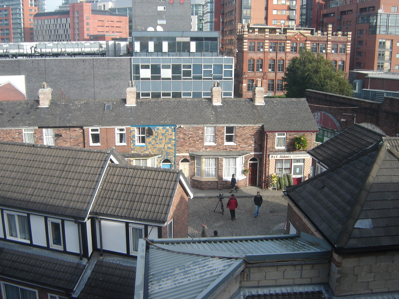
Weatherfield is a fictional town based on Salford, Greater Manchester, which has been the setting for the British ITV soap opera ''Coronation Street'' since its inception in 1960. Much of Weatherfield has been seen by viewers throughout the years, though the primary focus from the viewer's perspective is the eponymous Coronation Street, a cobbled street where many of the programme's characters live. Weatherfield areas are often shot on location around Salford and the neighbouring large city of Manchester, as its filming studios, the Granada Studios complex on Quay Street in Manchester city centre (which closed in 2013) and its replacement set MediaCityUK in Salford Quays (opened in 2014), only house the outdoor sets of Coronation Street and its immediate surrounding streets. As part of the 2010 Children in Need charity appeal, Weatherfield became twinned with Walford in a special programme uniting the two soaps, ''Coronation Street'' and ''EastEnders'' called ''East Street' ... [...More Info...] [...Related Items...] OR: [Wikipedia] [Google] [Baidu] |
Coronation Street
''Coronation Street'' is an English soap opera created by Granada Television and shown on ITV since 9 December 1960. The programme centres around a cobbled, terraced street in Weatherfield, a fictional town based on inner-city Salford. Originally broadcast twice weekly, the series began airing six times a week in 2017. The programme was conceived by scriptwriter Tony Warren. Warren's initial proposal was rejected by the station's founder Sidney Bernstein, but he was persuaded by producer Harry Elton to produce the programme for 13 pilot episodes, and the show has since become a significant part of English culture. ''Coronation Street'' is made by ITV Granada at MediaCityUK and shown in all ITV regions, as well as internationally. In 2010, upon its 50th anniversary, the series was recognised by Guinness World Records, as the world's longest-running television soap opera. Initially influenced by the conventions of kitchen sink realism, ''Coronation Street'' is noted for its ... [...More Info...] [...Related Items...] OR: [Wikipedia] [Google] [Baidu] |
Clean Air Act 1956
The Clean Air Act 1956 was an Act of the Parliament of the United Kingdom enacted principally in response to London's Great Smog of 1952. It was sponsored by the Ministry of Housing and Local Government in England and the Department of Health for Scotland, and was in effect until 1993. The Act introduced a number of measures to reduce air pollution. Primary among them was mandated movement toward smokeless fuels, especially in high-population ‘smoke control areas’ to reduce smoke pollution and sulphur dioxide from household fires. The Act also included measures that reduced the emission of gases, grit, and dust from chimneys and smoke-stacks. The Act was a significant milestone in the development of a legal framework to protect the environment. It was modified by later enactments, including the Clean Air Act 1968. The Act was repealed by the Clean Air Act 1993. Background London had long been noted for its pea soup fog. In 1880, meteorologist Rollo Russell wrote an i ... [...More Info...] [...Related Items...] OR: [Wikipedia] [Google] [Baidu] |


