|
Portage Island
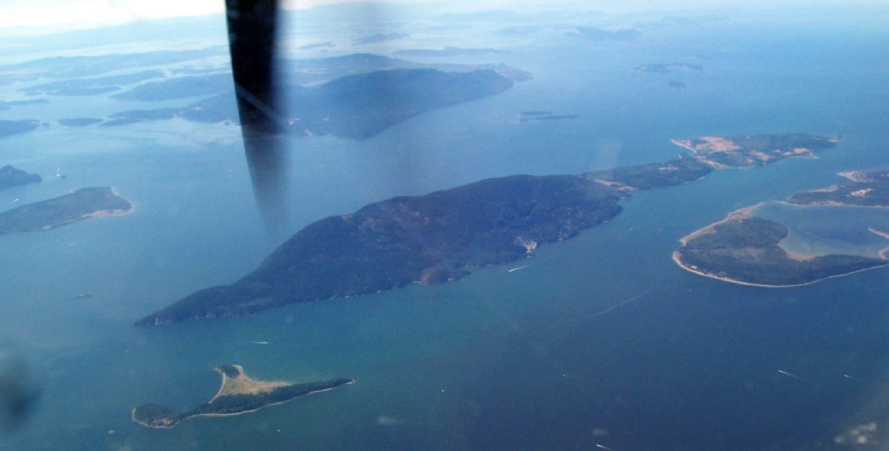
Portage Island is an island in the western part of Bellingham Bay in Whatcom County, Washington, United States. It is separated from the Lummi Peninsula by Portage Bay and from the central part of Lummi Island by Hale Passage, in Whatcom County. Portage Island has a land area of 3.803 km² (1.468 sq mi). There was no resident population as of the 2000 census. According to the Whatcom County Assessors database, the land and the surrounding tide flats are owned by the Lummi The Lummi ( ; Lummi: ''Xwlemi'' ; also known as Lhaq'temish (), or ''People of the Sea''), governed by the Lummi Nation, are a Native American tribe of the Coast Salish ethnolinguistic group. They are based in the coastal area of the Pacific N ... Native American tribe. The island is wholly contained within the boundaries of the Lummi Indian Reservation. ReferencesPortage Island: Blocks 3001 and 3002, Census Tract 108, Whatcom County, WashingtonUnited States Census Bureau Landforms of Whatcom C ... [...More Info...] [...Related Items...] OR: [Wikipedia] [Google] [Baidu] |
Bellingham Bay
Bellingham Bay is a bay of the Salish Sea located in Washington State in the United States. It is separated from the Strait of Georgia on the west by the Lummi Peninsula, Portage Island, and Lummi Island. It is bordered on the east by Bellingham, Washington, to the south-east by the Chuckanut Mountains, and to the south by Samish Bay. The Nooksack River empties into the bay, as does Whatcom Creek. Bellingham Bay is named for Sir William Bellingham, who was controller of the storekeeper's account for the Royal Navy at the time that the Vancouver Expedition visited the bay in June 1792. The first European entry of the bay was by the Spanish schooner ''Santa Saturnina'' under José María Narváez, during the 1791 expedition of Francisco de Eliza. Narváez named it ''Seno Gaston''. Economy Events Bellingham, Washington holds a run and walk marathon along the Bellingham Bay. There are three marathon races to choose from including a full marathon, half marathon, 10k, and/or ... [...More Info...] [...Related Items...] OR: [Wikipedia] [Google] [Baidu] |
Whatcom County, Washington
Whatcom County is a county located in the northwestern corner of the U.S. state of Washington, bordered by the Canadian Lower Mainland (the Metro Vancouver and Fraser Valley Regional Districts of British Columbia) to the north, Okanogan County to the east, Skagit County to the south, San Juan County across Rosario Strait to the southwest, and the Strait of Georgia to the west. Its county seat and largest population center is the coastal city of Bellingham, comprising the Bellingham, WA Metropolitan Statistical Area, and as of the 2020 census, the county's population was 226,847. The county was created from Island County by the Washington Territorial Legislature in March 1854. It originally included the territory of present-day San Juan and Skagit Counties, which were later independently organized after additional settlement. Its name derives from the Lummi word ''Xwotʼqom,'' meaning "noisy water." Whatcom County has a diversified economy with a significant agricultura ... [...More Info...] [...Related Items...] OR: [Wikipedia] [Google] [Baidu] |
United States
The United States of America (U.S.A. or USA), commonly known as the United States (U.S. or US) or America, is a country primarily located in North America. It consists of 50 states, a federal district, five major unincorporated territories, nine Minor Outlying Islands, and 326 Indian reservations. The United States is also in free association with three Pacific Island sovereign states: the Federated States of Micronesia, the Marshall Islands, and the Republic of Palau. It is the world's third-largest country by both land and total area. It shares land borders with Canada to its north and with Mexico to its south and has maritime borders with the Bahamas, Cuba, Russia, and other nations. With a population of over 333 million, it is the most populous country in the Americas and the third most populous in the world. The national capital of the United States is Washington, D.C. and its most populous city and principal financial center is New York City. Paleo-Americ ... [...More Info...] [...Related Items...] OR: [Wikipedia] [Google] [Baidu] |
Lummi Island
Lummi Island lies at the southwest corner of Whatcom County, Washington, United States, between the mainland part of the county and offshore San Juan County. The Lummi Indian Reservation is situated on a peninsula east of the island, but it does not include Lummi Island. The island has a land area of and had a population of 822 as of the 2000 census. The population nearly doubles in summer when second-home owners from Canada and the U.S. arrive for the summer months. The island is accessible by a 20-car ferry, the '' Whatcom Chief,'' run by Whatcom County Public Works. It is a 6-minute passage from Gooseberry Point on the mainland to the island. Public education for island residents is provided by the Ferndale School District. It operates one elementary school (K-5) on the island, Beach Elementary School. Middle and high school students must travel to attend schools on the mainland. History The island was originally called ''Sa nam a o'' ("High Mountain") and ''Skalla ... [...More Info...] [...Related Items...] OR: [Wikipedia] [Google] [Baidu] |
Hale Passage
Hale Passage is the name of two different bodies of water in Puget Sound, in the U.S. state of Washington. *In the north Sound, in Whatcom County, Hale Passage separates Lummi Island from the mainland near Bellingham. *In the south Sound in Pierce County, another Hale Passage separates Fox Island from the Kitsap Peninsula, near Gig Harbor. In both cases, the passages were named by the Wilkes Expedition for ethnologist Horatio Hale Horatio Emmons Hale (May 3, 1817 – December 28, 1896) was an American-Canadian ethnologist, philologist and businessman. He is known for his study of languages as a key for classifying ancient peoples and being able to trace their migrations. .... References Landforms of Puget Sound Straits of Washington (state) {{Washington-geo-stub ... [...More Info...] [...Related Items...] OR: [Wikipedia] [Google] [Baidu] |
United States Census, 2000
The United States census of 2000, conducted by the Census Bureau, determined the resident population of the United States on April 1, 2000, to be 281,421,906, an increase of 13.2 percent over the 248,709,873 people enumerated during the 1990 census. This was the twenty-second federal census and was at the time the largest civilly administered peacetime effort in the United States. Approximately 16 percent of households received a "long form" of the 2000 census, which contained over 100 questions. Full documentation on the 2000 census, including census forms and a procedural history, is available from the Integrated Public Use Microdata Series. This was the first census in which a state – California – recorded a population of over 30 million, as well as the first in which two states – California and Texas – recorded populations of more than 20 million. Data availability Microdata from the 2000 census is freely available through the Integrated Public Use Microdata Serie ... [...More Info...] [...Related Items...] OR: [Wikipedia] [Google] [Baidu] |
Lummi
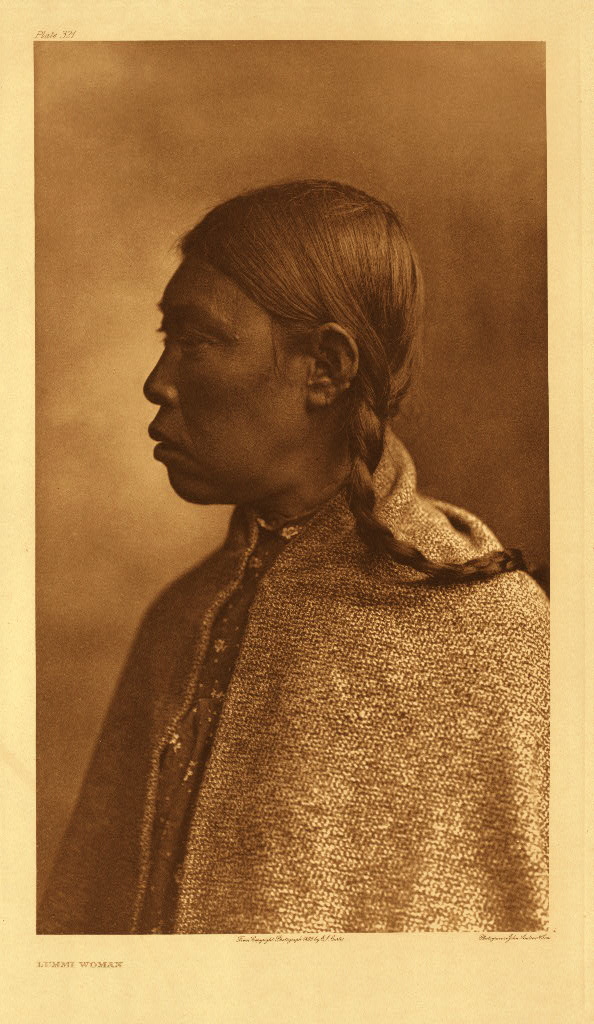
The Lummi ( ; Lummi: ''Xwlemi'' ; also known as Lhaq'temish (), or ''People of the Sea''), governed by the Lummi Nation, are a Native American tribe of the Coast Salish ethnolinguistic group. They are based in the coastal area of the Pacific Northwest region of Washington state in the United States. With a historic territory ranging from the San Juan Islands to interior foothills of the Lummi River watershed, today the federally recognized tribe primarily resides on and around the Lummi Indian Reservation slightly west of Bellingham. It takes in most of the Lummi Peninsula and Portage Island, and is in western Whatcom County, south of the border with Canada. History Lummi Nation was founded by Chief Henry Kwina. The Lummi traditionally have spoken the Songish dialect of the Coast Salish languages. Their ancient villages were known as Hutatchl, Lemaltcha, Statshum and Tomwhiksen. For 12,000 years, the Lummi subsisted near the sea and in mountain areas. They returned seasonal ... [...More Info...] [...Related Items...] OR: [Wikipedia] [Google] [Baidu] |
Lummi Indian Reservation
The Lummi ( ; Lummi: ''Xwlemi'' ; also known as Lhaq'temish (), or ''People of the Sea''), governed by the Lummi Nation, are a Native American tribe of the Coast Salish ethnolinguistic group. They are based in the coastal area of the Pacific Northwest region of Washington state in the United States. With a historic territory ranging from the San Juan Islands to interior foothills of the Lummi River watershed, today the federally recognized tribe primarily resides on and around the Lummi Indian Reservation slightly west of Bellingham. It takes in most of the Lummi Peninsula and Portage Island, and is in western Whatcom County, south of the border with Canada. History Lummi Nation was founded by Chief Henry Kwina. The Lummi traditionally have spoken the Songish dialect of the Coast Salish languages. Their ancient villages were known as Hutatchl, Lemaltcha, Statshum and Tomwhiksen. For 12,000 years, the Lummi subsisted near the sea and in mountain areas. They returned seasonal ... [...More Info...] [...Related Items...] OR: [Wikipedia] [Google] [Baidu] |
Landforms Of Whatcom County, Washington
A landform is a natural or anthropogenic land feature on the solid surface of the Earth or other planetary body. Landforms together make up a given terrain, and their arrangement in the landscape is known as topography. Landforms include hills, mountains, canyons, and valleys, as well as shoreline features such as bays, peninsulas, and seas, including submerged features such as mid-ocean ridges, volcanoes, and the great ocean basins. Physical characteristics Landforms are categorized by characteristic physical attributes such as elevation, slope, orientation, stratification, rock exposure and soil type. Gross physical features or landforms include intuitive elements such as berms, mounds, hills, ridges, cliffs, valleys, rivers, peninsulas, volcanoes, and numerous other structural and size-scaled (e.g. ponds vs. lakes, hills vs. mountains) elements including various kinds of inland and oceanic waterbodies and sub-surface features. Mountains, hills, plateaux, and plains are the fo ... [...More Info...] [...Related Items...] OR: [Wikipedia] [Google] [Baidu] |


.jpg)