|
Port Mansfield Channel
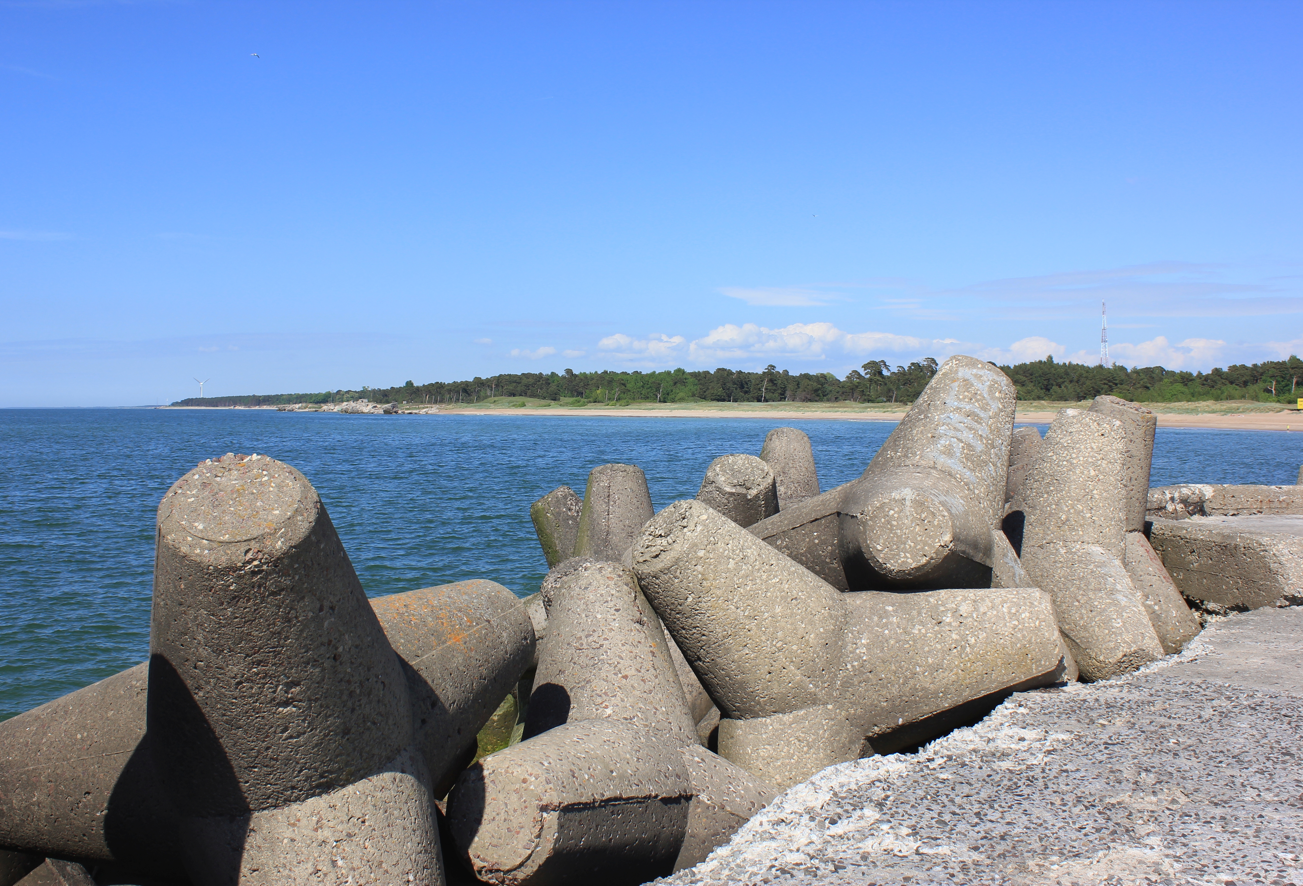
Port Mansfield Channel or Mansfield Cut is an artificial waterway encompassing the Laguna Madre positioned at the 97th meridian west on the earth's longest barrier island known as Padre Island. During Post–World War II, the tidal inlet was dredged as a private channel differentiating North Padre Island better known as Padre Island National Seashore and South Padre Island. The navigable waterway was channeled during the late 1950s ceremoniously cresting the intertidal zone of the Gulf of Mexico by September 1957 on the Texas Gulf Coast. The marginal sea inlet was defined by wave-dissipating concrete blocks similarly referred to as tetrapods protracting into the Gulf of Mexico at Padre Island. The breakwater structure was severely dilapidated during the 1957 Atlantic hurricane season with the Bay of Campeche spawning Hurricane Audrey and Tropical Storm Esther engulfing the existing jetty harbor entrance on Padre Island. In 1962, the United States Army Corps of Engin ... [...More Info...] [...Related Items...] OR: [Wikipedia] [Google] [Baidu] |
Padre Island
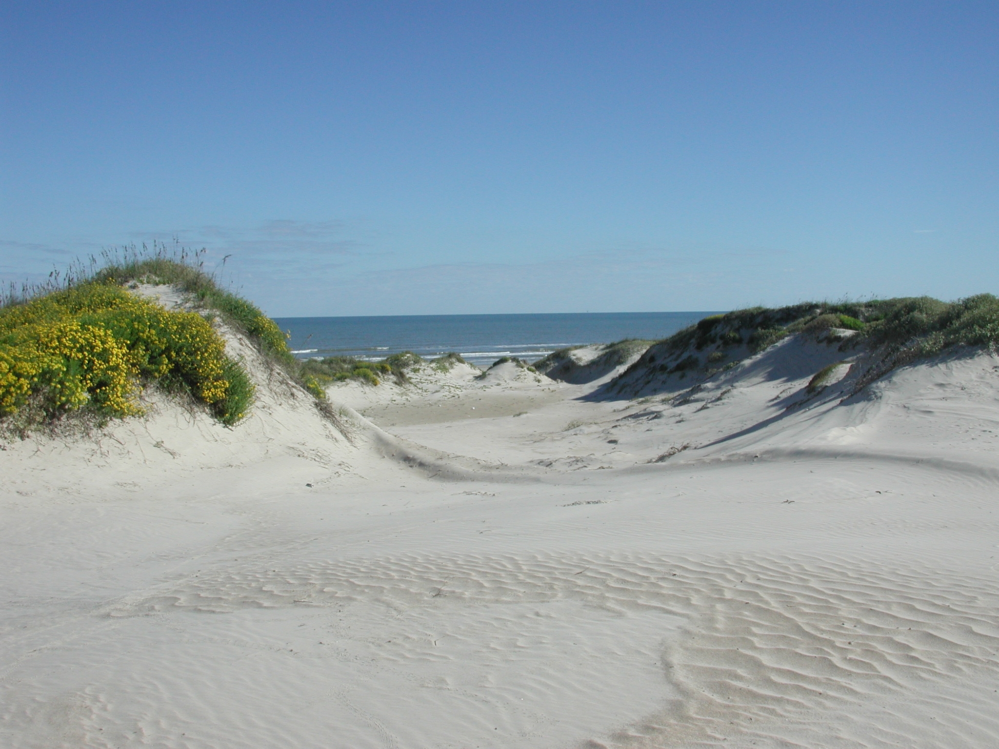
Padre Island is the largest of the Texas barrier islands and the world's longest barrier island. The island is located along Texas's southern coast of the Gulf of Mexico and is noted for its white sandy beaches. Meaning ''father'' in Spanish, it was named after Father José Nicolás Ballí (c.1770-1829), who owned the island and served as a missionary priest and collector of finances for all the churches in the Rio Grande Valley. He also founded the first mission in present-day Cameron County. Padre Island is the second-largest island by area in the contiguous United States, after Long Island in New York on the Atlantic Coast. It is about long and wide, stretching from the city of Corpus Christi, in the north, to the resort community of South Padre Island in the south. The island is oriented north-south, bordered by the Gulf of Mexico on the east and Laguna Madre on the west. The island's northern end connects to Mustang Island by roadway. The southern end of the island is s ... [...More Info...] [...Related Items...] OR: [Wikipedia] [Google] [Baidu] |
North Padre Island
North Padre Island is a barrier island along the coast of Texas. It and South Padre Island were formed after the creation of the Port Mansfield Channel split Padre Island in two. From north to south, North Padre Island is located in parts of Nueces, Kleberg, Kenedy, and Willacy counties. The northernmost part of the island to the Kleberg County line is part of the city of Corpus Christi. Corpus Christi The upper portion of North Padre Island is a district of the city of Corpus Christi. "The Island" as known by locals consists of high-income residential housing and condominiums and is a popular fishing destination. The Packery Channel, an inlet which connects the Gulf of Mexico to the Laguna Madre, separates North Padre Island from Mustang Island. There are numerous hotels located on North Padre Island, either along the beach or near the intersection of Texas Highway 361 and Texas Park Road 22, the district's two only main thoroughfares. Boating is also a popular activity on t ... [...More Info...] [...Related Items...] OR: [Wikipedia] [Google] [Baidu] |
Tetrapod (structure)
A Tetrapod is a form of wave-dissipating concrete block used to prevent erosion caused by weather and longshore drift, primarily to enforce coastal structures such as seawalls and breakwaters. Tetrapods are made of concrete, and use a tetrahedral shape to dissipate the force of incoming waves by allowing water to flow around rather than against them, and to reduce displacement by interlocking. Invention Tetrapods were originally developed in 1950 by Pierre Danel and Paul Anglès d'Auriac of Laboratoire Dauphinois d'Hydraulique (now Artelia) in Grenoble, France, who received a patent for the design. The name was derived from Greek, with ''tetra''- meaning four and -''pode'' meaning foot, a reference to the tetrahedral shape. Tetrapods were first used at the thermal power station in Roches Noires in Casablanca, Morocco, to protect the sea water intake. Adoption Tetrapods have become popular across the world, particularly in Japan; it is estimated that nearly 50 percent of Japan ... [...More Info...] [...Related Items...] OR: [Wikipedia] [Google] [Baidu] |
Wave-dissipating Concrete Block
A wave-dissipating concrete block is a naturally or manually interlocking concrete structure designed and employed to minimize the effects of wave action upon shores and shoreline structures, such as quays and jettys. Examples include such proprietary designs as the Tetrapod, Accropode, Xbloc, KOLOS, and Dolos A dolos (plural: dolosse) is a wave-dissipating concrete block used in great numbers as a form of coastal management. It is a type of tetrapod. Weighing up to , dolosse are used to build revetments for protection against the erosive force of .... See also * * * * * * * {{annotated link, Seawall * ... [...More Info...] [...Related Items...] OR: [Wikipedia] [Google] [Baidu] |
Inlet
An inlet is a (usually long and narrow) indentation of a shoreline, such as a small arm, bay, sound, fjord, lagoon or marsh, that leads to an enclosed larger body of water such as a lake, estuary, gulf or marginal sea. Overview In marine geography, the term "inlet" usually refers to either the actual channel between an enclosed bay and the open ocean and is often called an "entrance", or a significant recession in the shore of a sea, lake or large river. A certain kind of inlet created by past glaciation is a fjord, typically but not always in mountainous coastlines and also in montane lakes. Multi-arm complexes of large inlets or fjords may be called sounds, e.g., Puget Sound, Howe Sound, Karmsund (''sund'' is Scandinavian for "sound"). Some fjord-type inlets are called canals, e.g., Portland Canal, Lynn Canal, Hood Canal, and some are channels, e.g., Dean Channel and Douglas Channel. Tidal amplitude, wave intensity, and wave direction are all factors that in ... [...More Info...] [...Related Items...] OR: [Wikipedia] [Google] [Baidu] |
List Of Seas
This is a list of seas of the World Ocean, including marginal seas, areas of water, various gulfs, bights, bays, and straits. Terminology * Ocean – the four to seven largest named bodies of water in the World Ocean, all of which have "Ocean" in the name. See Borders of the oceans for details. * Sea has several definitions: ** A marginal sea is a division of an ocean, partially enclosed by islands, archipelagos, or peninsulas, adjacent to or widely open to the open ocean at the surface, and/or bounded by submarine ridges on the sea floor. ** A division of an ocean, delineated by landforms, currents (e.g., Sargasso Sea), or specific latitude or longitude boundaries. This includes but is not limited to marginal seas, and this is the definition used for inclusion in this list. ** The World Ocean. For example, the Law of the Sea states that all of the World Ocean is "sea", and this is also common usage for "the sea". ** Any large body of water with "Sea" in the name, inclu ... [...More Info...] [...Related Items...] OR: [Wikipedia] [Google] [Baidu] |
Port Mansfield Channel Jetty
A port is a maritime facility comprising one or more wharves or loading areas, where ships load and discharge cargo and passengers. Although usually situated on a sea coast or estuary, ports can also be found far inland, such as Hamburg, Manchester and Duluth; these access the sea via rivers or canals. Because of their roles as ports of entry for immigrants as well as soldiers in wartime, many port cities have experienced dramatic multi-ethnic and multicultural changes throughout their histories. Ports are extremely important to the global economy; 70% of global merchandise trade by value passes through a port. For this reason, ports are also often densely populated settlements that provide the labor for processing and handling goods and related services for the ports. Today by far the greatest growth in port development is in Asia, the continent with some of the world's largest and busiest ports, such as Singapore and the Chinese ports of Shanghai and Ningbo-Zho ... [...More Info...] [...Related Items...] OR: [Wikipedia] [Google] [Baidu] |
Defense Technical Information Center
The Defense Technical Information Center (DTIC, pronounced "Dee-tick") is the repository for research and engineering information for the United States Department of Defense (DoD). DTIC's services are available to DoD personnel, federal government personnel, federal contractors and selected academic institutions. The general public can access unclassified information through its public website. History The DTIC traces its history to the June 1945 formation of the Air Documents Research Center (ADRC), a joint effort of the US Army Air Force, US Navy and Royal Air Force to build a single collection of captured German aeronautical research, based in London. The ADRC was initially tasked with the sorting of the document collection into three broad groups; documents that would assist the war in the Pacific theater, documents of immediate intelligence interest to the United States or British forces and documents of interest for future research. With the ending of the war in 1945, the ... [...More Info...] [...Related Items...] OR: [Wikipedia] [Google] [Baidu] |
Texas State Historical Association
The Texas State Historical Association (TSHA) is a non-profit educational organization, dedicated to documenting the history of Texas. It was founded in Austin, Texas, on March 2, 1897. , TSHA moved their offices from Austin to the University of North Texas in Denton. In 2015, the offices were relocated again, to the University of Texas at Austin. Overview The chief executive officer is Jesús F. de la Teja and the chief historian is Walter L. Buenger. The association president (2018-2019) is Sarita Hixon; the preceding president is (2017-2018) Paula Mitchell Marks. Other past presidents include Steve Cook (2016-2017), Lynn Denton (2015-2016), John L. Nau III (2014-2015), Gregg Cantrell (2013-2014), Watson Arnold (2012-2013), Merline Pitre (2011-2012), Dianne Garrett Powell (2010–2011) and Walter L. Buenger (2009-2010). Other past presidents are the late Robert A. Calvert (1989–1990) of Texas A&M, Alwyn Barr (1992-1993) of Texas Tech University, and Jerry D. Thompson (2001� ... [...More Info...] [...Related Items...] OR: [Wikipedia] [Google] [Baidu] |
Texas Gulf Coast
Texas Gulf Coast is an intertidal zone which borders the coastal region of South Texas, Southeast Texas, and the Texas Coastal Bend. The Texas coastal geography boundaries the Gulf of Mexico encompassing a geographical distance relative bearing at of coastline according to CRS and of shoreline according to NOAA. Administrative divisions of Texas Gulf Coast There are 14 Texas counties encompassing the Gulf of Mexico coastal boundary; Topography of Texas Gulf Coast The Texas coastal bend sustains the Texas–Gulf water resource region as a hydrological cycle unifying a drainage basin of river deltas at the littoral zone of the Texas Gulf Coast. Texas coastal management and impact resiliency In accordance with the Coastal Zone Management Act and Coastal Barrier Resources Act, the Texas Gulf shores maintain a coastal management program striving to prohibit coastal erosion, coastal hazards, sea-level rise, and tidal flooding. The Texas beach observed the initial coastal bul ... [...More Info...] [...Related Items...] OR: [Wikipedia] [Google] [Baidu] |
Intertidal Zone
The intertidal zone, also known as the foreshore, is the area above water level at low tide and underwater at high tide (in other words, the area within the tidal range). This area can include several types of habitats with various species of life, such as seastars, sea urchins, and many species of coral with regional differences in biodiversity. Sometimes it is referred to as the ''littoral zone'' or '' seashore'', although those can be defined as a wider region. The well-known area also includes steep rocky cliffs, sandy beaches, bogs or wetlands (e.g., vast mudflats). The area can be a narrow strip, as in Pacific islands that have only a narrow tidal range, or can include many meters of shoreline where shallow beach slopes interact with high tidal excursion. The peritidal zone is similar but somewhat wider, extending from above the highest tide level to below the lowest. Organisms in the intertidal zone are adapted to an environment of harsh extremes, living in water pr ... [...More Info...] [...Related Items...] OR: [Wikipedia] [Google] [Baidu] |
Crest
Crest or CREST may refer to: Buildings *The Crest (Huntington, New York), a historic house in Suffolk County, New York *"The Crest", an alternate name for 63 Wall Street, in Manhattan, New York *Crest Castle (Château Du Crest), Jussy, Switzerland *Crest House, a building, now in ruins, at the summit of Mount Evans in Colorado *Crest Theatre, a historic theatre in downtown Sacramento, California *Crest Theatre, formerly Majestic Crest Theatre, Los Angeles, California *Crest Theatre, in Old School Square, Delray Beach, Florida Business or commerce *Crest (toothpaste), a brand of toothpaste * Crest Audio, an American manufacturer of power amplifiers and mixing consoles *Crest Animation Productions, an animation studio in Burbank, California * Crest Animation Studios, an animation studio in India *Crest Books, an imprint of now defunct Fawcett Publications *Crest Hotels, a defunct hotel chain in the UK * Crest Manufacturing Company, producer of the Crestmobile automobile in the ... [...More Info...] [...Related Items...] OR: [Wikipedia] [Google] [Baidu] |


