|
Porlock Stone Circle
Porlock Stone Circle is a stone circle located on Exmoor, near the village of Porlock in the south-western English county of Somerset. The Porlock ring is part of a tradition of stone circle construction that spread throughout much of Britain, Ireland, and Brittany during the Late Neolithic and Early Bronze Age, over a period between 3300 and 900 BCE. The purpose of such monuments is unknown, although archaeologists speculate that the stones represented supernatural entities for the circles' builders. Although Exmoor witnessed the construction of many monuments during the Bronze Age, only two stone circles survive in this area, the other being Withypool Stone Circle. The Porlock circle is about in diameter and contains thirteen green micaceous sandstone rocks; there may originally have been more. Directly to the north-east of the circle is a cairn connected to a linear stone row. No evidence has been found that allows for absolute dating of the monument's construction, al ... [...More Info...] [...Related Items...] OR: [Wikipedia] [Google] [Baidu] |
Porlock
Porlock is a coastal village in Somerset, England, west of Minehead. At the 2011 census, the village had a population of 1,440. In 2017, Porlock had the highest percentage of elderly population in Britain, with over 40% being of pensionable age as of 2010. History East of the village is Bury Castle, an Iron Age hill fort. There is evidence for 10th or 11th century origin for the name Porlock as Portloc or Portloca meaning enclosure by the harbour, from the Old English ''port'' and ''loca'', and in the Domesday Book the village was known as "Portloc". In 914 the Vikings plundered Porlock. Porlock was part of the hundred of Carhampton. The area has links with several Romantic poets, and R. D. Blackmore, the author of ''Lorna Doone'', and is popular with visitors. The visitor centre has exhibits and displays about the local area. Also on display are the bones of an aurochs, discovered on Porlock beach in 1999. Governance The parish council has responsibility for local iss ... [...More Info...] [...Related Items...] OR: [Wikipedia] [Google] [Baidu] |
Absolute Dating
Absolute dating is the process of determining an age on a specified chronology in archaeology and geology. Some scientists prefer the terms chronometric or calendar dating, as use of the word "absolute" implies an unwarranted certainty of accuracy. Absolute dating provides a numerical age or range, in contrast with relative dating, which places events in order without any measure of the age between events. In archaeology, absolute dating is usually based on the physical, chemical, and life properties of the materials of artifacts, buildings, or other items that have been modified by humans and by historical associations with materials with known dates (such as coins and historical records). For example, coins found in excavations may have their production date written on them, or there may be written records describing the coin and when it was used, allowing the site to be associated with a particular calendar year. Absolute dating techniques include radiocarbon dating of wood or ... [...More Info...] [...Related Items...] OR: [Wikipedia] [Google] [Baidu] |
Berry Castle, Somerset
Berry Castle (sometimes known as Berry Camp) is an early Roman (possible Iron Age) hillslope enclosure in the West Somerset district of Somerset, England. The hill fort is situated approximately west from the village of Luccombe. A series of earthworks survive in Berry Castle; it dates from the late Iron Age or early Romano British period. It has been protected as a scheduled monument. Background Hillforts developed in the Late Bronze and Early Iron Age, roughly the start of the first millennium BC. The reason for their emergence in Britain, and their purpose, has been a subject of debate. It has been argued that they could have been military sites constructed in response to invasion from continental Europe, sites built by invaders, or a military reaction to social tensions caused by an increasing population and consequent pressure on agriculture. The dominant view since the 1960s has been that the increasing use of iron led to social changes in Britain. Deposits of iro ... [...More Info...] [...Related Items...] OR: [Wikipedia] [Google] [Baidu] |
Kit Barrows
Kit may refer to: Places * Kitt, Indiana, US, formerly Kit * Kit, Iran, a village in Mazandaran Province * Kit Hill, Cornwall, England People * Kit (given name), a list of people and fictional characters * Kit (surname) Animals * Young animals: ** A short form of kitten, a young cat ** A young beaver ** A young ferret The ferret (''Mustela furo'') is a small, Domestication, domesticated species belonging to the family Mustelidae. The ferret is most likely a domesticated form of the wild European polecat (''Mustela putorius''), evidenced by their Hybrid (biol ... ** A young fox ** A young mink ** A young rabbit ** A young raccoon ** A young skunk ** A young squirrel ** A young wolverine * Old List of collective nouns#P, collective noun for a group of pigeons flying together Kinds of sets * Standard equipment and attire in sports: ** Kit (association football) ** Kit (cycling) ** Kit (rugby football) * Kit (of components), a set of components such as ** Electronic kit ** Ki ... [...More Info...] [...Related Items...] OR: [Wikipedia] [Google] [Baidu] |
Black Barrow
Black is a color which results from the absence or complete absorption of visible light. It is an achromatic color, without hue, like white and grey. It is often used symbolically or figuratively to represent darkness. Black and white have often been used to describe opposites such as good and evil, the Dark Ages versus Age of Enlightenment, and night versus day. Since the Middle Ages, black has been the symbolic color of solemnity and authority, and for this reason it is still commonly worn by judges and magistrates. Black was one of the first colors used by artists in Neolithic cave paintings. It was used in ancient Egypt and Greece as the color of the underworld. In the Roman Empire, it became the color of mourning, and over the centuries it was frequently associated with death, evil, witches, and magic. In the 14th century, it was worn by royalty, clergy, judges, and government officials in much of Europe. It became the color worn by English romantic poets, ... [...More Info...] [...Related Items...] OR: [Wikipedia] [Google] [Baidu] |
Alderman's Barrow
Alderman's Barrow is a bowl barrow on Exmoor. It was created as a burial chamber in the Bronze Age and subsequently became a marker for the boundary of the parishes of Exford, Somerset, Exford, Exmoor (civil parish), Exmoor, Luccombe, Somerset, Luccombe and Porlock. It was known as Osmunesburgh in the 13th century, Owlaman's Burrow in the 17th century and was named Alderman's Barrow in 1782. It was protected as a scheduled monument in 1934. References Barrows in England Boundary markers Scheduled monuments in West Somerset Archaeological sites on Exmoor {{UK-archaeology-stub ... [...More Info...] [...Related Items...] OR: [Wikipedia] [Google] [Baidu] |
Tumulus
A tumulus (plural tumuli) is a mound of earth and stones raised over a grave or graves. Tumuli are also known as barrows, burial mounds or ''kurgans'', and may be found throughout much of the world. A cairn, which is a mound of stones built for various purposes, may also originally have been a tumulus. Tumuli are often categorised according to their external apparent shape. In this respect, a long barrow is a long tumulus, usually constructed on top of several burials, such as passage graves. A round barrow is a round tumulus, also commonly constructed on top of burials. The internal structure and architecture of both long and round barrows has a broad range; the categorization only refers to the external apparent shape. The method of may involve a dolmen, a cist, a mortuary enclosure, a mortuary house, or a chamber tomb. Examples of barrows include Duggleby Howe and Maeshowe. Etymology The word ''tumulus'' is Latin for 'mound' or 'small hill', which is derived from th ... [...More Info...] [...Related Items...] OR: [Wikipedia] [Google] [Baidu] |
Round Barrow
A round barrow is a type of tumulus and is one of the most common types of archaeological monuments. Although concentrated in Europe, they are found in many parts of the world, probably because of their simple construction and universal purpose. In Britain, most of them were built between 2200BC and 1100BC. This was the Late Neolithic period to the Late Bronze Age. Later Iron Age barrows were mostly different, and sometimes square. Description At its simplest, a round barrow is a hemispherical mound of earth and/or stone raised over a burial placed in the middle. Beyond this there are numerous variations which may employ surrounding ditches, stone kerbs or flat berms between ditch and mound. Construction methods range from a single creation process of heaped material to a complex depositional sequence involving alternating layers of stone, soil and turf with timbers or wattle used to help hold the structure together. The center may be placed a stone chamber or cist or in a ... [...More Info...] [...Related Items...] OR: [Wikipedia] [Google] [Baidu] |
Exford, Somerset
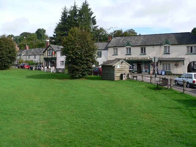
Exford is a rural village at the centre of Exmoor National Park, north-west of Dulverton, and south-west of Minehead, in Somerset, England. Less than a mile away is the hamlet of Lyncombe. Situated on the B3224, the main route across Exmoor, it is a small village on the River Exe with activities including hunting, shooting, fishing and horse riding. The centre of the village surrounds a traditional village green, and is home to a post office, general store, car repair shop, youth hostel and primary school as well as a children's play area. The village is on the route of the Samaritans Way South West and the Celtic Way Exmoor Option. History To the east of the village are the prehistoric hillside enclosures of Road Castle and Staddon Hill Camp and to the west is Cow Castle, an Iron Age hillfort. The Domesday Book of 1086 records eight settlements in the parish, five called Exford and the others at Almesworthy (Edmunds homestead), Stone and Downscombe. The parish was part ... [...More Info...] [...Related Items...] OR: [Wikipedia] [Google] [Baidu] |
A39 Road
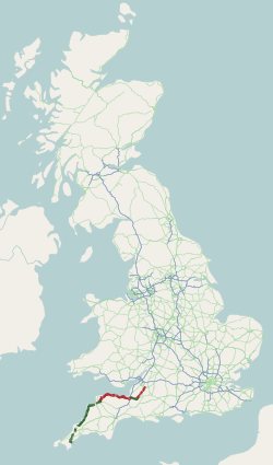
The A39 is an A road in south west England. It runs south-west from Bath in Somerset through Wells, Glastonbury, Street and Bridgwater. It then follows the north coast of Somerset, Devon and Cornwall through Williton, Minehead, Porlock, Lynmouth, Barnstaple, Bideford, Stratton, Camelford, Wadebridge and St Columb Major. It then joins the route of the A30 road for around , re-emerging near Zelah to head for the south Cornish coast via Truro and Falmouth. In Cornwall and North Devon (until the junction with the A361 "North Devon Link Road"), the road is known as the Atlantic Highway, and was classified as a trunk road until 2002. Porlock Hill Porlock Hill is a section of the A39 west of the village of Porlock. The road climbs approximately in less than up onto Exmoor: a very steep hill with gradients of up to 1 in 4 and hairpin bends. In Porlock itself you will often smell burning brakes from vehicles who have just descended the hill. On 12 January 1899, the ten- ... [...More Info...] [...Related Items...] OR: [Wikipedia] [Google] [Baidu] |


