|
Pooleville, Oklahoma
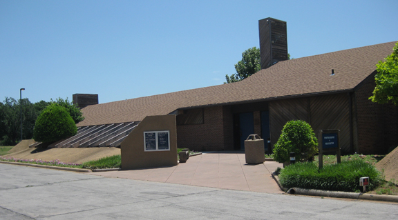
Pooleville is a community located in Carter County, Oklahoma, United States. It is west of the Arbuckles. During the territorial days, the community was originally known as Elk.Shirk, George H. ''Oklahoma Place Names'', Norman, Oklahoma: University of Oklahoma Press, 1965, p.71. At the time of its founding, the community was located in Pickens County, Chickasaw Nation.Charles Goins. ''Historical Atlas of Oklahoma'' (Norman: University of Oklahoma Press, 2006), p. 105. The Elk post office opened January 15, 1890, and the name was changed to Pooleville on July 20, 1907. The current ZIP Code is 73401 assigned to Ardmore. The community was named for an Ardmore banker, E.S. Poole.Shirk, George H. ''Oklahoma Place Names'', Norman, Oklahoma: University of Oklahoma Press, 1965, p.170. In 1907, when Oklahoma became a state, it was decided that Elk should be renamed because the mail kept getting mixed up with Elk City, and so a town meeting was called. Three possible names were chose ... [...More Info...] [...Related Items...] OR: [Wikipedia] [Google] [Baidu] |
Unincorporated Area
An unincorporated area is a region that is not governed by a local municipal corporation. Widespread unincorporated communities and areas are a distinguishing feature of the United States and Canada. Most other countries of the world either have no unincorporated areas at all or these are very rare: typically remote, outlying, sparsely populated or List of uninhabited regions, uninhabited areas. By country Argentina In Argentina, the provinces of Chubut Province, Chubut, Córdoba Province (Argentina), Córdoba, Entre Ríos Province, Entre Ríos, Formosa Province, Formosa, Neuquén Province, Neuquén, Río Negro Province, Río Negro, San Luis Province, San Luis, Santa Cruz Province, Argentina, Santa Cruz, Santiago del Estero Province, Santiago del Estero, Tierra del Fuego Province, Argentina, Tierra del Fuego, and Tucumán Province, Tucumán have areas that are outside any municipality or commune. Australia Unlike many other countries, Australia has only local government in Aus ... [...More Info...] [...Related Items...] OR: [Wikipedia] [Google] [Baidu] |
Arbuckle Mountains
The Arbuckle Mountains are an ancient mountain range in south-central Oklahoma in the United States. They lie in Murray, Carter, Pontotoc, and Johnston counties.Splinter, Dale K. and Richard A. Marston. ''Encyclopedia of Oklahoma History and Culture''. "Arbuckle Mountains." Retrieved October 7, 2013. The rocks of the Arbuckles date back to the Precambrian Eon some 1.4 billion years ago which were overlain by rhyolites during th ... [...More Info...] [...Related Items...] OR: [Wikipedia] [Google] [Baidu] |
Wild Bunch
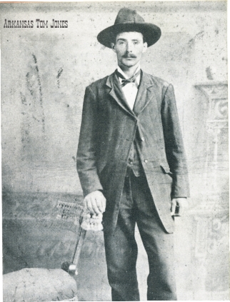
The Wild Bunch, also known as the Doolin–Dalton Gang, or the Oklahombres, were a gang of American outlaws based in the Indian Territory in the late 19th and early 20th centuries. They were active in Kansas, Missouri, Arkansas, and Oklahoma Territory during the 1890s—robbing banks and stores, holding up trains, and killing lawmen. They were also known as The Oklahoma Long Riders because of the long dusters that they wore. The gang formed in the last decade of the 19th century, and most of its members were killed before 1900. Only two of its eleven members survived into the 20th century, and all eleven met violent deaths in gun battles with lawmen. Members The gang was led by Bill Doolin and William Marion "Bill" Dalton; it included the following men at various times: William "Tulsa Jack" Blake, Dan "Dynamite Dick" Clifton, Roy Daugherty (a.k.a. "Arkansas Tom Jones");, George "Bitter Creek" Newcomb (a.k.a. "Slaughter Kid"); Charley Pierce, William F. "Little Bill" Raidler ... [...More Info...] [...Related Items...] OR: [Wikipedia] [Google] [Baidu] |
Dalton Gang
The Dalton Gang was a group of outlaws in the American Old West during 1890–1892. It was also known as The Dalton Brothers because four of its members were brothers. The gang specialized in bank and train robberies. During an attempted double bank robbery in Coffeyville, Kansas in 1892, two of the brothers and two other gang members were killed; Emmett Dalton survived, was captured, and later pleaded guilty to second-degree murder, although he later asserted that he never fired a shot during the robbery. He was paroled after serving 14 years in prison. Brothers Bob, "Grat", and Emmett had first worked as lawmen for the federal court at Fort Smith, Arkansas and then for the Osage Nation. They started stealing horses to make more money, and then fled the area. They decided to form a gang and started robbing trains and banks. While their older brother "Bill" Dalton never joined any heists, he served as their spy and informant. Due to the sensationalism that surrounded the ... [...More Info...] [...Related Items...] OR: [Wikipedia] [Google] [Baidu] |
William M
William is a male given name of Germanic origin.Hanks, Hardcastle and Hodges, ''Oxford Dictionary of First Names'', Oxford University Press, 2nd edition, , p. 276. It became very popular in the English language after the Norman conquest of England in 1066,All Things William"Meaning & Origin of the Name"/ref> and remained so throughout the Middle Ages and into the modern era. It is sometimes abbreviated "Wm." Shortened familiar versions in English include Will, Wills, Willy, Willie, Bill, and Billy. A common Irish form is Liam. Scottish diminutives include Wull, Willie or Wullie (as in Oor Wullie or the play ''Douglas''). Female forms are Willa, Willemina, Wilma and Wilhelmina. Etymology William is related to the given name ''Wilhelm'' (cf. Proto-Germanic ᚹᛁᛚᛃᚨᚺᛖᛚᛗᚨᛉ, ''*Wiljahelmaz'' > German ''Wilhelm'' and Old Norse ᚢᛁᛚᛋᛅᚼᛅᛚᛘᛅᛋ, ''Vilhjálmr''). By regular sound changes, the native, inherited English form of the name shoul ... [...More Info...] [...Related Items...] OR: [Wikipedia] [Google] [Baidu] |
Anadarko, Oklahoma
Anadarko is a city in Caddo County, Oklahoma, United States. The city is fifty miles southwest of Oklahoma City. The population was 5,745 at the 2020 census. It is the county seat of Caddo County. History Anadarko got its name when its post office was established in 1873. The designation came from the Nadaco Native Americans, a branch of the Caddo Nation, and the "A" was added due to a clerical error.Carolyn Riffel and Betty Bell, "Anadarko." ''Encyclopedia of Oklahoma History and Culture''. Accessed April 17, 2015. In 1871, the Wichita Agency was reestablished on the north bank of the after bein ... [...More Info...] [...Related Items...] OR: [Wikipedia] [Google] [Baidu] |
Ardmore, Oklahoma
Ardmore is the county seat of Carter County, Oklahoma, United States. According to the 2010 census, the city had a population of 24,283, with an estimated population of 24,698 in 2019. The Ardmore micropolitan statistical area had an estimated population of 48,491 in 2013. Ardmore is from both Oklahoma City and Dallas/Fort Worth, Texas, at the junction of Interstate 35 and U.S. Highway 70, and is generally considered the hub of the 13-county region of South Central Oklahoma, also known by state tourism pamphlets as " Chickasaw Country" and previously "Lake and Trail Country". It is also a part of the Texoma region. Ardmore is situated about south of the Arbuckle Mountains and is located at the eastern margin of the Healdton Basin, one of the most oil-rich regions of the United States. Ardmore was named after the affluent Philadelphia suburb and historic PRR Main Line stop of Ardmore, Pennsylvania, which was named after Ardmore in County Waterford, Ireland, by the Pennsyl ... [...More Info...] [...Related Items...] OR: [Wikipedia] [Google] [Baidu] |
Pickens County, Chickasaw Nation
Pickens County was a political subdivision of the Chickasaw Nation in the Indian Territory from 1855, prior to Oklahoma being admitted as a state in 1907. The county was one of four that comprised the Chickasaw Nation. Following statehood, its territory was divided among several Oklahoma counties that have continued to the present. History The Chickasaw Indians, after being removed from the southeastern United States to Indian Territory in the 1830s, were assigned to live within the boundaries of the Choctaw Nation. In 1855 the Chickasaw Nation was established as a separate entity. The boundaries and political subdivisions of the Chickasaw Nation may be traced to Choctaw laws and legislation. Until the Chickasaws’ separation from the Choctaw Nation in 1855, the Choctaws divided their territory into four major administrative and judicial regions, or districts. Although the Chickasaw were free to live anywhere within the Choctaw Nation they chose, most were concentrated in it ... [...More Info...] [...Related Items...] OR: [Wikipedia] [Google] [Baidu] |
Geographic Names Information System
The Geographic Names Information System (GNIS) is a database of name and locative information about more than two million physical and cultural features throughout the United States and its territories, Antarctica, and the associated states of the Marshall Islands, Federated States of Micronesia, and Palau. It is a type of gazetteer. It was developed by the United States Geological Survey (USGS) in cooperation with the United States Board on Geographic Names (BGN) to promote the standardization of feature names. Data were collected in two phases. Although a third phase was considered, which would have handled name changes where local usages differed from maps, it was never begun. The database is part of a system that includes topographic map names and bibliographic references. The names of books and historic maps that confirm the feature or place name are cited. Variant names, alternatives to official federal names for a feature, are also recorded. Each feature receives a per ... [...More Info...] [...Related Items...] OR: [Wikipedia] [Google] [Baidu] |
List Of Sovereign States
The following is a list providing an overview of sovereign states around the world with information on their status and recognition of their sovereignty. The 206 listed states can be divided into three categories based on membership within the United Nations System: 193 UN member states, 2 UN General Assembly non-member observer states, and 11 other states. The ''sovereignty dispute'' column indicates states having undisputed sovereignty (188 states, of which there are 187 UN member states and 1 UN General Assembly non-member observer state), states having disputed sovereignty (16 states, of which there are 6 UN member states, 1 UN General Assembly non-member observer state, and 9 de facto states), and states having a special political status (2 states, both in free association with New Zealand). Compiling a list such as this can be a complicated and controversial process, as there is no definition that is binding on all the members of the community of nations concerni ... [...More Info...] [...Related Items...] OR: [Wikipedia] [Google] [Baidu] |
Federal Information Processing Standard
The Federal Information Processing Standards (FIPS) of the United States are a set of publicly announced standards that the National Institute of Standards and Technology (NIST) has developed for use in computer systems of non-military, American government agencies and contractors. FIPS standards establish requirements for ensuring computer security and interoperability, and are intended for cases in which suitable industry standards do not already exist. Many FIPS specifications are modified versions of standards the technical communities use, such as the American National Standards Institute (ANSI), the Institute of Electrical and Electronics Engineers (IEEE), and the International Organization for Standardization (ISO). Specific areas of FIPS standardization The U.S. government has developed various FIPS specifications to standardize a number of topics including: * Codes, e.g., FIPS county codes or codes to indicate weather conditions or emergency indications. In 1994, Nat ... [...More Info...] [...Related Items...] OR: [Wikipedia] [Google] [Baidu] |


