|
Pontsticill
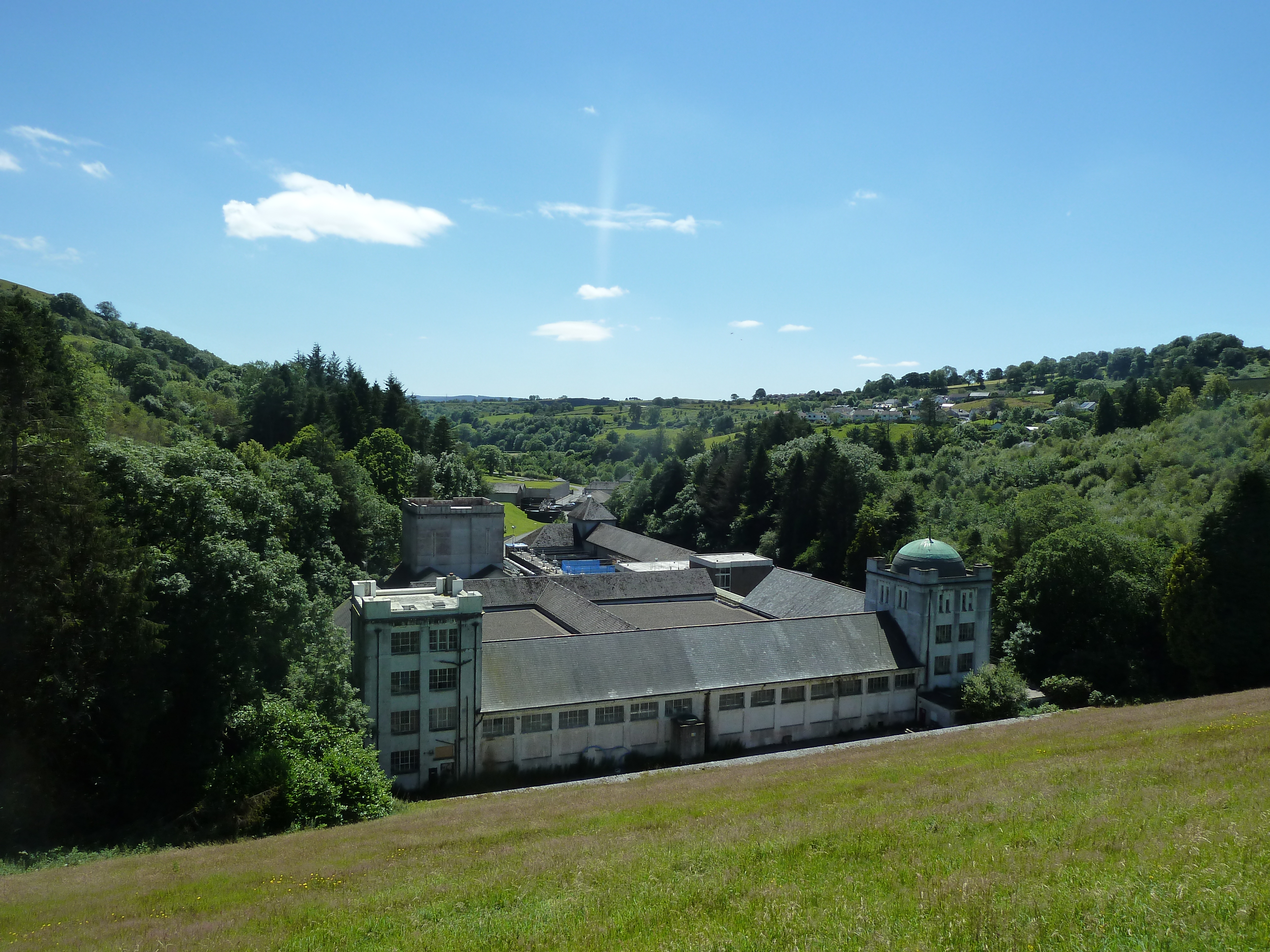
Pontsticill is a village within the county borough of Merthyr Tydfil in South Wales. It lies within the valley of the Taf Fechan on the southern edge of the Brecon Beacons National Park. The village lies within the community of Vaynor in an area that was, until the local government re-organisation of 1974, within the historic county of Brecknockshire. Pontsticill is closely associated with the Brecon Mountain Railway, a tourist railway which runs along the former Brecon and Merthyr Railway line. Immediately to the north of the village is the Pontsticill Reservoir which was completed in 1927. The village name originates from the Welsh words ''pont'' and ''sticill'' and signifies a 'bridge near a stile'. Ponsticill Reservoir Pontsticill Reservoir, originally Taff Fechan Reservoir, was opened in 1927 to supply water to much of the South Wales Valleys. The 110 ft high embankment holdings 15,400 megalitres of water. The reservoir is popular with sailors, anglers and picnicker ... [...More Info...] [...Related Items...] OR: [Wikipedia] [Google] [Baidu] |
Taf Fechan
The River Taff ( cy, Afon Taf) is a river in Wales. It rises as two rivers in the Brecon Beacons; the Taf Fechan (''little Taff'') and the Taf Fawr (''great Taff'') before becoming one just north of Merthyr Tydfil. Its confluence with the River Severn estuary is in Cardiff. The river supports several species of migratory fish, including salmon, sewin (sea trout), and eel. Course From its confluence at Cefn-coed-y-cymmer, the river flows south, passing several towns. It picks up a few tributaries, such as the River Cynon, River Rhondda, Bargoed Taf and Nant Clydach. It flows through Pontypridd and through to Taff's Well, the site of Wales' only thermal spring. It flows underneath the M4 Motorway, before turning southeastward and flowing past the Cardiff suburbs of Radyr, Whitchurch, Llandaff, Pontcanna, the city centre and Grangetown, before emptying into Cardiff Bay, near to the mouth of the River Ely. Taf Fawr The Taf Fawr rises below the peak of Corn Du, so ... [...More Info...] [...Related Items...] OR: [Wikipedia] [Google] [Baidu] |
Brecon Mountain Railway
The Brecon Mountain Railway (Welsh: ''Rheilffordd Mynydd Brycheiniog'') is a narrow gauge tourist railway on the south side of the Brecon Beacons. It climbs northwards from Pant along the full length of the Pontsticill Reservoir (also called 'Taf Fechan' reservoir by Welsh Water) and continues past the adjoining Pentwyn Reservoir to Torpantau railway station. The railway's starting point at Pant is located north of the town centre of Merthyr Tydfil, Merthyr Tydfil County Borough, South-East Wales. Route description The line runs along part of the trackbed of the northern section of the former Brecon and Merthyr Railway from Pant to a new station at Torpantau, via Pontsticill and Dolygaer, a total of about . This takes the BMR just short of the southern entrance to the 667 yd (610 m) long Torpantau tunnel, the highest railway tunnel in Great Britain, which carried the original line through the hills along the side of Glyn Collwn to Brecon or to Moat Lane or Hereford vi ... [...More Info...] [...Related Items...] OR: [Wikipedia] [Google] [Baidu] |
Pontsticill Reservoir
Pontsticill Reservoir () or Taf Fechan Reservoir is a large reservoir on the Taf Fechan lying partly in the county of Powys and partly within the county borough of Merthyr Tydfil in south Wales. It lies within the Brecon Beacons National Park and Fforest Fawr Geopark. The 110 ft high embankment has, since its completion in 1927, been holding back 15,400 megalitres of water for supply to industry and population to the south. The modern reservoir incorporates the earlier Pentwyn Reservoir (sometimes referred to as Dol-y-gaer Reservoir or Lake) which suffered major water losses after completion due to the presence of major fractures in the bedrock beneath its dam relating to the Neath Disturbance, a major geological fault which runs northeast to southwest through the area.‘Reservoir Builders of South Wales’ (Dam Builders in the Age of Steam series book six) Bowtell H.D. & Hill G. The reservoir is popular with sailors, anglers and picnickers. The Taff Trail runs throu ... [...More Info...] [...Related Items...] OR: [Wikipedia] [Google] [Baidu] |
Brecon And Merthyr Railway
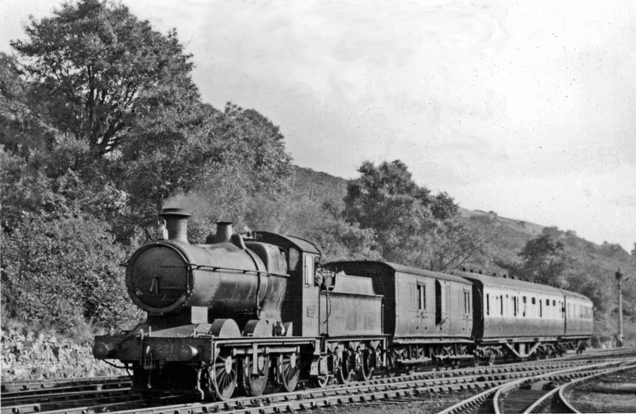
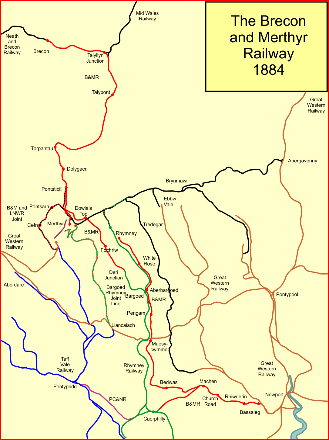
The Brecon and Merthyr Tydfil Junction Railway (B&MR) was a railway company in Wales. It was originally intended to link the towns in its name. Finding its access to Merthyr difficult at first, it acquired the Rumney Railway, an old plateway, and this gave it access to Newport docks. This changed its emphasis from rural line to mineral artery. It opened at the Brecon end to a point near Dowlais in 1863, and in 1865 it opened a disconnected section from Rhymney to Newport. In due course the company connected the two sections and reached Dowlais and Merthyr, but had to concede sharing a route with the powerful London and North Western Railway. The B&MR was always short of money, and was notable for its prodigious gradients, but it survived until the grouping of 1923, when it became part of the Great Western Railway. Its network declined steeply after 1945, and passenger operation ceased in 1962. Goods and mineral operation also lost its market, and as of 2020, only a short stub to ... [...More Info...] [...Related Items...] OR: [Wikipedia] [Google] [Baidu] |
Vaynor
Vaynor (Welsh: ''Y Faenor'', meaning "The Manor") is a village and community (formerly a parish) in Merthyr Tydfil County Borough in Wales, United Kingdom. The population of the community at the 2011 census was 3,551. Location It is about four miles north of the town of Merthyr Tydfil and is within the borders of the Brecon Beacons National Park. The community includes the three villages of Cefn-coed-y-cymmer, Trefechan and Pontsticill as well as Pontsarn and Vaynor. To the west are Nant Glais Caves. It also includes the southern section of Pontsticill Reservoir and the eastern end of Llwyn-On Reservoir. History Until 1974, the village was a civil parish in the Vaynor and Penderyn Rural District of Brecknockshire. From 1974 to 1996, it was part of Merthyr Tydfil district in Mid Glamorgan. It is notable for its connections with the Ironmaster Robert Crawshay, owner of the world's first ironworks at Cyfarthfa, who is buried in Vaynor churchyard. Governance Between 1973 a ... [...More Info...] [...Related Items...] OR: [Wikipedia] [Google] [Baidu] |
Brecknockshire
, image_flag= , HQ= Brecon , Government= Brecknockshire County Council (1889-1974) , Origin= Brycheiniog , Status= , Start= 1535 , End= 1974 , Code= BRE , CodeName= Chapman code , Replace= Brecknock, Powys , Motto= Undeb Hedd Llwyddiant (Unity, Peace, Prosperity) , Divisions= , DivisionsNames= , DivisionsMap= , Image= , Map= , Arms= , Civic= , PopulationFirst= 47,763Vision of Britain 1831 Census/ref> , PopulationFirstYear= 1831 , AreaFirst= , AreaFirstYear= 1831 , DensityFirst= 0.1/acre , DensityFirstYear= 1831 , PopulationSecond= 54,213 , PopulationSecondYear= 1901 , AreaSecond= , AreaSecondYear= 1911 , ... [...More Info...] [...Related Items...] OR: [Wikipedia] [Google] [Baidu] |
Brecon Beacons National Park
The Brecon Beacons National Park ( cy, Parc Cenedlaethol Bannau Brycheiniog) is one of three national parks in Wales, and is centred on the Brecon Beacons range of hills in southern Wales. It includes the Black Mountain (range), Black Mountain ( cy, Y Mynydd Du) in the west, Fforest Fawr (translates as 'great forest') and the Brecon Beacons in the centre and the Black Mountains, Wales, Black Mountains ( cy, Y Mynydd Du or Mynyddoedd Duon) in the east. Description The Brecon Beacons National Park was established in 1957, the last of the three Welsh parks designated after Snowdonia in 1951 and the Pembrokeshire Coast in 1952. It stretches from Llandeilo in the west to Hay-on-Wye in the northeast and Pontypool in the southeast, covering and encompassing four main regions – the Black Mountain (range), Black Mountain in the west, reaching 802 metres (2631 feet) at Fan Brycheiniog, Fforest Fawr and the Brecon Beacons in the centre, including the highest summit in the park and in ... [...More Info...] [...Related Items...] OR: [Wikipedia] [Google] [Baidu] |
Merthyr Tydfil
Merthyr Tydfil (; cy, Merthyr Tudful ) is the main town in Merthyr Tydfil County Borough, Wales, administered by Merthyr Tydfil County Borough Council. It is about north of Cardiff. Often called just Merthyr, it is said to be named after Tydfil, daughter of Brychan Brycheiniog, King Brychan of Brycheiniog, who according to legend was slain at Merthyr by pagans about 480 CE. generally means "Martyr of the Faith, martyr" in modern Welsh, but here closer to the Latin : a place of worship built over a martyr's relics. Similar place names in south Wales are Merthyr Cynog, Merthyr Dyfan and Merthyr Mawr. History Pre-history Peoples migrating north from Europe had lived in the area for many thousands of years. The archaeological record starts from about 1000 BC with the Celts. From their language, the Welsh language developed. Hillforts were built during the British Iron Age, Iron Age and the tribe that inhabited them in the south of Wales was called the Silures, according to Tacitu ... [...More Info...] [...Related Items...] OR: [Wikipedia] [Google] [Baidu] |
County Borough
County borough is a term introduced in 1889 in the United Kingdom of Great Britain and Ireland, to refer to a borough or a city independent of county council control, similar to the unitary authorities created since the 1990s. An equivalent term used in Scotland was a county of city. They were abolished by the Local Government Act 1972 in England and Wales, but continue in use for lieutenancy and shrievalty in Northern Ireland. In the Republic of Ireland they remain in existence but have been renamed ''cities'' under the provisions of the Local Government Act 2001. The Local Government (Wales) Act 1994 re-introduced the term for certain "principal areas" in Wales. Scotland did not have county boroughs but instead had counties of cities. These were abolished on 16 May 1975. All four Scottish cities of the time—Aberdeen, Dundee, Edinburgh, and Glasgow—were included in this category. There was an additional category of large burgh in the Scottish system (similar to a munici ... [...More Info...] [...Related Items...] OR: [Wikipedia] [Google] [Baidu] |
Site Of Special Scientific Interest
A Site of Special Scientific Interest (SSSI) in Great Britain or an Area of Special Scientific Interest (ASSI) in the Isle of Man and Northern Ireland is a conservation designation denoting a protected area in the United Kingdom and Isle of Man. SSSI/ASSIs are the basic building block of site-based nature conservation legislation and most other legal nature/geological conservation designations in the United Kingdom are based upon them, including national nature reserves, Ramsar sites, Special Protection Areas, and Special Areas of Conservation. The acronym "SSSI" is often pronounced "triple-S I". Selection and conservation Sites notified for their biological interest are known as Biological SSSIs (or ASSIs), and those notified for geological or physiographic interest are Geological SSSIs (or ASSIs). Sites may be divided into management units, with some areas including units that are noted for both biological and geological interest. Biological Biological SSSI/ASSIs may ... [...More Info...] [...Related Items...] OR: [Wikipedia] [Google] [Baidu] |
Welsh Language
Welsh ( or ) is a Celtic language family, Celtic language of the Brittonic languages, Brittonic subgroup that is native to the Welsh people. Welsh is spoken natively in Wales, by some in England, and in Y Wladfa (the Welsh colony in Chubut Province, Argentina). Historically, it has also been known in English as "British", "Cambrian", "Cambric" and "Cymric". The Welsh Language (Wales) Measure 2011 gave the Welsh language official status in Wales. Both the Welsh and English languages are ''de jure'' official languages of the Welsh Parliament, the Senedd. According to the 2021 United Kingdom census, 2021 census, the Welsh-speaking population of Wales aged three or older was 17.8% (538,300 people) and nearly three quarters of the population in Wales said they had no Welsh language skills. Other estimates suggest that 29.7% (899,500) of people aged three or older in Wales could speak Welsh in June 2022. Almost half of all Welsh speakers consider themselves fluent Welsh speakers ... [...More Info...] [...Related Items...] OR: [Wikipedia] [Google] [Baidu] |
Historic Counties Of Wales
The historic counties of Wales are sub-divisions of Wales. They were used for various functions for several hundred years,Bryne, T., ''Local Government in Britain'', (1994) but for administrative purposes have been superseded by contemporary Principal areas of Wales, sub-national divisions,Her Majesty's Stationery Office, ''Aspects of Britain: Local Government'', (1996) some of which bear some limited similarity to the historic entities in name and extent. They are alternatively known as ancient counties. The counties :1 The earldom of Pembroke and lordship of Glamorgan pre-date the Edwardian conquest. :2 These counties originate in 1282, following King Edward I of England, Edward I's conquest. :3 These counties originate in 1535, with the Laws in Wales Acts 1535-1542, Laws in Wales Act, 1535, converting the remaining Welsh Marches, Marcher Lordships into counties. :4 Despite being created at the same Act as the other counties, Monmouthshire was included with English ... [...More Info...] [...Related Items...] OR: [Wikipedia] [Google] [Baidu] |


