|
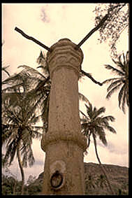
Ponta Das Bicudas , near the neighbourhood Achada Grande Tras. The Praia Harbour lies west of the headland.
Ponta das Bicudas is a headland in the southeastern part of the island of Santiago, Cape Verde. It is 3 km east of the city centre of Praia Praia (, Portuguese language, Portuguese for "beach") is the capital and largest city of Cape Verde. 
References [...More Info...] [...Related Items...] OR: [Wikipedia] [Google] [Baidu] |
Headland
A headland, also known as a head, is a coastal landform, a point of land usually high and often with a sheer drop, that extends into a body of water. It is a type of promontory. A headland of considerable size often is called a cape.Whittow, John (1984). ''Dictionary of Physical Geography''. London: Penguin, 1984, pp. 80, 246. . Headlands are characterised by high, breaking waves, rocky shores, intense erosion, and steep sea cliff. Headlands and bays are often found on the same coastline. A bay is flanked by land on three sides, whereas a headland is flanked by water on three sides. Headlands and bays form on discordant coastlines, where bands of rock of alternating resistance run perpendicular to the coast. Bays form when weak (less resistant) rocks (such as sands and clays) are eroded, leaving bands of stronger (more resistant) rocks (such as chalk, limestone, and granite) forming a headland, or peninsula. Through the deposition of sediment within the bay and the erosion of the ... [...More Info...] [...Related Items...] OR: [Wikipedia] [Google] [Baidu] |
Santiago, Cape Verde
Santiago (Portuguese for “ Saint James”) is the largest island of Cape Verde, its most important agricultural centre and home to half the nation's population. Part of the Sotavento Islands, it lies between the islands of Maio ( to the east) and Fogo ( to the west). It was the first of the islands to be settled: the town of Ribeira Grande (now Cidade Velha and a UNESCO World Heritage Site) was founded in 1462. Santiago is home to the nation's capital city of Praia. History The eastern side of the nearby island of Fogo collapsed into the ocean 73,000 years ago, creating a tsunami 170 meters high which struck Santiago. In 1460, António de Noli became the first to visit the island. Da Noli settled at ''Ribeira Grande'' (now Cidade Velha) with his family members and Portuguese from Algarve and Alentejo in 1462.Valor simbóli ... [...More Info...] [...Related Items...] OR: [Wikipedia] [Google] [Baidu] |
Achada Grande Tras
Achada Grande Tras is a subdivision of the city of Praia in the island of Santiago, Cape Verde. Its population was 2,958 at the 2010 census. It is situated east of the city centre, and south of the Nelson Mandela International Airport. Adjacent neighbourhoods include Achada Grande Frente and Lem Ferreira to the west. Landmarks and points of interest * Complexo Desportivo Adega - center *Nelson Mandela International Airport, the city's and the island's airport - north *Praia Harbour Praia Harbor ( pt, Porto da Praia) is the port of the city of Praia in the southern part of the island of Santiago, Cape Verde. It is situated in a natural bay of the Atlantic Ocean. Since the latest modernization in 2014, it has 2 long quays, 3 sh ... References {{Authority control Subdivisions of Praia ... [...More Info...] [...Related Items...] OR: [Wikipedia] [Google] [Baidu] |
Praia
Praia (, Portuguese language, Portuguese for "beach") is the capital and largest city of Cape Verde.Cape Verde, Statistical Yearbook 2015 Instituto Nacional de Estatística (Cape Verde), Instituto Nacional de Estatística Located on the southern coast of Santiago, Cape Verde, Santiago island, within the Sotavento Islands group, the city is the seat of the Praia, Cape Verde (municipality), Praia Municipality. Praia is the economic, political, and cultural center of Cape Verde. History  The island of Santiago was discovered by António da Noli in 1460.
 [...More Info...] [...Related Items...] OR: [Wikipedia] [Google] [Baidu] |
Atlantic Ocean
The Atlantic Ocean is the second-largest of the world's five oceans, with an area of about . It covers approximately 20% of Earth's surface and about 29% of its water surface area. It is known to separate the " Old World" of Africa, Europe and Asia from the "New World" of the Americas in the European perception of the World. The Atlantic Ocean occupies an elongated, S-shaped basin extending longitudinally between Europe and Africa to the east, and North and South America to the west. As one component of the interconnected World Ocean, it is connected in the north to the Arctic Ocean, to the Pacific Ocean in the southwest, the Indian Ocean in the southeast, and the Southern Ocean in the south (other definitions describe the Atlantic as extending southward to Antarctica). The Atlantic Ocean is divided in two parts, by the Equatorial Counter Current, with the North(ern) Atlantic Ocean and the South(ern) Atlantic Ocean split at about 8°N. Scientific explorations of the A ... [...More Info...] [...Related Items...] OR: [Wikipedia] [Google] [Baidu] |
Cape Verde
, national_anthem = () , official_languages = Portuguese , national_languages = Cape Verdean Creole , capital = Praia , coordinates = , largest_city = capital , demonym = Cape Verdean or Cabo Verdean , ethnic_groups_year = 2017 , government_type = Unitary semi-presidential republic , leader_title1 = President , leader_name1 = José Maria Neves , leader_title2 = Prime Minister , leader_name2 = Ulisses Correia e Silva , legislature = National Assembly , area_rank = 166th , area_km2 = 4033 , area_sq_mi = 1,557 , percent_water = negligible , population_census = 561,901 , population_census_rank = 172nd , population_census_year = 2021 , population_density_km2 = 123.7 , population_density_sq_mi = 325.0 , population_density_rank = 89th , GDP_PPP ... [...More Info...] [...Related Items...] OR: [Wikipedia] [Google] [Baidu] |
Praia Harbour
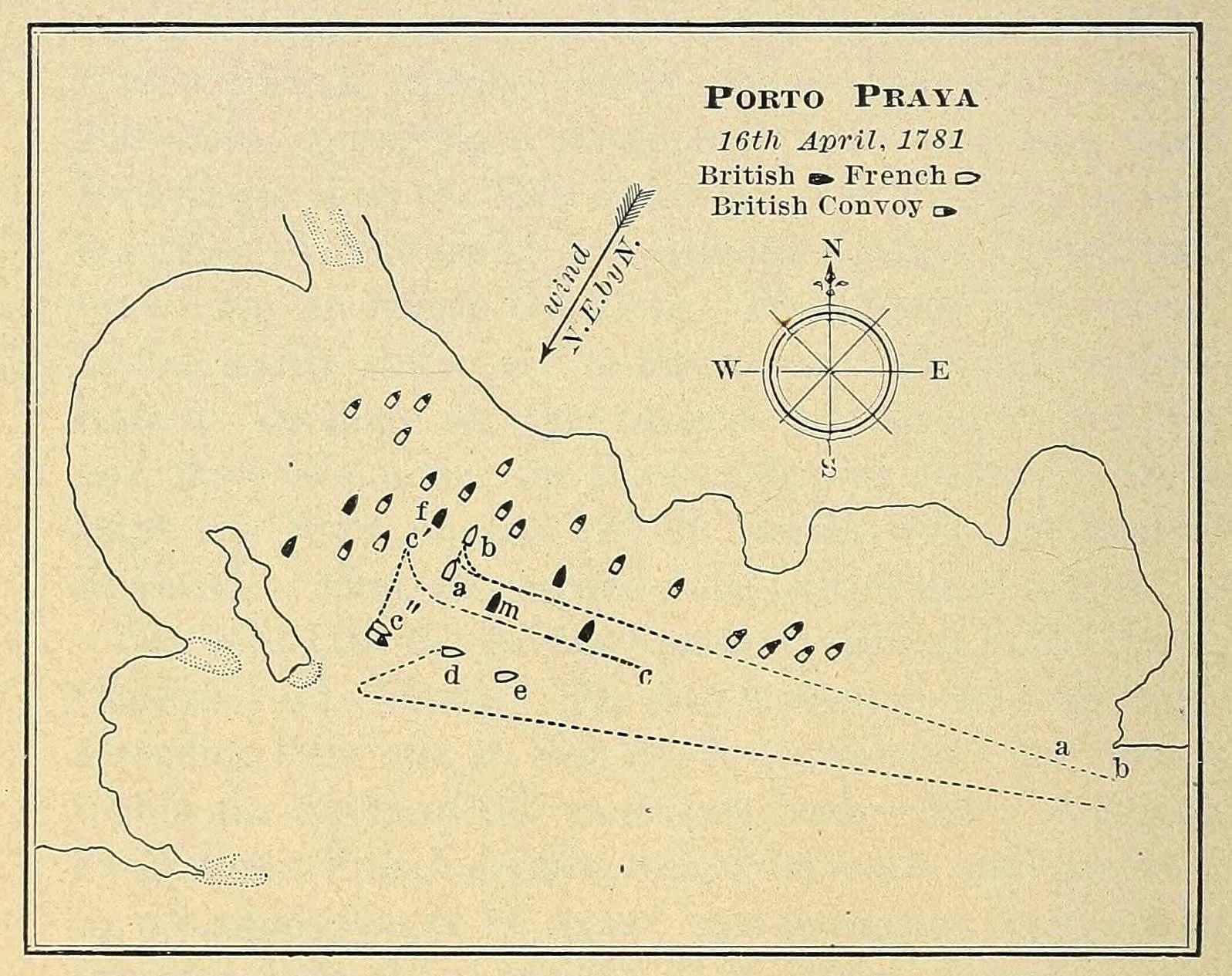
Praia Harbor ( pt, Porto da Praia) is the port of the city of Praia in the southern part of the island of Santiago, Cape Verde. It is situated in a natural bay of the Atlantic Ocean. Since the latest modernization in 2014, it has 2 long quays, 3 shorter quays, a quay for fishing boats with fish processing installations, 2 container parks, 2 roll-on/roll-off ramps and a passenger terminal. The total length of the quays is 863 m, and the maximum depth is 13.5 m. The port of Praia played an important role in the colonization of Africa and South America by the Portuguese. With 817,845 metric tonnes of cargo and 85,518 passengers handled (2017), it is the second busiest port of Cape Verde, after Porto Grande (Mindelo). The bay of Praia lies between the headlands Ponta Temerosa and Ponta das Bicudas. The islet Ilhéu de Santa Maria lies in the bay, west of the port. The river Ribeira da Trindade empties into the bay, between the city centre (Plateau) and the port. Directly north of t ... [...More Info...] [...Related Items...] OR: [Wikipedia] [Google] [Baidu] |
Headlands Of Cape Verde
A headland, also known as a head, is a coastal landform, a point of land usually high and often with a sheer drop, that extends into a body of water. It is a type of promontory. A headland of considerable size often is called a cape.Whittow, John (1984). ''Dictionary of Physical Geography''. London: Penguin, 1984, pp. 80, 246. . Headlands are characterised by high, breaking waves, rocky shores, intense erosion, and steep sea cliff. Headlands and bays are often found on the same coastline. A bay is flanked by land on three sides, whereas a headland is flanked by water on three sides. Headlands and bays form on discordant coastlines, where bands of rock of alternating resistance run perpendicular to the coast. Bays form when weak (less resistant) rocks (such as sands and clays) are eroded, leaving bands of stronger (more resistant) rocks (such as chalk, limestone, and granite) forming a headland, or peninsula. Through the deposition of sediment within the bay and the erosion of the ... [...More Info...] [...Related Items...] OR: [Wikipedia] [Google] [Baidu] |
Geography Of Santiago, Cape Verde
Geography (from Greek: , ''geographia''. Combination of Greek words ‘Geo’ (The Earth) and ‘Graphien’ (to describe), literally "earth description") is a field of science devoted to the study of the lands, features, inhabitants, and phenomena of Earth. The first recorded use of the word γεωγραφία was as a title of a book by Greek scholar Eratosthenes (276–194 BC). Geography is an all-encompassing discipline that seeks an understanding of Earth and its human and natural complexities—not merely where objects are, but also how they have changed and come to be. While geography is specific to Earth, many concepts can be applied more broadly to other celestial bodies in the field of planetary science. One such concept, the first law of geography, proposed by Waldo Tobler, is "everything is related to everything else, but near things are more related than distant things." Geography has been called "the world discipline" and "the bridge between the human a ... [...More Info...] [...Related Items...] OR: [Wikipedia] [Google] [Baidu] |
_p0166_CAPE_VERDE%2C_PORTO_PRAYA.jpg)


