|
Podillia
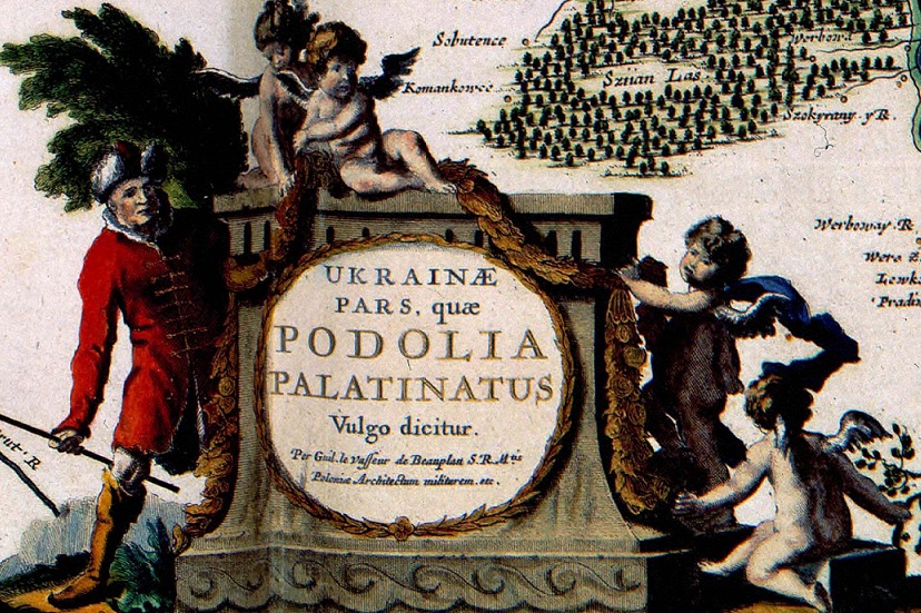
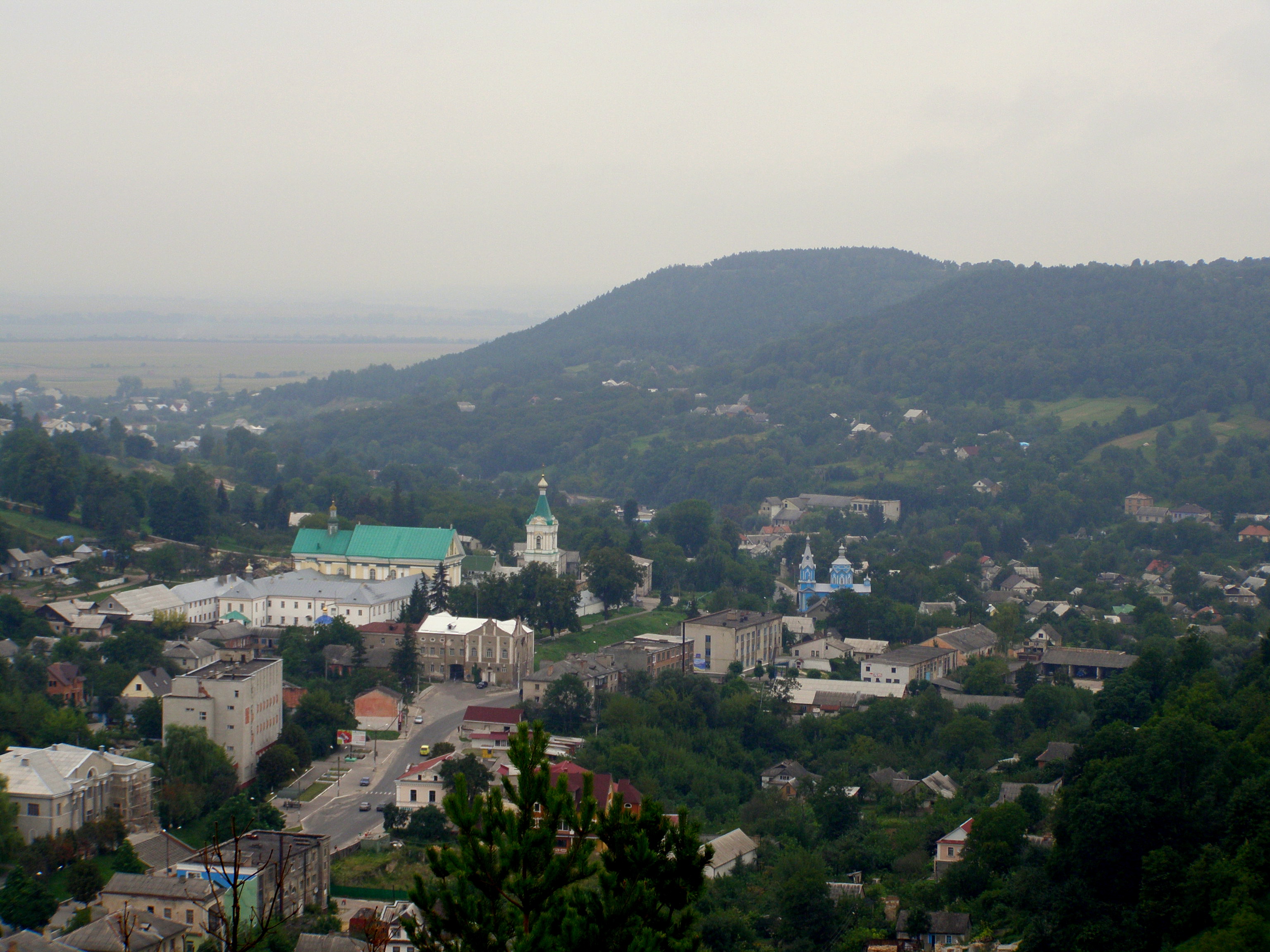
Podolia or Podilia ( uk, Поділля, Podillia, ; russian: Подолье, Podolye; ro, Podolia; pl, Podole; german: Podolien; be, Падолле, Padollie; lt, Podolė), is a historic region in Eastern Europe, located in the west-central and south-western parts of Ukraine and in northeastern Moldova (i.e. northern Transnistria). The name derives from Old Slavic ''po'', meaning "by/next to/along" and ''dol'', "valley" (see dale). Geography The area is part of the vast East European Plain, confined by the Dniester River and the Carpathian arc in the southwest. It comprises an area of about , extending for from northwest to southeast on the left bank of the Dniester. In the same direction run two ranges of relatively low hills separated by the Southern Bug, ramifications of the Avratynsk heights. The Podolian Upland, an elongated, up to high plateau stretches from the Western and Southern Bug rivers to the Dniester, and includes hill countries and mountainous regions ... [...More Info...] [...Related Items...] OR: [Wikipedia] [Google] [Baidu] |
Vinnytsia Oblast
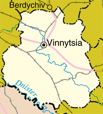
Vinnytsia Oblast ( uk, Ві́нницька о́бласть, translit=Vinnytska oblast; ; also referred to as Vinnychchyna — uk, Ві́нниччина) is an oblast of western and southwestern Ukraine. Its administrative center is Vinnytsia. The oblast has a population of History Vinnytsia Oblast, first established on February 27, 1932, originally comprised raions (regions) of the following former okruhas of Ukraine (districts of Soviet Ukraine): * Uman Okruha * Berdychiv Okruha * Vinnytsia Okruha * Mohyliv Okruha * Tulchyn Okruha * Shepetivka Okruha * Proskuriv Okruha * Kamianets Okruha In 1935 bordering territories of the oblast were transformed into Soviet border districts: Shepetivka Okrug, Proskuriv Okrug, and Kamianets Okrug. In 1937 the Kamianets Oblast, based on the border districts, was formed (it later became Khmelnytsky Oblast). During World War II the occupying Axis powers split the territory of Vinnytsia Oblast between the General District Shitomir (Zhyto ... [...More Info...] [...Related Items...] OR: [Wikipedia] [Google] [Baidu] |
Ternopil Oblast
Ternopil Oblast ( uk, Тернопі́льська о́бласть, translit=Ternopilska oblast; also referred to as Ternopilshchyna, uk, Терно́пільщина, label=none, or Ternopillia, uk, Тернопілля, label=none) is an oblast (province) of Ukraine. Its administrative center is Ternopil, through which flows the Seret, a tributary of the Dniester. Population: One of the natural wonders of the region are its cave complexes.Tell about Ukraine. Ternopil Oblast 24 Kanal (youtube). Although Ternopil Oblast is among the smallest regions in Ukraine, over 100 caves have been discovered there. Scientists believe these are only 20% of all possible caves in the region. The biggest cave is |
Kamianets-Podilskyi Castle
Kamianets-Podilskyi Castle ( uk, links=no, Кам'янець-Подільська фортеця; pl, links=no, twierdza w Kamieńcu Podolskim) is a former Ruthenian- Lithuanian castle and a later three-part Polish fortress located in the historic city of Kamianets-Podilskyi, Ukraine, in the historic region of Podolia in the western part of the country. Its name is attributed to the root word ''kamin''', from the Slavic word for 'stone'. Historical accounts date Kamianets-Podilskyi Castle to the early 14th century, although recent archaeological evidence has proved human existence in the area back to the 12th or 13th century. Initially built to protect the bridge connecting the city with the mainland, the castle sits on top of a peninsula carved out by the winding Smotrych River, forming a natural defense system for Kamianets-Podilskyi's historic Old Town neighborhood. Its location on a strategic transport crossroad in Podolia made the castle a prime target for foreign inva ... [...More Info...] [...Related Items...] OR: [Wikipedia] [Google] [Baidu] |
Southern Bug
, ''Pivdennyi Buh'' , name_etymology = , image = Sunset S Bug Vinnitsa 2007 G1.jpg , image_size = 270 , image_caption = Southern Bug River in the vicinity of Vinnytsia, Ukraine , map = PietinisBugas.png , map_size = 270px , map_caption = Southern Bug through Ukraine , pushpin_map = , pushpin_map_size = , pushpin_map_caption= , subdivision_type1 = Country , subdivision_name1 = Ukraine , subdivision_type2 = , subdivision_name2 = , subdivision_type3 = Oblast , subdivision_name3 = , subdivision_type4 = , subdivision_name4 = , subdivision_type5 = , subdivision_name5 = , length = , width_min = , width_avg = , width_max = , depth_min = , depth_avg = , depth_max = , discharge1_location= , discharge1_min = , discharge1_avg = 108 m3/s , discharge1_max = , source1 = , source1_location = ... [...More Info...] [...Related Items...] OR: [Wikipedia] [Google] [Baidu] |
Ukrainian Historical Regions
A list of the various regions of Ukraine and/or inhabited by Ukrainians and their ancestors throughout history. Main historical regions Traditional regions The traditional names of the regions of Ukraine are important geographic, historical, and ethnographic identifiers. * Over-Dnieper Ukraine, Great Ukraine ** Land of Kyiv *** Right-bank Ukraine (east of Zhytomyr Oblast, Kyiv Oblast, Cherkasy Oblast), Central Ukraine *** Polesia, Land of Turov (north of Kyiv Oblast, east of Brest Oblast, west of Gomel Oblast), Northern Ukraine ** Land of Pereyaslav (predominantly Poltava Oblast and east of Kyiv Oblast), southern part of Left-bank Ukraine, Little Russia, Central Ukraine ** Land of Chernihiv (predominantly Chernihiv Oblast, west of Bryansk Oblast, east of Gomel Oblast), northern part of Left-bank Ukraine, Little Russia, Northern Ukraine ** Severia (Sumy Oblast, Kharkiv Oblast, Kursk Oblast, Belgorod Oblast) ** Sloboda Ukraine (mostly Kharkiv Oblast) * Ruthenia, Kingdom ... [...More Info...] [...Related Items...] OR: [Wikipedia] [Google] [Baidu] |
West Ukraine
Western Ukraine or West Ukraine ( uk, Західна Україна, Zakhidna Ukraina or , ) is the territory of Ukraine linked to the former Kingdom of Galicia–Volhynia, which was part of the Polish–Lithuanian Commonwealth, the Austrian Empire, Austria-Hungary and the Second Polish Republic, and came fully under the control of the Soviet Union (via the Ukrainian Soviet Socialist Republic) only in 1939, following the Molotov–Ribbentrop Pact. There is no universally accepted definition of the territory's boundaries (see the map, right), but the contemporary Ukrainian administrative regions or Oblasts of Chernivtsi, Ivano-Frankovsk, Lviv, Ternopil and Transcarpathia (which were part of the former Austro-Hungarian Empire) are nearly always included and the Lutsk and Rivne Oblasts (parts of the annexed from Poland during its Third Partition) are usually included. It is less common to include the Khmelnytski and, especially, the Vinnytsia and Zhytomyr Oblasts in this cate ... [...More Info...] [...Related Items...] OR: [Wikipedia] [Google] [Baidu] |
Ukraine
Ukraine ( uk, Україна, Ukraïna, ) is a country in Eastern Europe. It is the second-largest European country after Russia, which it borders to the east and northeast. Ukraine covers approximately . Prior to the ongoing Russian invasion, it was the eighth-most populous country in Europe, with a population of around 41 million people. It is also bordered by Belarus to the north; by Poland, Slovakia, and Hungary to the west; and by Romania and Moldova to the southwest; with a coastline along the Black Sea and the Sea of Azov to the south and southeast. Kyiv is the nation's capital and largest city. Ukraine's state language is Ukrainian; Russian is also widely spoken, especially in the east and south. During the Middle Ages, Ukraine was the site of early Slavic expansion and the area later became a key centre of East Slavic culture under the state of Kievan Rus', which emerged in the 9th century. The state eventually disintegrated into rival regional po ... [...More Info...] [...Related Items...] OR: [Wikipedia] [Google] [Baidu] |
Kamianets-Podilskyi
Kamianets-Podilskyi ( uk, Ка́м'яне́ць-Поді́льський, russian: Каменец-Подольский, Kamenets-Podolskiy, pl, Kamieniec Podolski, ro, Camenița, yi, קאַמענעץ־פּאָדאָלסק / קאַמעניץ, Kamenetz-Podolsk / Kamenitz) is a city on the Smotrych River in Western Ukraine, western Ukraine, to the north-east of Chernivtsi. Formerly the administrative center of the Khmelnytskyi Oblast, the city is now the administrative center of the Kamianets-Podilskyi Raion, Kamianets-Podilskyi Raion, district within the Khmelnytskyi Oblast, Khmelnytskyi Oblast, province. It hosts the administration of Kamianets-Podilskyi urban hromada. Current population has been estimated as In 1919–1920, during the unfolding Ukrainian–Soviet War, the city officially served as the temporary capital of the Ukrainian People's Republic. Name The first part of the city's dual name originates from ' ( uk, камiнь) or ', meaning 'stone' in Old East Slav ... [...More Info...] [...Related Items...] OR: [Wikipedia] [Google] [Baidu] |
Podolian Upland
The Podolian Upland (Podolian Plateau) or Podillia Upland ( uk, подільська височина, ''podilska vysochyna'') is a Upland (geology), highland area in southwestern Ukraine, on the left (northeast) bank of the Dniester, Dniester River, with small portions in its western extent stretching into eastern Poland. The region lies roughly between the Southern Bug and Dniester Rivers, with the Western Bug also originating in the northwest of the highlands. The average altitude of the Podolian Upland is over with the maximum being a hill known as Kamula Mountain, at . The surface is characterized by a combination of wide flat interfluves and deep canyon-like valleys (so called Dale (landform), dales) dissected into separate natural sub-regions: *Wooded heightened hills ** Roztocze, Roztochia ** Holohory ** Voronyaky ** Kremenets Hills (Mountains) ** Tovtry *Flat treeless plateaus ** Ternopil Plateau ** Upper Bug Plateau ** North-Podolian Plateau The Podolian Upland and t ... [...More Info...] [...Related Items...] OR: [Wikipedia] [Google] [Baidu] |
Kirovohrad Oblast
Kirovohrad Oblast ( uk, Кіровоградська область, translit=Kirovohradska oblast; also referred to as #Nomenclature, Kirovohradschyna — uk, Кіровоградщина) is an administrative divisions of Ukraine, oblast (province) of Ukraine. The administrative center of the oblast is the city of Kropyvnytskyi. Its population is . It is Ukraine's second least populated oblast, behind Chernivtsi Oblast, Chernivtsi. In 2019, the Constitutional Court of Ukraine approved the change of the oblast's name to Kropyvnytskyi Oblast (), or Kropyvnychchyna (). Geography The area of the province is . The city of Dobrovelychkivka is the geographical center of Ukraine. History The oblast was created as part of the Ukrainian Soviet Socialist Republic on January 10, 1939 out of the northern raions of Mykolaiv Oblast. In 1954 the oblast lost some raions to the newly created Cherkasy Oblast, but later that year received its western raions from the Odessa Oblast. Between 1939 ... [...More Info...] [...Related Items...] OR: [Wikipedia] [Google] [Baidu] |
Mohyliv-Podilskyi
Mohyliv-Podilskyi (, , , ) is a city in the Mohyliv-Podilskyi Raion of the Vinnytsia Oblast, Ukraine. Administratively, Mohyliv-Podilskyi is incorporated as a town of regional significance. It also serves as the administrative center of Mohyliv-Podilskyi Raion, one of twenty-seven districts of Vinnytsia Oblast, though it is not a part of the district. It is located in the historic region of Podolia, on the border with Bessarabia, Moldova, along the left bank of the Dniester river. On the opposite side of the river lies the Moldovan town of Otaci, and the two municipalities are connected to each other by a bridge. Population: History Polish period The first mention of the town dates from 1595. The owner of the town, Moldavian hospodar Ieremia Movilă (from which the name Mohyliv, ''Moghilău/Movilău'' in Romanian) bestowed it as a dowry gift to his daughter, who married into the Potocki family of Polish nobility. At that time, the groom named the town Movilǎu in honor of h ... [...More Info...] [...Related Items...] OR: [Wikipedia] [Google] [Baidu] |
Kyiv Oblast
Kyiv Oblast ( uk, Ки́ївська о́бласть, translit=Kyïvska oblast), also called Kyivshchyna ( uk, Ки́ївщина), is an oblast (province) in central and northern Ukraine. It surrounds, but does not include, the city of Kyiv, which is a self-governing city with special status. The administrative center of the oblast is in Kyiv city, the capital of Ukraine, despite the city not being part of the oblast. The Kyiv metropolitan area extends out from Kyiv city into parts of the oblast, which is significantly dependent on the urban economy and transportation of Kyiv. The population of Kyiv Oblast is . Its largest city is Bila Tserkva, with a population over 200,000. The Chernobyl Exclusion Zone is in the northern part of Kyiv Oblast. It is administered separately from the oblast and public access is prohibited. History Kyiv Oblast was created as part of the Ukrainian Soviet Socialist Republic on February 27, 1932 among the first five original oblasts in Ukraine. It ... [...More Info...] [...Related Items...] OR: [Wikipedia] [Google] [Baidu] |
