|
Platte Canyon
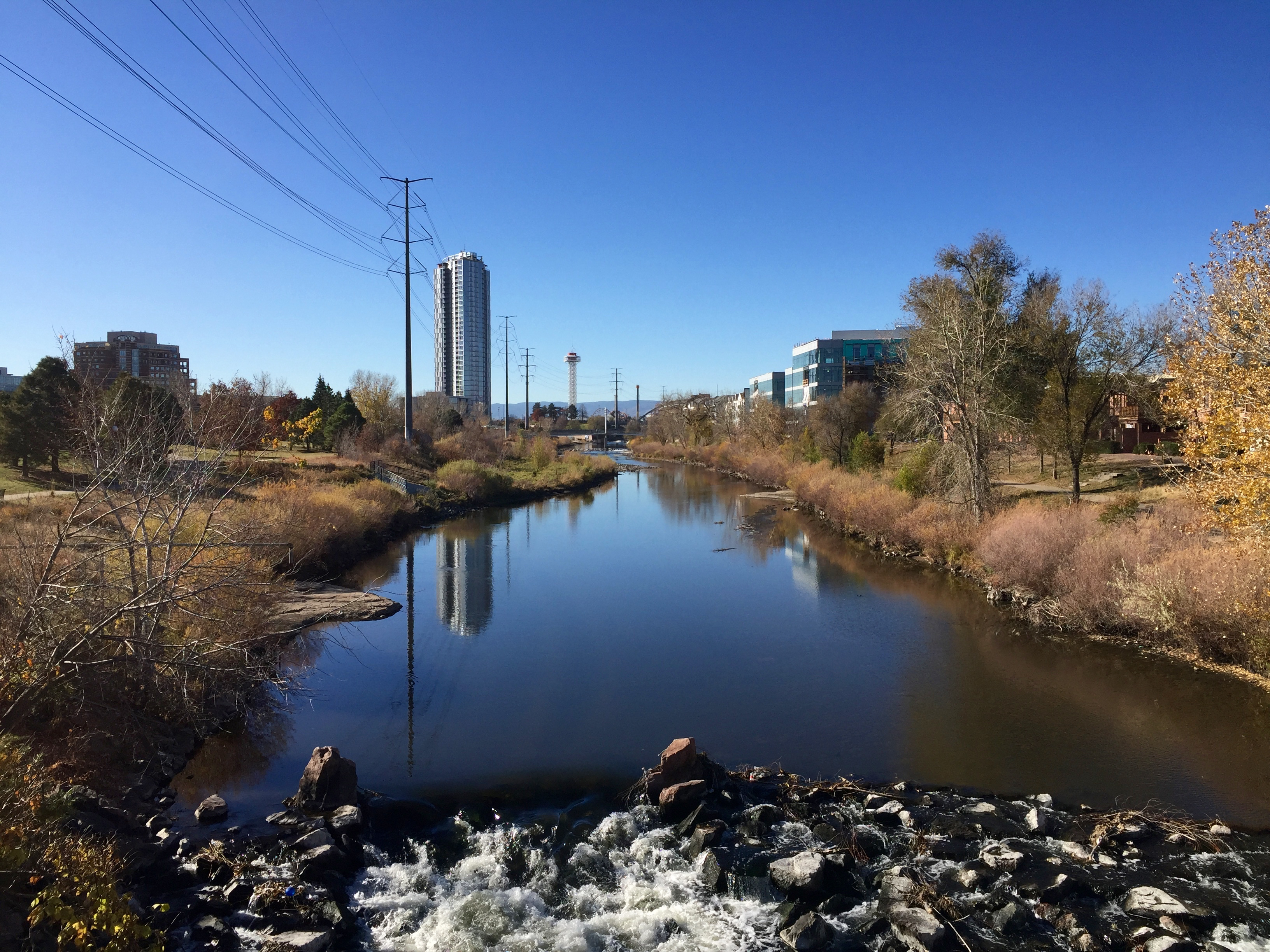
The Platte Canyon is a deep, narrow, scenic gorge on the South Platte River in the Rocky Mountains of Colorado. The canyon is southwest of Denver on the border between Jefferson and Douglas counties. The canyon is at the entrance to the mountains, where the South Platte emerges through the Rampart Range through the hogbacks onto Eastern Plains. The lower narrow section is sometimes called Waterton Canyon, referring to Waterton, Colorado. Geography The term Platte Canyon is used varyingly to apply to the entire section of the South Platte and the North Fork South Platte in the mountains between South Park and the eastern plains. It also is often applied to the communities along the North Fork near Bailey. The narrowest part of the canyon is a remote and roadless gorge (Waterton Canyon) approximately 8 miles (13 km) long, at its lower extremity between the hamlet of South Platte and Kassler, where it emerges from the mountains. In this section, the canyon has walls that ... [...More Info...] [...Related Items...] OR: [Wikipedia] [Google] [Baidu] |
South Platte River
The South Platte River is one of the two principal tributaries of the Platte River. Flowing through the U.S. states of Colorado and Nebraska, it is itself a major river of the American Midwestern United States, Midwest and the American Southwestern United States, Southwest/Mountain States, Mountain West. Its drainage basin includes much of the eastern flank of the Rocky Mountains in Colorado, much of the populated region known as the Colorado Front Range and Colorado Eastern Plains, Eastern Plains, and a portion of southeastern Wyoming in the vicinity of the city of Cheyenne, Wyoming, Cheyenne. It joins the North Platte River in western Nebraska to form the Platte, which then flows across Nebraska to the Missouri River, Missouri. The river serves as the principal source of water for eastern Colorado. In its valley along the foothills in Colorado, it has permitted agriculture in an area of the Colorado Piedmont and Great Plains that is otherwise arid. Description The river ... [...More Info...] [...Related Items...] OR: [Wikipedia] [Google] [Baidu] |
Canyons And Gorges Of Colorado
A canyon (from ; archaic British English spelling: ''cañon''), or gorge, is a deep cleft between escarpments or cliffs resulting from weathering and the erosive activity of a river over geologic time scales. Rivers have a natural tendency to cut through underlying surfaces, eventually wearing away rock layers as sediments are removed downstream. A river bed will gradually reach a baseline elevation, which is the same elevation as the body of water into which the river drains. The processes of weathering and erosion will form canyons when the river's headwaters and estuary are at significantly different elevations, particularly through regions where softer rock layers are intermingled with harder layers more resistant to weathering. A canyon may also refer to a rift between two mountain peaks, such as those in ranges including the Rocky Mountains, the Alps, the Himalayas or the Andes. Usually, a river or stream carves out such splits between mountains. Examples of mountain-type c ... [...More Info...] [...Related Items...] OR: [Wikipedia] [Google] [Baidu] |
Foothills Project
Foothills or piedmont are geographically defined as gradual increases in elevation at the base of a mountain range, higher hill range or an upland area. They are a transition zone between plains and low relief hills and the adjacent topographically higher mountains, hills, and uplands. Frequently foothills consist of alluvial fans, coalesced alluvial fans, and dissected plateaus. Description Foothills primarily border mountains, especially those which are reached through low ridges that increase in size closer and closer to the mountain, but can also border uplands and higher hills. Examples Areas where foothills exist, or areas commonly referred to as the foothills, include the: *Sierra Nevada foothills of California, USA *Foothills of the San Gabriel Valley in Los Angeles County, California, USA *Rocky Mountain Foothills in British Columbia and Alberta, Canada *Silesian Foothills in Silesia, Poland *Sivalik Hills along the Himalayas in the Indian subcontinent *Catalina ... [...More Info...] [...Related Items...] OR: [Wikipedia] [Google] [Baidu] |
Colorado And Southern Railway
The Colorado and Southern Railway was an American Class I railroad in the western United States that operated independently from 1898 to 1908, then as part of the Chicago, Burlington and Quincy Railroad until it was absorbed into the Burlington Northern Railroad in 1981. The railway began as the consolidation of bankrupt railroads in 1898. The Colorado Central Railroad and Cheyenne and Northern Railway were brought together to form the Union Pacific, Denver and Gulf Railway in 1890. When Union Pacific went bankrupt in 1893 they were separated from the Union Pacific and united with the Denver, Leadville and Gunnison Railway and others, by Frank Trumbull to form the Colorado and Southern Railroad in 1898. In 1908 the Chicago, Burlington and Quincy Railroad bought control of the C&S. It would later merge into the Burlington Northern Railroad in 1981. At the end of 1970 it operated 692 miles of road on 1116 miles of track; that year it reported of revenue freight. In 19 ... [...More Info...] [...Related Items...] OR: [Wikipedia] [Google] [Baidu] |
Narrow Gauge Railway
A narrow-gauge railway (narrow-gauge railroad in the US) is a railway with a track gauge narrower than standard . Most narrow-gauge railways are between and . Since narrow-gauge railways are usually built with tighter curves, smaller structure gauges, and lighter rails, they can be less costly to build, equip, and operate than standard- or broad-gauge railways (particularly in mountainous or difficult terrain). Lower-cost narrow-gauge railways are often used in mountainous terrain, where engineering savings can be substantial. Lower-cost narrow-gauge railways are often built to serve industries as well as sparsely populated communities where the traffic potential would not justify the cost of a standard- or broad-gauge line. Narrow-gauge railways have specialised use in mines and other environments where a small structure gauge necessitates a small loading gauge. In some countries, narrow gauge is the standard; Japan, Indonesia, Taiwan, New Zealand, South Africa, and the Aust ... [...More Info...] [...Related Items...] OR: [Wikipedia] [Google] [Baidu] |
Gunnison, Colorado
Gunnison is a home rule municipality that is the county seat and the most populous municipality of Gunnison County, Colorado. The city population was 6,560 at the 2020 United States Census. Gunnison was named in honor of John W. Gunnison, a United States Army officer who surveyed for a transcontinental railroad in 1853. History The City of Gunnison got its name from the first known European-American explorer of the area, John W. Gunnison. He was searching for a route for the transcontinental railroad in 1853 and only stayed for three days before traveling west to Utah. Gunnison saw its first population increase in the 1870s, due to the mining surge throughout the state. The railroad arrived soon after in 1880 to appreciative miners, ranchers, and farmers. In the early 1800s, the groups moving into the Gunnison area were mainly fur trappers and mountain men, trying to make a living for themselves in the rocky mountain terrain. But a drop in fur prices in the 1840s essentially ... [...More Info...] [...Related Items...] OR: [Wikipedia] [Google] [Baidu] |
Leadville, Colorado
The City of Leadville is a List of municipalities in Colorado#Statutory city, statutory city that is the county seat, the most populous community, and the only List of municipalities in Colorado, incorporated municipality in Lake County, Colorado, Lake County, Colorado, United States. The city population was 2,602 at the 2010 United States Census, 2010 census and an estimated 2,762 in 2018. It is situated at an elevation of . Leadville is the highest United States Cities and Towns above 10,000 feet, incorporated city in the United States and it is surrounded by two of the tallest Fourteener, 14,000 foot peaks in the state. Leadville is a former silver mining town that lies among the headwaters of the Arkansas River within the Rocky Mountains. The Leadville Historic District, designated a National Historic Landmark in 1961, contains many historic structures and sites of Leadville's mining era. In the late 19th century, Leadville was the second most populous city in Colorado, after ... [...More Info...] [...Related Items...] OR: [Wikipedia] [Google] [Baidu] |
Denver, South Park And Pacific Railroad
The Denver, South Park, and Pacific Railroad (later called the Denver, Leadville and Gunnison Railway) was a historic narrow gauge railroad that operated in Colorado in the western United States in the late 19th century. The railroad opened up the first rail routes to a large section of the central Colorado mining district in the decades of the mineral boom. The railroad took its name from the fact that its main line from Denver ascended the Platte Canyon and traversed South Park, hence its popular name "The South Park Line." Founded in 1872 by Colorado Governor John Evans, the company was purchased by the Union Pacific Railway in 1880, though it continued to be operated independently. The line went bankrupt in 1889 and was reorganized under a new corporate name as the Denver, Leadville and Gunnison Railway. When the Union Pacific went bankrupt in 1893, the DL&G lines went into receivership and were eventually sold to the Colorado and Southern Railway. In the first half of the 20th ... [...More Info...] [...Related Items...] OR: [Wikipedia] [Google] [Baidu] |
High Line Canal
The High Line Canal (HLC) is a man-made waterway, used for irrigation and recreation, that serves the Denver-Aurora metropolitan area. It begins at a diversion dam on the South Platte River, some above the mouth of Waterton Canyon. From its headgate, the HLC runs generally northeast for (historically 71 miles), passing through Douglas, Arapahoe, Denver, and Adams Counties.Denver Water: High Line Canal , accessed 09/23/2011. Source: Origin of the name The High Line Canal is not the only one so named. Others in Colorado include the Farmer's High Line (which flows from passing through |


