|
Planpincieux Glacier
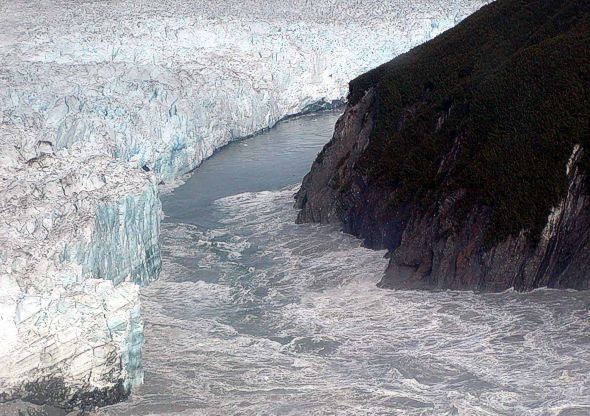
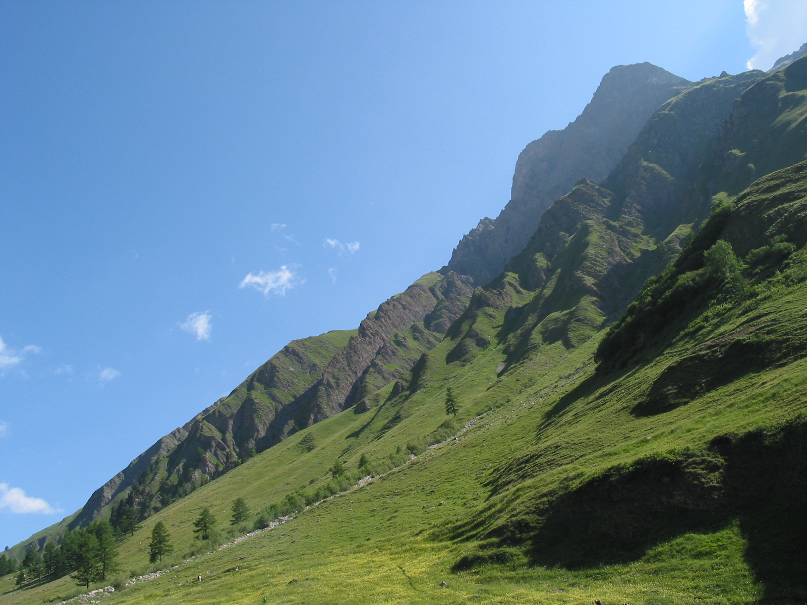
The Planpincieux Glacier (french: Glacier de Planpincieux, it, Ghiacciaio di Planpincieux) is a hanging glacier, located on the southern slopes of the Grandes Jorasses in the Mont Blanc massif of the Alps. It is located above the hamlet of Planpincieux, Val Ferret, in the Aosta Valley. The glacier has a length of and covers an area of , and its elevation ranges from 2640 to 3680 m at a slope of 30°. Thermally, it is a temperate glacier. Over the years, several ice avalanches and glacial outburst floods have occurred that posed a threat to the hamlet of Planpincieux at the bottom of the valley. The glacier has been closely monitored since 2013, and the registered displacement rate in the summer period reaches 2 m per day. An acceleration in the displacement rate of the glacier occurred in September 2019, and experts warned that approximately 250,000 cubic metres of ice could break away from the glacier. On 24 September 2019, the mayor of Courmayeur Courmayeur (; Valdôtain: ... [...More Info...] [...Related Items...] OR: [Wikipedia] [Google] [Baidu] |
Grandes Jorasses
The Grandes Jorasses (4,208 m; 13,806 ft) is a mountain in the Mont Blanc massif, on the boundary between Haute-Savoie in France and Aosta Valley in Italy. The first ascent of the highest peak of the mountain (''Pointe Walker'') was by Horace Walker with guides Melchior Anderegg, Johann Jaun and Julien Grange on 30 June 1868. The second-highest peak on the mountain (''Pointe Whymper'', 4,184 m; 13,727 ft) was first climbed by Edward Whymper, Christian Almer, Michel Croz and Franz Biner on 24 June 1865, using what has become the normal route of ascent and the one followed by Walker's party in 1868. The summits on the mountain (from east to west) are: * ''Pointe Walker'' (4,208 m; 13,806 ft) – named after Horace Walker, who made the first ascent of the mountain * ''Pointe Whymper'' (4,184 m; 13,727 ft) – named after Edward Whymper, who made the first ascent of this, the second-highest summit * ''Pointe Croz'' (4,110 m; 13,484 ft) – named ... [...More Info...] [...Related Items...] OR: [Wikipedia] [Google] [Baidu] |
Aosta Valley
, Valdostan or Valdotainian it, Valdostano (man) it, Valdostana (woman)french: Valdôtain (man)french: Valdôtaine (woman) , population_note = , population_blank1_title = Official languages , population_blank1 = Italian French , demographics_type1 = Citizenship , demographics1_footnotes = , demographics1_title1 = Italian , demographics1_info1 = 95% , demographics1_title2 = , demographics1_info2 = , demographics1_title3 = , demographics1_info3 = , timezone1 = CET , utc_offset1 = +1 , timezone1_DST = CEST , utc_offset1_DST = +2 , postal_code_type = , postal_code = , area_code_type = ISO 3166 code , area_code = IT-23 , blank_name_sec1 = GDP (nominal) , blank_info_sec1 = €4.9 billion (2018) , blank1_name_sec1 = GDP per capita , blank1_info_sec1 = €38,900 (2018) , blank2_name_sec1 = HDI ... [...More Info...] [...Related Items...] OR: [Wikipedia] [Google] [Baidu] |
The Guardian
''The Guardian'' is a British daily newspaper. It was founded in 1821 as ''The Manchester Guardian'', and changed its name in 1959. Along with its sister papers ''The Observer'' and ''The Guardian Weekly'', ''The Guardian'' is part of the Guardian Media Group, owned by the Scott Trust. The trust was created in 1936 to "secure the financial and editorial independence of ''The Guardian'' in perpetuity and to safeguard the journalistic freedom and liberal values of ''The Guardian'' free from commercial or political interference". The trust was converted into a limited company in 2008, with a constitution written so as to maintain for ''The Guardian'' the same protections as were built into the structure of the Scott Trust by its creators. Profits are reinvested in journalism rather than distributed to owners or shareholders. It is considered a newspaper of record in the UK. The editor-in-chief Katharine Viner succeeded Alan Rusbridger in 2015. Since 2018, the paper's main news ... [...More Info...] [...Related Items...] OR: [Wikipedia] [Google] [Baidu] |
BBC News
BBC News is an operational business division of the British Broadcasting Corporation (BBC) responsible for the gathering and broadcasting of news and current affairs in the UK and around the world. The department is the world's largest broadcast news organisation and generates about 120 hours of radio and television output each day, as well as online news coverage. The service maintains 50 foreign news bureaus with more than 250 correspondents around the world. Deborah Turness has been the CEO of news and current affairs since September 2022. In 2019, it was reported in an Ofcom report that the BBC spent £136m on news during the period April 2018 to March 2019. BBC News' domestic, global and online news divisions are housed within the largest live newsroom in Europe, in Broadcasting House in central London. Parliamentary coverage is produced and broadcast from studios in London. Through BBC English Regions, the BBC also has regional centres across England and national news c ... [...More Info...] [...Related Items...] OR: [Wikipedia] [Google] [Baidu] |
Agenzia Nazionale Stampa Associata
The Agenzia Nazionale Stampa Associata (ANSA; literally "National Associated Press Agency") is the leading news agency in Italy. ANSA is a not-for-profit cooperative, whose members and owners are 36 leading news organizations in Italy. Its mission is the distribution of fair and objective news reporting. History In January 1945, three representatives of the major political forces of the Italian Resistance, Giuseppe Liverani, managing director of "Il Popolo" (The People), Primo Parrini, managing director of Avanti!, and Amerigo Terenzi, CEO of L'Unità, advanced the possibility to organize a news agency as a cooperative of newspapers, not controlled by the government nor private groups, replacing the work of the Agenzia Stefani, moved to Milan to meet the information needs of the Italian Social Republic. Their proposal had the approval from the Allied military authorities who, a few months later, favored the success of the new agency by closing the Italian ''Notizie Nazioni Unite' ... [...More Info...] [...Related Items...] OR: [Wikipedia] [Google] [Baidu] |
Courmayeur
Courmayeur (; Valdôtain: ) is a town and ''comune'' in northern Italy, in the autonomous region of Aosta Valley. History The toponym ''Courmayeur'' has been mentioned as ''Curia majori'' (1233–1381), ''Corte Maggiore'' (1620), ''Cormoyeu'' (1648), ''Cormaior'' (1680), ''Cormaior'' (Vissher, 1695), ''Cormaggior'' (L'Isle, 1707), ''Cormaior'' (Stagnoni, 1772) and ''Cormaieur'' (Martinel, 1799). The present toponym was first confirmed by Édouard Aubert (''La Vallée d'Aoste'', 1860), Joseph-Marie Henry (''Histoire populaire de la Vallée d'Aoste'', 1929) and Amé Gorret (''Guide de la Vallée d'Aoste'', 1877). It became a popular tourist destination when alpinism arose, thanks to its proximity to Mont Blanc. Under the Fascist regime and its "Italianist" rule, the town was briefly renamed ''Cormaiore''. Courmayeur was reestablished in 1948 alongside all other French toponyms in the Aosta Valley. The Mont Blanc Tunnel, connecting Courmayeur with Chamonix, opened in 1965, and pro ... [...More Info...] [...Related Items...] OR: [Wikipedia] [Google] [Baidu] |
Jökulhlaup
A jökulhlaup ( ) (literally "glacial run") is a type of glacial outburst flood. It is an Icelandic term that has been adopted in glaciological terminology in many languages. It originally referred to the well-known subglacial outburst floods from Vatnajökull, Iceland, which are triggered by geothermal heating and occasionally by a volcanic subglacial eruption, but it is now used to describe any large and abrupt release of water from a subglacial or proglacial lake/reservoir. Since jökulhlaups emerge from hydrostatically sealed lakes with floating levels far above the threshold, their peak discharge can be much larger than that of a marginal or extra-marginal lake burst. The hydrograph of a jökulhlaup from Vatnajökull typically either climbs over a period of weeks with the largest flow near the end, or it climbs much faster during the course of some hours. These patterns are suggested to reflect channel melting, and sheet flow under the front, respectively. Similar pr ... [...More Info...] [...Related Items...] OR: [Wikipedia] [Google] [Baidu] |
Ice Avalanche
An avalanche is a rapid flow of snow down a slope, such as a hill or mountain. Avalanches can be set off spontaneously, by such factors as increased precipitation or snowpack weakening, or by external means such as humans, animals, and earthquakes. Primarily composed of flowing snow and air, large avalanches have the capability to capture and move ice, rocks, and trees. Avalanches occur in two general forms, or combinations thereof: slab avalanches made of tightly packed snow, triggered by a collapse of an underlying weak snow layer, and loose snow avalanches made of looser snow. After being set off, avalanches usually accelerate rapidly and grow in mass and volume as they capture more snow. If an avalanche moves fast enough, some of the snow may mix with the air, forming a powder snow avalanche. Though they appear to share similarities, avalanches are distinct from slush flows, mudslides, rock slides, and serac collapses. They are also different from large scale movements ... [...More Info...] [...Related Items...] OR: [Wikipedia] [Google] [Baidu] |
Val Ferret
Val Ferret is the name shared by two valleys separated by the Col Ferret, a pass on the border between Italy and Switzerland. The valleys lie southeast of Mont Blanc Massif. The Swiss valley drains northeast towards Orsières and on into the Rhône basin; whereas the Italian valley drains southwest towards Courmayeur and on into the Po basin. The two valleys are connected by a mountain footpath through Col Ferret which forms part of the circular Tour du Mont Blanc route. Access to Col Ferret is forbidden for private motor vehicles, on both sides. Swiss Val Ferret The Swiss Val Ferret is a valley on the southern side of Rhône valley in the canton of Valais in Switzerland. It lies between the Mont Blanc Massif and the Pennine Alps, with the river ''La Dranse de Ferret'' running down the length of the valley from its source to ''La Dranse'' river. Geography The valley starts at the Col Ferret (2490 m) on the Italian border. It is surrounded by high mountains, especially on ... [...More Info...] [...Related Items...] OR: [Wikipedia] [Google] [Baidu] |
Hanging Glacier
A hanging glacier originates high on the wall of a glacial valley and descends only part of the way to the surface of the main glacier and abruptly stops, typically at a cliff. Avalanching and icefall An icefall is a portion of certain glaciers characterized by relatively rapid flow and chaotic crevassed surface, caused in part by gravity. The term ''icefall'' is formed by analogy with the word ''waterfall'', which is a similar phenomenon of t ...s are the mechanisms for ice and snow transfer to the valley floor below. Rock and icefall from a hanging glacier was responsible for triggering the Kolka-Karmadon rock ice slide in 2002, which killed 125 people. References Glaciology {{Glaciology-stub ... [...More Info...] [...Related Items...] OR: [Wikipedia] [Google] [Baidu] |
Alps
The Alps () ; german: Alpen ; it, Alpi ; rm, Alps ; sl, Alpe . are the highest and most extensive mountain range system that lies entirely in Europe, stretching approximately across seven Alpine countries (from west to east): France, Switzerland, Italy, Liechtenstein, Austria, Germany, and Slovenia. The Alpine arch generally extends from Nice on the western Mediterranean to Trieste on the Adriatic and Vienna at the beginning of the Pannonian Basin. The mountains were formed over tens of millions of years as the African and Eurasian tectonic plates collided. Extreme shortening caused by the event resulted in marine sedimentary rocks rising by thrusting and folding into high mountain peaks such as Mont Blanc and the Matterhorn. Mont Blanc spans the French–Italian border, and at is the highest mountain in the Alps. The Alpine region area contains 128 peaks higher than . The altitude and size of the range affect the climate in Europe; in the mountains, precipitation ... [...More Info...] [...Related Items...] OR: [Wikipedia] [Google] [Baidu] |


