|
Piercebridge
Piercebridge is a village and civil parish in the borough of Darlington and the ceremonial county of Durham, England. The population of the civil parish as of the 2011 census was 113. It is situated a few miles west of the town of Darlington. It is on the site of a Roman fort of AD 260–270, which was built at the point where Dere Street crossed the River Tees. Part of the fort is under the village green. The village is sited where the York- Newstead Roman road known as Dere Street crosses the River Tees. The excavated Roman fort is open to the public and the remains of Piercebridge Roman Bridge over the Tees now lie around south of the current course of the river, approximately east of Piercebridge, at the east side of Cliffe, Richmondshire. Toponym Piercebridge is named after its Roman bridge or ''brigg'': in 1104 it was ''Persebrig''; in 1577 it was ''Priestbrigg''. It is thought that ''pierce'' comes from ''pershe'', meaning osiers, perhaps because the bridge was at lea ... [...More Info...] [...Related Items...] OR: [Wikipedia] [Google] [Baidu] |
Piercebridge Roman Fort
Piercebridge Roman Fort (possibly originally known as ''Morbium'' or ''Vinovium'') is a scheduled ancient monument situated in the village of Piercebridge on the banks of the River Tees in modern-day County Durham, England. There were Romans here from about AD 70 until at least the early 5th century. There was an associated vicus and bath house at Piercebridge, and another vicus and a villa south of the river at Cliffe. The Victorians used carved stones from this site when they built St Mary's church at Gainford. Part of the site is under Piercebridge village green. The fort was situated on Dere Street, the major Roman road linking York to the north. The fort was strategically placed to control the crossing of the road over the river Tees, and the major Roman bridge crossing it. History Fort Lumps and bumps in the village green at Piercebridge as well as extensive excavated Roman buildings show that underneath it is the Roman fort which was called ''Magis'' or ''M ... [...More Info...] [...Related Items...] OR: [Wikipedia] [Google] [Baidu] |
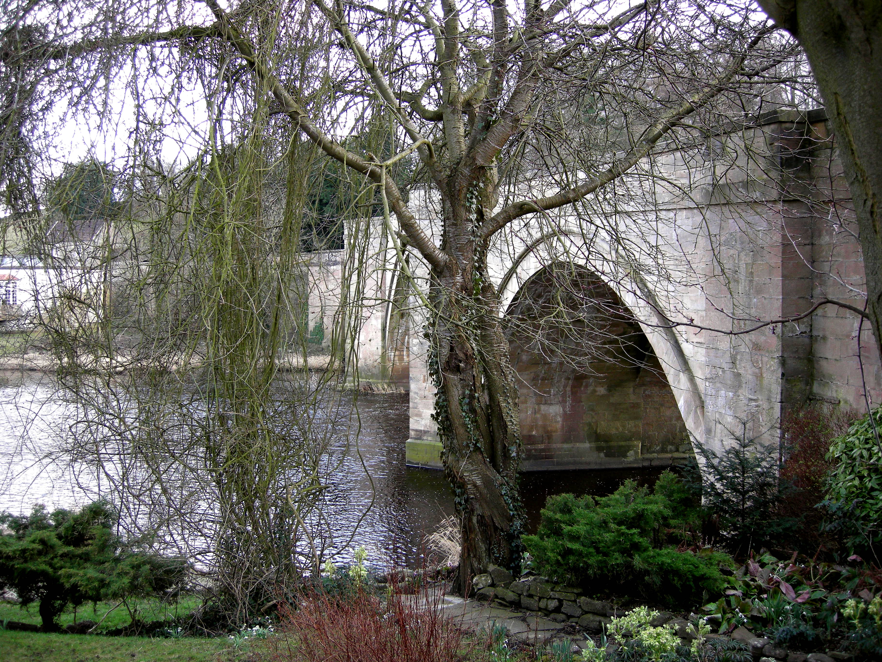
Piercebridge Bridge 025
Piercebridge is a village and civil parish in the borough of Darlington and the ceremonial county of Durham, England. The population of the civil parish as of the 2011 census was 113. It is situated a few miles west of the town of Darlington. It is on the site of a Roman fort of AD 260–270, which was built at the point where Dere Street crossed the River Tees. Part of the fort is under the village green. The village is sited where the York- Newstead Roman road known as Dere Street crosses the River Tees. The excavated Roman fort is open to the public and the remains of Piercebridge Roman Bridge over the Tees now lie around south of the current course of the river, approximately east of Piercebridge, at the east side of Cliffe, Richmondshire. Toponym Piercebridge is named after its Roman bridge or ''brigg'': in 1104 it was ''Persebrig''; in 1577 it was ''Priestbrigg''. It is thought that ''pierce'' comes from ''pershe'', meaning osiers, perhaps because the bridge was at ... [...More Info...] [...Related Items...] OR: [Wikipedia] [Google] [Baidu] |
Cliffe, Richmondshire
Cliffe is a small village and civil parish in Richmondshire district of North Yorkshire, England. A stream called the Glen runs through the village to the River Tees, Tees. It is in the Teesdale and Yorkshire Dales national park. It is about west of Darlington, north of Richmond, North Yorkshire, Richmond and near Piercebridge. The village has a long history, as shown by the number and range of archaeological sites from tumulus, tumuli to an English Civil War battleground, most of which are scheduled monuments. and the area is largely agricultural. It is notable for its 17th-century Grade II Listed building, listed George Hotel, where the story behind the song ''My Grandfather's Clock'' is said to have originated in 1875. In 2015 North Yorkshire County Council estimated the population of the village to be 30. The civil parish's 2011 Census population count was fewer than 100, therefore information taken by ONS was included in the Manfield parish (together with Aldbrough St J ... [...More Info...] [...Related Items...] OR: [Wikipedia] [Google] [Baidu] |
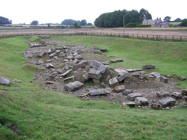
Piercebridge Roman Bridge
Piercebridge Roman Bridge is the ruin of a Roman bridge over the River Tees, northern England. It is near the villages of Cliffe (North Yorkshire) and Piercebridge, County Durham. The most recent excavations were by Channel 4's Time Team in 2009. History The bridge carried Dere Street Roman road across the river. Piercebridge Roman Fort guarded the bridge. The first bridge was built around 90 AD, but this may have been replaced by a second bridge after it was washed away. The Tees has narrowed and changed its course over the centuries and as a result the remains lie in a field around south of the current course of the river, and about east of Piercebridge. Remains What remains of the bridge are massive masonry blocks that formed at least five piers. The lower courses of one of the abutments still stand, partially complete, and it is possible to see the holes into which the wooden structure of the bridge would have fitted. All of the timber has disappeared in the near ... [...More Info...] [...Related Items...] OR: [Wikipedia] [Google] [Baidu] |
Battle Of Piercebridge
The Battle of Piercebridge was fought on 1 December 1642 in County Durham, England, during the First English Civil War. The Earl of Newcastle was advancing with an army of 6,000 from Newcastle upon Tyne to York to reinforce the local Royalists. Aware of his approach, the Parliamentarians defended the main crossing over the River Tees, at Piercebridge. Under the command of Captain John Hotham, around 580 troops had barricaded the bridge. Newcastle sent an advance guard under the command of Sir Thomas Howard to take the crossing. The Royalists placed their ten artillery pieces on a hill to the north east of the bridge, allowing them to soften up the Parliamentarian defences. Howard, who was killed during the engagement, led his dragoons in an assault on the bridge, and after three hours of heavy fighting, Hotham and his men retreated, allowing the Royalists to continue on to York. The introduction of Newcastle's army into Yorkshire gave the Royalists a numerical advantage in ... [...More Info...] [...Related Items...] OR: [Wikipedia] [Google] [Baidu] |
Dere Street
Dere Street or Deere Street is a modern designation of a Roman road which ran north from Eboracum (York), crossing the Stanegate at Corbridge (Hadrian's Wall was crossed at the Portgate, just to the north) and continuing beyond into what is now Scotland, later at least as far as the Antonine Wall. Portions of its route are still followed by modern roads, including the A1 (south of the River Tees), the B6275 road through Piercebridge, where Dere Street crosses the River Tees, and the A68 north of Corbridge in Northumberland. Name The Roman name for the route is lost. Its English name corresponds with the post-Roman Anglo-Saxon kingdom of Deira, through which the first part of its route lies. That kingdom possibly took its name from the Yorkshire River Derwent. The term "street" derives from its Old English sense (from la, via strata), which referred to any paved road and had no particular association with urban thoroughfares. Portions of the road in Scotland were late ... [...More Info...] [...Related Items...] OR: [Wikipedia] [Google] [Baidu] |
River Tees
The River Tees (), in Northern England, rises on the eastern slope of Cross Fell in the North Pennines and flows eastwards for to reach the North Sea between Hartlepool and Redcar near Middlesbrough. The modern day history of the river has been tied with the industries on Teesside in its lower reaches, where it has provided the means of import and export of goods to and from the North East England. The need for water further downstream also meant that reservoirs were built in the extreme upper reaches, such as Cow Green Reservoir, Cow Green. Etymology The name ''Tees'' is possibly of Common Brittonic, Brittonic origin. The element ''*tēs'', meaning "warmth" with connotations of "boiling, excitement" (Welsh language, Welsh ''tes''), may underlie the name. ''*Teihx-s'', a root possibly derived from Brittonic ''*ti'' (Welsh ''tail'', "dung, manure"), has also been used to explain the name ''Tees'' (compare River Tyne#Origins of name, River Tyne). Geography The river drains and ... [...More Info...] [...Related Items...] OR: [Wikipedia] [Google] [Baidu] |
Darlington (borough)
The Borough of Darlington is a unitary authority and borough in County Durham, Northern England. The borough is named after the town of Darlington, and in 2011 had a population of 106,000. It is in the Tees Valley mayoralty. The borough borders three local authority areas; County Durham is to the north and west, Stockton-on-Tees to the east and North Yorkshire to the south, the River Tees forming the border for the latter. History The current borough boundaries were formed on 1 April 1974, by the creation of a new non-metropolitan district of Darlington by the Local Government Act 1972, covering the previous county borough of Darlington along with nearly all of Darlington Rural District (the Newton Aycliffe parts of which went to Sedgefield). It remained part of County Durham for administrative purposes until reconstituted as a unitary authority on 1 April 1997. For ceremonial purposes it remains part of County Durham, with whom it continues to share certain local services, ... [...More Info...] [...Related Items...] OR: [Wikipedia] [Google] [Baidu] |
Darlington
Darlington is a market town in the Borough of Darlington, County Durham, England. The River Skerne flows through the town; it is a tributary of the River Tees. The Tees itself flows south of the town. In the 19th century, Darlington underwent substantial industrial development, spurred by the establishment there of the world's first permanent steam-locomotive-powered passenger railway: the Stockton and Darlington Railway. Much of the vision (and financing) behind the railway's creation was provided by local Quaker families in the Georgian and Victorian eras. In the 2011 Census, the town had a population of 92,363 (the county's largest settlement by population) which had increased by the 2020 estimate population to 93,417. The borough's population was 105,564 in the census, It is a unitary authority and is a constituent member of the Tees Valley Combined Authority therefore part of the Tees Valley mayoralty. History Darnton Darlington started as an Anglo-Saxon settlem ... [...More Info...] [...Related Items...] OR: [Wikipedia] [Google] [Baidu] |
Time Team
''Time Team'' is a British television programme that originally aired on Channel 4 from 16 January 1994 to 7 September 2014. It returned online in 2022 for two episodes released on YouTube. Created by television producer Tim Taylor and presented by actor Tony Robinson, each episode featured a team of specialists carrying out an archaeological dig over a period of three days, with Robinson explaining the process in lay terms. The specialists changed throughout the programme's run, although it consistently included professional archaeologists such as Mick Aston, Carenza Lewis, Francis Pryor and Phil Harding. The sites excavated ranged in date from the Palaeolithic to the Second World War. In October 2012, Channel 4 announced that the final series would be broadcast in 2013. Series 20 was screened from January–March 2013 and nine specials were screened between May 2013 and September 2014. In May 2021, Taylor announced ... [...More Info...] [...Related Items...] OR: [Wikipedia] [Google] [Baidu] |
Listed Building
In the United Kingdom, a listed building or listed structure is one that has been placed on one of the four statutory lists maintained by Historic England in England, Historic Environment Scotland in Scotland, in Wales, and the Northern Ireland Environment Agency in Northern Ireland. The term has also been used in the Republic of Ireland, where buildings are protected under the Planning and Development Act 2000. The statutory term in Ireland is " protected structure". A listed building may not be demolished, extended, or altered without special permission from the local planning authority, which typically consults the relevant central government agency, particularly for significant alterations to the more notable listed buildings. In England and Wales, a national amenity society must be notified of any work to a listed building which involves any element of demolition. Exemption from secular listed building control is provided for some buildings in current use for worship, ... [...More Info...] [...Related Items...] OR: [Wikipedia] [Google] [Baidu] |
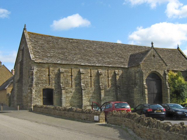
Monastic Grange
Monastic granges were outlying landholdings held by monasteries independent of the manorial system. The first granges were owned by the Cistercians and other orders followed. Wealthy monastic houses had many granges, most of which were largely agricultural providing food for the monastic community. A grange might be established adjacent to the monastery but others were established wherever it held lands, some at a considerable distance. Some granges were worked by lay-brothers belonging to the order, others by paid labourers. Granges could be of six known types: agrarian, sheep or cattle farms, horse studs, fisheries and industrial complexes. Industrial granges were significant in the development of medieval industries, particularly iron working. Description Granges were landed estates used for food production, centred on a farm and out-buildings and possibly a mill or a tithe barn. The word grange comes through French from Latin meaning a granary. The granges might be loca ... [...More Info...] [...Related Items...] OR: [Wikipedia] [Google] [Baidu] |


