|
Penshurst Airfield
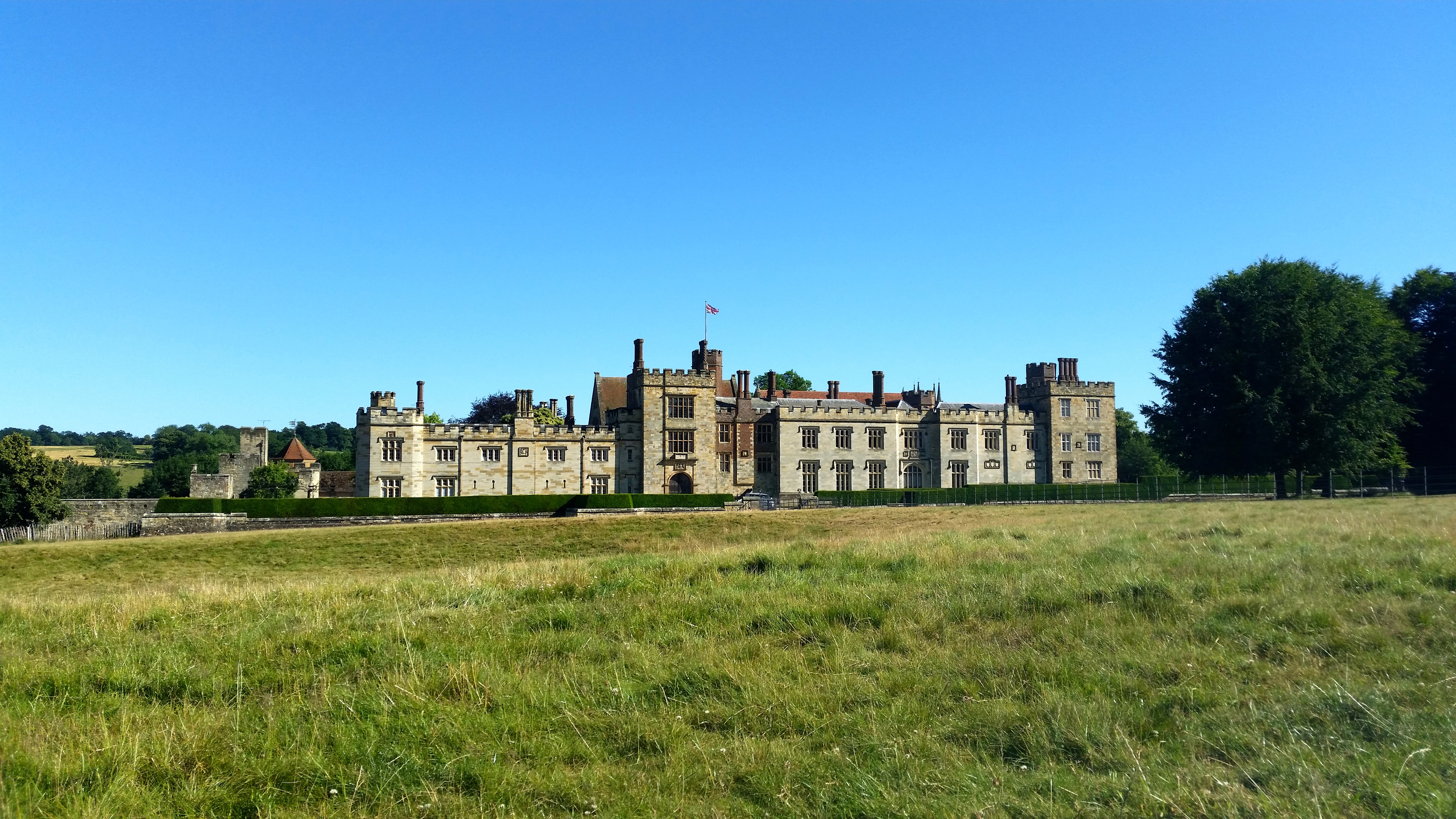
Penshurst Airfield was an airfield in operation between 1916–36 and 1940–46. Initially a military airfield, after the First World War it was used as an alternate destination to Croydon Airport, with some civil flying taking place. The airfield closed following the crash of a Flying Flea at an air display in 1936, and was converted to a polo ground. It re-opened during the Second World War as an Emergency Landing Ground, RAF Penshurst. As well as serving in this role, it was mainly used by Air Observation Post (AOP) squadrons of the Royal Air Force. The airfield finally closed in May 1946. Location The airfield was located south of Charcott, on the western edge of Leigh, and eastern edge of Chiddingstone, at (). The parish boundary running through the site. It was named Penshurst as it was considered that name was more up-market than Chiddingstone Causeway or Leigh. The airfield was some north of Penshurst. Nearby Penshurst railway station lies within the parish of Chiddi ... [...More Info...] [...Related Items...] OR: [Wikipedia] [Google] [Baidu] |
Penshurst
Penshurst is a historic village and civil parish located in a valley upon the northern slopes of the Kentish Weald, at the confluence of the River Medway and the River Eden, within the Sevenoaks district of Kent, England. The village is situated between the market town of Tonbridge and the spa town of Royal Tunbridge Wells, some south of Sevenoaks. Penshurst and its neighbouring village, Fordcombe, recorded a combined population of some 1,628 at the 2011 Census. The majority of the parish falls within the High Weald Area of Outstanding Natural Beauty, and the village is itself a conservation zone, with controls on the landscape ensuring the protection of its woodland and fields. There are several listed buildings in the village. The village is the home of two historic estates. Penshurst Place, formerly owned by King Henry VIII, sits at the centre of the village in the valley, while Swaylands is situated at the top of Rogues Hill on the outskirts of the village. History The ... [...More Info...] [...Related Items...] OR: [Wikipedia] [Google] [Baidu] |
Sopwith Camel
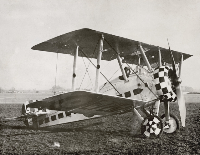
The Sopwith Camel is a British First World War single-seat biplane fighter aircraft that was introduced on the Western Front in 1917. It was developed by the Sopwith Aviation Company as a successor to the Sopwith Pup and became one of the best known fighter aircraft of the Great War. The Camel was powered by a single rotary engine and was armed with twin synchronized Vickers machine guns. Though difficult to handle, it was highly manoeuvrable in the hands of an experienced pilot, a vital attribute in the relatively low-speed, low-altitude dogfights of the era. In total, Camel pilots have been credited with downing 1,294 enemy aircraft, more than any other Allied fighter of the conflict. Towards the end of the First World War, the type also saw use as a ground-attack aircraft, partly because the capabilities of fighter aircraft on both sides had advanced rapidly and left the Camel somewhat outclassed. The main variant of the Camel was designated as the F.1. Other variants ... [...More Info...] [...Related Items...] OR: [Wikipedia] [Google] [Baidu] |
Edgware
Edgware () is a suburban town in northern Greater London, mostly in the London Borough of Barnet but with small parts falling in the London Borough of Harrow and in the London Borough of Brent. Edgware is centred north-northwest of Charing Cross and has its own commercial centre. Edgware has a generally suburban character, typical of the rural-urban fringe. It was an ancient parish in the county of Middlesex directly east of the ancient Watling Street, and gives its name to the present day Edgware Road that runs from central London towards the town. The community benefits from some elevated woodland on a high ridge marking the Hertfordshire border of gravel and sand. It includes the areas of Burnt Oak, The Hale, Edgwarebury, Canons Park, and parts of Queensbury, London, Queensbury. Edgware is principally a shopping and residential area, identified in the London Plan as one of the capital's 35 major centres, and one of the northern termini of the Northern line. It has a Edgware b ... [...More Info...] [...Related Items...] OR: [Wikipedia] [Google] [Baidu] |
Stag Lane Aerodrome
Stag Lane Aerodrome was a private aerodrome between 1915 and 1933 in Edgware, north London, UK. History The land for an aerodrome was purchased by the London & Provincial Aviation Company (Warren and Smiles - Michael Geoffrey Smiles of Bonnington died in 1921) in October 1915. The company used the aerodrome for flying training during the First World War. London & Provincial ceased flying in July 1919 after a dispute with Department of Civil Aviation (see United Kingdom Civil Aviation Authority), which refused them a licence. Stag Lane became the main base of The de Havilland Aircraft Company Limited in 1920 and they purchased the freehold in 1922. Former wartime aircraft were refurbished in the early years, and the company designed and built large numbers of aircraft at Stag Lane in the 1920s and early 1930s. In 1934 the company moved to a larger factory and airfield at Hatfield Aerodrome, Hatfield, Hertfordshire. Stag Lane Aerodrome was sold for housing development in 1933, ... [...More Info...] [...Related Items...] OR: [Wikipedia] [Google] [Baidu] |
Alan Cobham
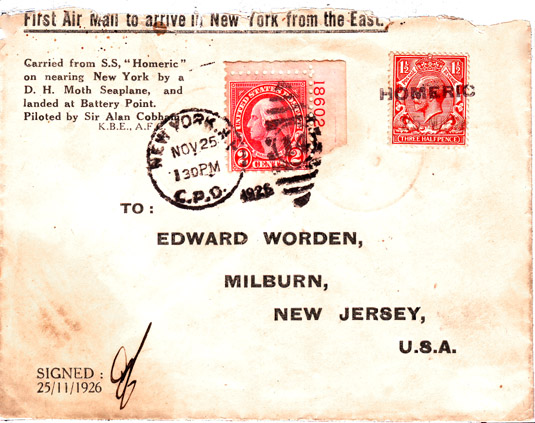
Sir Alan John Cobham, KBE, AFC (6 May 1894 – 21 October 1973) was an English aviation pioneer. Early life and family As a child he attended Wilson's School, then in Camberwell, London. The school relocated to the former site of Croydon Airport in 1975. In the summer of 1922 he married Gladys Lloyd, and subsequently they had two sons, Geoffrey (b.1925) and Michael (b.1927). After National Service and a short career at the Bar, Michael Cobham followed him into the Flight Refuelling business, and for many years was in charge of it. Lady Cobham died in 1961 aged 63. Career Alan Cobham began work as a teenage commercial apprentice in the City of London. He enjoyed the outdoors, and after completing his apprenticeship spent a year working on his uncle's farm, hoping to make a career in estate management. After a brief return to London commercial work, in August 1914 he joined the British Army, being directed to the Royal Army Veterinary Corps due to his farming experience. ... [...More Info...] [...Related Items...] OR: [Wikipedia] [Google] [Baidu] |
Anemometer
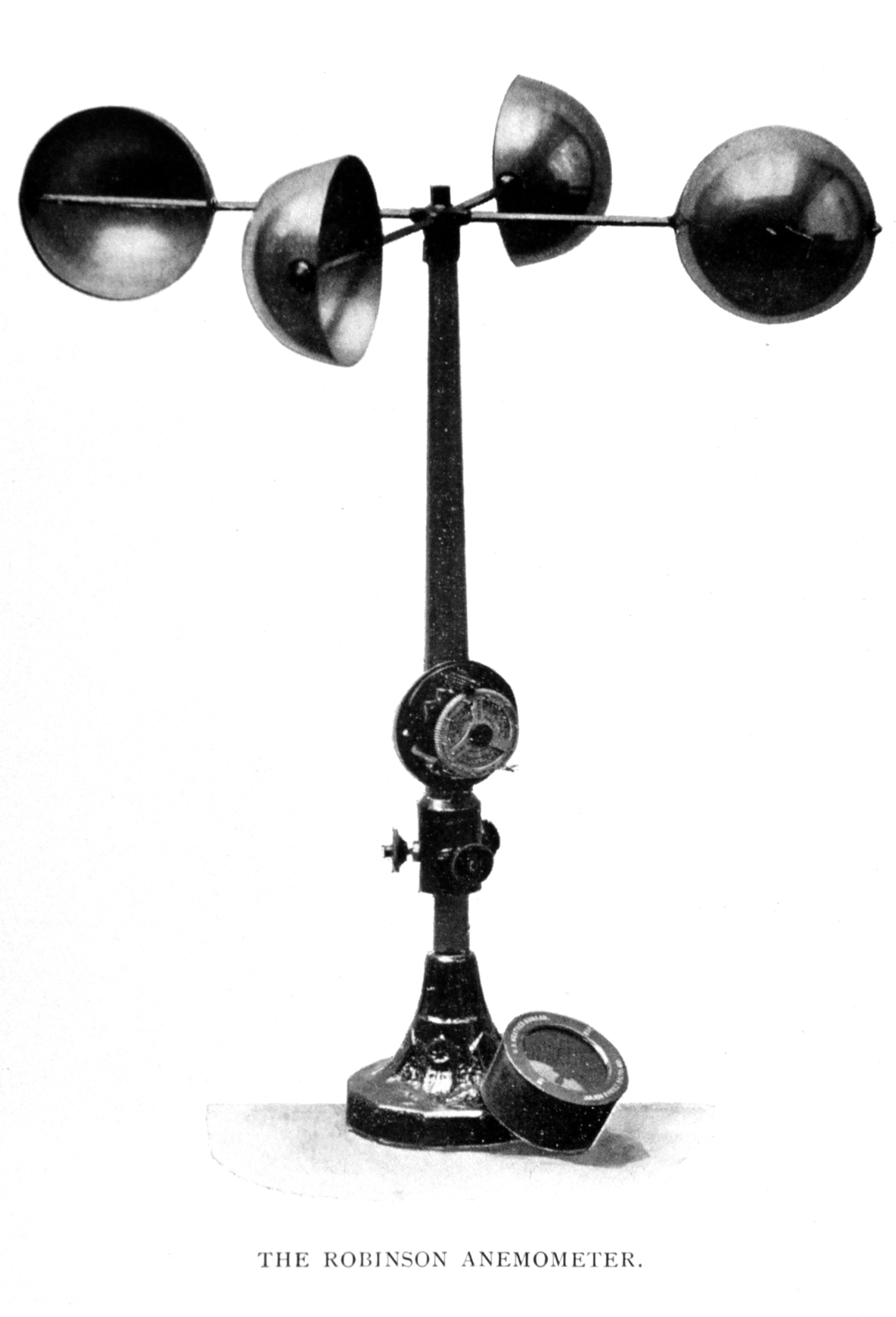
In meteorology, an anemometer () is a device that measures wind speed and direction. It is a common instrument used in weather stations. The earliest known description of an anemometer was by Italian architect and author Leon Battista Alberti (1404–1472) in 1450. History The anemometer has changed little since its development in the 15th century. Alberti is said to have invented it around 1450. In the ensuing centuries numerous others, including Robert Hooke (1635–1703), developed their own versions, with some mistakenly credited as its inventor. In 1846, John Thomas Romney Robinson (1792–1882) improved the design by using four hemispherical cups and mechanical wheels. In 1926, Canadian meteorologist John Patterson (1872–1956) developed a three-cup anemometer, which was improved by Brevoort and Joiner in 1935. In 1991, Derek Weston added the ability to measure wind direction. In 1994, Andreas Pflitsch developed the sonic anemometer. Velocity anemometers Cup anemomet ... [...More Info...] [...Related Items...] OR: [Wikipedia] [Google] [Baidu] |
Windsock
A windsock (also called a wind cone) is a conical textile tube that resembles a giant sock. It can be used as a basic indicator of wind speed and direction, or as decoration. They are typically used at airports to show the direction and strength of the wind to pilots, and at chemical plants where there is risk of gaseous leakage. They are also sometimes located alongside highways at windy locations. At many airports, windsocks are externally or internally lit at night. Function Wind direction is the direction in which the windsock is pointing. (Wind directions are conventionally specified as the compass point from which the wind originates; so a windsock pointing due north indicates a southerly wind). Wind speed is indicated by the windsock's angle relative to the mounting pole; in low winds it droops; in high winds it flies horizontally. Alternating stripes of high visibility orange and white were initially used to help to estimate wind speed, with each stripe adding 3 knots ... [...More Info...] [...Related Items...] OR: [Wikipedia] [Google] [Baidu] |
Lympne Airport
Lympne Airport , was a military and later civil airfield , at Lympne, Kent, United Kingdom, which operated from 1916 to 1984. During the First World War RFC Lympne was originally an acceptance point for aircraft being delivered to, and returning from, France but was later designated as a First Class Landing Ground, RAF Lympne. It became a civil airfield in 1919 and saw the operation of early air mail services after the 1918 armistice. It was one of the first four airfields in the United Kingdom with customs facilities. Lympne was also involved in the evolution of air traffic control, with facilities developing and improving during the 1920s and 1930s. A number of record-breaking flights originated or ended at Lympne. During the 1920s Lympne was the venue for the Lympne light aircraft trials from which a number of aircraft types entered production. Air racing was also held at Lympne. Just before the Second World War, Lympne was requisitioned by the Fleet Air Arm. It was named H ... [...More Info...] [...Related Items...] OR: [Wikipedia] [Google] [Baidu] |
Amsterdam Airport Schiphol
Amsterdam Airport Schiphol , known informally as Schiphol Airport ( nl, Luchthaven Schiphol, ), is the main international airport of the Netherlands. It is located southwest of Amsterdam, in the municipality of Haarlemmermeer in the province of North Holland. It is the world's third busiest airport by international passenger traffic in 2021. With almost 72 million passengers in 2019, it is the third-busiest airport in Europe in terms of passenger volume and the busiest in Europe in terms of aircraft movements. With an annual cargo tonnage of 1.74 million, it is the 4th busiest in Europe. AMS covers a total area of of land. The airport is built on the single-terminal concept: one large terminal split into three large departure halls. Schiphol is the hub for KLM and its regional affiliate KLM Cityhopper as well as for Corendon Dutch Airlines, Martinair, Transavia and TUI fly Netherlands. The airport also serves as a base for EasyJet. Schiphol opened on 16 September 1916 ... [...More Info...] [...Related Items...] OR: [Wikipedia] [Google] [Baidu] |
United Kingdom Of Great Britain And Ireland
The United Kingdom of Great Britain and Ireland was a sovereign state in the British Isles that existed between 1801 and 1922, when it included all of Ireland. It was established by the Acts of Union 1800, which merged the Kingdom of Great Britain and the Kingdom of Ireland into a unified state. The establishment of the Irish Free State in 1922 led to the remainder later being renamed the United Kingdom of Great Britain and Northern Ireland in 1927. The United Kingdom, having financed the European coalition that defeated France during the Napoleonic Wars, developed a large Royal Navy that enabled the British Empire to become the foremost world power for the next century. For nearly a century from the final defeat of Napoleon following the Battle of Waterloo to the outbreak of World War I, Britain was almost continuously at peace with Great Powers. The most notable exception was the Crimean War with the Russian Empire, in which actual hostilities were relatively limited. How ... [...More Info...] [...Related Items...] OR: [Wikipedia] [Google] [Baidu] |
Netherlands
) , anthem = ( en, "William of Nassau") , image_map = , map_caption = , subdivision_type = Sovereign state , subdivision_name = Kingdom of the Netherlands , established_title = Before independence , established_date = Spanish Netherlands , established_title2 = Act of Abjuration , established_date2 = 26 July 1581 , established_title3 = Peace of Münster , established_date3 = 30 January 1648 , established_title4 = Kingdom established , established_date4 = 16 March 1815 , established_title5 = Liberation Day (Netherlands), Liberation Day , established_date5 = 5 May 1945 , established_title6 = Charter for the Kingdom of the Netherlands, Kingdom Charter , established_date6 = 15 December 1954 , established_title7 = Dissolution of the Netherlands Antilles, Caribbean reorganisation , established_date7 = 10 October 2010 , official_languages = Dutch language, Dutch , languages_type = Regional languages , languages_sub = yes , languages = , languages2_type = Reco ... [...More Info...] [...Related Items...] OR: [Wikipedia] [Google] [Baidu] |


.jpg)
