|
Pennsylvania Route 666
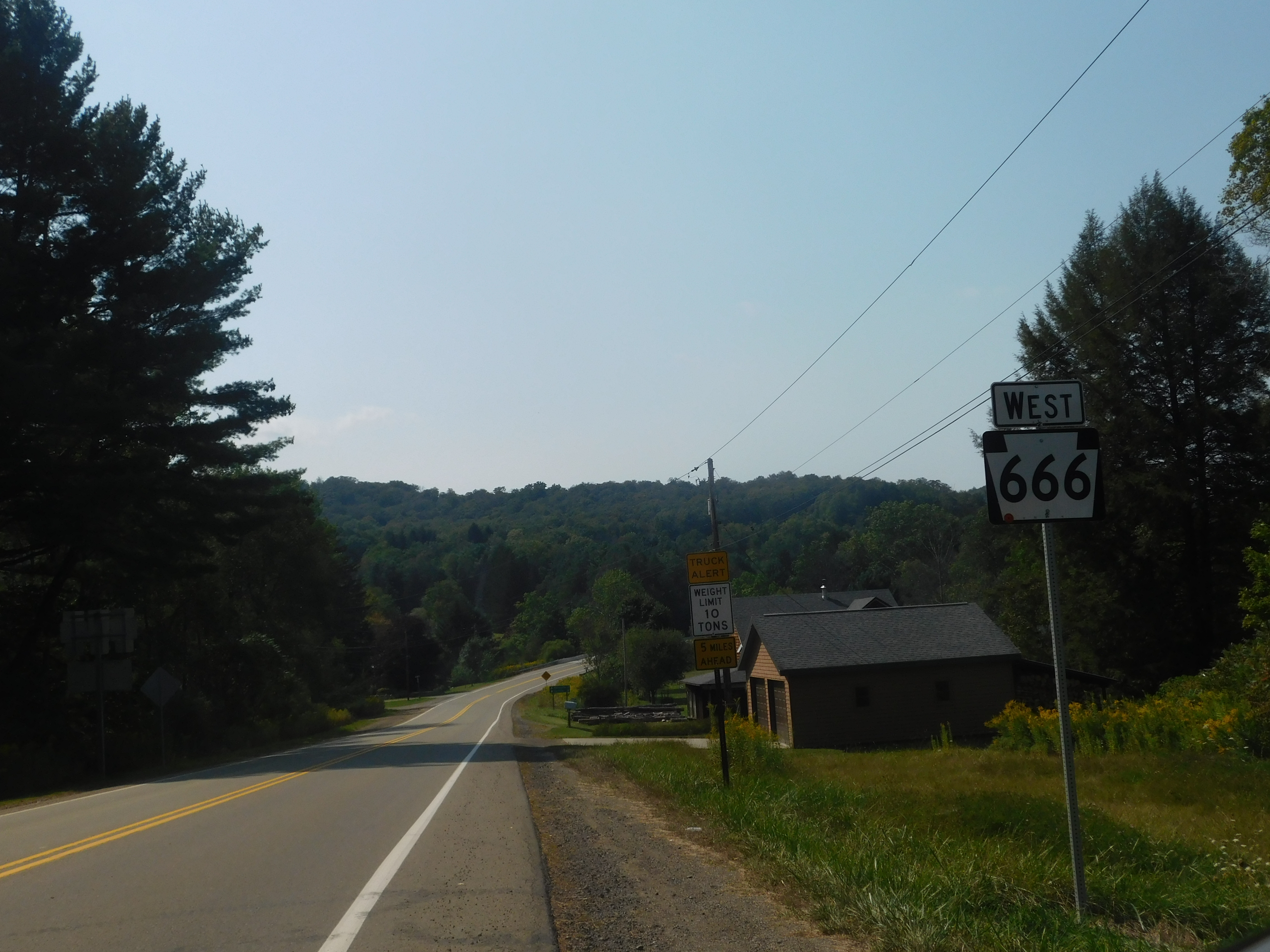
Pennsylvania Route 666 (PA 666) is an east–west state route located in northwest Pennsylvania. The western terminus of the route is at U.S. Route 62 (US 62) in the Hickory Township municipality of East Hickory, and its eastern terminus is at US 6 in the hamlet of Sheffield. It cuts through most of Allegheny National Forest, and is therefore sparsely populated, with the largest settlement along the road being Endeavor. Its official name is the David Zeisberger Memorial Highway. The route was assigned in the 1928 numbering of State Routes in Pennsylvania. The highway originally ended in the town of Nebraska until being extended southward along other streets. The route was realigned in 1946 onto its present routing. The highway has remained the same since. Route description East Hickory to Old PA 666 PA 666 begins at an intersection with US 62 along the banks of the Allegheny River in East Hickory. The route progresses eastward, intersecting with East H ... [...More Info...] [...Related Items...] OR: [Wikipedia] [Google] [Baidu] |
Hickory Township, Forest County, Pennsylvania
Hickory Township is a township in Forest County, Pennsylvania, United States. As of the 2020 census, the township population was 416, a decline from 558 in 2010. History The West Hickory Bridge was listed on the National Register of Historic Places in 1988. Geography Hickory Township is located in northwestern Forest County, and is bordered to the north by Warren County. The Allegheny River forms the western boundary of the township. U.S. Route 62 follows the east side of the river through the township, leading north to Warren and south to Tionesta. Pennsylvania Route 666 crosses the township from US-62 at East Hickory in the west to Kellettville in neighboring Kingsley Township. In addition to East Hickory, unincorporated places in Hickory Township include Queen, Endeavor, Church Hill, and Little Hickory. According to the United States Census Bureau, Hickory Township has a total area of , of which is land and , or 1.11%, is water. Demographics As of the census of 20 ... [...More Info...] [...Related Items...] OR: [Wikipedia] [Google] [Baidu] |
Pennsylvania State Route 666 (15388487334)
Pennsylvania Route 666 (PA 666) is an east–west state route located in northwest Pennsylvania. The western terminus of the route is at U.S. Route 62 (US 62) in the Hickory Township municipality of East Hickory, and its eastern terminus is at US 6 in the hamlet of Sheffield. It cuts through most of Allegheny National Forest, and is therefore sparsely populated, with the largest settlement along the road being Endeavor. Its official name is the David Zeisberger Memorial Highway. The route was assigned in the 1928 numbering of State Routes in Pennsylvania. The highway originally ended in the town of Nebraska until being extended southward along other streets. The route was realigned in 1946 onto its present routing. The highway has remained the same since. Route description East Hickory to Old PA 666 PA 666 begins at an intersection with US 62 along the banks of the Allegheny River in East Hickory. The route progresses eastward, intersecting with Eas ... [...More Info...] [...Related Items...] OR: [Wikipedia] [Google] [Baidu] |
List Of Highways Numbered 666
The following highways are numbered 666: Belgium * The pilgrimage centre of Banneux in Belgium is located on the N666 road. Canada * Alberta Highway 666 * Ontario Highway 666 (former) Ireland * R666 Italy * Strada regionale 666 di Sora (formerly ''strada statale 666 di Sora) Philippines * N666 highway (Philippines) Sweden * Länsväg 666, in Uppland, eastbound from Alunda. United Kingdom * A666 road The A666 is a major road in Greater Manchester and Lancashire, England. Route The road runs from its junction with the A6, and A580 at the Irlams o' th' Height boundary with Pendlebury near Manchester, through Pendlebury, Clifton, Kearsl ... United States * * * (former) * * * * {{Road index, 666 ... [...More Info...] [...Related Items...] OR: [Wikipedia] [Google] [Baidu] |
Pennsylvania Route 208
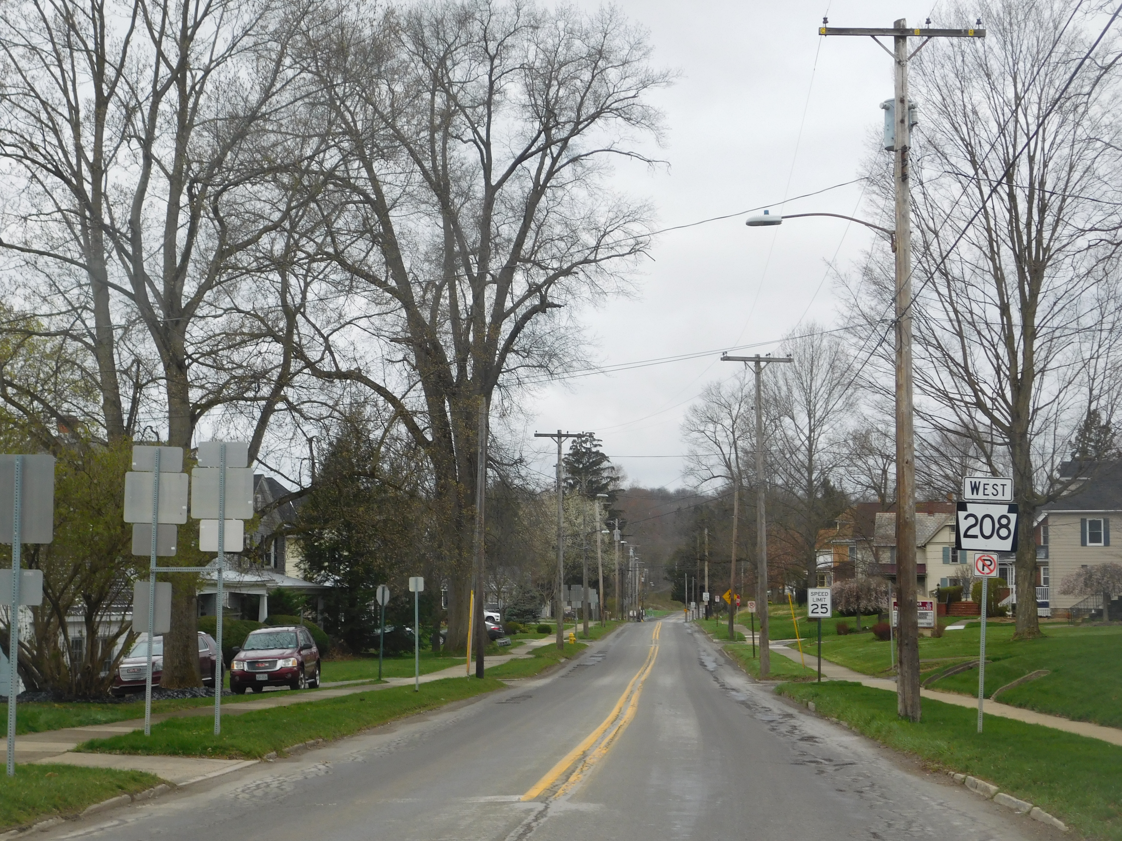
Pennsylvania Route 208 (PA 208) is located in Western Pennsylvania; its western terminus just west of the village of New Bedford in Lawrence County (11½ miles northwest of New Castle) at U.S. Route 422 (US 422) and the Ohio state line. It runs nearly to its eastern terminus in the village of Frills Corners in Clarion County (22 miles east of Oil City) at PA 36. Route description The route begins in Lawrence County where US 422 meets the Ohio state line; PA 208 heads east-northeastward to the village of New Bedford about a mile from the state line. The route junctions with the former PA 932 in the village and was the former alignment of US 422 from the state line to this point, where the old alignment turned southeast; PA 208 continues eastward here. About later, it is joined by PA 551 and the concurrency turns northward for about before turning east again as it crosses the Shenango River and enters the village of Pulaski. The concurrency ends later, and PA 208 con ... [...More Info...] [...Related Items...] OR: [Wikipedia] [Google] [Baidu] |
Pennsylvania Route 36
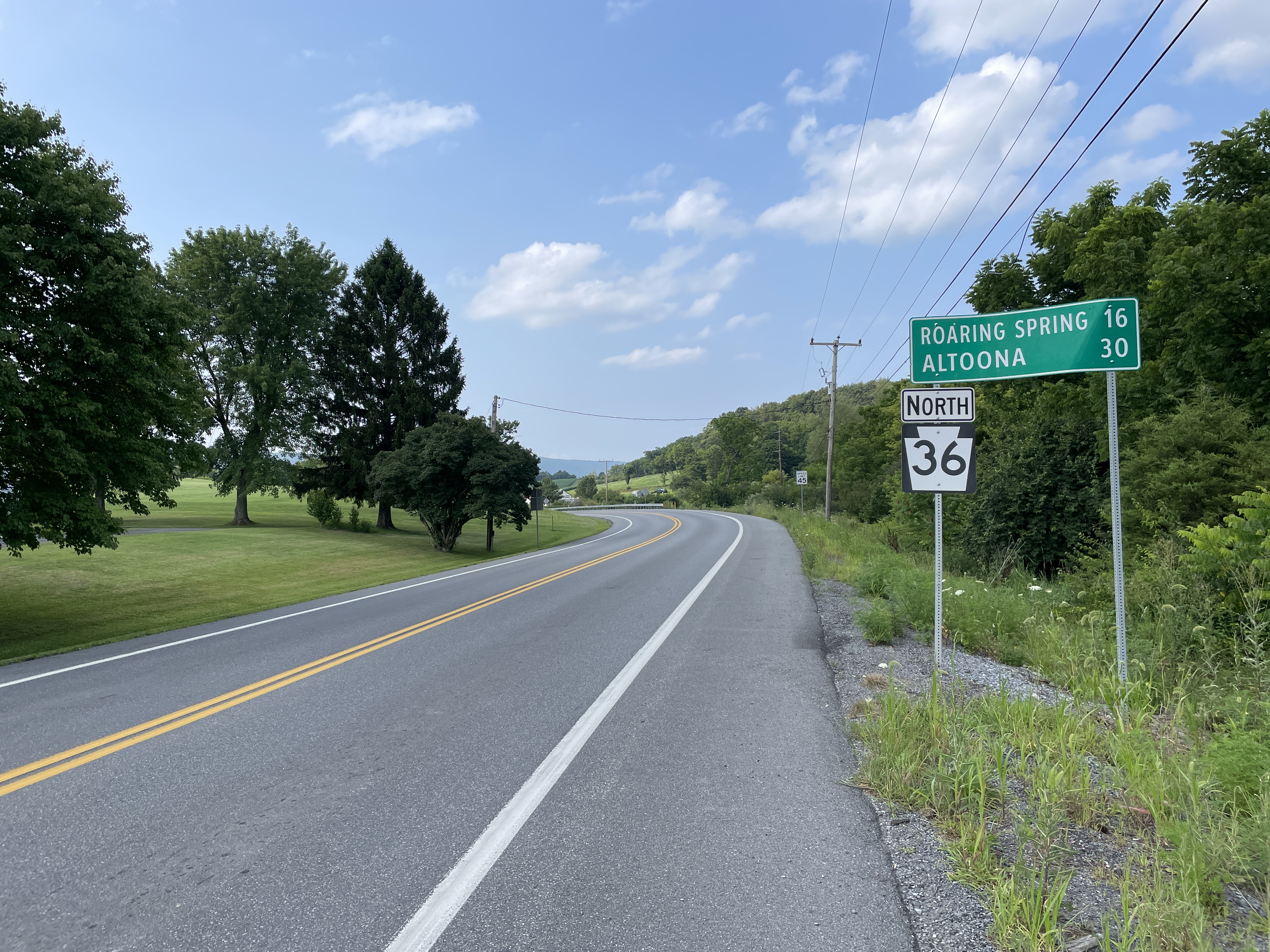
Pennsylvania Route 36 (PA 36) is a long state highway located in the U.S. state of Pennsylvania. The southern terminus is at PA 26 near the Hopewell Township community of Yellow Creek. The northern terminus is at PA 27 and PA 227 in Pleasantville. One of the longest and oldest highways in the commonwealth, PA 36 serves as a major connector between South Central and Northwestern Pennsylvania. In 1955, the highway was designated as the Colonel Drake Highway in honor of Edwin Drake. Route description Bedford and Blair counties PA 36 begins in the Bedford County hamlet of Yellow Creek at PA 26 along the Tussey Mountain range. The distance in Bedford County is brief as the highway enters Blair County and proceeds northward as the Woodbury Pike, intersecting several 800-series state highways like PA 866, PA 868, and PA 869. A short distance between Roaring Spring and the hamlet of McKee, PA 36 overlaps the east–west running PA 164. North of McKee, PA 36 become ... [...More Info...] [...Related Items...] OR: [Wikipedia] [Google] [Baidu] |
Pennsylvania Route 948
Pennsylvania Route 948 (PA 948) is a state highway located in Elk, Forest, and Warren counties in Pennsylvania. The southern terminus is at PA 255 in Fox Township. The northern terminus is at PA 666 in Sheffield Township. Route description PA 948 begins at an intersection with PA 255 in Fox Township, Elk County, heading southwest on two-lane undivided Fairview Road. The road passes through rural residential areas, curving west into a mix of farmland, woodland, and homes. The route becomes Main Street and runs through the community of Kersey, where it passes residences and a few businesses. PA 948 becomes West Main Street Extended and heads west-northwest into wooded areas with some fields and development, becoming Shelvey Summit Road and passing through Shelvey. The road heads west between agricultural areas to the north and woodland to the south before heading into more wooded areas with some homes, curving northwest. The route heads into Ridgway Township and becomes ... [...More Info...] [...Related Items...] OR: [Wikipedia] [Google] [Baidu] |
Howe Township, Forest County, Pennsylvania
Howe Township is a township in Forest County, Pennsylvania, United States. The population was 201 at the 2020 census, down from 405 in 2010. Geography The township occupies the northeastern corner of Forest County. It is bordered to the north by Warren County, to the east by Elk County, and at its northeast corner by McKean County. Tionesta Creek, a westward-flowing tributary of the Allegheny River, crosses the northern part of the township. Pennsylvania Route 666 follows the creek through the township, passing the unincorporated communities of Mayburg, Balltown, Porkey, Minister, Truemans, and Lynch. Pennsylvania Route 948 crosses the northeastern corner of the township, following the South Branch of Tionesta Creek and passing through the unincorporated community of Brookston. Pennsylvania Route 66 crosses the southeastern part of the township, passing through the settlement known as Pigeon near the southern border. According to the United States Census Bureau, the townsh ... [...More Info...] [...Related Items...] OR: [Wikipedia] [Google] [Baidu] |
Porkey, Pennsylvania
Porkey is an unincorporated community in Howe Township, Forest County, Pennsylvania, United States. The settlement is located within the Allegheny National Forest along Pennsylvania Route 666, next to Tionesta Creek Tionesta Creek is a tributary of the Allegheny River in Forest, Clarion, Warren, McKean, and Elk Counties in Pennsylvania in the United States. Together with its West Branch, Tionesta Creek is long, flows generally south, and its watershed is .... History The early settlement contained three lumber mills and was described as "a small but active little town". Porkey was a stop on the Sheffield and Tionesta Railway, a now-abandoned -long railway that began operating in 1900. A wagon bridge was built across Tionesta Creek at Porkey in 1918. References {{authority control Unincorporated communities in Forest County, Pennsylvania Unincorporated communities in Pennsylvania ... [...More Info...] [...Related Items...] OR: [Wikipedia] [Google] [Baidu] |
Allegheny River
The Allegheny River ( ) is a long headwater stream of the Ohio River in western Pennsylvania and New York (state), New York. The Allegheny River runs from its headwaters just below the middle of Pennsylvania's northern border northwesterly into New York then in a zigzag southwesterly across the border and through Western Pennsylvania to join the Monongahela River at the Forks of the Ohio on the "Point" of Point State Park in Downtown Pittsburgh, Pennsylvania. The Allegheny River is, by volume, the main headstream of both the Ohio and Mississippi Rivers. Historically, the Allegheny was considered to be the upper Ohio River by both Native Americans and European settlers. The shallow river has been made navigable upstream from Pittsburgh to East Brady, Pennsylvania, East Brady by a series of locks and dams constructed in the early 20th century. A 24-mile long portion of the upper river in Warren County, Pennsylvania, Warren and McKean County, Pennsylvania, McKean counties of Pennsy ... [...More Info...] [...Related Items...] OR: [Wikipedia] [Google] [Baidu] |
2022-06-13 15 56 32 View West Along Pennsylvania State Route 666 (South Main Street) At Horton Avenue In Sheffield Township, Warren County, Pennsylvania
The hyphen-minus is the most commonly used type of hyphen, widely used in digital documents. It is the only character that looks like a minus sign or a dash in many character sets such as ASCII or on most keyboards, so it is also used as such. The name "hyphen-minus" derives from the original ASCII standard, where it was called "hyphen(minus)". The character is referred to as a "hyphen", a "minus sign", or a "dash" according to the context where it is being used. Description In early monospaced font typewriters and character encodings, a single key/code was almost always used for hyphen, minus, various dashes, and strikethrough, since they all have a roughly similar appearance. The current Unicode Standard specifies distinct characters for a number of different dashes, an unambiguous minus sign ("Unicode minus") at code point U+2212, and various types of hyphen including the unambiguous "Unicode hyphen" at U+2010 and the hyphen-minus at U+002D. When a hyphen is called ... [...More Info...] [...Related Items...] OR: [Wikipedia] [Google] [Baidu] |
Sheffield, Pennsylvania
Sheffield is a census-designated place (CDP) within Sheffield Township in southeastern Warren County, Pennsylvania, United States. It is named after Sheffield, England. The population was 1,123 as of the 2010 census. Geography Sheffield is located at (41.704246, -79.034022). According to the United States Census Bureau, the CDP has a total area of , all land. Demographics As of the 2010 census, there were 1,123 people, 510 households, and 344 families residing in the CDP. The population density was . There were 566 housing units at an average density of . The racial makeup of the CDP was 98.66% White, 0.39% African American, 0.08% Native American, 0.08% Asian, 0.32% from other races, and 0.47% from two or more races. Hispanic or Latino of any race were 0.63% of the population. There were 510 households, out of which 30.4% had children under the age of 18 living with them, 52.5% were married couples living together, 11.8% had a female householder with no husband present, and ... [...More Info...] [...Related Items...] OR: [Wikipedia] [Google] [Baidu] |


