|
Pennsylvania Route 332
Pennsylvania Route 332 (PA 332) is a state highway in the U.S. state of Pennsylvania. The route runs from PA 263 in Hatboro, Montgomery County, east to PA 32 in Yardley, Bucks County. PA 332 runs through suburban areas to the north of Philadelphia, serving Warminster, Ivyland, Richboro, and Newtown. The route is two lanes wide most of its length, with the bypass around Newtown a four-lane divided highway. PA 332 intersects PA 132 in Warminster, PA 232 in Richboro, PA 413 and PA 532 in Newtown (all three run concurrently on the Newtown Bypass), and Interstate 295 (I-295) in Lower Makefield Township. What would become PA 332 between Newtown and Yardley was designated part of Legislative Route 252 in 1911. PA 332 was created in 1928 to run from PA 263 in Hatboro east to Ivyland with the road between Newtown and Yardley designated as part of PA 532. In 1937, PA 332 was extended to PA&n ... [...More Info...] [...Related Items...] OR: [Wikipedia] [Google] [Baidu] |
Hatboro, Pennsylvania
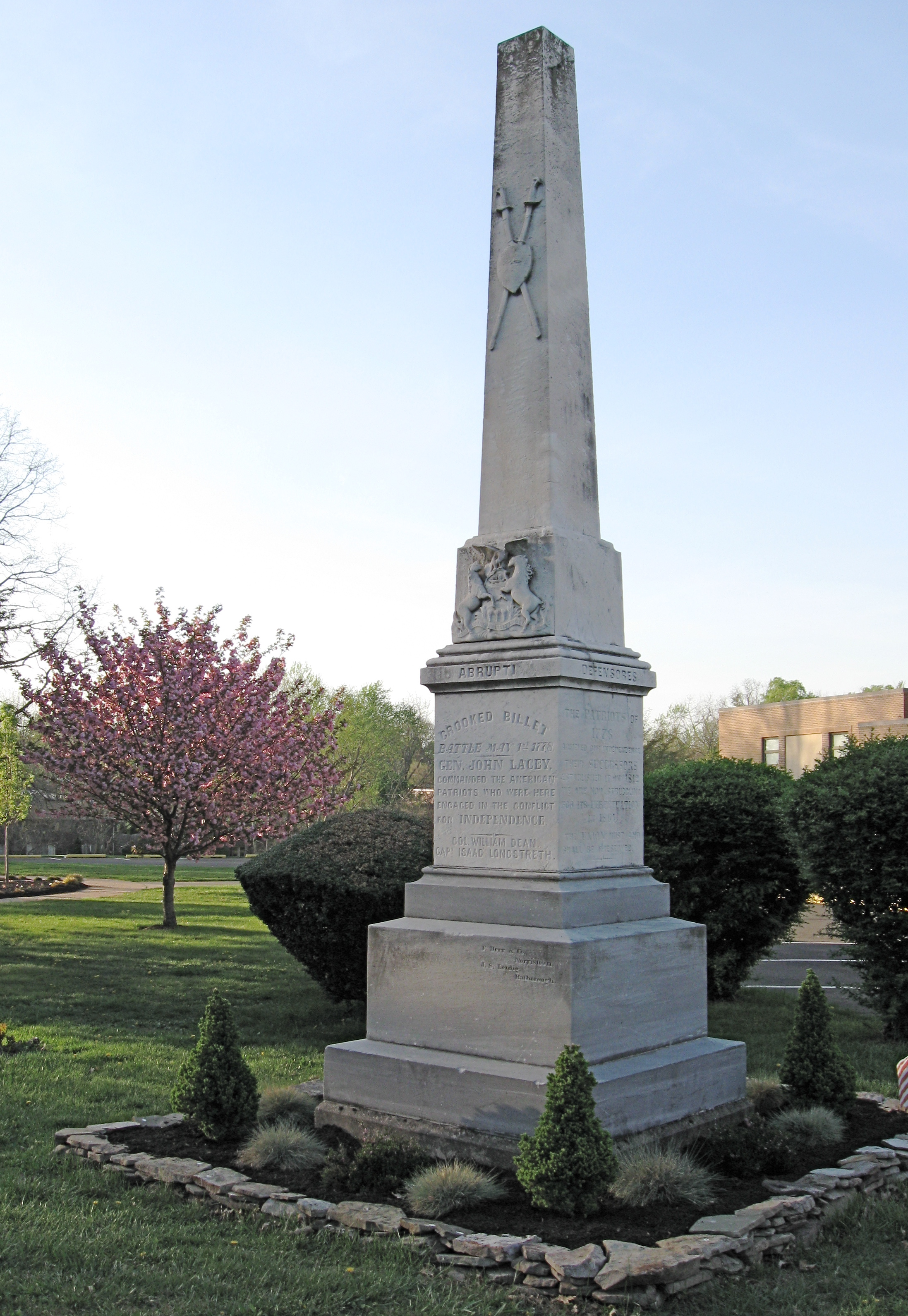
Hatboro (known locally as the Boro) is a borough in Montgomery County, Pennsylvania, United States. The population was 8,238 at the 2020 census. History The town of Hatboro is located on land purchased from William Penn by the family of Nicholas More around 1705. The first land titles in town were issued in 1711. Original construction by early residents of the town occurred between 1715 and 1719. Early settlement pre-dating the Hatboro name occurred in the Crooked Billet area east of York Road, between Moreland Avenue and Byberry Road. Early resident John Dawson entertained guests at the Crooked Billet Inn as well as manufacturing a line of hats. When the post office opened in 1809 the town was officially called Hatborough. U.S. Postmaster General John Wanamaker officially changed the name of the town in the 1880s to Hatboro. The Union Library Company of Hatboro, the third library company to be founded in Pennsylvania, was formed in 1755. This building still stands on its ori ... [...More Info...] [...Related Items...] OR: [Wikipedia] [Google] [Baidu] |
Pennsylvania Route 532
Pennsylvania Route 532 (PA 532) is a state route located in the Philadelphia, Pennsylvania area. The route runs from an intersection with U.S. Route 1 (US 1) in Northeast Philadelphia north to an intersection with PA 32 in Washington Crossing near the Washington Crossing Bridge over the Delaware River. The route passes through developed areas in Northeast Philadelphia before heading north through suburban Bucks County, serving Feasterville, Holland, and Newtown before coming to Washington Crossing. Most of the portion of PA 532 south of Feasterville was chartered as the Bustleton and Somerton Turnpike in 1840. This road in Philadelphia became known as Bustleton Avenue in 1903. PA 532 was designated in 1928 to run from US 1 in Northeast Philadelphia to PA 32 in Yardley while PA 632 was designated on the route between Newtown and Washington Crossing. In 1946, PA 532 was rerouted to Washington Crossing, replacing PA 632, while the road between Newtown and Yardley became an exte ... [...More Info...] [...Related Items...] OR: [Wikipedia] [Google] [Baidu] |
Northampton Township, Bucks County, Pennsylvania
Northampton Township is a township in Bucks County, Pennsylvania. The township is located approximately 12 miles northeast of Philadelphia. The population was 39,726 at the 2010 census. History Northampton Township was originally settled by English colonists who came with William Penn on his voyage to Pennsylvania. They named it after Northampton, the county town of Northamptonshire, England. Northampton Township was incorporated in 1722. Geography According to the U.S. Census Bureau, the township has a total area of 26.1 square miles (67.6 km), of which 25.8 square miles (66.9 km) is land and 0.3 square mile (0.7 km) (1.07%) is water. It is drained by the Neshaminy Creek, which forms its entire northeastern boundary, into the Delaware River. The township is made up of the following unincorporated communities and census-designated places: * Churchville *Holland *Ivyland * Richboro * Village Shires Other past and present place names include Bull ... [...More Info...] [...Related Items...] OR: [Wikipedia] [Google] [Baidu] |
Warminster Heights, Pennsylvania
Warminster Heights is a census-designated place and part of Warminster Township in Bucks County, Pennsylvania, United States. It is located near the eastern border of Hatboro in Montgomery County. The population was 4,124 at the 2010 census. History This neighborhood, built in 1943, formerly served as the civilian housing area for the long-defunct Brewster Aeronautical Corporation, established in 1941, while the area was still referred to as Johnsville. It later became the Naval Air Development Center and was finally known as the NAWC, Aircraft Division, Warminster prior to its being decommissioned and closed by the US federal government in the mid-1990s. The community was previously named Lacey Park, for Pennsylvania Militia General John Lacey, who fought during the American Revolutionary War at the Battle of Crooked Billet, which took place near the neighborhood. It is still referred to colloquially as Lacey Park by local residents. In the 1960s, Lacey Park was renamed War ... [...More Info...] [...Related Items...] OR: [Wikipedia] [Google] [Baidu] |
Warminster Station (SEPTA)
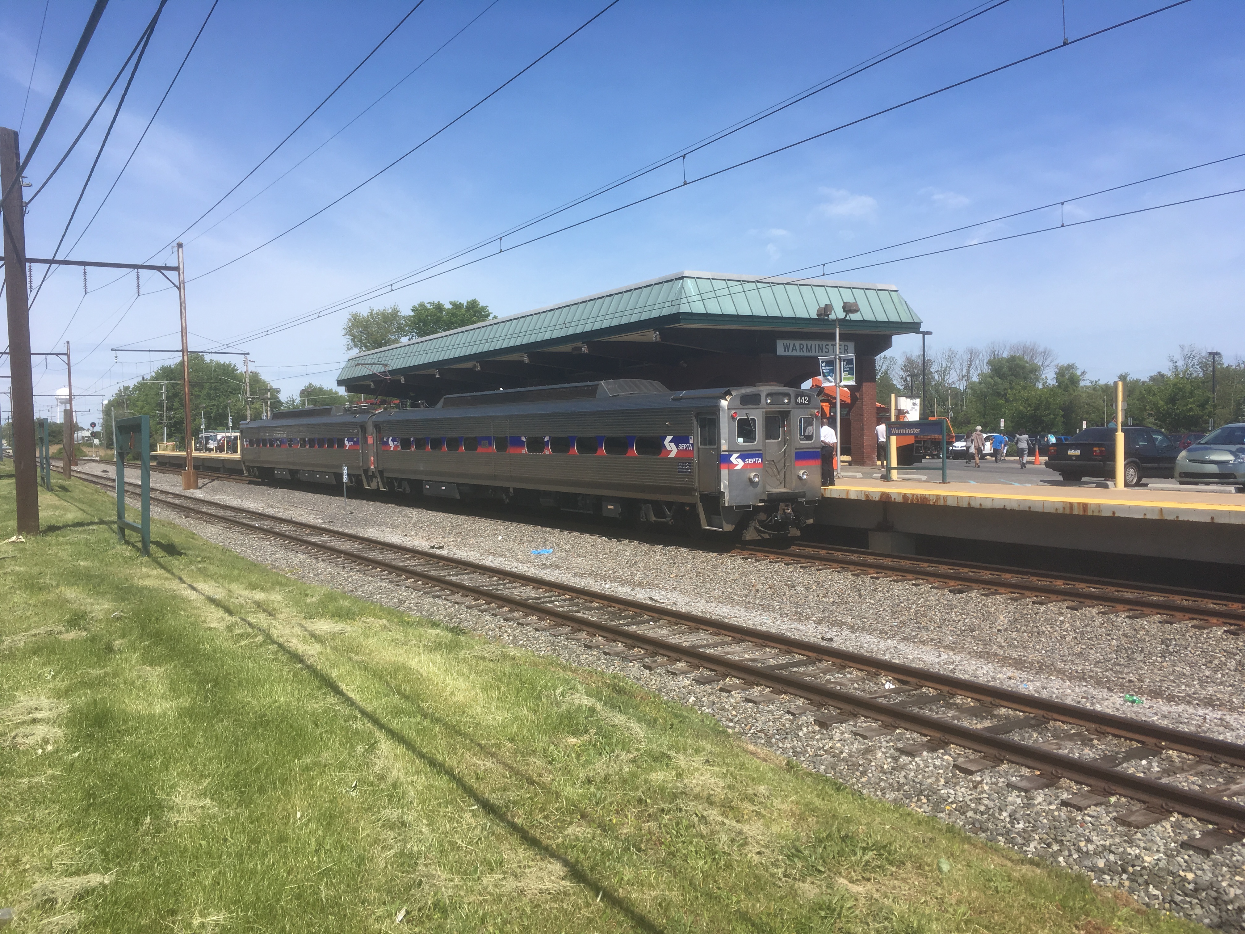
Warminster station is a SEPTA Regional Rail station in Warminster, Pennsylvania. It serves as the North end of the Warminster Line. The station is occasionally served by passenger trains operated by the New Hope Railroad, which has an interchange just north of the station with Pennsylvania Northeastern Railroad. Original electrification from Hatboro was extended to Warminster on July 29, 1974, replacing the former Reading Company Bonair station. This station is wheelchair ADA accessible. Description Warminster station consists of a side platform along the tracks that is wheelchair accessible. The station has a ticket office and waiting room that is open on weekday mornings. There are four bike racks available that can hold up to eight bicycles. Warminster station has a daily parking lot with 562 spaces that charges $1 a day and a permit parking lot with 238 spaces that charges $25 a month. Train service at Warminster station is provided along the Warminster Line of SEPTA Re ... [...More Info...] [...Related Items...] OR: [Wikipedia] [Google] [Baidu] |
Center Left-turn Lane
A reversible lane (British English: tidal flow) is a lane in which traffic may travel in either direction, depending on certain conditions. Typically, it is meant to improve traffic flow during rush hours, by having overhead traffic lights and lighted street signs notify drivers which lanes are open or closed to driving or turning. Reversible lanes are also commonly found in tunnels and on bridges, and on the surrounding roadways – even where the lanes are not regularly reversed to handle normal changes in traffic flow. The presence of lane controls allows authorities to close or reverse lanes when unusual circumstances (such as construction or a traffic mishap) require use of fewer or more lanes to maintain orderly flow of traffic. Separation of flows Some more recent implementations of reversible lanes use a movable barrier to establish a physical separation between allowed and disallowed lanes of travel. In some systems, a concrete barrier is moved during low-traffic peri ... [...More Info...] [...Related Items...] OR: [Wikipedia] [Google] [Baidu] |
Warminster Township, Pennsylvania
Warminster Township (also referred to as Warminster) is located in Bucks County, Pennsylvania, United States. It was formally established in 1711. The township is 13.7 miles north of Philadelphia and had a population of 32,682 according to the 2010 U.S. census. History The town was called Warminster Township as early as 1685, before its borders were formally established in 1711. It was originally part of Southampton Township, which was founded in 1682 by William Penn. Warminster was named after a small town in the county of Wiltshire, at the western extremity of Salisbury Plain, England. Warminster, Pennsylvania was mostly settled by English and Scotch-Irish colonists after William Penn received a grant of land in the area from King Charles, II. It was the site of the Battle of Crooked Billet during the Revolutionary War, which resulted in a resounding defeat for George Washington's colonial troops. Warminster's Craven Hall is included in the National Register of Historic Places ... [...More Info...] [...Related Items...] OR: [Wikipedia] [Google] [Baidu] |
ADC Map
Kappa Publishing Group, Inc. is a Blue Bell, Pennsylvania-based publishing company concentrating on adult puzzle books and magazines as well as children's magazines and maps. It is a private company founded in 1955 with $11.5 million in annual sales. History In January 2012, Kappa announced that they had acquired Modern Publishing. Subsidiaries It has a number of subsidiary companies, such as London Publishing or GAMES Publications. It original owner, H.L. Herbert ("Larry") founded his puzzle business, Official Publications in Manhattan with titles including Teen Word-Finds, Superb Word-Finds, Variety Word-Finds and countless crossword puzzle, crosspatch and fill-it-in titles. Sons Anthony Herbert (Editorial Director) and Paul Herbert (Sales) helped the business grow to the success it became. Edward Tobias was the Editor. Prior to Mr. Herbert, Sr.'s passing in the 1980s, he sold the business to Nick Karabots, who owned the printer where the titles were being printed. The b ... [...More Info...] [...Related Items...] OR: [Wikipedia] [Google] [Baidu] |
Warminster Line
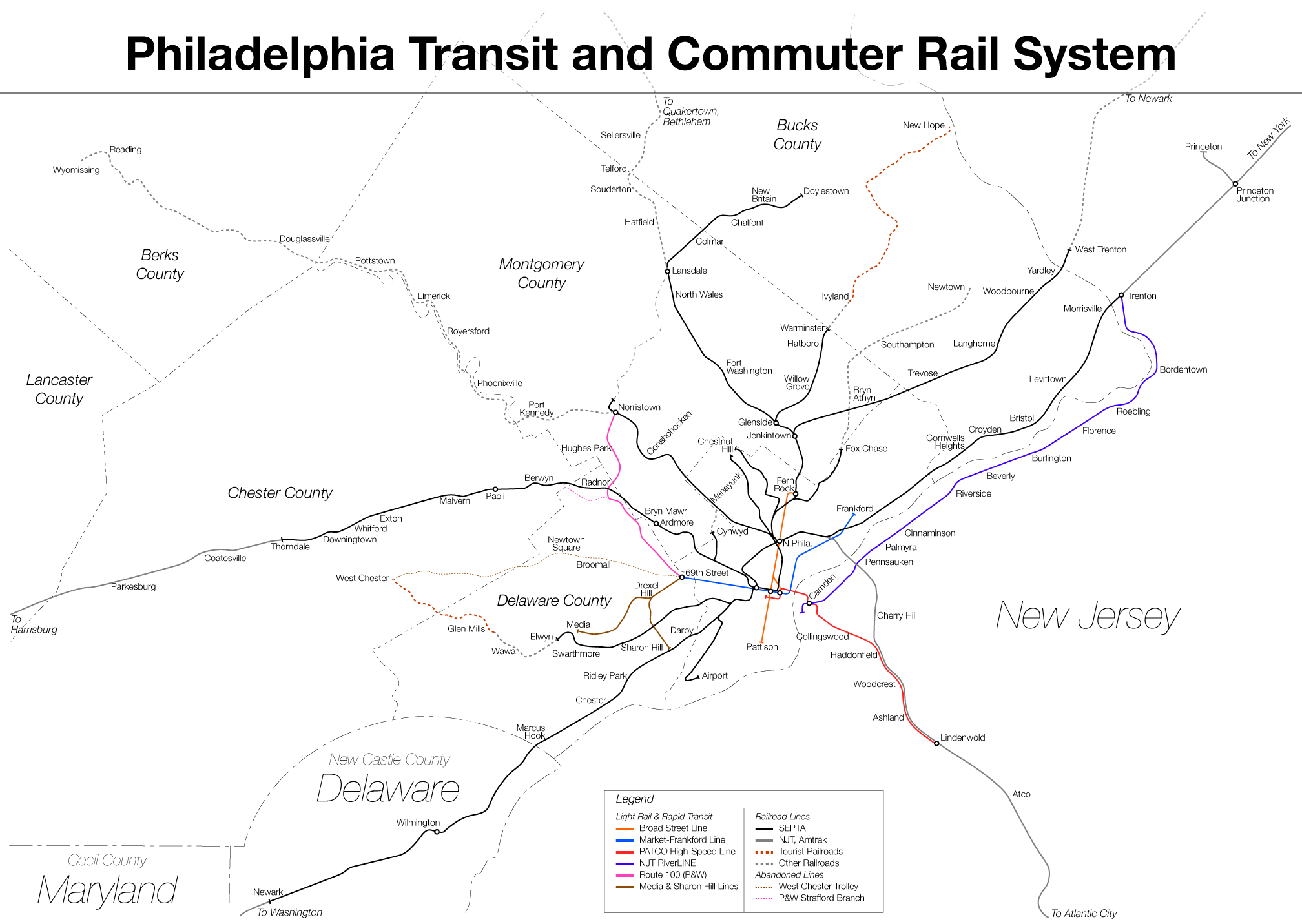
The Warminster Line is a route of the SEPTA Regional Rail commuter rail system. It serves stations between its namesake town, Warminster (SEPTA station), Warminster, and Center City, Philadelphia. Half of the route is shared by other lines, including the Lansdale/Doylestown Line, West Trenton Line (SEPTA), West Trenton Line, Fox Chase Line, Chestnut Hill East Line, and Manayunk/Norristown Line. The great majority of trains continue as part of the Airport Line (SEPTA), Airport Line. Route The Warminster Line uses the SEPTA Main Line between Center City and Glenside (SEPTA station), Glenside, where it branches off onto the Warminster Branch to Hatboro (SEPTA station), Hatboro and Warminster (SEPTA station), Warminster. The tracks continue past Warminster to Ivyland, Pennsylvania, Ivyland and eventually to New Hope, Pennsylvania, New Hope, where the New Hope Railroad runs heritage excursion trains. The Warminster Line becomes a single-track line just north of Ardsley, Pennsylvani ... [...More Info...] [...Related Items...] OR: [Wikipedia] [Google] [Baidu] |
SEPTA
The Southeastern Pennsylvania Transportation Authority (SEPTA) is a regional public transportation authority that operates bus, rapid transit, commuter rail, light rail, and electric trolleybus services for nearly 4 million people in five counties in and around Philadelphia, Pennsylvania. It also manages projects that maintain, replace and expand its infrastructure, facilities and vehicles. SEPTA is the major transit provider for Philadelphia and the counties of Delaware, Montgomery, Bucks, and Chester. It is a state-created authority, with the majority of its board appointed by the five Pennsylvania counties it serves. While several SEPTA commuter rail lines terminate in the nearby states of Delaware and New Jersey, additional service to Philadelphia from those states is provided by other agencies: the PATCO Speedline from Camden County, New Jersey is run by the Delaware River Port Authority, a bi-state agency; NJ Transit operates many bus lines and a commuter rail line to ... [...More Info...] [...Related Items...] OR: [Wikipedia] [Google] [Baidu] |
Old York Road
Old York Road (originally York Road, with reference to New York) is a roadway that was built during the 18th century to connect Philadelphia with New York City. Through New Jersey it was built along the Raritan (Unami tribe) "Naraticong Trail", also known as the Tuckaraming Trail. A memorial plaque to the friendship of the Naraticong Indians, who permitted the road to be built over their trail, is at the intersection of Old York Road and Canal in Raritan, NJ. The Swift Sure Stage Coach Line completed the journey between the two cities in two days and cost a few dollars. A ferry left Elizabethtown Point for New York City, or passengers could continue onto Newark and ultimately Powles Hook Ferry (present day Exchange Place in Jersey City) via Bergen Point Plank Road/Newark Plank Road. Pennsylvania route Sign for Old York Road in Cheltenham Township, Pennsylvania. Old York Road was laid out from New Hope, Pennsylvania to Philadelphia between 1711 and 1771. Its start (or end ... [...More Info...] [...Related Items...] OR: [Wikipedia] [Google] [Baidu] |


