|
Pennsylvania Route 167
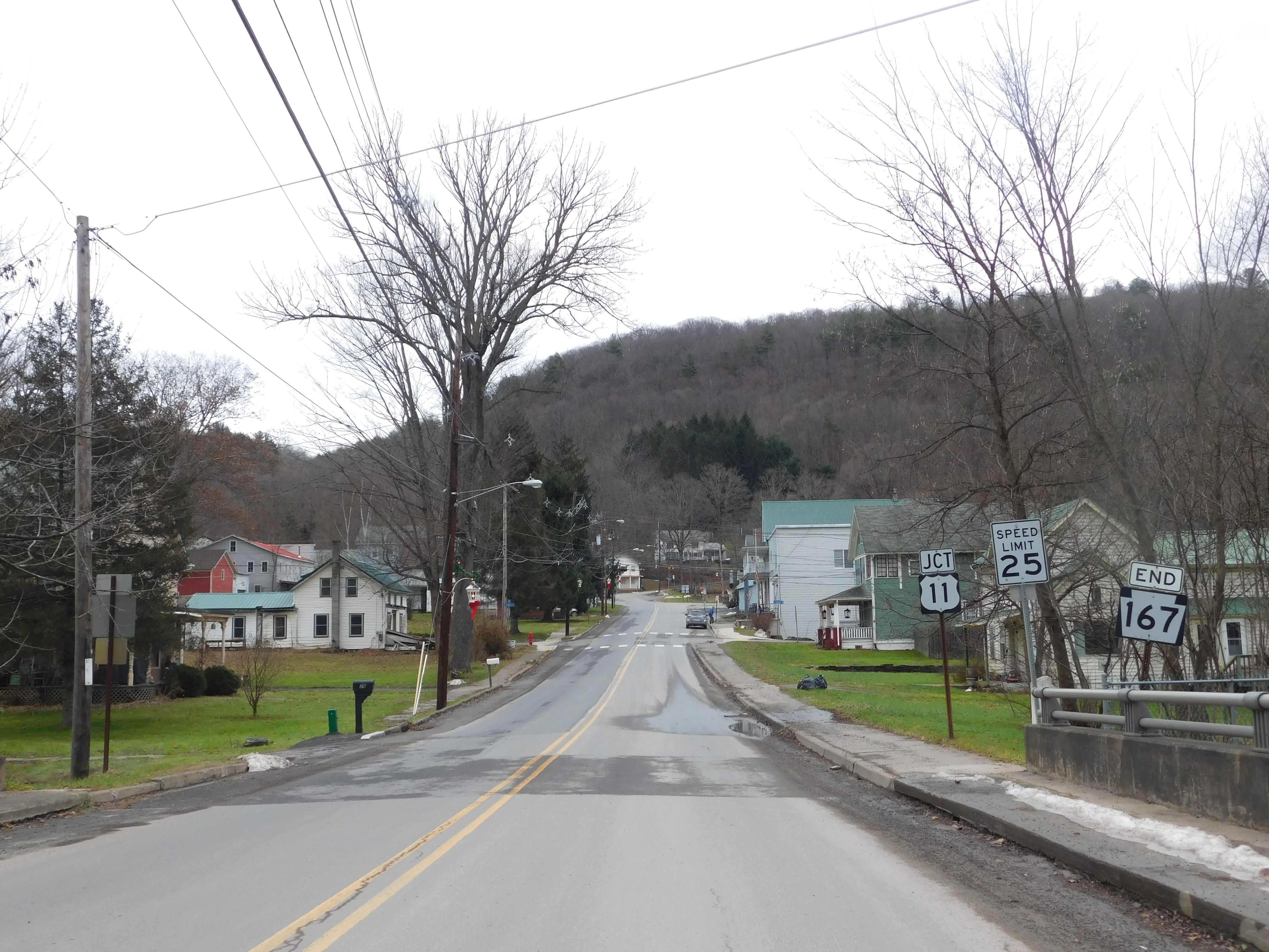
Pennsylvania Route 167 (PA 167) is a state highway located in Susquehanna County in Pennsylvania. The southern terminus is at U.S. Route 11 (US 11) in Hop Bottom. The northern terminus is at the New York state border near Brackney. Route description PA 167 begins at an intersection with US 11 in the borough of Hop Bottom, heading west on two-lane undivided Main Street. The route passes homes and businesses, turning northwest onto Greenwood Street. The road heads through fields and woods with some homes before crossing into Lathrop Township. Here, PA 167 heads northwest as an unnamed road, passing through forested areas with a few residences and occasional fields as it enters Brooklyn Township. The road heads through farmland and woodland with some homes, passing through the community of Brooklyn. The route turns to the north before heading northeast into more forested areas with some small fields and residences. PA 167 curves north again and runs through more rural areas, h ... [...More Info...] [...Related Items...] OR: [Wikipedia] [Google] [Baidu] |
Hop Bottom, Pennsylvania
Hop Bottom is a borough of Susquehanna County, Pennsylvania, United States. The population was 310 as of the 2020 census. The name comes from the hop, a plant providing flowers for brewing. History Hop Bottom was formerly known as "Foster." The present name is derived from nearby Hop Bottom Creek. Native Americans once lived in the area, and the only clear meadows to be found were near the bottom of the creek. These meadows were covered with hop vines, leading to the name "Hop Bottom." Geography Hop Bottom is located at . According to the United States Census Bureau, the borough has a total area of , all land. Hop Bottom is located at the junction of U.S. Route 11 and Pennsylvania Route 167. It is also seven miles west of Interstate 81. Demographics According to the census of 2010, there were 337 people, 138 households, and 88 families residing in the borough. The population density was . There were 147 housing units at an average density of . The racial makeup of the borou ... [...More Info...] [...Related Items...] OR: [Wikipedia] [Google] [Baidu] |
Bridgewater Township, Pennsylvania
Bridgewater Township is a township in Susquehanna County, Pennsylvania, United States. The population was 2,582 at the 2020 census, but is now estimated to be 2,754. History Bridgewater Township was formed in November 1806 from parts of Tunkhannock, Braintrim, Nicholson, and Rush Townships in what was then northern Luzerne County. The Borough of Montrose was incorporated from part of Bridgewater Township in 1824. Geography According to the United States Census Bureau, the township has a total area of , of which is land and (0.82%) is water. Demographics As of the census of 2010, there were 2,844 people, 1,124 households, and 766 families residing in the township. The population density was 69.3 people per square mile (26.8/km2). There were 1,303 housing units at an average density of 31.7/sq mi (12.4/km2). The racial makeup of the township was 98.1% White, 0.4% African American, 0.2% Native American, 0.4% Asian, 0.1% from other races, and 0.8% from two or more rac ... [...More Info...] [...Related Items...] OR: [Wikipedia] [Google] [Baidu] |
Binghamton, New York
Binghamton () is a city in the U.S. state of New York, and serves as the county seat of Broome County. Surrounded by rolling hills, it lies in the state's Southern Tier region near the Pennsylvania border, in a bowl-shaped valley at the confluence of the Susquehanna and Chenango Rivers. Binghamton is the principal city and cultural center of the Binghamton metropolitan area (also known as Greater Binghamton, or historically the Triple Cities, including Endicott and Johnson City), home to a quarter million people. The city's population, according to the 2020 census, is 47,969. From the days of the railroad, Binghamton was a transportation crossroads and a manufacturing center, and has been known at different times for the production of cigars, shoes, and computers. IBM was founded nearby, and the flight simulator was invented in the city, leading to a notable concentration of electronics- and defense-oriented firms. This sustained economic prosperity earned Binghamton the mon ... [...More Info...] [...Related Items...] OR: [Wikipedia] [Google] [Baidu] |
Broome County, New York
Broome County is a county in the U.S. state of New York. As of the 2020 United States census, the county had a population of 198,683. Its county seat is Binghamton. The county was named for John Broome, the state's lieutenant governor when Broome County was created. The county is part of the Binghamton, NY Metropolitan Statistical Area. It is home to Binghamton University, one of four university centers in the State University of New York (SUNY) system. History When counties were established in the Province of New York in 1683, the present Broome County was part of the enormous Albany County, including the northern part of New York State as well as all of the present State of Vermont and, in theory, extending westward to the Pacific Ocean. This county was reduced in size on July 3, 1766, by the creation of Cumberland County, and further on March 16, 1770, by the creation of Gloucester County, both containing territory now in Vermont. On March 12, 1772, what was left of Alb ... [...More Info...] [...Related Items...] OR: [Wikipedia] [Google] [Baidu] |
Silver Lake Township, Pennsylvania
Silver Lake Township is a township in Susquehanna County, Pennsylvania, United States. The population was 1,525 at the 2020 census. The village of Brackney is in the township. History In 1809, Dr Richard Rose purchased 100,000 acres in what was then northern Luzerne County. On April 27, 1813 Silver Lake Township was formed from the north part of Bridgewater Township in this area. In 1848, J.W. Brackney of Prattsville, NY, founded the village of Brackney where he operated a large tannery. Geography According to the United States Census Bureau, the township has a total area of , of which is land and (1.8%) is water. Demographics As of the census of 2010, there were 1,716 people, 708 households, and 512 families residing in the township. The population density was 52.5 people per square mile (20.3/km2). There were 1,102 housing units at an average density of 33.7/sq mi (13.2/km2). The racial makeup of the township was 98.6% White, 0.2% African American, 0.1 ... [...More Info...] [...Related Items...] OR: [Wikipedia] [Google] [Baidu] |
2021-09-09 16 55 12 View South Along Pennsylvania State Route 167 Just South Of The Wilkes Barre Turnpike In Silver Lake Township, Susquehanna County, Pennsylvania
Increment or incremental may refer to: *Incrementalism, a theory (also used in politics as a synonym for gradualism) *Increment and decrement operators, the operators ++ and -- in computer programming *Incremental computing *Incremental backup, which contain only that portion that has changed since the preceding backup copy. *Increment, chess term for additional time a chess player receives on each move *Incremental games * Increment in rounding See also * * *1+1 (other) 1+1 is a mathematical expression that evaluates to: * 2 (number) (in ordinary arithmetic) * 1 (number) (in Boolean algebra with a notation where '+' denotes a logical disjunction) * 0 (number) (in Boolean algebra with a notation where '+' denotes ' ... {{Disambiguation da:Inkrementel fr:Incrémentation nl:Increment ja:インクリメント pl:Inkrementacja ru:Инкремент sr:Инкремент sv:++ ... [...More Info...] [...Related Items...] OR: [Wikipedia] [Google] [Baidu] |
Pennsylvania Department Of Transportation
The Pennsylvania Department of Transportation (PennDOT) oversees transportation issues in the Commonwealth of Pennsylvania. The administrator of PennDOT is the Pennsylvania Secretary of Transportation, currently Yassmin Gramian. Presently, PennDOT supports over of state roads and highways, about 25,000 bridges, as well as new roadway construction, the exception being the Pennsylvania Turnpike Commission, although they currently follow PennDOT policies and procedures. In addition, other modes of transportation are supervised or supported by PennDOT. These include aviation, Railroad, rail traffic, mass transit, intrastate highway shipping traffic, motor vehicle safety & licensing, and Driver's license, driver licensing. PennDOT also supports the Ports of Philadelphia, Pittsburgh, and Erie, Pennsylvania, Erie. The current budget is approximately $3.8 billion in federal and state funds. The state budget is supported by the motor vehicle fuels tax which is dedicated solely to ... [...More Info...] [...Related Items...] OR: [Wikipedia] [Google] [Baidu] |
Pennsylvania Route 29
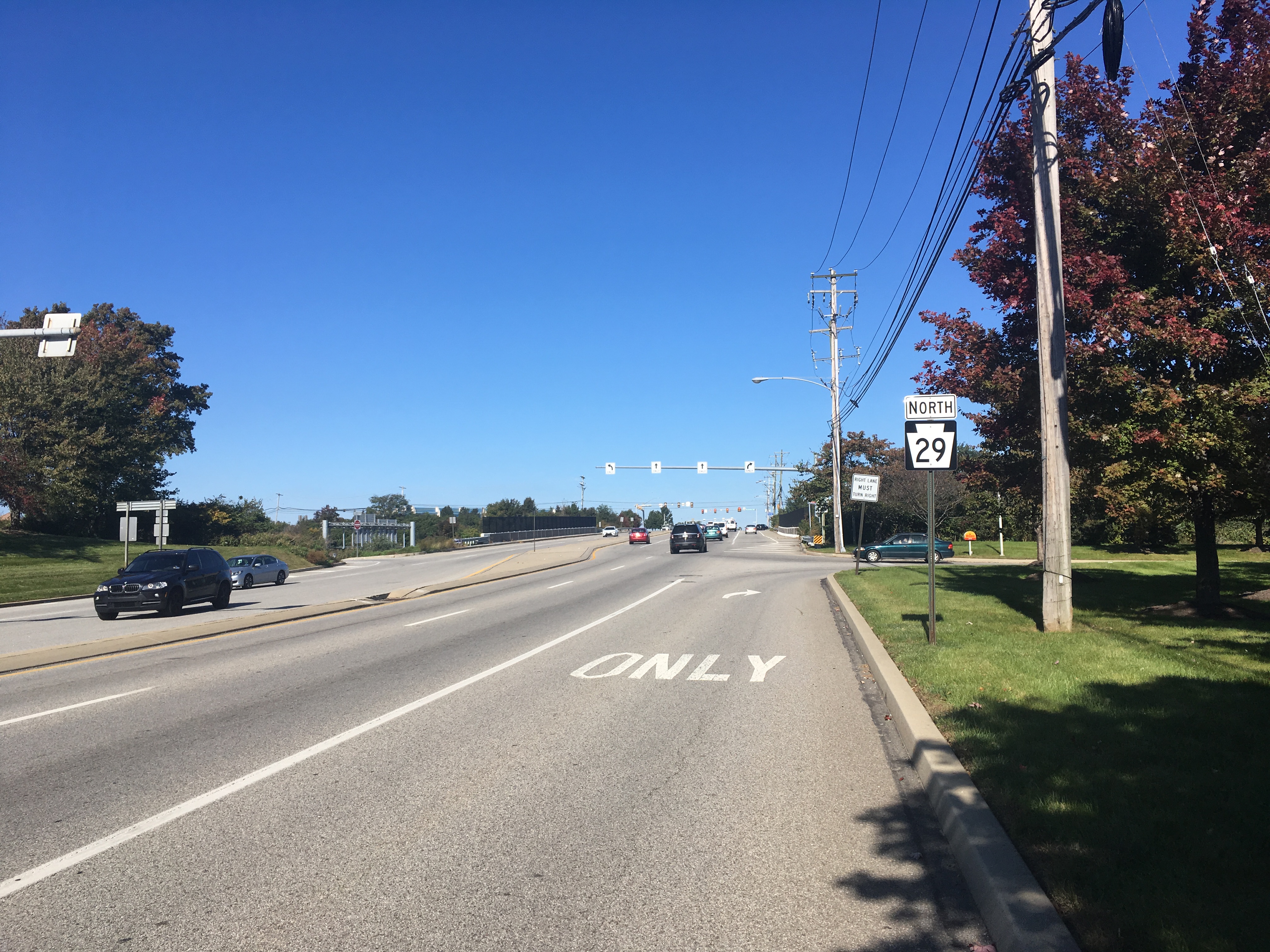
Pennsylvania Route 29 (PA 29) is a north–south state highway that runs through most of eastern Pennsylvania. The route currently exists in two segments, a southern segment and a northern segment. The southern segment runs from U.S. Route 30 (US 30) near Malvern north to Interstate 78 (I-78)/ PA 309 near Allentown. The northern segment runs from I-81 in Ashley north to the New York state line near Brookdale, Pennsylvania, where the road becomes New York State Route 7 (NY 7). The southernmost of PA 29's northern segment is a freeway known as the South Cross Valley Expressway. The route was continuous until May 9, 1966 when PA 29 was split into the two segments that exist today. Route description Southern section Chester County The southern section of PA 29 begins at an intersection with US 30 near the borough of Malvern in East Whiteland Township, Chester County, heading north on six-lane divided South Morehall Road. The road passes businesses and office parks, curv ... [...More Info...] [...Related Items...] OR: [Wikipedia] [Google] [Baidu] |
Concurrency (road)
A concurrency in a road network is an instance of one physical roadway bearing two or more different route numbers. When two roadways share the same right-of-way, it is sometimes called a common section or commons. Other terminology for a concurrency includes overlap, coincidence, duplex (two concurrent routes), triplex (three concurrent routes), multiplex (any number of concurrent routes), dual routing or triple routing. Concurrent numbering can become very common in jurisdictions that allow it. Where multiple routes must pass between a single mountain crossing or over a bridge, or through a major city, it is often economically and practically advantageous for them all to be accommodated on a single physical roadway. In some jurisdictions, however, concurrent numbering is avoided by posting only one route number on highway signs; these routes disappear at the start of the concurrency and reappear when it ends. However, any route that becomes unsigned in the middle of the concurren ... [...More Info...] [...Related Items...] OR: [Wikipedia] [Google] [Baidu] |
Pennsylvania Route 706
Pennsylvania Route 706 (PA 706) is a state highway in Pennsylvania. The western terminus is at U.S. Route 6 (US 6) in Wyalusing, and the eastern terminus is at US 11 in New Milford. Route description PA 706 begins at an intersection with US 6 in the borough of Wyalusing in Bradford County, heading northeast on two-lane undivided Church Street. The road passes downtown businesses before heading into residential areas, becoming Taylor Avenue. The route turns north into agricultural areas and crosses into Wyalusing Township, becoming an unnamed road and running to the west of Wyalusing Creek. PA 706 turns northeast and passes some industry, heading into more wooded areas with some fields and homes. The road crosses the creek and turns north at Merryall, running through more farmland with some woods and residences to the east of Wyalusing Creek. The route crosses the creek again and heads into the community of Camptown, turning to the northeast at an intersection with the nor ... [...More Info...] [...Related Items...] OR: [Wikipedia] [Google] [Baidu] |
Brooklyn, Pennsylvania
Brooklyn is an unincorporated community in Susquehanna County Susquehanna County is a county in the Commonwealth of Pennsylvania. It is part of Northeastern Pennsylvania. As of the 2020 census, the population was 38,434 Its county seat is Montrose. The county was created on February 21, 1810, from part ..., Pennsylvania, United States. The community is located along Pennsylvania Route 167, northwest of Hop Bottom. Brooklyn has a post office with ZIP code 18813, which opened on March 20, 1830. References Unincorporated communities in Susquehanna County, Pennsylvania Unincorporated communities in Pennsylvania {{SusquehannaCountyPA-geo-stub ... [...More Info...] [...Related Items...] OR: [Wikipedia] [Google] [Baidu] |
Montrose, Pennsylvania
Montrose is a borough in Susquehanna County, Pennsylvania, United States, south-southeast of Binghamton, New York and north by west of Scranton. The land is elevated approximately 1,400 feet (427 m) above sea level. It is the Susquehanna County seat. History Montrose was laid out in 1812 in an area of Pennsylvania historically associated with the Indigenous Susquehannock people. The first non-Indigenous settler in 1800 was a Revolutionary War officer, Captain Bartlett Hinds, who traveled from Long Island, NY with his stepson, Isaac Post. Upon seeing the area's natural beauty and potential, he returned to NY to bring his family to Pennsylvania. Among other settlers were the descendants of Sir Peter Warren, Knight Vice Admiral on England's Royal Fleet. Upon retirement, he was given the land by grateful American soldiers. The first courthouse was built a year later, and Montrose was incorporated as a borough from part of Bridgewater Township on March 29, 1824. Its name is a port ... [...More Info...] [...Related Items...] OR: [Wikipedia] [Google] [Baidu] |


