|
Pennsylvania Route 132
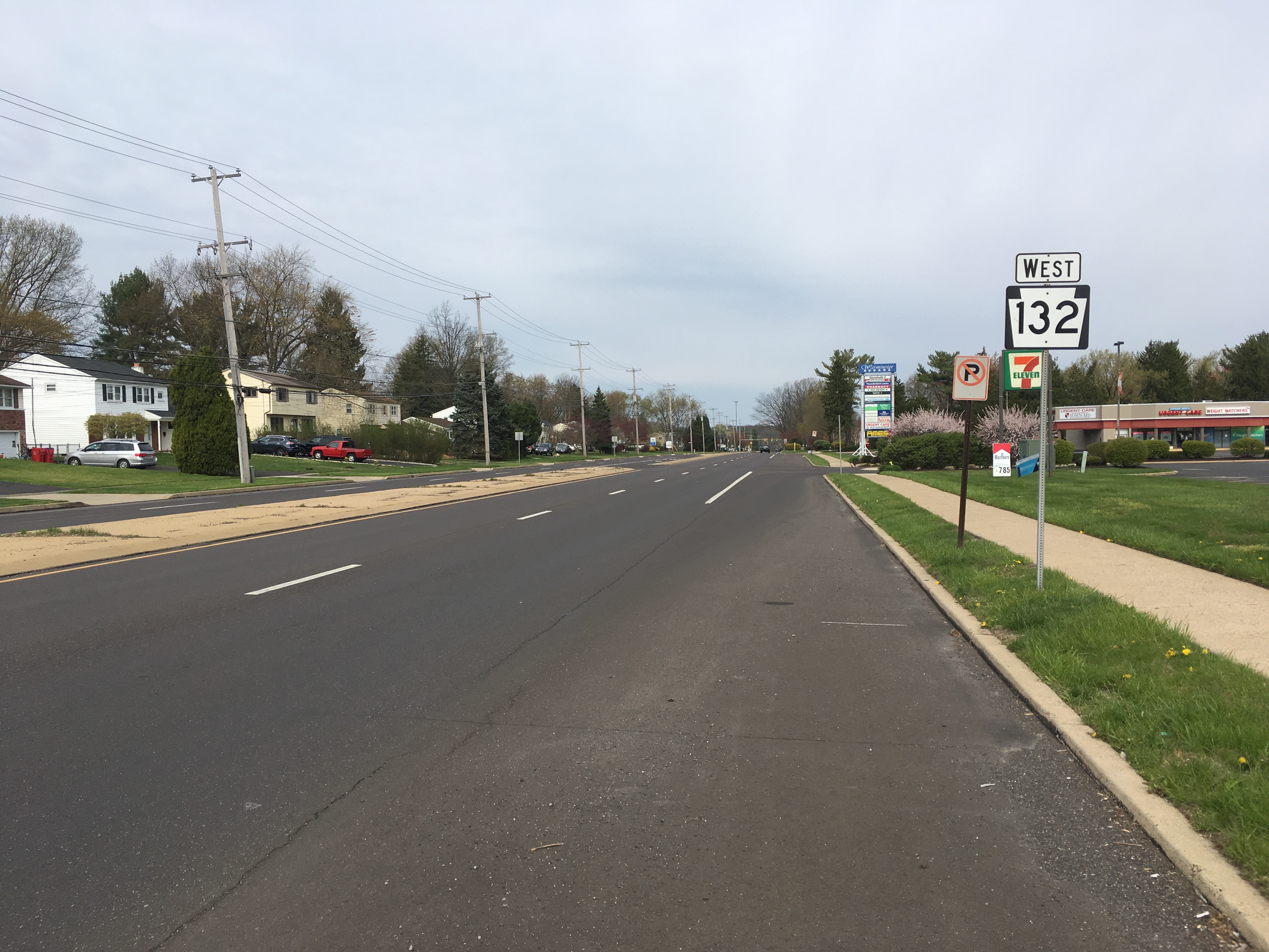
Pennsylvania Route 132 (PA 132) is a state highway in southeast Pennsylvania. The route, which is signed east-west, runs northwest to southeast through Bucks County in suburban Philadelphia from PA 611 in Warrington southeast to Interstate 95 (I-95) in Bensalem. PA 132 is a commercial route lined with shopping centers throughout much of its length. It is named Street Road and is five lanes wide for much of its length. The route was also designated as the Armed Forces and Veterans Memorial Highway in 2005. From west to east, PA 132 crosses PA 263 and PA 332 in Warminster; PA 232 in Southampton; PA 532 in Feasterville; and U.S. Route 1 (US 1), the Pennsylvania Turnpike (I-276), PA 513, and US 13 in Bensalem. Street Road was included in William Penn's survey plans and completed by 1737. The road was paved by 1911 and received the PA 132 designation between US 611 (now PA 611) and US& ... [...More Info...] [...Related Items...] OR: [Wikipedia] [Google] [Baidu] |
Pennsylvania Department Of Transportation
The Pennsylvania Department of Transportation (PennDOT) oversees transportation issues in the Commonwealth of Pennsylvania. The administrator of PennDOT is the Pennsylvania Secretary of Transportation, currently Yassmin Gramian. Presently, PennDOT supports over of state roads and highways, about 25,000 bridges, as well as new roadway construction, the exception being the Pennsylvania Turnpike Commission, although they currently follow PennDOT policies and procedures. In addition, other modes of transportation are supervised or supported by PennDOT. These include aviation, rail traffic, mass transit, intrastate highway shipping traffic, motor vehicle safety & licensing, and driver licensing. PennDOT also supports the Ports of Philadelphia, Pittsburgh, and Erie. The current budget is approximately $3.8 billion in federal and state funds. The state budget is supported by the motor vehicle fuels tax which is dedicated solely to transportation issues. In recent years, Pe ... [...More Info...] [...Related Items...] OR: [Wikipedia] [Google] [Baidu] |
Pennsylvania Turnpike
The Pennsylvania Turnpike (Penna Turnpike or PA Turnpike) is a toll highway operated by the Pennsylvania Turnpike Commission (PTC) in the U.S. state of Pennsylvania. A controlled-access highway, it runs for across the state. The turnpike's western terminus is at the Ohio state line in Lawrence County, where the road continues west as the Ohio Turnpike. The eastern terminus is at the New Jersey state line at the Delaware River–Turnpike Toll Bridge over the Delaware River in Bucks County, where the road continues east as the Pearl Harbor Memorial Extension of the New Jersey Turnpike. The highway runs east–west through the southern part of the state, connecting the Pittsburgh, Harrisburg, and Philadelphia areas. It crosses the Appalachian Mountains in central Pennsylvania, passing through four tunnels. The turnpike is part of the Interstate Highway System; it is designated as part of Interstate 76 (I-76) between the Ohio state line and Valley Forge, I-70 ... [...More Info...] [...Related Items...] OR: [Wikipedia] [Google] [Baidu] |
Warminster Line
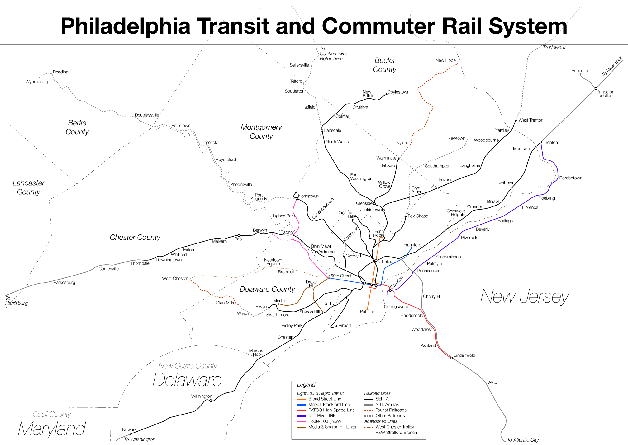
The Warminster Line is a route of the SEPTA Regional Rail commuter rail system. It serves stations between its namesake town, Warminster, and Center City, Philadelphia. Half of the route is shared by other lines, including the Lansdale/Doylestown Line, West Trenton Line, Fox Chase Line, Chestnut Hill East Line, and Manayunk/Norristown Line. The great majority of trains continue as part of the Airport Line. Route The Warminster Line uses the SEPTA Main Line between Center City and Glenside, where it branches off onto the Warminster Branch to Hatboro and Warminster. The tracks continue past Warminster to Ivyland and eventually to New Hope, where the New Hope Railroad runs heritage excursion trains. The Warminster Line becomes a single-track line just north of Ardsley, but was once double-tracked as far north as Roslyn, the original northbound track being removed in 2010. A passing siding exists north of Willow Grove. There is also a second storage track at the Hatboro ... [...More Info...] [...Related Items...] OR: [Wikipedia] [Google] [Baidu] |
SEPTA
The Southeastern Pennsylvania Transportation Authority (SEPTA) is a regional public transportation authority that operates transit bus, bus, rapid transit, commuter rail, light rail, and electric trolleybus services for nearly 4 million people in five counties in and around Philadelphia, Pennsylvania. It also manages projects that maintain, replace and expand its infrastructure, facilities and vehicles. SEPTA is the major transit provider for Philadelphia and the counties of Delaware County, Pennsylvania, Delaware, Montgomery County, Pennsylvania, Montgomery, Bucks County, Pennsylvania, Bucks, and Chester County, Pennsylvania, Chester. It is a state-created authority, with the majority of its board appointed by the five Pennsylvania counties it serves. While several SEPTA commuter rail lines terminate in the nearby states of Delaware and New Jersey, additional service to Philadelphia from those states is provided by other agencies: the PATCO Speedline from Camden County, New Jer ... [...More Info...] [...Related Items...] OR: [Wikipedia] [Google] [Baidu] |
New Hope Railroad
The New Hope Railroad , formerly and colloquially known as the New Hope and Ivyland Railroad, is a shortline and heritage railroad located in New Hope, Pennsylvania. Today, the railroad operates both steam and diesel powered locomotives and is an associate member of NORAC. Services Heritage The heritage operations utilize both steam and diesel powered locomotives for excursion trips out of New Hope. Regular NHRR excursions typically operate between New Hope and Lahaska, with some occasionally going to Buckingham Valley. The railroad mostly uses former Reading Company passenger cars, which date between 1914 and 1932, for excursions. Freight NHRR is involved in the import and export of raw materials and manufactured products. Freight customers range from national chemical companies to consumer product manufacturers. NHRR interchanges with Pennsylvania Northeastern Railroad in Johnsville, which in turn interchanges with CSX Transportation in Lansdale. NHRR's primary custome ... [...More Info...] [...Related Items...] OR: [Wikipedia] [Google] [Baidu] |
Old York Road
Old York Road (originally York Road, with reference to New York) is a roadway that was built during the 18th century to connect Philadelphia with New York City. Through New Jersey it was built along the Raritan (Unami tribe) "Naraticong Trail", also known as the Tuckaraming Trail. A memorial plaque to the friendship of the Naraticong Indians, who permitted the road to be built over their trail, is at the intersection of Old York Road and Canal in Raritan, NJ. The Swift Sure Stage Coach Line completed the journey between the two cities in two days and cost a few dollars. A ferry left Elizabethtown Point for New York City, or passengers could continue onto Newark and ultimately Powles Hook Ferry (present day Exchange Place in Jersey City) via Bergen Point Plank Road/ Newark Plank Road. Pennsylvania route Sign for Old York Road in Cheltenham Township, Pennsylvania. Old York Road was laid out from New Hope, Pennsylvania to Philadelphia between 1711 and 1771. Its start (or ... [...More Info...] [...Related Items...] OR: [Wikipedia] [Google] [Baidu] |
Little Neshaminy Creek
Little Neshaminy Creek is a tributary of the Neshaminy Creek, part of the Delaware River Watershed rising near the intersection of U.S. Route 202 and Pennsylvania Route 309 near Montgomeryville, Pennsylvania and meets its confluence with Neshaminy Creek at the Neshaminy's 24.10 River mile. History There were a number of mills erected on the Little Neshaminy including the Old Hartsville Mill and the Upper and Lower Mearns' Mills. In 1942 there were ten bridges across the creek.MacReynolds, George, ''Place Names in Bucks County, Pennsylvania'', Doylestown, Bucks County Historical Society, Doylestown, PA, 1942, P229. Statistics The watershed of the Little Neshaminy Creek is , passing through surburban residential and commercial areas, as well as four public parks in Montgomery County, and Bucks County. The Geographic Name Information System I.D. is 1179624, U.S. Department of the Interior Geological Survey I.D. is 02638. Course Rising in Montgomery Township the Little Neshamin ... [...More Info...] [...Related Items...] OR: [Wikipedia] [Google] [Baidu] |
Quadrant Route
In the U.S. state of Pennsylvania, state highways are generally maintained by the Pennsylvania Department of Transportation (PennDOT). Each is assigned a four-digit State Route (SR) number in the present Location Referencing System. Traffic Routes are signed as Interstate Highways, U.S. Routes and Pennsylvania Routes (PA Routes), and are prefixed with one to three zeroes to give a four-digit number. PA Routes are also called Pennsylvania Traffic Routes, and formerly State Highway Routes. There are of roadway maintained by state agencies, with maintained by PennDOT, maintained by the Pennsylvania Turnpike Commission, and maintained by other state agencies. History The Pennsylvania State Route System was established by the Sproul Road Bill passed in 1911. The system took control of over 4,000 miles of road. The system of roads continued to grow over the next few decades until continual addition of roads faced greater opposition. On October 1, 1940, the Pennsylvania Turnpike's f ... [...More Info...] [...Related Items...] OR: [Wikipedia] [Google] [Baidu] |
Center Left-turn Lane
A reversible lane (British English: tidal flow) is a lane in which traffic may travel in either direction, depending on certain conditions. Typically, it is meant to improve traffic flow during rush hours, by having overhead traffic lights and lighted street signs notify drivers which lanes are open or closed to driving or turning. Reversible lanes are also commonly found in tunnels and on bridges, and on the surrounding roadways – even where the lanes are not regularly reversed to handle normal changes in traffic flow. The presence of lane controls allows authorities to close or reverse lanes when unusual circumstances (such as construction or a traffic mishap) require use of fewer or more lanes to maintain orderly flow of traffic. Separation of flows Some more recent implementations of reversible lanes use a movable barrier to establish a physical separation between allowed and disallowed lanes of travel. In some systems, a concrete barrier is moved during low-traffic pe ... [...More Info...] [...Related Items...] OR: [Wikipedia] [Google] [Baidu] |
Divided Highway
A dual carriageway ( BE) or divided highway ( AE) is a class of highway with carriageways for traffic travelling in opposite directions separated by a central reservation (BrE) or median (AmE). Roads with two or more carriageways which are designed to higher standards with controlled access are generally classed as motorways, freeways, etc., rather than dual carriageways. A road without a central reservation is a single carriageway regardless of the number of lanes. Dual carriageways have improved road traffic safety over single carriageways and typically have higher speed limits as a result. In some places, express lanes and local/collector lanes are used within a local-express-lane system to provide more capacity and to smooth traffic flows for longer-distance travel. History A very early (perhaps the first) example of a dual carriageway was the '' Via Portuensis'', built in the first century by the Roman emperor Claudius between Rome and its port Ostia at the mout ... [...More Info...] [...Related Items...] OR: [Wikipedia] [Google] [Baidu] |
Neshaminy, Pennsylvania
Neshaminy is an unincorporated community in Warrington Township in Bucks County, Pennsylvania, United States. Neshaminy is located at the intersection of Pennsylvania Route 611 and Pennsylvania Route 132 Pennsylvania Route 132 (PA 132) is a state highway in southeast Pennsylvania. The route, which is signed east-west, runs northwest to southeast through Bucks County in suburban Philadelphia from PA 611 in Warrington southeast t .... References {{authority control Unincorporated communities in Bucks County, Pennsylvania Unincorporated communities in Pennsylvania ... [...More Info...] [...Related Items...] OR: [Wikipedia] [Google] [Baidu] |


_1.jpg)