|
Penninghame
Penninghame in Wigtownshire, Dumfries and Galloway, Scotland, is a civil parish area, 8 miles (N. W.) from Wigtown. The area is approx 16 miles in length, and from 5 to 6 miles' width, bounded on the north and east by the River Cree, and on the west by the Bladnoch; comprising nearly 38,000 acres, of which 12,000 were arable, 600 woodland and plantations, 1600 meadow, and the remainder hill pasture, moorland, moss, etc. The civil parish area of Penninghame is bounded on the south by the civil parish area of Wigtown and on the west by Kirkcowan on the north by the civil parish area of Colmonell and on the east by the civil parish area of Minnigaff. There are numerous nature trails nearby, managed on behalf of the state by Forest Enterprise. Etymology Penninghame (spelled ''Peningham'' in 1287 in Bagimonds Roll) has been argued to be one of the earliest Anglo-Saxon place-names in south-west Scotland. Hough has proposed that it is derived either from Old English ''*pening-hām' ... [...More Info...] [...Related Items...] OR: [Wikipedia] [Google] [Baidu] |
Mains Of Penninghame Platform Railway Station
Mains of Penninghame Platform railway station (NX410617) was a halt on the Wigtownshire Railway branch line, from Newton Stewart to Whithorn, of the Portpatrick and Wigtownshire Joint Railway. It served a rural area of farms, including the large Mains of Pennighame and the nearby Clachan and old Kirk of Penninghame in the Parish of Penninghame, old Wigtownshire. History The Portpatrick Railway and the Wigtownshire Railway amalgamated to become the Portpatrick and Wigtownshire Joint Railway following financial difficulties. The line between Newton Stewart and Wigtown had no intermediate stops at first however in May 1875 it was decided to locate platforms or halts at Causeway End and Mains of Penninghame.Smith, David L, ''The Little Railways of South West Scotland'', David and Charles, Newton Abbot, 1969, The single platformed station stood on a typical single track section of the branch. Ordnance Survey maps do not clearly indicate the exact location however a map of 1882 gi ... [...More Info...] [...Related Items...] OR: [Wikipedia] [Google] [Baidu] |
Newton Stewart
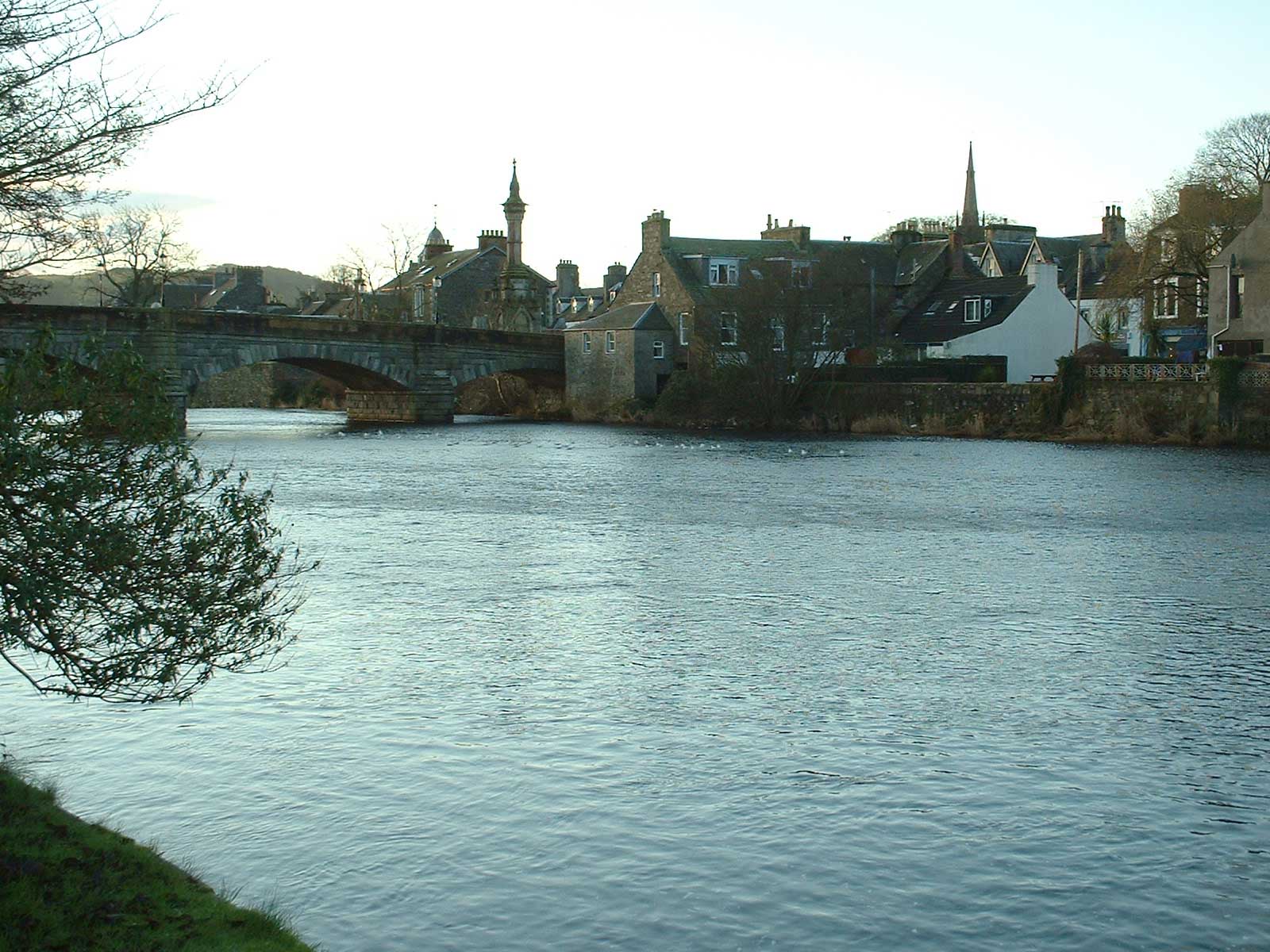
Newton Stewart ( Gd: ''Baile Ùr nan Stiùbhartach'') is a former burgh town in the historical county of Wigtownshire in Dumfries and Galloway, southwest Scotland. The town is on the River Cree with most of the town to the west of the river, and is sometimes referred to as the "Gateway to the Galloway Hills". The main local industries are agriculture, forestry and tourism. The town hosts a local market, and a number of services to support the farming industry. There are many mountain biking trails in the area. Newton Stewart lies on the southern edge of the Galloway Forest Park, which supplies many jobs to the town. Newton Stewart is from Scotland's book town Wigtown. History The town was founded in the mid 17th century by William Stewart, fourth and youngest son of the 2nd Earl of Galloway. The "New Town of Stewart" was granted burgh status by charter from King Charles II, allowing a weekly market and two annual fairs to be held. It was on a pilgrimage to the shrine of St N ... [...More Info...] [...Related Items...] OR: [Wikipedia] [Google] [Baidu] |
List Of Civil Parishes In Scotland
This is a list of the 871 civil parishes in Scotland. *The 871 parishes are listed here Context From 1845 to 1930, parishes formed part of the local government system of Scotland: having parochial boards from 1845 to 1894, and parish councils from 1894 until 1930. The parishes, which had their origins in the ecclesiastical parishes of the Church of Scotland, often overlapped county boundaries, largely because they reflected earlier territorial divisions. In the early 1860s, many parishes which were physically detached from their county were re-allocated to the county by which they were surrounded; some border parishes were transferred to neighbouring counties. This affects the indexing of such things as birth, marriage, and death registrations and other records indexed by county. In 1891, there were further substantial changes to the areas of many parishes, as the boundary commission appointed under the Local Government (Scotland) Act 1889 eliminated many anomalies, and a ... [...More Info...] [...Related Items...] OR: [Wikipedia] [Google] [Baidu] |
Newton Stewart Railway Station
Newton Stewart railway station served the town of Newton Stewart, Dumfries and Galloway, Scotland from 1861 to 1965 on the Portpatrick and Wigtownshire Joint Railway. History The station opened on 12 March 1861 and was situated by the Portpatrick and Wigtownshire Joint Railway The Portpatrick and Wigtownshire Joint RailwaysThe final word is in the plural. was a network of railway lines serving sparsely populated areas of south-west Scotland. The title appeared in 1885 when the previously independent Portpatrick Rai ... with the goods yard, a structure which still survives today, to the north. A locomotive shed to the west of the junction was built in 1920. The station was closed to both passengers and goods traffic on 14 June 1965. References External links Disused railway stations in Dumfries and Galloway Former Portpatrick and Wigtownshire Joint Railway stations Railway stations in Great Britain opened in 1861 Railway stations in Great Britain closed i ... [...More Info...] [...Related Items...] OR: [Wikipedia] [Google] [Baidu] |
River Cree
The River Cree is a river in Dumfries and Galloway, Scotland which runs through Newton Stewart and into the Solway Firth. It forms part of the boundary between the counties of Wigtownshire and Kirkcudbrightshire. The tributaries of the Cree are the Minnoch, Trool, Penkiln and Palnure which drain from the Range of the Awful Hand, the labyrinthine range of mountains and lochs, bogs, burns and crags, rising at its highest to The Merrick, Galloway ( above sea level), north and visible from Newton Stewart. The River Cree provided a route from the coast into the forested hinterland. Then it became the boundary between communities living on either side, dividing the County, or Shire, of Wigtownshire from the Stewartry of Kirkcudbright. It also divides the parish of Penninghame from the parish of Minnigaff and the town of Newton Stewart from the villages of Creebridge and Minnigaff, thus identifying a variety of administrative entities. There were very few bridges until the 18th ce ... [...More Info...] [...Related Items...] OR: [Wikipedia] [Google] [Baidu] |
River Bladnoch
The Bladnoch is a river in Wigtownshire in the Machars of Galloway in southwest Scotland. One of the earliest descriptions of it is given by Sir Andrew Agnew of Lochnaw and Sir David Dunbar in an appendix to Andrew Symson's work "A Large Description of Galloway" written in the 17th century. In this they state that: Course The river Bladnoch rises at Loch Maberry in the parish of Kirkcowan, through which it runs south to Polbae. On its journey south it is joined by Reoch Burn as it passes through Carseriggan Moor. Continuing its journey it passes Isle-na-Gower and becomes a border between the afforested land at Hopeless Howe and the Ring of Barfad. Shortly after this it is met and joined by Black Burn. At this point the river is bordered on its east side by Barnley Plantation. Crossing the river at the stepping stones is a single-track road which links Mark of Shennanton with Little Eldrig. Shortly after this point the river widens briefly at Broad Wheel. Continuing on its journey ... [...More Info...] [...Related Items...] OR: [Wikipedia] [Google] [Baidu] |
Wigtownshire
Wigtownshire or the County of Wigtown (, ) is one of the historic counties of Scotland, covering an area in the south-west of the country. Until 1975, Wigtownshire was an administrative county used for local government. Since 1975 the area has formed part of Dumfries and Galloway for local government purposes. Wigtownshire continues to be used as a territory for land registration, being a registration county. The historic county is all within the slightly larger Wigtown Area, which is one of the lieutenancy areas of Scotland and was used in local government as the Wigtown District from 1975 to 1996. Wigtownshire forms the western part of the medieval lordship of Galloway, which retained a degree of autonomy until it was fully absorbed by Scotland in the 13th century. In 1369, the part of Galloway east of the River Cree was placed under the control of a steward and so became known as the Stewartry of Kirkcudbright. The rest of Galloway remained under the authority of a sheriff, an ... [...More Info...] [...Related Items...] OR: [Wikipedia] [Google] [Baidu] |
Alan Lennox-Boyd, 1st Viscount Boyd Of Merton
Alan Tindal Lennox-Boyd, 1st Viscount Boyd of Merton, CH, PC, DL (18 November 1904 – 8 March 1983), was a British Conservative politician. Background, education and military service Lennox-Boyd was the son of Alan Walter Lennox-Boyd by his second wife Florence Annie, daughter of James Warburton Begbie and Anna Maria née Reid. He had an elder half-sister and three full brothers, two of whom were killed in the Second World War and one who died in Germany in April 1939. He was educated at Sherborne School, Dorset, and graduated from Christ Church, Oxford, with a BA later promoted to MA. In the Second World War he saw active service as a lieutenant in the Royal Naval Volunteer Reserve with Coastal Forces. Political career Lennox-Boyd was elected as Member of Parliament (MP) for Mid Bedfordshire in 1931 (at the age of 26), and was admitted to Inner Temple, as a barrister in 1941. He was a member of Winston Churchill's peacetime government as Minister for Transport and Civil ... [...More Info...] [...Related Items...] OR: [Wikipedia] [Google] [Baidu] |
Barons In Scotland
In Scotland, a baron or baroness is the head of a feudal barony, also known as a prescriptive barony. This used to be attached to a particular piece of land on which was situated the ''caput'' (Latin for "head") or essence of the barony, normally a building, such as a castle or manor house. Accordingly, the owner of the piece of land containing the ''caput'' was called a baron or baroness. According to Grant, there were around 350 identifiable local baronies in Scotland by the early fifteenth century and these could mostly be mapped against local parish boundaries. The term baron was in general use from the thirteenth century to describe what would have been known in England as a knight of the shire.Alexander Grant, "Franchises North of the Border: Baronies and Regalities in Medieval Scotland", Chapter 9, Michael Prestwich. ed., ''Liberties and Identities in Medieval Britain and Ireland'' (Boydell Press: Woodbridge, 2008) The 1896 edition of ''Green's Encyclopaedia of the Law of ... [...More Info...] [...Related Items...] OR: [Wikipedia] [Google] [Baidu] |
Old Public House, Clachan Of Penninghame, Dumfries & Galloway
Old or OLD may refer to: Places *Old, Baranya, Hungary *Old, Northamptonshire, England *Old Street station, a railway and tube station in London (station code OLD) *OLD, IATA code for Old Town Municipal Airport and Seaplane Base, Old Town, Maine, United States People *Old (surname) Music *OLD (band), a grindcore/industrial metal group * ''Old'' (Danny Brown album), a 2013 album by Danny Brown * ''Old'' (Starflyer 59 album), a 2003 album by Starflyer 59 * "Old" (song), a 1995 song by Machine Head *''Old LP'', a 2019 album by That Dog Other uses * ''Old'' (film), a 2021 American thriller film *''Oxford Latin Dictionary'' *Online dating *Over-Locknut Distance (or Dimension), a measurement of a bicycle wheel and frame *Old age See also *List of people known as the Old * * *Olde, a list of people with the surname *Olds (other) Olds may refer to: People * The olds, a jocular and irreverent online nickname for older adults * Bert Olds (1891–1953), Australian rules ... [...More Info...] [...Related Items...] OR: [Wikipedia] [Google] [Baidu] |
Robert Wodrow
Robert Wodrow (167921 March 1734) was a Scottish minister and historian, known as a chronicler and defender of the Covenanters. Robert Wodrow was born at Glasgow, where his father, James Wodrow, was a professor of divinity. Robert was educated at the university and was librarian from 1697 to 1701. From 1703 till his death, he was parish minister at Eastwood, near Glasgow. He had sixteen children, his son Patrick being the "auld Wodrow" of Burns's poem Twa Herds. Biography Robert Wodrow was the youngest son of James Wodrow, Professor of Divinity, at the University of Glasgow. He was born in the Trongate there, April (or September) 1679. At the very hour of his birth, soldiers under warrant of the Privy Council, were searching the house to seize his father, but the latter, having exchanged clothes with the physician's man-servant, succeeded in escaping. Wodrow entered the University of Glasgow in 1691, and graduated with an M.A. on 18 January 1697. He served as chaplain in th ... [...More Info...] [...Related Items...] OR: [Wikipedia] [Google] [Baidu] |
Clachan Of Penninghame And The Old Cemetery, Dumfries & Galloway
A clachan ( ga, clochán or ; gd, clachan ; gv, claghan ) is a small settlement or hamlet on the island of Ireland, the Isle of Man and Scotland. Though many were originally kirktowns,MacBain, A. (1911) ''An Etymological Dictionary of the Gaelic Language'' Stirling Eneas MacKay, 1982 edition by Gairm today they are often thought of as small villages lacking a church, post office, or other formal building. It is likely that many date to medieval times or earlier – a cluster of small single-storey cottages of farmers and/or fishermen, invariably found on poorer land. They were often related to the rundale system of farming. According to David Lloyd, the Great Famine in Ireland (1845–49) caused such disruption to the social system that the clachans there virtually disappeared; many in the Scottish Highlands were victims of the Clearances. In some cases, they have evolved into holiday villages, or one or two houses have taken over, turning smaller houses into agricultural o ... [...More Info...] [...Related Items...] OR: [Wikipedia] [Google] [Baidu] |


