|
Peake, South Australia
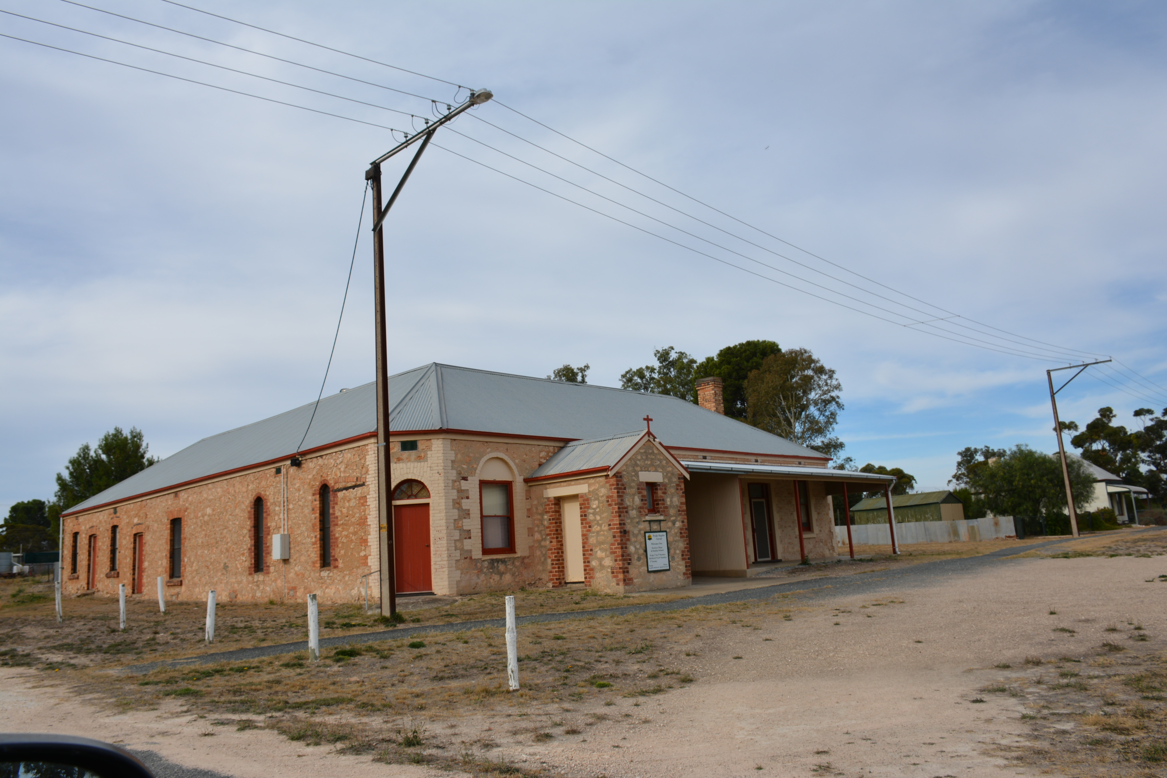
Peake is a town and locality in the Australian state of South Australia situated along the Mallee Highway (B12), approximately east of the state capital of Adelaide. At the , Peake had a population of 117. History The town of Peake was proclaimed on 8 August 1907. It was surveyed during May 1907 and its name is derived from the cadastral unit of the Hundred of Peake which itself is derived from Archibald Henry Peake, a South Australian politician who served three terms as the Premier of South Australia. Along one of the major railway lines of the time, many settlers and travelers passed along the route. The town of Peak was the seat for the District Council of Peake which was established on 16 November 1911. In 1997, the district council was amalgamated with the District Council of Coonalpyn Downs and the District Council of Meningie to form the Coorong District Council. Boundaries for the locality of Peake were created on 24 August 2000. Peake Historical Walk A walk e ... [...More Info...] [...Related Items...] OR: [Wikipedia] [Google] [Baidu] |
Coorong District Council
Coorong District Council is a local government area in South Australia located between the River Murray and the Limestone Coast region. The district cover mostly rural areas with small townships, as well as part of the Coorong National Park. The council was formed in May 1997 with the amalgamation of the District Council of Coonalpyn Downs, the District Council of Meningie and the District Council of Peake. It is geographically the largest council area in South Australia. The economy of the district is based mostly around agriculture. The council seat is at Tailem Bend; the council also operates service centres in Meningie and Tintinara. The council opened a new civic centre at Tailem Bend on 27 October 2014. This centre is located on Railway Tce and is joined to the Tailem Bend Town Hall. Economy Agriculture is prominent in the district, with grain crops the predominant land use. Due to improvement of grain crops in the area, district grain storage near Tailem Bend no ... [...More Info...] [...Related Items...] OR: [Wikipedia] [Google] [Baidu] |
Mallee Highway
Mallee Highway (formerly Ouyen Highway in Victoria) is a highway in south-eastern South Australia and north-western Victoria, Australia, Victoria, running mostly across the Mallee plains. It forms part of the shortest route between Adelaide, South Australia, Adelaide and Sydney, New South Wales, Sydney. Route Mallee Highway begins at the intersection with Dukes Highway just south-east of Tailem Bend, South Australia, Tailem Bend in South Australia and runs east as a dual-lane, single-carriageway road, through cereal-growing farmland at the southern end of the Murray Mallee to Pinnaroo, South Australia, Pinnaroo near the border with Victoria, where it crosses the Ngarkat Highway, Ngarkat and Browns Well Highways. It continues east into Victoria through Ouyen, Victoria, Ouyen, where it crosses the Calder Highway, via Manangatang, Victoria, Manangatang and eventually to Piangil, Victoria, Piangil, where it meets with the Murray Valley Highway, then along Tooleybuc Road two kilometre ... [...More Info...] [...Related Items...] OR: [Wikipedia] [Google] [Baidu] |
Baptist Union Of Australia
Australian Baptist Ministries (formerly Baptist Union of Australia) is the oldest and largest national cooperative body of Baptists in Australia. The Baptist Union of Australia was inaugurated on 24 August 1926 at the Burton Street Church in Sydney. It is affiliated with the Baptist World Alliance. History Baptist work in Australia began in Sydney in 1831, forty-three years after the British penal colony was established. The first preacher was John McKaeg, who conducted the first Baptist service on Sunday 24 April in ''The Rose and Crown Inn'' on the corner of Castlereagh and King Streets. The first baptism, of two female congregants, was conducted by McKaeg in Woolloomooloo Bay on 12 August 1832. It was not until 1835 that the first church was established in Hobart Town by Henry Dowling, a strict Calvinist. John Saunders, who had been sent by the Baptist Missionary Society of England to Sydney in 1834, raised the funding to erect a second church which was opened on 23 S ... [...More Info...] [...Related Items...] OR: [Wikipedia] [Google] [Baidu] |
Baptist Church At Peake
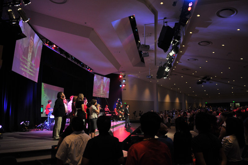
Baptists form a major branch of Protestantism distinguished by baptizing professing Christian believers only (believer's baptism), and doing so by complete immersion. Baptist churches also generally subscribe to the doctrines of soul competency (the responsibility and accountability of every person before God), ''sola fide'' (salvation by just faith alone), ''sola scriptura'' (scripture alone as the rule of faith and practice) and congregationalist church government. Baptists generally recognize two ordinances: baptism and communion. Diverse from their beginning, those identifying as Baptists today differ widely from one another in what they believe, how they worship, their attitudes toward other Christians, and their understanding of what is important in Christian discipleship. For example, Baptist theology may include Arminian or Calvinist beliefs with various sub-groups holding different or competing positions, while others allow for diversity in this matter within thei ... [...More Info...] [...Related Items...] OR: [Wikipedia] [Google] [Baidu] |
District Council Of Meningie
The District Council of Meningie was a local government area in the colony and then the Australian state of South Australia that existed from 1888 to 1997 on land in the state’s south-east. It was proclaimed on 5 January 1888 under the ''District Councils Act 1887'' with its seat being located in the town of Meningie. At establishment, it consisted of land in the hundreds of Baker, Bonney, Burdett, Coolinong, Glyde, Malcolm and Neville, Santo and Seymour and the part of the County of Cardwell located to the west of the hundreds of Glyde, Neville, and Santo. In 1936, it covered an area of and had an estimated population of 2,100 people of which 575 were ratepayer Rates are a type of property tax system in the United Kingdom, and in places with systems deriving from the British one, the proceeds of which are used to fund local government. Some other countries have taxes with a more or less comparable role ...s. On 13 February 1997, it and the distri ... [...More Info...] [...Related Items...] OR: [Wikipedia] [Google] [Baidu] |
District Council Of Coonalpyn Downs
The District Council of Coonalpyn Downs was a local government area in the Australian state of South Australia that existed from 1957 to 1997 on land in the state’s south-east. It was established on 30 May 1957 with its seat being located in the town of Coonalpyn. At establishment, the district consisted of land in the hundreds of Jeffries, Strawbridge, Coneybeer, Lewis, Field, Colebatch, Richards and Coombe and parts of the hundreds of Archibald, Carcuma and Kirkpatrick. The district therefore included parts of the cadastral counties of Buccleuch, Russell, Cardwell and Buckingham. At establishment, councillors were elected from the following five wards with all returning two councillors each with the exception of Yumali which returned one councillor – Coonalpyn, Mclntosh, Richards, Tintinara and Yumali. On 13 February 1997, it was amalgamated with the district councils of Meningie and Peake to create the Coorong District Council Coorong District Counc ... [...More Info...] [...Related Items...] OR: [Wikipedia] [Google] [Baidu] |
The Mount Barker Courier And Onkaparinga And Gumeracha Advertiser
''The Courier'' is a weekly newspaper published in Mount Barker, South Australia. For much of its existence its full title was ''The Mount Barker Courier and Onkaparinga and Gumeracha Advertiser'', later shortened to ''The Mount Barker Courier''. History The newspaper was founded as ''The Mount Barker Courier and Onkaparinga and Gumeracha Advertiser'' on 1 October 1880, price 3d. (3 pence) for 4 pages. Charles M. R. Dumas was sole proprietor, and its offices were on Gawler Street, Mount Barker. Publication continued every Friday morning. In 1893 tentative moves were made to introduce an alternative title ''Mount Barker Courier and Southern Advertiser'', but somehow the "less cumbrous title" never made it to the front page. The newspaper later absorbed another publication, printed by Lancelot Ramsay Thomson, the ''Mannum Mercury and Farmer's Journal'' (30 March 1912 - 2 March 1917). Dumas, who was for four years Member for Mount Barker, died on 19 February 1935, and his family ... [...More Info...] [...Related Items...] OR: [Wikipedia] [Google] [Baidu] |
District Council Of Peake
The District Council of Peake was a local government area in the Australian state of South Australia that existed from 1911 to 1997 on land in the state’s south-east. It was proclaimed on 16 November 1911 with its seat being located in the town of Peake. At establishment, it consisted of the whole of the hundreds of Peake, Sherlock, Roby and Livingston. At establishment, the district consisted of four wards whose names and boundaries were identical to the consistent hundreds and which were represented by two councillors each with the exception of Livingston Ward which were represented by one councillor. On 13 February 1997, it was amalgamated with the district councils of Coonalpyn Downs and Meningie to create the Coorong District Council Coorong District Council is a local government area in South Australia located between the River Murray and the Limestone Coast region. The district cover mostly rural areas with small townships, as well as part of the Cooro ... [...More Info...] [...Related Items...] OR: [Wikipedia] [Google] [Baidu] |
Premier Of South Australia
The premier of South Australia is the head of government in the state of South Australia, Australia. The Government of South Australia follows the Westminster system, with a Parliament of South Australia acting as the legislature. The premier is appointed by the Governor of South Australia, and by modern convention holds office by virtue of his or her ability to command the support of a majority of members of the lower house of Parliament, the House of Assembly. Peter Malinauskas is the current premier, having served since 21 March 2022. History The office of premier of South Australia was established upon the commencement of responsible government with the passage of the ''Constitution Act 1856''. The role was based upon that of the Prime Minister of the United Kingdom, with the premier requiring the support of a majority of the members of the lower house to remain head of government. No parties or solid groupings would be formed until after the 1890 election, which resul ... [...More Info...] [...Related Items...] OR: [Wikipedia] [Google] [Baidu] |
Archibald Henry Peake
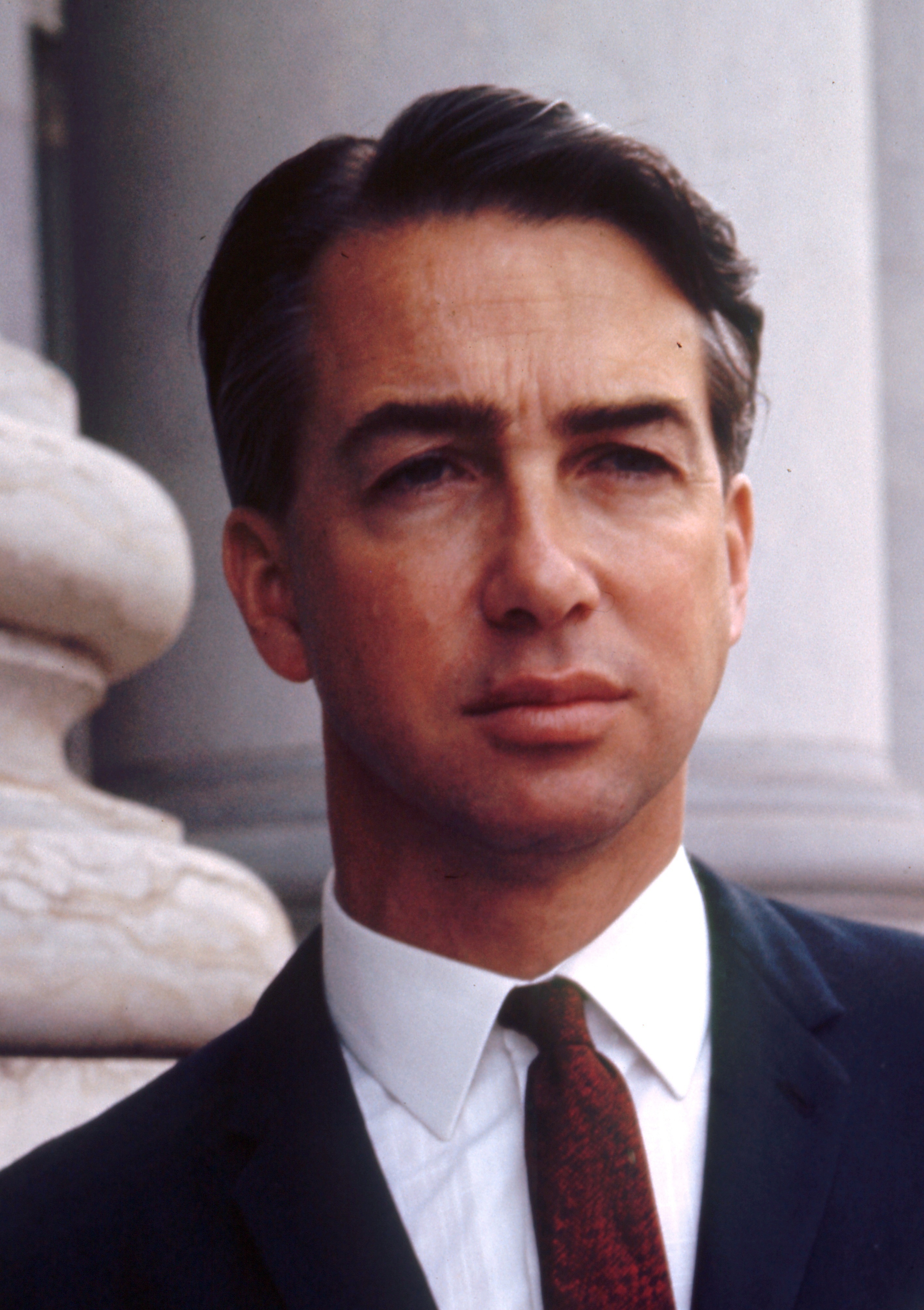
Archibald Henry Peake (15 January 1859 – 6 April 1920) was an Australian politician. He was Premier of South Australia on three occasions: from 1909 to 1910 for the Liberal and Democratic Union, and from 1912 to 1915 and 1917 to 1920 for its successor, the Liberal Union. He had also been Treasurer and Attorney-General in the Price-Peake coalition government from 1905 to 1909. Early life and career Peake's family migrated from Chelsea, London in 1862, initially settled in Victoria, before moving to South Australia two years later. Peake was educated at state schools under his father, but in later life widened his education by studying in English history and literature. He entered the service of the District Council of Naracoorte, became district clerk in 1878. In 1893 he contested Albert in an election for the House of Assembly and was beaten by 50 votes, but four years later won the seat by two votes. He resigned his position as district clerk when he entered politics, and ... [...More Info...] [...Related Items...] OR: [Wikipedia] [Google] [Baidu] |
Hundred Of Peake
The County of Buccleuch is one of the Lands administrative divisions of South Australia, 49 cadastral counties of South Australia. It was proclaimed in 1893 and named for the sixth Duke of Buccleuch, William Montagu Douglas Scott, 6th Duke of Buccleuch, William Scott, of Scotland. It is located east of the Murray River at the south western edge of the Mallee (Victoria), Mallee region. The small locality of Buccleuch, South Australia, Buccleuch and its railway station are located at the centre of the county. Hundreds The County of Buccleuch is divided into the following 17 hundred (county subdivision), hundreds: * Hundred of Bowhill (Bowhill, South Australia, Bowhill) * Hundred of Vincent (Perponda, South Australia, Perponda) * Hundred of Wilson (Borrika, South Australia, Borrika) * Hundred of McPherson (Halidon, South Australia, Halidon, Sandalwood, South Australia, Sandalwood) * Hundred of Hooper (Wynarka, South Australia, Wynarka) * Hundred of Marmon Jabuk (Karoonda, South A ... [...More Info...] [...Related Items...] OR: [Wikipedia] [Google] [Baidu] |
Adelaide City Centre
Adelaide city centre (Kaurna: Tarndanya) is the inner city locality of Greater Adelaide, the capital city of South Australia. It is known by locals simply as "the City" or "Town" to distinguish it from Greater Adelaide and from the City of Adelaide local government area (which also includes North Adelaide and from the Park Lands around the whole city centre). The population was 15,115 in the . Adelaide city centre was planned in 1837 on a greenfield site following a grid layout, with streets running at right angles to each other. It covers an area of and is surrounded by of park lands.The area of the park lands quoted is based, in the absence of an official boundary between the City and North Adelaide, on an east–west line past the front entrance of Adelaide Oval. Within the city are five parks: Victoria Square in the exact centre and four other, smaller parks. Names for elements of the city centre are as follows: *The "city square mile" (in reality 1.67 square miles ... [...More Info...] [...Related Items...] OR: [Wikipedia] [Google] [Baidu] |


