|
Paulsen Peak
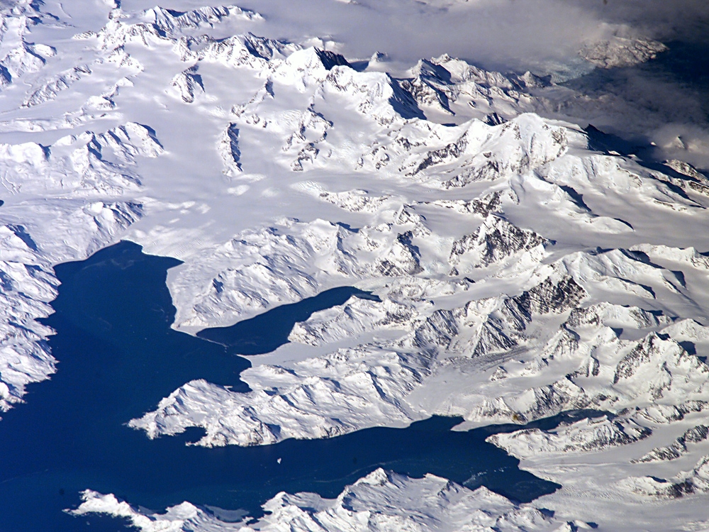
Paulsen Peak () is a rock peak, 1,875 m, standing near the head of Lyell Glacier, 2 miles (3.2 km) northwest of Mount Sugartop in the Allardyce Range of South Georgia. Named by the United Kingdom Antarctic Place-Names Committee The UK Antarctic Place-Names Committee (or UK-APC) is a United Kingdom government committee, part of the Foreign and Commonwealth Office, responsible for recommending names of geographical locations within the British Antarctic Territory (BAT) and ... (UK-APC), following mapping by the SGS, 1951–52, for Harald B. Paulsen (1898–1951), a leading figure in the Norwegian whaling industry. Mountains and hills of South Georgia {{SouthGeorgia-geo-stub ... [...More Info...] [...Related Items...] OR: [Wikipedia] [Google] [Baidu] |
Pyramidal Peak
A pyramidal peak, sometimes called a glacial horn in extreme cases, is an angular, sharply pointed mountain peak which results from the cirque erosion due to multiple glaciers diverging from a central point. Pyramidal peaks are often examples of nunataks. Formation Glaciers, typically forming in drainages on the sides of a mountain, develop bowl-shaped basins called cirques (sometimes called ‘corries’ - from Scottish Gaelic ʰəɾə(a bowl) - or s). Cirque glaciers have rotational sliding that abrades the floor of the basin more than walls and that causes the bowl shape to form. As cirques are formed by glaciation in an alpine environment, the headwall and ridges between parallel glaciers called arêtes become more steep and defined. This occurs due to freeze/thaw and mass wasting beneath the ice surface. It is widely held that a common cause for headwall steepening and extension headward is the crevasses known as bergschrund that occur between the moving ice and the he ... [...More Info...] [...Related Items...] OR: [Wikipedia] [Google] [Baidu] |
Lyell Glacier, South Georgia
Lyell Glacier () is a glacier flowing in a northerly direction to Harpon Bay at the southeast head of Cumberland West Bay, South Georgia. It was mapped by the Swedish Antarctic Expedition, 1901–04, under Otto Nordenskjöld, who named it for Sir Charles Lyell, an eminent British geologist. See also * List of glaciers in the Antarctic * Glaciology Glaciology (; ) is the scientific study of glaciers, or more generally ice and natural phenomena that involve ice. Glaciology is an interdisciplinary Earth science that integrates geophysics, geology, physical geography, geomorphology, c ... References Glaciers of South Georgia {{SouthGeorgia-glacier-stub ... [...More Info...] [...Related Items...] OR: [Wikipedia] [Google] [Baidu] |
Mount Sugartop
Mount Sugartop () is a prominent, partly snow-covered mountain, 2,325 m, standing 5 miles (8 km) northwest of Mount Paget in the Allardyce Range of South Georgia. The name "Sugarloaf Peak" has appeared on maps for this feature for many years, but the South Georgia Survey The South Georgia Survey was a series of expeditions to survey and map the island of South Georgia, led by Duncan Carse between 1951 and 1957. Although South Georgia had been commercially exploited as a whaling station during the first half of t ..., following its 1951-52 surveying expedition, reported that the name Mount Sugartop is well established locally for this mountain. This latter name is approved on the basis of local usage. Mountains and hills of South Georgia {{SouthGeorgia-geo-stub ... [...More Info...] [...Related Items...] OR: [Wikipedia] [Google] [Baidu] |
Allardyce Range
The Allardyce Range ( es, Cordillera de San Telmo) is a mountain range rising south of Cumberland Bay and dominating the central part of South Georgia, a UK overseas territory. It extends for from Mount Globus in the northwest to Mount Brooker in the southeast, with peaks of and including Mount Paget () the highest peak of the range and also the highest point in the UK territory. Other peaks of the range include Mount Roots. Although not shown on the charts of South Georgia by Cook in 1775 or Bellingshausen in 1819, peaks of this range were doubtless seen by those explorers. The range was named c. 1915 after Sir William Lamond Allardyce (1861–1930), Governor of the Falkland Islands The Falkland Islands (; es, Islas Malvinas, link=no ) is an archipelago in the South Atlantic Ocean on the Patagonian Shelf. The principal islands are about east of South America's southern Patagonian coast and about from Cape Dubouze ... and Dependencies, 1904–14. See also * N ... [...More Info...] [...Related Items...] OR: [Wikipedia] [Google] [Baidu] |


