|
Patrol Squadron 4 (United States Navy)
Patrol Squadron Four (VP-4) is a U.S. Navy land-based patrol squadron based at the Naval Air Station Whidbey Island, Oak Harbor, Washington, which is tasked to undertake maritime patrol, anti-submarine warfare (ASW), and intelligence, surveillance and reconnaissance (ISR) missions flying the Boeing P-8 Poseidon. The squadron was originally established as Bombing Squadron 144 (VB-144) on 1 July 1943, redesignated Patrol Bombing Squadron 144 (VPB-144) on 1 October 1944, redesignated Patrol Squadron 144 (VP-144) on 15 May 1946, redesignated Medium Patrol Squadron (Landplane) 4 (VP-ML-4) on 15 November 1946 and redesignated Patrol Squadron FOUR (VP-4) on 1 September 1948. It is the second squadron to be designated VP-4, the first VP-4 was redesignated VP-22 on 1 July 1939. History VB-144 was established at NAS Alameda, California on 1 July 1943, as a squadron flying the PV-1 Ventura, by 14 August The squadron completed training and boarded for transport to NAS Kaneohe Bay, Hawaii. ... [...More Info...] [...Related Items...] OR: [Wikipedia] [Google] [Baidu] |
United States Department Of The Navy Seal
United may refer to: Places * United, Pennsylvania, an unincorporated community * United, West Virginia, an unincorporated community Arts and entertainment Films * ''United'' (2003 film), a Norwegian film * ''United'' (2011 film), a BBC Two film Literature * ''United!'' (novel), a 1973 children's novel by Michael Hardcastle Music * United (band), Japanese thrash metal band formed in 1981 Albums * ''United'' (Commodores album), 1986 * ''United'' (Dream Evil album), 2006 * ''United'' (Marvin Gaye and Tammi Terrell album), 1967 * ''United'' (Marian Gold album), 1996 * ''United'' (Phoenix album), 2000 * ''United'' (Woody Shaw album), 1981 Songs * "United" (Judas Priest song), 1980 * "United" (Prince Ital Joe and Marky Mark song), 1994 * "United" (Robbie Williams song), 2000 * "United", a song by Danish duo Nik & Jay featuring Lisa Rowe Television * ''United'' (TV series), a 1990 BBC Two documentary series * ''United!'', a soap opera that aired on BBC One from 1965-19 ... [...More Info...] [...Related Items...] OR: [Wikipedia] [Google] [Baidu] |
NAS Kaneohe Bay
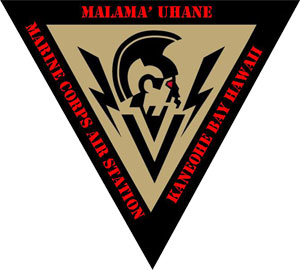
Marine Corps Air Station Kaneohe Bay or MCAS Kaneohe Bay is a United States Marine Corps (USMC) airfield located within the Marine Corps Base Hawaii complex, formerly known as Marine Corps Air Facility (MCAF) Kaneohe Bay or Naval Air Station (NAS) Kaneohe Bay. Most of the original contract work at Kaneohe had been completed when the Navy transferred what was undone to the Seabees of the 56th Naval Construction Battalion on 1 April 1943. The 112th CB was tasked with adding a second runway 400' x 5,000' to the airfield. That was completed by the men of the 74th CB. December 7, 1941, the Imperial Japanese Navy attacked the air station minutes prior to the attack on Pearl Harbor. Of the 36 Catalinas stationed here, 27 were destroyed and six others were damaged, along with 18 sailors who perished in the attack. The first Japanese aircraft destroyed in action were shot down at Kaneohe, along with Aviation Ordnanceman Chief Petty Officer John William Finn becoming one of the first Med ... [...More Info...] [...Related Items...] OR: [Wikipedia] [Google] [Baidu] |
Johnston Atoll
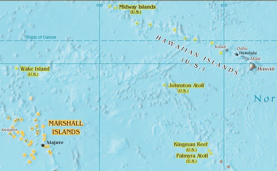
Johnston Atoll is an Unincorporated territories of the United States, unincorporated territory of the United States, currently administered by the United States Fish and Wildlife Service (USFWS). Johnston Atoll is a National Wildlife Refuge and part of the Pacific Remote Islands Marine National Monument. It is closed to public entry, and limited access for management needs is only granted by Letter of Authorization from the United States Air Force and a Special Use Permit from the U.S. Fish and Wildlife Service. For nearly 70 years, the isolated atoll was under the control of the United States Armed Forces, U.S. military. During that time, it was variously used as a naval refueling depot, an Johnston Island Air Force Base, airbase, a testing site for nuclear and biological weapons, a secret missile base, and a site for the storage and disposal of chemical weapons and Agent Orange. Those activities left the area environmentally contaminated, and monitoring continues. The island i ... [...More Info...] [...Related Items...] OR: [Wikipedia] [Google] [Baidu] |
Enewetak Atoll
Enewetak Atoll (; also spelled Eniwetok Atoll or sometimes Eniewetok; mh, Ānewetak, , or , ; known to the Japanese as Brown Atoll or Brown Island; ja, ブラウン環礁) is a large coral atoll of 40 islands in the Pacific Ocean and with its 664 people (as of 2011) forms a legislative district of the Ralik Chain of the Marshall Islands. With a land area total less than , it is no higher than and surrounds a deep central lagoon, in circumference. It is the second-westernmost atoll of the Ralik Chain and is west from Bikini Atoll. It was held by the Japanese from 1914 until its capture by the United States in February 1944, during World War II, then became Naval Base Eniwetok. Nuclear testing by the US totaling the equivalent of over 30 megatons of TNT took place during the Cold War; in 1977–1980, a concrete dome (the Runit Dome) was built on Runit Island to deposit radioactive soil and debris. The Runit Dome is deteriorating and could be breached by a typhoon, though ... [...More Info...] [...Related Items...] OR: [Wikipedia] [Google] [Baidu] |
Midway Island
Midway Atoll (colloquial: Midway Islands; haw, Kauihelani, translation=the backbone of heaven; haw, Pihemanu, translation=the loud din of birds, label=none) is a atoll in the North Pacific Ocean. Midway Atoll is an insular area of the United States and is an unorganized and unincorporated territory. The largest island is Sand Island, which has housing and an airstrip. Immediately to the east of Sand Island across the narrow Brooks Channel is Eastern Island, which is uninhabited and no longer has any facilities. Forming a rough, incomplete circle around the two main islands and creating Midway Lagoon is Spit Island, a narrow reef. Roughly equidistant between North America and Asia, Midway is the only island in the Hawaiian Archipelago that is not part of the state of Hawaii. Unlike the other Hawaiian islands, Midway observes Samoa Time ( UTC−11:00, i.e., eleven hours behind Coordinated Universal Time), which is one hour behind the time in the Hawaii–Aleutian Time Zone ... [...More Info...] [...Related Items...] OR: [Wikipedia] [Google] [Baidu] |
Naval Base Pearl Harbor
A navy, naval force, or maritime force is the branch of a nation's armed forces principally designated for naval and amphibious warfare; namely, lake-borne, riverine, littoral, or ocean-borne combat operations and related functions. It includes anything conducted by surface ships, amphibious ships, submarines, and seaborne aviation, as well as ancillary support, communications, training, and other fields. The strategic offensive role of a navy is projection of force into areas beyond a country's shores (for example, to protect sea-lanes, deter or confront piracy, ferry troops, or attack other navies, ports, or shore installations). The strategic defensive purpose of a navy is to frustrate seaborne projection-of-force by enemies. The strategic task of the navy also may incorporate nuclear deterrence by use of submarine-launched ballistic missiles. Naval operations can be broadly divided between riverine and littoral applications (brown-water navy), open-ocean applications (blue ... [...More Info...] [...Related Items...] OR: [Wikipedia] [Google] [Baidu] |
Moffett Federal Airfield
Moffett Federal Airfield , also known as Moffett Field, is a joint civil-military airport located in an unincorporated part of Santa Clara County, California, United States, between northern Mountain View and northern Sunnyvale. On November 10, 2014, NASA announced that it would be leasing of the airfield property to Google for 60 years. The airport is near the south end of San Francisco Bay, northwest of San Jose. Formerly a US Navy facility, the former naval air station is now owned and operated by the NASA Ames Research Center. Tenant military activities include the 129th Rescue Wing of the California Air National Guard, operating the HC-130J Combat King II and HH-60G Pave Hawk aircraft, as well as the adjacent Headquarters for the 7th Psychological Operations Group of the US Army Reserve. Until 28 July 2010, the US Air Force's 21st Space Operations Squadron was also a tenant command at Moffett Field, occupying the former Onizuka Air Force Station. In addition to these m ... [...More Info...] [...Related Items...] OR: [Wikipedia] [Google] [Baidu] |
NAS Whidbey Island
Naval Air Station Whidbey Island (NASWI) is a naval air station of the United States Navy located on two pieces of land near Oak Harbor, on Whidbey Island, in Island County, Washington. The main portion of the base, Ault Field, is about three miles north of Oak Harbor. The other section, called the Seaplane Base for the PBY Catalina flying boats once based there, holds most of the island's Navy housing as well as the air station's main Navy Exchange and DeCA Commissary. The NASWI commanding officer also has command of a satellite airfield, Naval Outlying Landing Field (NOLF) Coupeville, on central Whidbey Island at , roughly nine miles south of Ault Field. Primarily used for Field Carrier Landing Practice (FCLP) by carrier-based jets, this field has no permanently assigned personnel. NASWI supports the MH-60S Seahawk helicopter and the EA-18G Growler, P-8 Poseidon, EP-3E ARIES, and C-40 Clipper fixed-wing aircraft. History 1940s On 17 January 1941, almost 11 months ... [...More Info...] [...Related Items...] OR: [Wikipedia] [Google] [Baidu] |
Jaluit Atoll
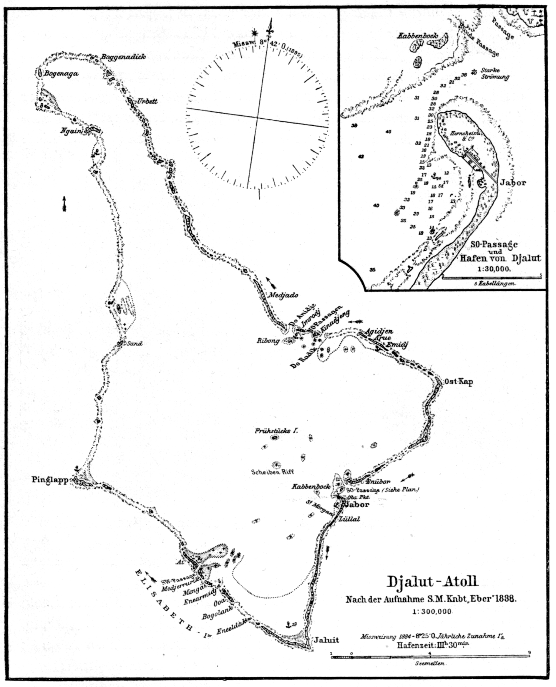
Jaluit Atoll ( Marshallese: , , or , ) is a large coral atoll of 91 islands in the Pacific Ocean and forms a legislative district of the Ralik Chain of the Marshall Islands. Its total land area is , and it encloses a lagoon with an area of . Most of the land area is on the largest islet ( motu) of Jaluit (10.4 km²). Jaluit is approximately southwest of Majuro. Jaluit Atoll is a designated conservation area and Ramsar Wetland. In 2011 the population of the islands of Jaluit Atoll was 1,788. It was the former administrative seat of the Marshall Islands. History The British merchant vessel '' Rolla'' sighted Jaluit in 1803. She had transported convicts from Britain to New South Wales and was on her way to China to find a cargo to take back to Britain. In 1884, the German Empire claimed Jaluit Atoll, along with the rest of the Marshall Islands, and the Germans established a trading outpost. Jaluit became a German protectorate on September 13, 1886 and had several imperial c ... [...More Info...] [...Related Items...] OR: [Wikipedia] [Google] [Baidu] |
Wotje Atoll
Wotje Atoll ( Marshallese: , ) is a coral atoll of 75 islands in the Pacific Ocean, and forms a legislative district of the Ratak Chain of the Marshall Islands. Geography Wotje's land area of is one of the largest in the Marshall Islands, and encloses a lagoon of . The atoll is oriented east and west and is at its longest point, and at its greatest width. , the population was nearly 1,000, which included about 200 teenagers who live on the island at the public boarding school, Northern Islands High School. In 2011, the resident population of the islands in atoll was 859. The Wotje Atoll includes a number of islets, including Wotje (the largest), Bodao, Enejeltalk, Ukon, Wetwirok, Kaiken, Wormej, Kimajo, Ninum, Kaben. About 125 people live on Wodmej, which is approximately 8 miles from the main island of Wotje. All other islands are uninhabited and are used only for copra production, picnics, and food gathering. History First recorded sighting by Europeans was by the Spanish exp ... [...More Info...] [...Related Items...] OR: [Wikipedia] [Google] [Baidu] |
Caroline Islands
The Caroline Islands (or the Carolines) are a widely scattered archipelago of tiny islands in the western Pacific Ocean, to the north of New Guinea. Politically, they are divided between the Federated States of Micronesia (FSM) in the central and eastern parts of the group, and Palau at the extreme western end. Historically, this area was also called ''Nuevas Filipinas'' or New Philippines, because they were part of the Spanish East Indies and were governed from Manila in the Philippines. The Carolines are scattered across a distance of approximately 3,540 kilometers (2,200 miles), from the westernmost island, Tobi (island), Tobi, in Palau, to the easternmost island, Kosrae, a Administrative divisions of the Federated States of Micronesia, state of the FSM. Description The group consists of about 500 small coral islands, east of the Philippines, in the Pacific Ocean. The distance from Yap (one of the larger Caroline islands) to Manila is . Most of the islands are made up of ... [...More Info...] [...Related Items...] OR: [Wikipedia] [Google] [Baidu] |
Marshall Islands
The Marshall Islands ( mh, Ṃajeḷ), officially the Republic of the Marshall Islands ( mh, Aolepān Aorōkin Ṃajeḷ),'' () is an independent island country and microstate near the Equator in the Pacific Ocean, slightly west of the International Date Line. Geographically, the country is part of the larger island group of Micronesia. The country's population of 58,413 people (at the 2018 World Bank Census) is spread out over five islands and 29 coral atolls, comprising 1,156 individual islands and islets. The capital and largest city is Majuro. It has the largest portion of its territory composed of water of any sovereign state, at 97.87%. The islands share maritime boundaries with Wake Island to the north, Kiribati to the southeast, Nauru to the south, and Federated States of Micronesia to the west. About 52.3% of Marshall Islanders (27,797 at the 2011 Census) live on Majuro. In 2016, 73.3% of the population were defined as being "urban". The UN also indicates a population d ... [...More Info...] [...Related Items...] OR: [Wikipedia] [Google] [Baidu] |


