|
Passo Dello Stelvio
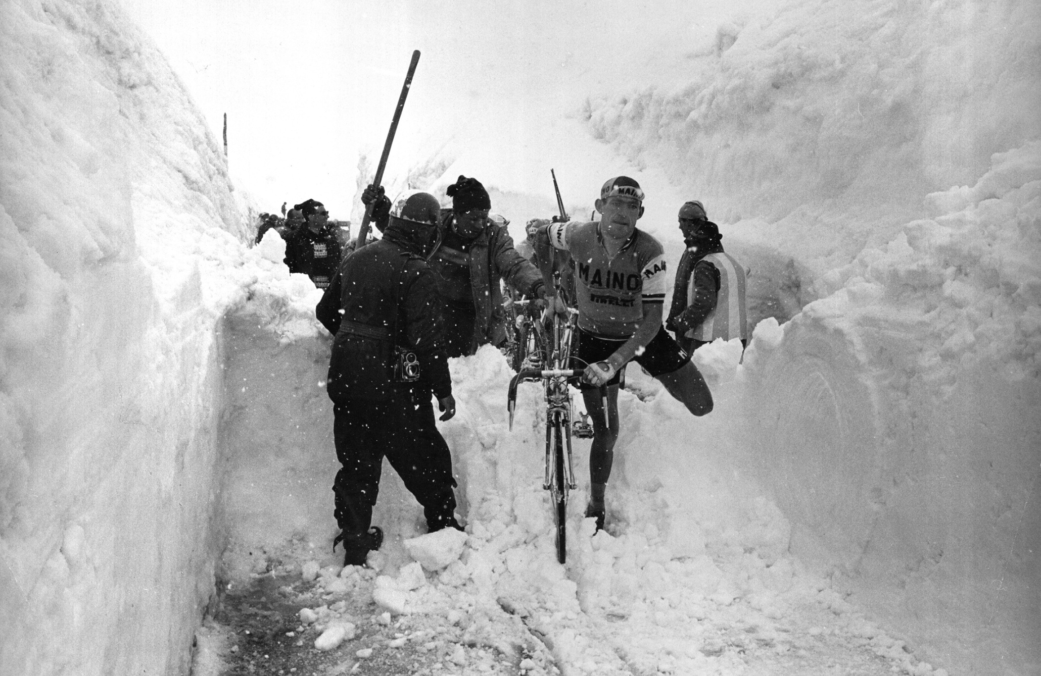
''Giogo dello Stèlvio''german: Stilfser Joch , photo = The_Stelvio_pass.jpg , photo_caption = Some of the 48 hairpin turns near the top of the eastern ramp of the Stelvio Pass , photo_alt = , map = Alps , map_caption = Location of Stelvio Pass in the Alps. , map_size = , label = Stelvio Pass , label_position = , elevation_m = 2757 , elevation_ref = , location = Border of South Tyroland Sondrio provinces,Italy , range = Eastern Alps , topo = , coords = , coordinates_ref = , traversed = Strada Statale 38 The Stelvio Pass ( it, Passo dello Stelvio , ''Giogo dello Stelvio'' ; german: Stilfser Joch; ) is a mountain pass in northern Italy bordering Switzerland at an elevation of above sea level. It is the highest paved mountain pass in the Eastern Alps, and the second highest in the Alps, below France's Col de l'Iseran (). Location The pass is located in the Ortler Alps in Italy between Stilfs ("Stelvio" in Italian) in South Tyrol and Bormio in the province of Sondrio. It is abou ... [...More Info...] [...Related Items...] OR: [Wikipedia] [Google] [Baidu] |
Hairpin Turn
A hairpin turn (also hairpin bend or hairpin corner) is a bend in a road with a very acute inner angle, making it necessary for an oncoming vehicle to turn about 180° to continue on the road. It is named for its resemblance to a bent metal hairpin. Such turns in ramps and trails may be called switchbacks in American English, by analogy with switchback railways. Description Hairpin turns are often built when a route climbs up or down a steep slope, so that it can travel mostly across the slope with only moderate steepness, and are often arrayed in a zigzag pattern. Highways with repeating hairpin turns allow easier, safer ascents and descents of mountainous terrain than a direct, steep climb and descent, at the price of greater distances of travel and usually lower speed limits, due to the sharpness of the turn. Highways of this style are also generally less costly to build and maintain than highways with tunnels. On occasion, the road may loop completely, using a tunnel or ... [...More Info...] [...Related Items...] OR: [Wikipedia] [Google] [Baidu] |
Bormio
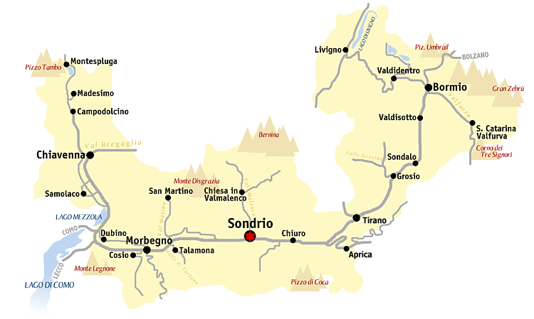
Bormio ( lmo, Bormi, rm, italic=yes, , german: Worms im Veltlintal) is a town and ''comune'' with a population of about 4,100 located in the Province of Sondrio, Lombardy region of the Alps in northern Italy. The centre of the upper Valtellina valley, it is a popular winter sports resort. It was the site of the Alpine World Ski Championships in 1985 and 2005, and annually hosts the Alpine Ski World Cup. In addition to modern skiing facilities, the town is noted for the presence of several hot springs that have been tapped to provide water to three thermal baths. Geography Bormio lies in the northeast of the Lombardy region at the top of the Valtellina, a broad glacial valley formed by the Adda River that flows down into Lake Como. It is linked to other valleys via four passes: * South Tyrol via the Stelvio Pass * Val Müstair via the Umbrail Pass * Livigno via the Foscagno Pass * Ponte di Legno via the Gavia Pass History Due to its thermal baths at ''Bagni Vecchi'', ' ... [...More Info...] [...Related Items...] OR: [Wikipedia] [Google] [Baidu] |
Ortler
Ortler (; it, Ortles ) is, at above sea level, the highest mountain in the Eastern Alps outside the Bernina Range. It is the main peak of the Ortler Range. It is the highest point of the Southern Limestone Alps, of South Tyrol in Italy, of Tyrol overall, and, until 1919, of the Austrian-Hungarian empire. In German the mountain is commonly referred to as "König Ortler" (King Ortler), like in the unofficial hymn of South Tyrol, the ''Bozner Bergsteigerlied''. Geography The massive mountain is capped by a glacier on the northwest flank and has a long north ridge that ends at the village of ''Gomagoi'' and separates the valleys of Trafoi and Sulden. The South ridge leads to the Hochjoch (3527 m) on the main ridge of the Ortler Alps that forms the border of the Province of Sondrio and South Tyrol. Going west on this main ridge are the Thurwieserspitze (3652) and Trafoier Wall (3565 m), while to the Southeast are the Monte Zebrù (3740 m) and the majestic Königspitze (3859 m). Fr ... [...More Info...] [...Related Items...] OR: [Wikipedia] [Google] [Baidu] |
Piz Cotschen (Ortler Alps)
Piz Cotschen, also named ''Rötlspitz'' or ''Punta Rosa'', is a mountain of the Ortler Alps, overlooking both the Umbrail and Stelvio Pass. Its summit is located within the Swiss canton of Graubünden, near the border with Italy Italy ( it, Italia ), officially the Italian Republic, ) or the Republic of Italy, is a country in Southern Europe. It is located in the middle of the Mediterranean Sea, and its territory largely coincides with the homonymous geographical re .... References External links Piz Cotschen on Hikr.org Ortler Alps Mountains of Graubünden Mountains of the Alps Alpine three-thousanders Mountains partially in Italy Mountains of Switzerland Val Müstair {{graubünden-mountain-stub ... [...More Info...] [...Related Items...] OR: [Wikipedia] [Google] [Baidu] |
Piz Umbrail
Piz Umbrail (3,033 m) is a mountain of the Ortler Alps, south of the Umbrail Pass (2,503 m), located on the border between Lombardy (Italy) and Graubünden (Switzerland). The mountain surface is partly of rubble and partly covered by grass, and therefore of little interest to mountaineers, but its proximity to the Umbrail Pass and accessible surface make it a popular destination for other visitors. In winter it is a relatively easy destination for ski-mountaineers. Normal route to the summit The route starts at the Umbrail pass, very close to the Swiss border check point. There is a lot of free parking space around. You will need up to 90 minutes from there to the summit. No special equipment is needed, there are a few fixed chains along the route but those are not exposed sections, good marking all the time, and orientation is not a problem. Access roads There are three roads to the Umbrail pass; two from the Italian and one from the Swiss side. From Italy you have a south r ... [...More Info...] [...Related Items...] OR: [Wikipedia] [Google] [Baidu] |
Thurwieserspitze
The Thurwieserspitze ( it, Punta Thurwieser; german: Thurwieserspitze) is a mountain in the Ortler Alps on the border between South Tyrol and the Province of Sondrio, Italy Italy ( it, Italia ), officially the Italian Republic, ) or the Republic of Italy, is a country in Southern Europe. It is located in the middle of the Mediterranean Sea, and its territory largely coincides with the homonymous geographical re .... References * Peter Holl: '' Alpenvereinsführer Ortleralpen'', 9. Auflage, München 2003, * ''Zeitschrift des Deutschen und Oesterreichischen Alpenvereins'', Band I, Seite 42, Wien 1869 * Wilhelm Hammer: ''Sammlung geologischer Führer'', Band 22, Gebrüder Borntraeger, Berlin 1922 * Casa Editrice Tabacco, Udine: Carta topografica 1:25.000, Blatt 08, ''Ortles-Cevedale/Ortlergebiet'' External links Mountains of the Alps Mountains of South Tyrol Alpine three-thousanders Ortler Alps {{Sondrio-mountain-stub ... [...More Info...] [...Related Items...] OR: [Wikipedia] [Google] [Baidu] |
Meran
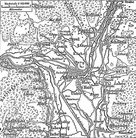
Merano (, , ) or Meran () is a city and ''comune'' in South Tyrol, northern Italy. Generally best known for its spa resorts, it is located within a basin, surrounded by mountains standing up to above sea level, at the entrance to the Passeier Valley and the Vinschgau. In the past, the city has been a popular place of residence for several scientists, literary people, and artists, including Franz Kafka, Ezra Pound, Paul Lazarsfeld, and also Empress Elisabeth of Austria, who appreciated its mild climate. Name Both the Italian () and the German () names for the city are used in English. The Ladin form of the name is . The official name of the municipality (''comune'') is ''Comune di Merano'' in Italian and ''Stadtgemeinde Meran'' in German (both are in official use). History In 17th-century Latin, the city was called ''Meranum''. Other archaic names are ''Mairania'' (from 857 AD) and ''an der Meran'' (from the 15th century). Origin The area has been inhabited since the thir ... [...More Info...] [...Related Items...] OR: [Wikipedia] [Google] [Baidu] |
Vinschgau
The Vinschgau, Vintschgau () or Vinschgau Valley ( it, Val Venosta ; rm, Vnuost ; lld, Val Venuesta; medieval toponym: ''Finsgowe'') is the upper part of the Adige or Etsch river valley, in the western part of the province of South Tyrol, Italy. Etymology The German name ''Vinschgau'', like Italian ''Val Venosta'', is derived from the Celtic (Rhaetian) Venostes tribes mentioned on the ancient Tropaeum Alpium. A Frankish '' Gau'' was established under Charlemagne in 772; it was first mentioned in a 1077 deed, when King Henry IV of Germany granted the estates of Schlanders ''in pago Finsgowe'' to Bishop Altwin of Brixen. Geography The Vinschgau ValleyAllgemeiner historischer Handatlas, Gustav Droysen runs in a west-east orientation, from the Merano basin at Partschins up the Adige river to Reschen Pass in the northwest. The Ötztal Alps in the north, part of the Alpine crest, separate it from the upper Inn Valley. The Adige valley is further confined by the Sesvenna Alps in the ... [...More Info...] [...Related Items...] OR: [Wikipedia] [Google] [Baidu] |
Valtellina
Valtellina or the Valtelline (occasionally spelled as two words in English: Val Telline; rm, Vuclina (); lmo, Valtelina or ; german: Veltlin; it, Valtellina) is a valley in the Lombardy region of northern Italy, bordering Switzerland. Today it is known for its ski center, hot spring spas, bresaola, cheeses (in particular Bitto, named after the river Bitto) and wines. In past centuries it was a key alpine pass between northern Italy and Germany and control of the Valtellina was much sought after, particularly during the Thirty Years' War as it was an important part of the Spanish Road. Geography The most important comune of the valley is Sondrio; the others major centers are Aprica, Morbegno, Tirano, Bormio and Livigno. Although Livigno is on the northern side of the alpine watershed, it is considered part of Valtellina as it falls within the province of Sondrio. History Antiquity and the middle ages The region was conquered in 16 BC by the Romans. By the 5th century i ... [...More Info...] [...Related Items...] OR: [Wikipedia] [Google] [Baidu] |
Romansh Language
Romansh (; sometimes also spelled Romansch and Rumantsch; Sursilvan: ; Vallader, Surmiran, and Rumantsch Grischun: ; Putèr: ; Sutsilvan: , , ; Jauer: ) is a Gallo-Romance language spoken predominantly in the Swiss canton of the Grisons (Graubünden). Romansh has been recognized as a national language of Switzerland since 1938, and as an official language in correspondence with Romansh-speaking citizens since 1996, along with German, French, and Italian. It also has official status in the canton of the Grisons alongside German and Italian and is used as the medium of instruction in schools in Romansh-speaking areas. It is sometimes grouped by linguists with Ladin and Friulian as the Rhaeto-Romance languages, though this is disputed. Romansh is one of the descendant languages of the spoken Latin language of the Roman Empire, which by the 5th century AD replaced the Celtic and Raetic languages previously spoken in the area. Romansh retains a small number of words fro ... [...More Info...] [...Related Items...] OR: [Wikipedia] [Google] [Baidu] |
German (language)
German ( ) is a West Germanic language mainly spoken in Central Europe. It is the most widely spoken and official or co-official language in Germany, Austria, Switzerland, Liechtenstein, and the Italian province of South Tyrol. It is also a co-official language of Luxembourg and Belgium, as well as a national language in Namibia. Outside Germany, it is also spoken by German communities in France (Bas-Rhin), Czech Republic (North Bohemia), Poland (Upper Silesia), Slovakia (Bratislava Region), and Hungary (Sopron). German is most similar to other languages within the West Germanic language branch, including Afrikaans, Dutch, English, the Frisian languages, Low German, Luxembourgish, Scots, and Yiddish. It also contains close similarities in vocabulary to some languages in the North Germanic group, such as Danish, Norwegian, and Swedish. German is the second most widely spoken Germanic language after English, which is also a West Germanic language. German is one of the maj ... [...More Info...] [...Related Items...] OR: [Wikipedia] [Google] [Baidu] |
Italian (language)
Italian (''italiano'' or ) is a Romance language of the Indo-European language family that evolved from the Vulgar Latin of the Roman Empire. Together with Sardinian, Italian is the least divergent language from Latin. Spoken by about 85 million people (2022), Italian is an official language in Italy, Switzerland (Ticino and the Grisons), San Marino, and Vatican City. It has an official minority status in western Istria (Croatia and Slovenia). Italian is also spoken by large immigrant and expatriate communities in the Americas and Australia.Ethnologue report for language code:ita (Italy) – Gordon, Raymond G., Jr. (ed.), 2005. Ethnologue: Languages of the World, Fifteenth edition. Dallas, Tex.: SIL International. Online version Italian ... [...More Info...] [...Related Items...] OR: [Wikipedia] [Google] [Baidu] |


