|
Pascack Valley Line
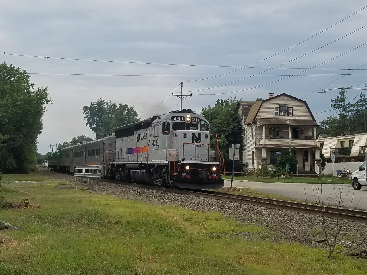
The Pascack Valley Line is a commuter rail line operated by the Hoboken Division of New Jersey Transit, in the United States. The line runs north from Hoboken Terminal, through Hudson County and Bergen County in New Jersey, and into Rockland County in New York, terminating at Spring Valley. Service within New York State is operated under contract with Metro-North Railroad. The line is named for the Pascack Valley region that it passes through in northern Bergen County. The line parallels the Pascack Brook for some distance. The line is colored purple on system maps, and its symbol is a pine tree. Description The Pascack Valley Line runs between Spring Valley, New York, and Hoboken Terminal. The line is long, of which the northernmost are in New York State. The entire line is owned by NJ Transit, but the Pearl River, Nanuet and Spring Valley stations are leased to Metro-North Railroad. The line is single tracked, but sidings at points along the line, including the Meadowl ... [...More Info...] [...Related Items...] OR: [Wikipedia] [Google] [Baidu] |
Hoboken Terminal
Hoboken Terminal is a commuter-oriented intermodal passenger station in Hoboken, Hudson County, New Jersey. One of the New York metropolitan area's major transportation hubs, it is served by nine NJ Transit (NJT) commuter rail lines, one Metro-North Railroad line, various NJT buses and private bus lines, the Hudson–Bergen Light Rail, the Port Authority Trans Hudson (PATH) rapid transit system, and NY Waterway-operated ferries. More than 50,000 people use the terminal daily, making it the ninth-busiest railroad station in North America and the sixth-busiest in the New York area. It is also the second-busiest railroad station in New Jersey, behind only Newark Penn Station, and its third-busiest transportation facility, after Newark Liberty International Airport and Newark Penn Station. Hoboken Terminal is wheelchair-accessible, with high-level platforms for light rail and PATH services and portable lifts for commuter rail services. History The site of the terminal had ... [...More Info...] [...Related Items...] OR: [Wikipedia] [Google] [Baidu] |
New Jersey Transit
New Jersey Transit Corporation, branded as NJ Transit, and often shortened to NJT, is a state-owned public transportation system that serves the U.S. state of New Jersey, along with portions of New York State and Pennsylvania. It operates bus, light rail, and commuter rail services throughout the state, connecting to major commercial and employment centers both within the state and in the adjacent major cities of New York and Philadelphia. In , the system had a ridership of . Covering a service area of , NJT is the largest statewide public transit system and the third-largest provider of bus, rail, and light rail transit by ridership in the United States. NJT also acts as a purchasing agency for many private operators in the state; in particular, buses to serve routes not served by the transit agency. History NJT was founded on July 17, 1979, an offspring of the New Jersey Department of Transportation (NJDOT), mandated by the state government to address many then-pressi ... [...More Info...] [...Related Items...] OR: [Wikipedia] [Google] [Baidu] |
Nanuet, New York
Nanuet is a hamlet and census-designated place in the town of Clarkstown, Rockland County, New York, United States. The third largest hamlet in Clarkstown, it is located north of Pearl River, south of New City, east of Spring Valley, and west of West Nyack. It is located midway between Manhattan and Bear Mountain, north and south of each respectively; and north of the New Jersey border. It has one of three Rockland County stations on New Jersey Transit's Pascack Valley Line. The population of Nanuet was 17,882 at the 2010 census. The opening of the New York State Thruway ( Interstate 87/287), the Tappan Zee Bridge, and the Palisades Interstate Parkway in the mid-1950s helped usher in decades of population growth and real estate development, including the construction of the Nanuet Mall and local shopping centers. In 2011, CNN Money ranked Nanuet 76 on its annual 100 Best Places to Live list, citing its relatively inexpensive housing and the recreation and shopping opportun ... [...More Info...] [...Related Items...] OR: [Wikipedia] [Google] [Baidu] |
Hackensack, New Jersey
Hackensack is a city in and the county seat of Bergen County, New Jersey, United States.New Jersey County Map New Jersey Department of State. Accessed July 10, 2017. The area was officially named New Barbadoes Township until 1921, but has informally been known as Hackensack since at least the 18th century. As of the , the city's population was 46,030. An |
New Jersey Meadowlands
New Jersey Meadowlands, also known as the Hackensack Meadowlands after the primary river flowing through it, is a general name for the large ecosystem of wetlands in northeastern New Jersey in the United States, a few miles to the west of New York City. In the 20th century, much of the Meadowlands area was urbanized, and it became known for being the site of large landfills and decades of environmental abuse. A variety of projects are underway to restore and conserve the remaining ecological resources in the Meadowlands. Geography The Meadowlands stretch mainly along the terminus of the Hackensack and Passaic Rivers as they flow into Newark Bay; tributaries of the Hackensack include Mill Creek, Berrys Creek, and Overpeck Creek. The Meadowlands consist of roughly 8,400 acres (34 km2) of open, undeveloped space in addition to developed areas that had been part of the natural wetlands which were heavily developed by H. Bert Mack and M. Bolero in the 1960s. [...More Info...] [...Related Items...] OR: [Wikipedia] [Google] [Baidu] |
Rail Siding
A siding, in rail terminology, is a low-speed track section distinct from a running line or through route such as a main line, branch line, or spur. It may connect to through track or to other sidings at either end. Sidings often have lighter rails, meant for lower speed or less heavy traffic, and few, if any, signals. Sidings connected at both ends to a running line are commonly known as loops; those not so connected may be referred to as single-ended or dead-end sidings, or (if short) stubs. Functions Sidings may be used for marshalling (classifying), stabling, storing, loading, and unloading vehicles. Common sidings store stationary rolling stock, especially for loading and unloading. Industrial sidings (also known as spurs) go to factories, mines, quarries, wharves, warehouses, some of them are essentially links to industrial railways. Such sidings can sometimes be found at stations for public use; in American usage these are referred to as team tracks (after the use ... [...More Info...] [...Related Items...] OR: [Wikipedia] [Google] [Baidu] |
20220905 181226 NJT GP40 4213
9 (nine) is the natural number following and preceding . Evolution of the Arabic digit In the beginning, various Indians wrote a digit 9 similar in shape to the modern closing question mark without the bottom dot. The Kshatrapa, Andhra and Gupta started curving the bottom vertical line coming up with a -look-alike. The Nagari continued the bottom stroke to make a circle and enclose the 3-look-alike, in much the same way that the sign @ encircles a lowercase ''a''. As time went on, the enclosing circle became bigger and its line continued beyond the circle downwards, as the 3-look-alike became smaller. Soon, all that was left of the 3-look-alike was a squiggle. The Arabs simply connected that squiggle to the downward stroke at the middle and subsequent European change was purely cosmetic. While the shape of the glyph for the digit 9 has an ascender in most modern typefaces, in typefaces with text figures the character usually has a descender, as, for example, in . The mod ... [...More Info...] [...Related Items...] OR: [Wikipedia] [Google] [Baidu] |
Pine Tree
A pine is any conifer tree or shrub in the genus ''Pinus'' () of the family Pinaceae. ''Pinus'' is the sole genus in the subfamily Pinoideae. The World Flora Online created by the Royal Botanic Gardens, Kew and Missouri Botanical Garden accepts 187 species names of pines as current, together with more synonyms. The American Conifer Society (ACS) and the Royal Horticultural Society accept 121 species. Pines are commonly found in the Northern Hemisphere. ''Pine'' may also refer to the lumber derived from pine trees; it is one of the more extensively used types of lumber. The pine family is the largest conifer family and there are currently 818 named cultivars (or trinomials) recognized by the ACS. Description Pine trees are evergreen, coniferous resinous trees (or, rarely, shrubs) growing tall, with the majority of species reaching tall. The smallest are Siberian dwarf pine and Potosi pinyon, and the tallest is an tall ponderosa pine located in southern Oregon's Rogue River-Si ... [...More Info...] [...Related Items...] OR: [Wikipedia] [Google] [Baidu] |
Pascack Brook
Pascack Brook is a tributary of the Hackensack River in Bergen County, New Jersey, United States. History At least one late 18th-century map calls the brook "Great Pascack River." Its tributary Musquapsink Brook is shown as "Little Pascack River." The name "Pascack River" also occurs in an 1876 map of the area. Course and watershed Pascack Brook forms a region known as the Pascack Valley. The brook is dammed to form the Woodcliff Lake Reservoir in the town of Woodcliff Lake. The Pascack formerly flowed directly into the Hackensack River, but now ends at the Oradell Reservoir short of its historical juncture with the Hackensack. A dam on Pascack Brook in Spring Valley, New York, impounded Lake Hyenga until it collapsed during Hurricane Floyd in September 1999. Heavy flooding resulted downstream. The dam was not rebuilt. Tributaries ''(Listed from mouth to source)'' * Musquapsink Brook * Tandy Brook * Bear Brook * Mill Brook * Muddy Brook See also * List of rivers of New ... [...More Info...] [...Related Items...] OR: [Wikipedia] [Google] [Baidu] |
Pascack Valley
The Pascack Valley is the name for a region of New Jersey, United States, contained within Bergen County. It is named for the Pascack Brook. The region consists of eight municipalities: Montvale, Park Ridge, Woodcliff Lake, Hillsdale, Westwood, River Vale, Washington Township, and Emerson. Entities named after the valley * Pascack Valley Regional High School District serving students from Hillsdale, Montvale, River Vale and Woodcliff Lake. It operates two schools: ** Pascack Valley High School, Hillsdale ** Pascack Hills High School, Montvale * Pascack Valley Line, operated by New Jersey Transit, offers service to Hoboken, New Jersey, and to New York City via the Secaucus Junction * Pascack Valley Hospital, former hospital in Westwood, now re-opened as the Hackensack University Medical Center at Pascack Valley * Hackensack University Medical Center at Pascack Valley Pascack Valley Medical Center formerly known as Hackensack University Medical Center at Pascack Valley is a ... [...More Info...] [...Related Items...] OR: [Wikipedia] [Google] [Baidu] |
Spring Valley, New York
Spring Valley is a village in the towns of Ramapo and Clarkstown in Rockland County, New York, United States. It is located north of Chestnut Ridge, east of Airmont and Monsey, south of Hillcrest, and west of Nanuet. The population was 33,066 at the 2020 census, making it the 2nd most populous community in Rockland County, after New City. Spring Valley spans the border of two towns, occupying an eastern portion of the town of Ramapo and a small western portion of the town of Clarkstown. The village is next to the New York State Thruway ( Interstate 87) and is served by a New Jersey Transit train station at the terminus of the Pascack Valley Line. Spring Valley is north of Manhattan and north of the New Jersey border. History Before the opening of the railroad, there were no homes in Spring Valley. In 1842, the New York & Erie Railroad called this part of the territory "Pascack", after a stream by the same name. The residents of the area decided to call the place S ... [...More Info...] [...Related Items...] OR: [Wikipedia] [Google] [Baidu] |
Rockland County, New York
Rockland County is the southernmost county on the west side of the Hudson River in the U.S. state of New York. It is part of the New York metropolitan area. It is about from the Bronx at their closest points. The county's population, as of the 2020 United States Census, is 338,329, making it the state's third-most densely populated county outside New York City (after Nassau and neighboring Westchester Counties, respectively). The county seat is New City. Rockland County is accessible via the New York State Thruway, which crosses the Hudson to Westchester at the Tappan Zee Bridge ten exits up from the NYC border, as well as the Palisades Parkway five exits up from the George Washington Bridge. The county's name derives from "rocky land", as the area has been aptly described, largely due to the Hudson River Palisades. This county is home to one of the most prominent towns in American history. Congers, NY is home to the stepping grounds of Commander-In-Chief George Washing ... [...More Info...] [...Related Items...] OR: [Wikipedia] [Google] [Baidu] |


.jpg)


