|
Pasarlapudi
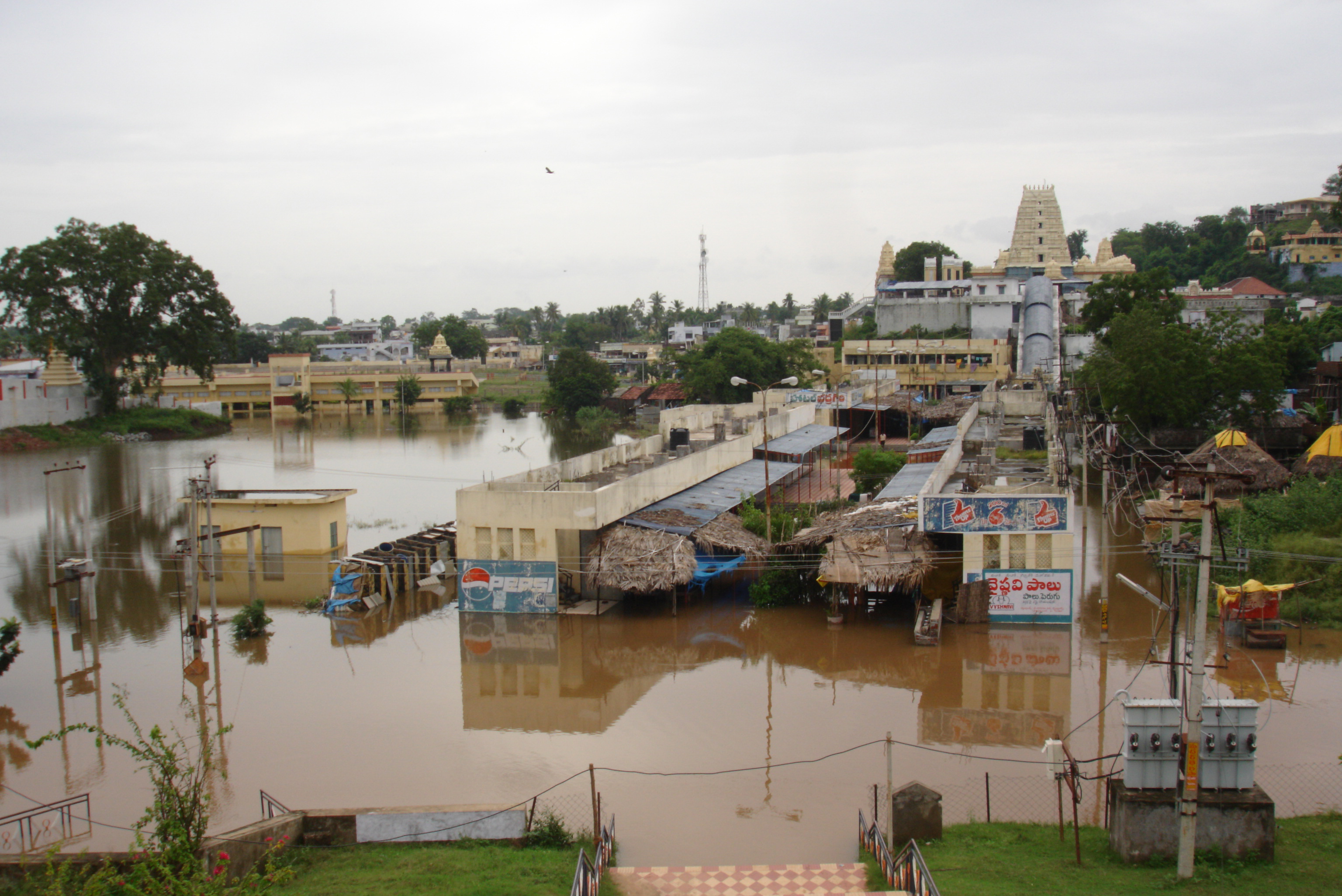
Pasarlapudi is the river delta of the Godavari River at the Bay of Bengal in southeastern India. It is located in the Konaseema district of Andhra Pradesh state, in the South India Region. The Pasarlapudi village is known for its scenic vegetation, and is one of the three important Ferry points for ''Bodasakurru-Pasarlapudi'' and the other two being; ''Kotipalli-Mukteswaram'' and ''Sakhinetipalli-Narasapuram'' in the Konaseema region. Resources The west bank of the Godavari River in the delta is one a fertile region in the area, and is also known as Konaseema. It supports Coconut tree and Mango plantations, and rice paddies. Many gas and oil wells are located in Pasarlapudi and its surrounding villages. They use pipelines to a GCS (gas collecting station) at Tatipaka, from there ONGC is supplying gas to the NFCL and other power plants. See also *Pasarlapudi blowout *Coastline of Andhra Pradesh *Coromandal Coast *Geography of Andhra Pradesh Andhra Pradesh lies between 12┬ ... [...More Info...] [...Related Items...] OR: [Wikipedia] [Google] [Baidu] |
Pasarlapudi Blowout
The Pasarlapudi blowout was an oil rig blowout that took place on 6.50 pm, 8 January 1995 in Pasarlapudi, near Amalapuram in the East Godavari district of Andhra Pradesh, India. It was the largest blowout ever recorded in the history of the India's oil and natural gas exploration with a fire that engulfed drilling site number 19, rig number E 1400-18GF. The fire continued for 65 days. Initially Neil Adams Fire Fighters(NAF, Houston) was hired to bring fire under control. After ONGC disagreed with their strategy NAF left and it was finally brought under control on 15 March 1995 by International Well Control. The blowout did not cause any casualties, but the drilling rig was destroyed. Damages to the drilling rig were estimated at Rs 9.2 crore crore as well as about Rs 7 crore of damage to equipment at the well site area. Evacuation 7 villages within the 2 kilometers radius of the rig, approximately 1,500 people were evacuated immediately by APSRTC buses. More people fled in pa ... [...More Info...] [...Related Items...] OR: [Wikipedia] [Google] [Baidu] |
Kotipalli
Kotipalli also known as Koti Theertham is a village located in K. Gangavaram mandal of Ramachandrapuram revenue division in Konaseema district of Andhra Pradesh, India. The temple town is also known as Kumararama of the Pancharama Kshetras, and is located 15 km from Amalapuram. Every year festivals such as Maha Sivaratri, Vaisakha Suddha Ekadasi, Aswayuja Suddha Padyami to Dwadasi and Ksheerabdi Dwadasi Teppotsavam are celebrated in this village. Lord Siva is worshiped here as Someswaraswamy and Koteswaraswamy along with his consort Parvati as Rajarajeswari Devi. Kotipalli is located on banks of the river Gautami-Godavari, one of the two branches of the river Godavari. Godavari splits into two branches - Vriddha Gautami (Gautami Godavari) and Vasishta Godavari. Again the Gautami branch splits into two branches namely Gautami and Nilarevu. Vengi kings of Eastern Chalukyas, who ruled this region between 7th and 12th centuries C.E. built this temple and the pond called as SomaG ... [...More Info...] [...Related Items...] OR: [Wikipedia] [Google] [Baidu] |
Godavari Satellite View
The Godavari (IAST: ''God─üvar─½'' Īod╠¬a╦É╩ŗ╔Ö╔Ši╦É is India's second longest river after the Ganga river and drains into the third largest basin in India, covering about 10% of India's total geographical area. Its source is in Trimbakeshwar, Nashik, Maharashtra. It flows east for , draining the states of Maharashtra (48.6%), Telangana (18.8%), Andhra Pradesh (4.5%), Chhattisgarh (10.9%) and Odisha (5.7%). The river ultimately empties into the Bay of Bengal through an extensive network of tributaries. Measuring up to , it forms one of the largest river basins in the Indian subcontinent, with only the Ganga and Indus rivers having a larger drainage basin. In terms of length, catchment area and discharge, the Godavari is the largest in peninsular India, and had been dubbed as the Dakshina Ganga (Ganges of the South). The river has been revered in Hindu scriptures for many millennia and continues to harbour and nourish a rich cultural heritage. In the past few decades, the rive ... [...More Info...] [...Related Items...] OR: [Wikipedia] [Google] [Baidu] |
Rice Paddy
A paddy field is a flooded field of arable land used for growing semiaquatic crops, most notably rice and taro. It originates from the Neolithic rice-farming cultures of the Yangtze River basin in southern China, associated with pre-Austronesian and Hmong-Mien cultures. It was spread in prehistoric times by the expansion of Austronesian peoples to Island Southeast Asia, Southeast Asia including Northeastern India, Madagascar, Melanesia, Micronesia, and Polynesia. The technology was also acquired by other cultures in mainland Asia for rice farming, spreading to East Asia, Mainland Southeast Asia, and South Asia. Fields can be built into steep hillsides as terraces or adjacent to depressed or steeply sloped features such as rivers or marshes. They require a great deal of labor and materials to create and need large quantities of water for irrigation. Oxen and water buffalo, adapted for life in wetlands, are important working animals used extensively in paddy field farm ... [...More Info...] [...Related Items...] OR: [Wikipedia] [Google] [Baidu] |
Landforms Of Andhra Pradesh
A landform is a natural or anthropogenic land feature on the solid surface of the Earth or other planetary body. Landforms together make up a given terrain, and their arrangement in the landscape is known as topography. Landforms include hills, mountains, canyons, and valleys, as well as shoreline features such as bays, peninsulas, and seas, including submerged features such as mid-ocean ridges, volcanoes, and the great ocean basins. Physical characteristics Landforms are categorized by characteristic physical attributes such as elevation, slope, orientation, stratification, rock exposure and soil type. Gross physical features or landforms include intuitive elements such as berms, mounds, hills, ridges, cliffs, valleys, rivers, peninsulas, volcanoes, and numerous other structural and size-scaled (e.g. ponds vs. lakes, hills vs. mountains) elements including various kinds of inland and oceanic waterbodies and sub-surface features. Mountains, hills, plateaux, and plains are the fou ... [...More Info...] [...Related Items...] OR: [Wikipedia] [Google] [Baidu] |
River Deltas Of Asia
A river is a natural flowing watercourse, usually freshwater, flowing towards an ocean, sea, lake or another river. In some cases, a river flows into the ground and becomes dry at the end of its course without reaching another body of water. Small rivers can be referred to using names such as creek, brook, rivulet, and rill. There are no official definitions for the generic term river as applied to geographic features, although in some countries or communities a stream is defined by its size. Many names for small rivers are specific to geographic location; examples are "run" in some parts of the United States, "burn" in Scotland and northeast England, and "beck" in northern England. Sometimes a river is defined as being larger than a creek, but not always: the language is vague. Rivers are part of the water cycle. Water generally collects in a river from precipitation through a drainage basin from surface runoff and other sources such as groundwater recharge, springs, a ... [...More Info...] [...Related Items...] OR: [Wikipedia] [Google] [Baidu] |
Geography Of Andhra Pradesh
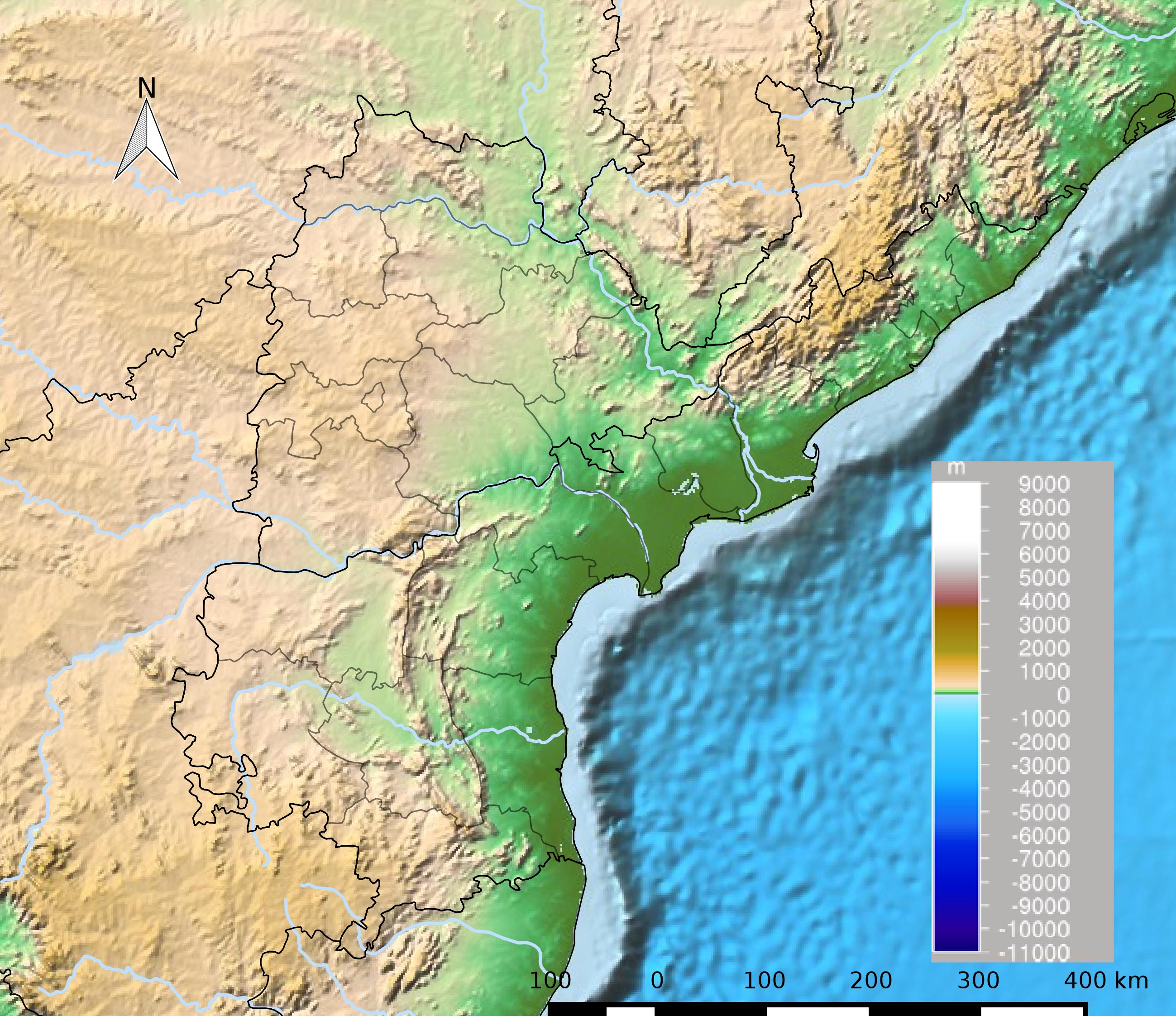
Andhra Pradesh lies between 12┬░41' and 19.07┬░N latitude and 77┬░ and 84┬░40'E longitude, and is bordered by Telangana to the north and west, Chhattisgarh to the north-west, Orissa to the north, the Bay of Bengal to the east, Tamil Nadu to the south and Karnataka to the southwest and west. Andhra Pradesh has a coastline of around 974 km, which gives it the second longest coastline in the nation. Two major rivers, the Godavari and the Krishna run across the state. A small enclave 12 sq mi (30 km┬▓), the Yanam district of Puducherry, lies in the Godavari Delta in the north east of the state. The state includes the eastern part of Deccan plateau as well as a considerable part of the Eastern Ghats. Historically the region comprising the state was known as ''Andhraapatha'', ''Andhradesa'', ''Andhraavani'', and ''Andhra vishaya''. Climate The climate of Andhra Pradesh is generally hot and humid in the lowland coastal regions, while it is mostly semi-arid in parts of ... [...More Info...] [...Related Items...] OR: [Wikipedia] [Google] [Baidu] |
Coromandal Coast
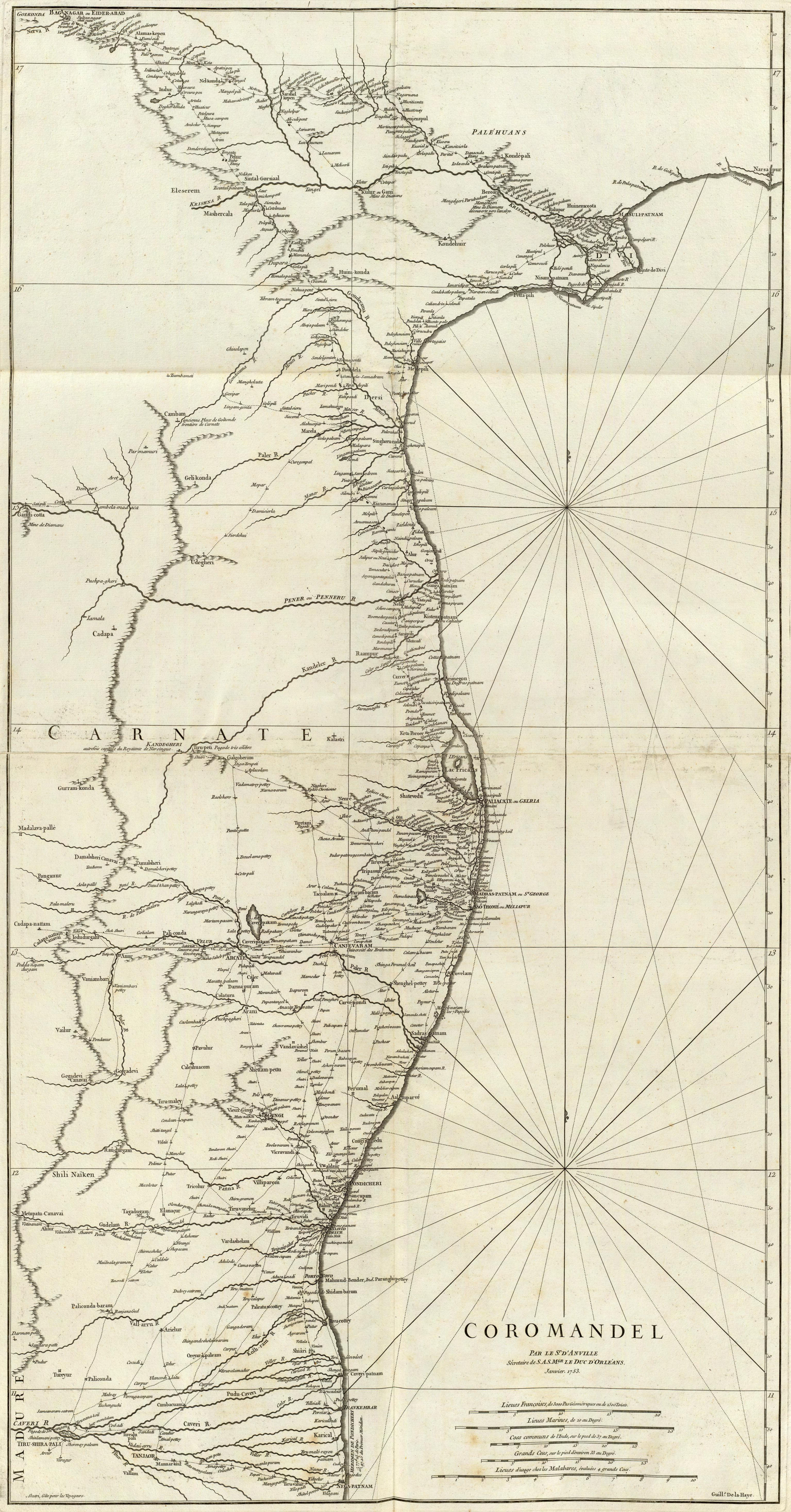
The Coromandel Coast is the southeastern coastal region of the Indian subcontinent, bounded by the Utkal Plains to the north, the Bay of Bengal to the east, the Kaveri delta to the south, and the Eastern Ghats to the west, extending over an area of about 22,800 square kilometres. The coast has an average elevation of 80 metres and is backed by the Eastern Ghats, a chain of low lying and flat-topped hills. In historical Muslim sources from the 12th century onward, the Coromandel Coast was called Ma╩┐bar. Etymology The land of the Chola dynasty was called ''Cholamandalam'' (Ó«ÜÓ»ŗÓ«┤ Ó««Ó«ŻÓ»ŹÓ«¤Ó«▓Ó««Ó»Ź) in Tamil, translated as ''The realm of the Cholas'', from which the Portuguese derived the name ''Coromandel''.''The Land of the Tamulians and Its Missions'', by Eduard Raimund Baierlein, James Dunning BakerSouth Indian Coins ŌĆō Page 61 by T. Desikachari ŌĆō Coins, Indic ŌĆō 1984Indian History ŌĆō Page 112''Annals of Oriental Research'' ŌĆō Page 1 by University of Madras ŌĆ ... [...More Info...] [...Related Items...] OR: [Wikipedia] [Google] [Baidu] |
Coastline Of Andhra Pradesh
The coastline of Andhra Pradesh is located on the southeast coast of the Indian Peninsula, and forms a part of the Northern Circars, with waters in Bay of Bengal. It has the second longest coastline in India next to Gujarat, with a length of . The coastal corridor consists of several ports, harbours, vast stretches of sandy beaches, wildlife, bird sanctuaries, fresh water lakes and estuaries. Geography The coast stretches from Ichchapuram of Srikakulam district to Tirupati district, and geographically lies in between the coasts of Orissa and Tamil Nadu. Coastal wetlands are spread over an area of . Coastal districts There are 19 districts that have coastlines: 12 in Coastal Andhra, six in the Uttarandhra region and one in the Rayalaseema region of Andhra Pradesh. They are: * Srikakulam, * Anakapalli, * Alluri Sitharama Raju district, * Vizianagaram, * Guntur, * Bapatla, * konaseema, * NTR district, * Palnadu, * Eluru, * kakinada, * Vishakhapatnam, * East Godavari, ... [...More Info...] [...Related Items...] OR: [Wikipedia] [Google] [Baidu] |
Power Plant
A power station, also referred to as a power plant and sometimes generating station or generating plant, is an industrial facility for the generation of electric power. Power stations are generally connected to an electrical grid. Many power stations contain one or more generators, a rotating machine that converts mechanical power into three-phase electric power. The relative motion between a magnetic field and a conductor creates an electric current. The energy source harnessed to turn the generator varies widely. Most power stations in the world burn fossil fuels such as coal, oil, and natural gas to generate electricity. Low-carbon power sources include nuclear power, and an increasing use of renewables such as solar, wind, geothermal, and hydroelectric. History In early 1871 Belgian inventor Z├®nobe Gramme invented a generator powerful enough to produce power on a commercial scale for industry. In 1878, a hydroelectric power station was designed and built by Wil ... [...More Info...] [...Related Items...] OR: [Wikipedia] [Google] [Baidu] |
ONGC
The Oil and Natural Gas Corporation (ONGC) is a central public sector undertaking under the ownership of Ministry of Petroleum and Natural Gas, Government of India. It is headquartered in New Delhi. ONGC was founded on 14 August 1956 by the Government of India. It is the largest government-owned-oil and gas explorer and producer in the country, and produces around 70% of India's crude oil (equivalent to around 57% of the country's total demand) and around 84% of its natural gas. In November 2010, the Government of India conferred the '' Maharatna'' status to ONGC. In a survey by the Government of India for fiscal year 2019ŌĆō20, it was ranked as the largest profit making Central Public Sector Undertaking (PSU) in India. It is ranked 25th among the Top 250 Global Energy Companies by Platts. ONGC is involved in exploring for and exploiting hydrocarbons in 26 sedimentary basins of India, and owns and operates over 11,000 kilometers of pipelines in the country. Its internation ... [...More Info...] [...Related Items...] OR: [Wikipedia] [Google] [Baidu] |
Oil Well
An oil well is a drillhole boring in Earth that is designed to bring petroleum oil hydrocarbons to the surface. Usually some natural gas is released as associated petroleum gas along with the oil. A well that is designed to produce only gas may be termed a gas well. Wells are created by drilling down into an oil or gas reserve that is then mounted with an extraction device such as a pumpjack which allows extraction from the reserve. Creating the wells can be an expensive process, costing at least hundreds of thousands of dollars, and costing much more when in hard to reach areas, e.g., when creating offshore oil platforms. The process of modern drilling for wells first started in the 19th century, but was made more efficient with advances to oil drilling rigs during the 20th century. Wells are frequently sold or exchanged between different oil and gas companies as an asset ŌĆō in large part because during falls in price of oil and gas, a well may be unproductive, but if price ... [...More Info...] [...Related Items...] OR: [Wikipedia] [Google] [Baidu] |


.jpg)
.jpg)


