|
Parry Street, Fremantle
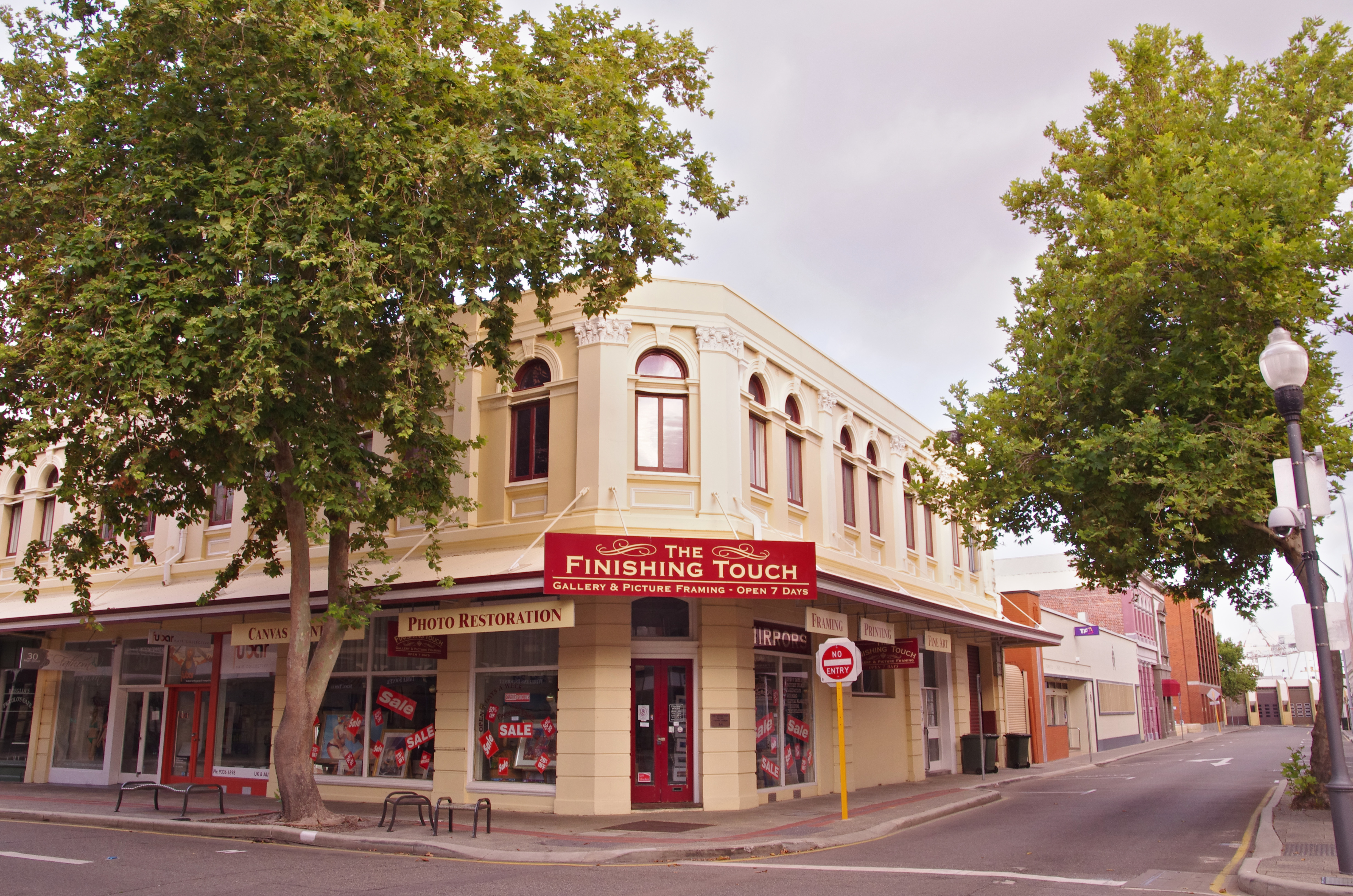
Parry Street is a street in Fremantle, Western Australia. Its northernmost point is its junction with Elder Place and Beach Street. Near the corner of Parry Street and Quarry Street is the Fremantle Substation, which was built in 1932 as a power station for the Fremantle Municipal Tramway network. It was taken over by the State Energy Commission of Western Australia when the trams were decommissioned in 1952, and operated as an energy-themed museum from 1989 to 2009, before being sold into private ownership at the latter date. Private residential apartments are planned for the site, with the original building exterior being mostly retained. The Fremantle Bowling club is located at the intersection with Ellen Street. Parry Street intersects with High Street at Queens Square. The Parry Street car park, south of the intersection with High Street is adjacent to the Fremantle Prison. The Fremantle branch of Legacy Australia Legacy is an Australian non-profit organisat ... [...More Info...] [...Related Items...] OR: [Wikipedia] [Google] [Baidu] |
Beach Street, Fremantle
Beach Street in a street located in Fremantle, Western Australia. It runs along the historic (original before Victoria Quay was built) southern shore of the Swan River, south-east of the inner harbour, between Parry Street and East Street. It crosses under the Fremantle Traffic Bridge and turns uphill next to the Fremantle Railway Bridge. At one end, south-west of Parry Street, Beach Street becomes Elder Place; the other end, east of East Street, becomes Riverside Road. In the 1920s its general condition was noted as being hazardous by local businesses. The harbour section of the street is lined with heritage buildings, such Dalgety Woolstores, Australia Hotel, and other shipping and export related industries, as well as former businesses existing in the street, such as Western Ice Works, and Western Engineering and Foundry Company. Due to its location, it was possible to see the development of the portion of Eastern Fremantle (formerly known as Richmond), from B ... [...More Info...] [...Related Items...] OR: [Wikipedia] [Google] [Baidu] |
South Terrace, Fremantle
South Terrace, Fremantle is a road in Fremantle, Western Australia that is renowned as the "Cappucino Strip" of Fremantle, due to the high number of coffee shops and restaurants. South Terrace extends from Market Street southwards, parallel to the coast, for to Ocean Road. It is also the location of the Fremantle Technical College, Fremantle Markets, and Fremantle Hospital, along with a significant number of heritage buildings. A number of historic hotels are on South Terrace, including the Sail and Anchor (formerly the Freemasons Hotel), the Newport, Norfolk Norfolk () is a ceremonial and non-metropolitan county in East Anglia in England. It borders Lincolnshire to the north-west, Cambridgeshire to the west and south-west, and Suffolk to the south. Its northern and eastern boundaries are the No ..., Davilak and South Beach hotels. See also Notes :* External links * {{Attached KML, display=inline,title Streets in Fremantle Restaurant districts and s ... [...More Info...] [...Related Items...] OR: [Wikipedia] [Google] [Baidu] |
Fremantle
Fremantle () () is a port city in Western Australia, located at the mouth of the Swan River in the metropolitan area of Perth, the state capital. Fremantle Harbour serves as the port of Perth. The Western Australian vernacular diminutive for Fremantle is Freo. Prior to British settlement, the indigenous Noongar people inhabited the area for millennia, and knew it by the name of Walyalup ("place of the woylie")."(26/3/2018) Inaugural Woylie Festival starts tomorrow" fremantle.gov.au. Retrieved 5 July 2020. Visited by in the 1600s, Fremantle was the first area settled by ... [...More Info...] [...Related Items...] OR: [Wikipedia] [Google] [Baidu] |
Queen Victoria Street, Fremantle
Queen Victoria Street is the main road entering the city centre of Fremantle, Western Australia from the direction of Perth. The road was originally named Cantonment Road, but was subsequently renamed Victoria Road, and a few years later Queen Victoria Street, after Queen Victoria of the United Kingdom, to avoid confusion with similarly named roads in the area. Due to its proximity to Fremantle Harbour it has at times had very heavy traffic. Route description The road's northern terminus, as well as that of State Route 12, is at a traffic light controlled with Stirling Highway in . The next major intersection, south, is with Tydeman Road, which leads to Fremantle Port to the west, and to the residential area of North Fremantle to the east. After another , the road reaches the Fremantle Traffic Bridge which crosses the Swan River. On the south side of the river, the road meets Canning Highway, and turns south-west towards the centre of Fremantle. After travelling south- ... [...More Info...] [...Related Items...] OR: [Wikipedia] [Google] [Baidu] |
High Street, Fremantle
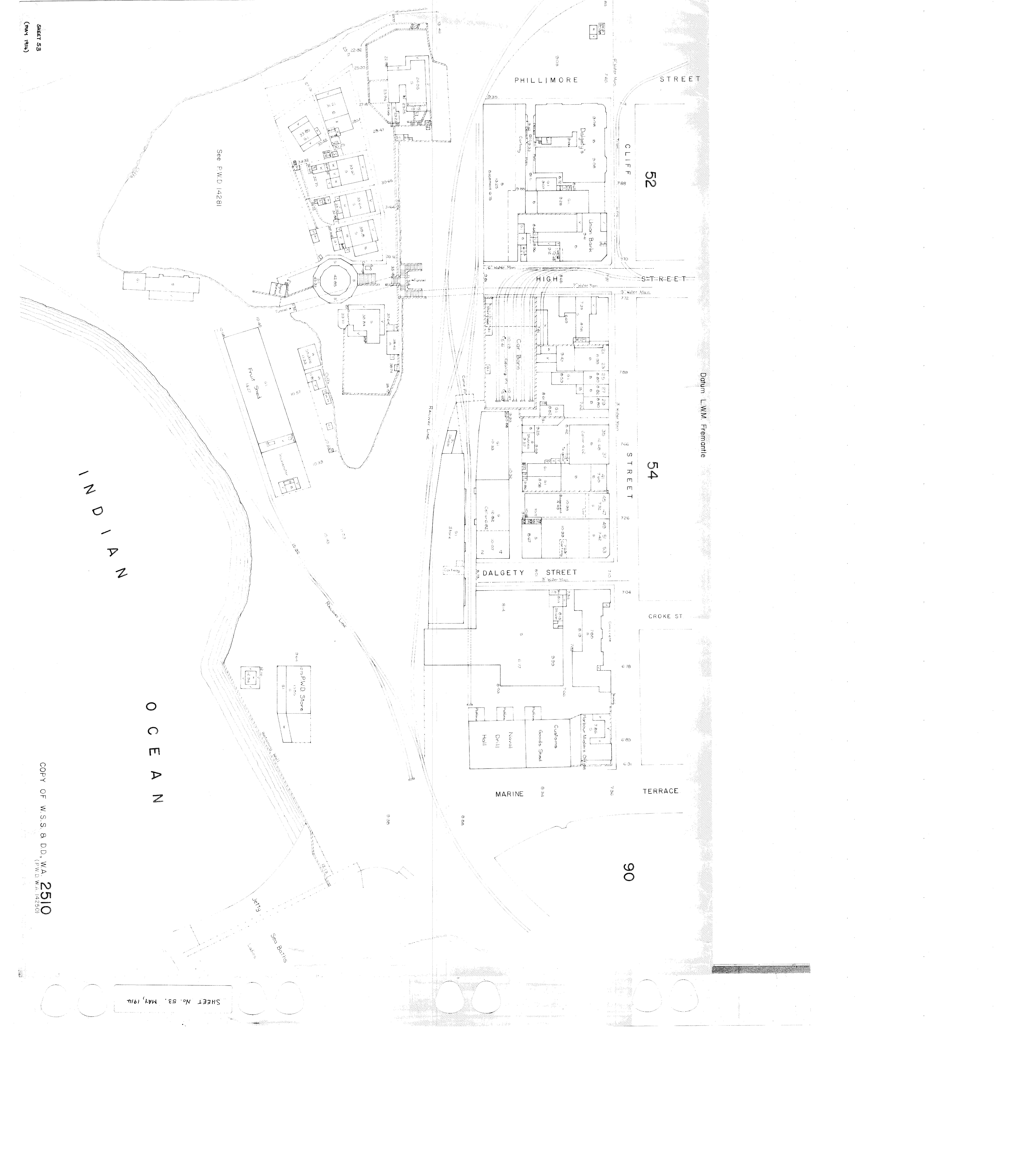
High Street is the main street running through the City of Fremantle, Western Australia. The street passes by historic landmarks, including the Round House, the Fremantle Town Hall, and the Fremantle War Memorial, through the Fremantle West End Heritage area and through two town squares. Trams operated along High Street for 47 years, between 1905 and 1952. Running east–west, High Street continues as Leach Highway, a major arterial road, at Stirling Highway, linking Fremantle with Perth Airport although the stretch of road between Stirling Highway and Carrington Street is known locally—and signed—as High Street. History Within twelve years of Fremantle being settled in 1829, High Street was considered the main road of the area. The street was named by the Surveyor-General of Western Australia John Septimus Roe, in line with the traditional naming of main streets in England. The east–west route linked the Round House at Arthur Head to Saint John's Church of En ... [...More Info...] [...Related Items...] OR: [Wikipedia] [Google] [Baidu] |
Junction Of Beach Street Elder Place And Parry Street Fremantle
Junction may refer to: Arts and entertainment * ''Junction'' (film), a 2012 American film * Jjunction, a 2002 Indian film * Junction (album), a 1976 album by Andrew Cyrille * Junction (EP), by Basement Jaxx, 2002 * Junction (manga), or ''Hot Tails'' * ''Junction'' (video game), 1990 * Junction Theatre Company, in South Australia (1984–2002) * Junction system, a feature of video game '' Final Fantasy VIII'' Science and technology * Cell junction, a class of cellular structures in biology * Electrical junction, a point or area where multiple conductors or semiconductors make physical contact * Junction (hackathon), an event in Helsinki, Finland * Junctions, a construct of Raku (programming language) Transport * Junction (traffic), a location where traffic can change between different routes ** Road junction ** Junction (rail) ** Junction (canal) * Junctions (software), a traffic simulation software package Places in the United States * Junction, California, now Ro ... [...More Info...] [...Related Items...] OR: [Wikipedia] [Google] [Baidu] |
Elder Place, Fremantle
Elder Place in a street in Fremantle, Western Australia that primarily runs between the north-west ends of Parry Street and Queen Street, south-west of the Fremantle railway line. At the north-eastern end Elder Place becomes Beach Street; at the south-western end it becomes Phillimore Street. A small cul de sac, also called Elder Place, but not connected to the main street, runs off Phillimore Street, in the direction of Market Street Market Street may refer to: *Market Street, Cambridge, England *Market Street, Fremantle, Western Australia, Australia * Market Street, George Town, Penang, Malaysia *Market Street, Manchester, England *Market Street, Melbourne, Victoria, Australia .... The southern side of the street was taken up with a large building known as Elders Wool Store, which was run by Elder, Smith and Company. This building was demolished and replaced by the Woolstores Shopping Centre. In the late nineteenth century, the street was known as ''Bay Street''. In ... [...More Info...] [...Related Items...] OR: [Wikipedia] [Google] [Baidu] |
Trams In Fremantle
The Fremantle tramway network linked the central business district of Fremantle, the port city for Perth, Western Australia, with nearby suburbs. Small but comprehensive, it operated between 1905 and 1952. It was not connected with the larger Perth tramway system. History The Fremantle Municipal Tramways (FMT) began operations on 30 October 1905. Prior to that date, there was no public transport system in Fremantle. The tram network expanded into North Fremantle in 1908, and into Melville in 1915. The North Fremantle line closed in 1938 and was replaced by diesel buses. The rest of the network reached its peak usage during World War II. After World War II, the system operated quite profitably for the Council. However, the decision of the State Government to nationalise the south-west electricity systems from private and council ownership to the newly formed State Electricity Commission in the early 1950s meant that the price of power to the trams increased markedly, to the ... [...More Info...] [...Related Items...] OR: [Wikipedia] [Google] [Baidu] |
State Energy Commission Of Western Australia
The State Energy Commission of Western Australia was an Australian energy provider. It was established on 1 January 1975 as an amalgamation of the State Electricity Commission of Western Australia (established 1945) plus the Fuel and Power Commission. It was involved in the buying of the Fremantle Gas and Coke Company as part of the WA Inc events. On 1 January 1995 it was split up into separate gas and electricity utilities, named AlintaGas and Western Power Corporation Western Power Corporation (WPC), owned by the Government of Western Australia, was Western Australia's major electricity supplier from 1995 until 2006. It was formed in 1995 when the monopoly electricity and gas supplier, the State Energy Com ... respectively. References External links Australian Science at Work - State Electricity Commission of Western Australia (1945 - 1975) Defunct utility companies of Western Australia Energy in Western Australia Defunct government agencies of Western Aus ... [...More Info...] [...Related Items...] OR: [Wikipedia] [Google] [Baidu] |
Ellen Street, Fremantle
Ellen Street is a parallel road to High Street in Fremantle, Western Australia. It was named after Ellen Stirling (née Mangles), wife of Governor Stirling. It has a range of heritage listed properties on its southern side including Christian Brothers College and Samson House, and on the northern side has the Fremantle Bowling Club at the intersection with Parry Street, Fremantle Park, and John Curtin College of the Arts John Curtin College of the Arts, originally John Curtin High School, is an independent, public co-educational, partially selective high school, located in East Street, , a suburb of Perth, Western Australia. The school provides a general and .... Intersections See also Notes Streets in Fremantle {{Fremantle-stub ... [...More Info...] [...Related Items...] OR: [Wikipedia] [Google] [Baidu] |
Queens Square, Fremantle
Queens Square, also known as Queen's Square, is a town square in Fremantle, Western Australia. It is located at the intersection of High Street and Parry Street, both of which bisect the square. The square was originally a single space, but was divided into four sections due to the extensions of High and Parry Streets, completed in 1886. Today Queens Square still functions as a public open space for residents of Fremantle. History The square began as an open space on John Septimus Roe's original town plan of Fremantle, drawn in 1883. In 1866, the Fremantle City Council decided that the extension of High Street should proceed through Queens Square, rather than around it. By 1886 Parry Street had also been extended through the square. In February 1896 the council decided to erect fencing at Queens Square, in order to establish a tree nursery there. Tenders were called for in March, and whilst several were received, all were rejected on the grounds that the proposed fences were too ... [...More Info...] [...Related Items...] OR: [Wikipedia] [Google] [Baidu] |
Fremantle Prison
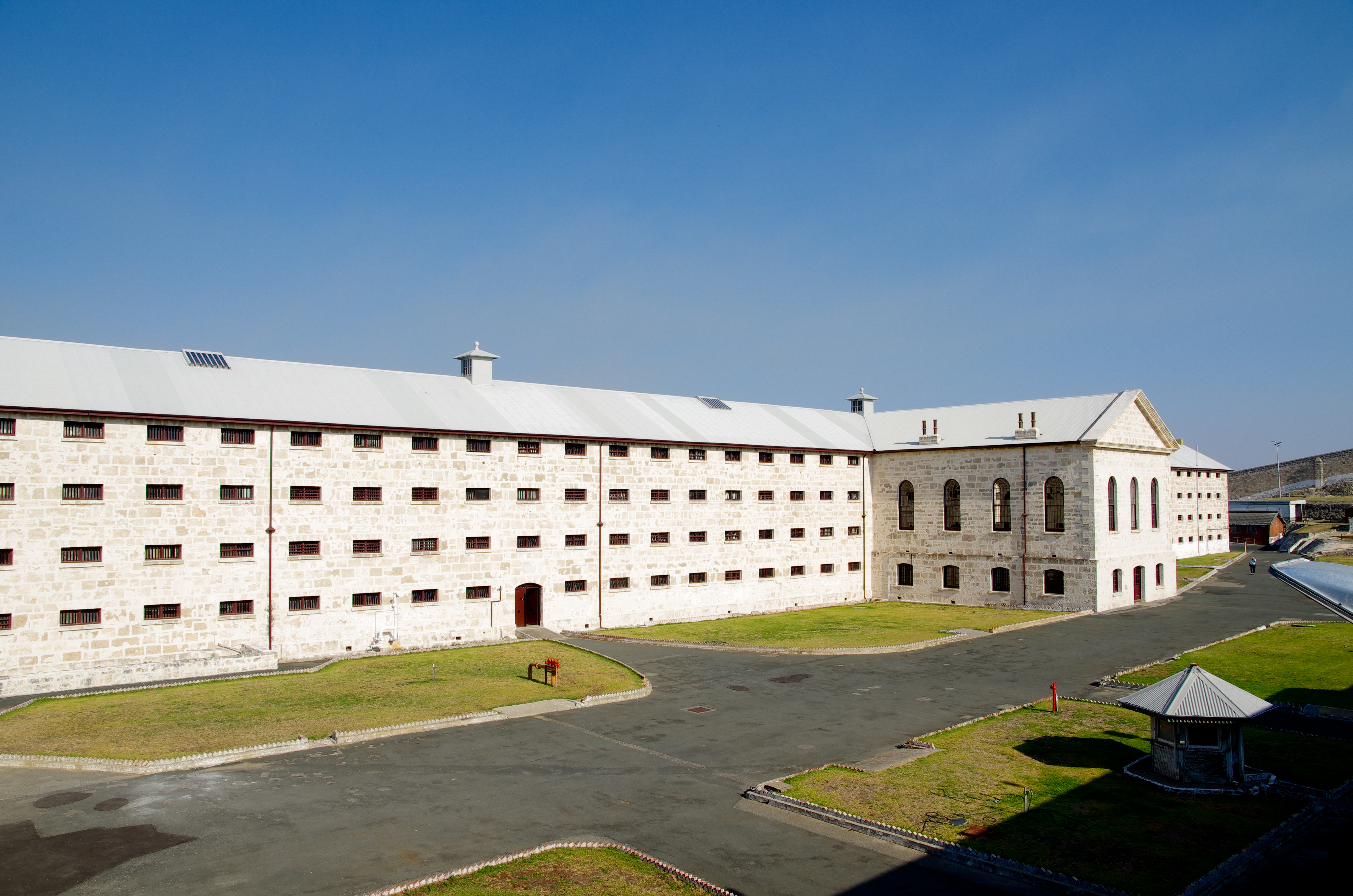
Fremantle Prison, sometimes referred to as Fremantle Gaol or Fremantle Jail, is a former Australian prison and World Heritage Site in Fremantle, Western Australia. The site includes the prison cellblocks, gatehouse, perimeter walls, cottages, and tunnels. It was initially used for convicts transported from Britain, but was transferred to the colonial government in 1886 for use for locally-sentenced prisoners. Royal Commissions were held in 1898 and 1911, and instigated some reform to the prison system, but significant changes did not begin until the 1960s. The government department in charge of the prison underwent several reorganisations in the 1970s and 1980s, but the culture of Fremantle Prison was resistant to change. Growing prisoner discontent culminated in a 1988 riot with guards taken hostage, and a fire that caused $1.8 million worth of damage. The prison closed in 1991, replaced by the new maximum-security Casuarina Prison. The prison was administered by a comp ... [...More Info...] [...Related Items...] OR: [Wikipedia] [Google] [Baidu] |


