|
Parnon
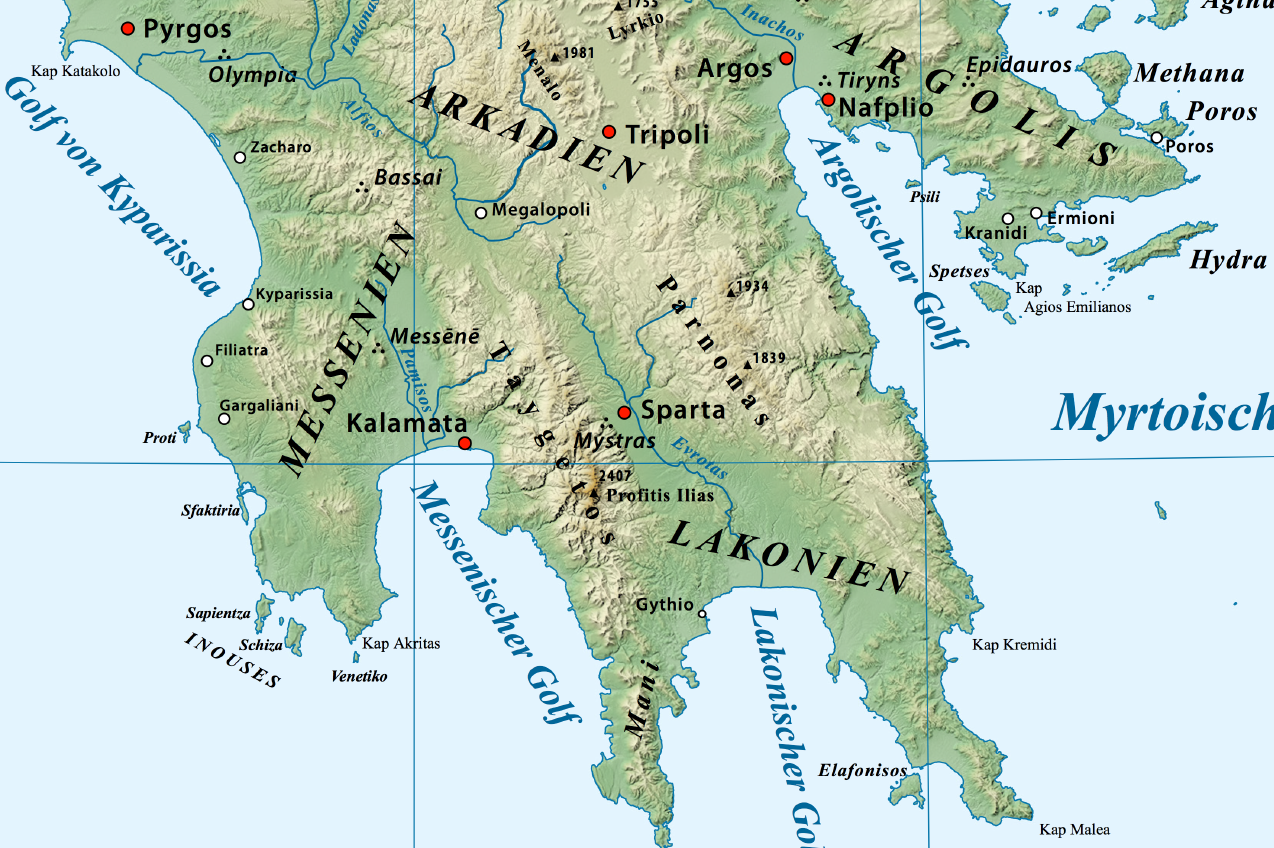
Parnon or Parnonas ( el, Πάρνων/Πάρνωνας) or Malevos (Μαλεβός) is a mountain range, or massif, on the east of the Laconian plain and the Evrotas valley. It is visible from Athens above the top of the Argive mountains. The western part is in the Laconia prefecture and the northeastern part is in the Arcadia prefecture. The Parnon range separates Laconia from Arcadia. Its summit offers panoramic views of southeastern Arcadia and South Kynouria and much of Laconia that includes the northern and the central portions and reaches as far as the Taygetos mountains. It also views a part of the central Arcadia and the southern Argolis prefectures. It views the Myrtoan and the Laconian Gulfs. Geography Physical The Parnon Massif is divided into three parts.Unless otherwise cited this section relies heavily on The northernmost, which is the highest, runs from just north of Ano Doliana in North Kynouria, eastern Arcadia, southeast to Platanaki Pass. P ... [...More Info...] [...Related Items...] OR: [Wikipedia] [Google] [Baidu] |
Ano Doliana
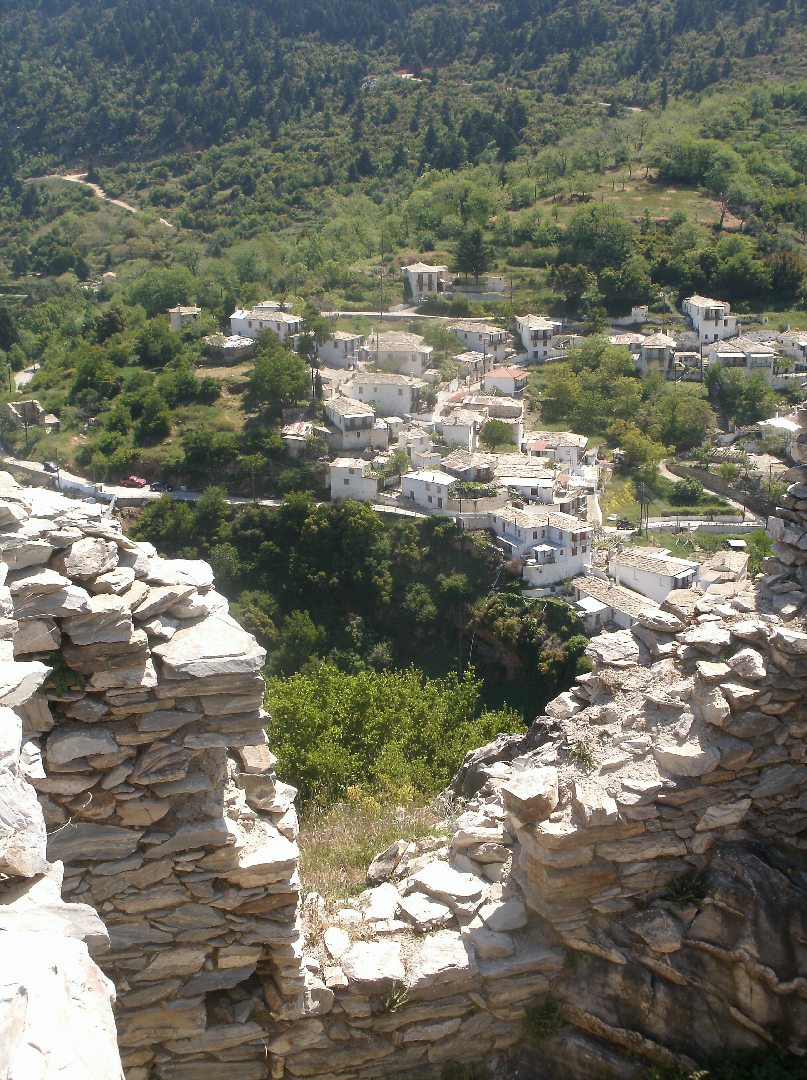
Ano Doliana (Ano meaning "upper", el, Άνω Δολιανά, ) or simply Doliana, is a stone-built mountainous village in the municipality of North Kynouria, in eastern Arcadia, Greece. As of 2011 it had 90 inhabitants. It is a protected traditional settlement. It used to be the main residence of the settlers, but nowadays only a handful of them stay throughout the year, as most use it as their summer residence and instead overwinter in Kato Doliana because of the milder climate. In recent years it has emerged as a relatively popular tourist destination, with a significant number of visitors, especially during the autumn and winter season weekends. Location The settlement is located on the southern outskirts of the plain of Tripoli. It extends at an altitude of 950 to 1.050 meters, built amphitheatrically on the northern slopes of mount Parnon, filled with fir, chestnut, platanus and cherry trees, surrounded by creeks and small waterfalls. The village is spread in two neighbor ... [...More Info...] [...Related Items...] OR: [Wikipedia] [Google] [Baidu] |
Therapnes
Therapnes ( el, Θεράπνες) is a municipal unit (''dimotiki enotita'') of the municipality (''dimos'') of Sparti within the regional unit (''perifereiaki enotita'') of Laconia in the region (''perifereia'') of Peloponnese, one of 13 regions into which Greece has been divided. The municipal unit has an area of 261.711 km2. Before 2011 Therapnes was a Demos of Lakonia according to Law 2539 of 1997, the Kapodistria Plan. Its seat was Gkoritsa, which now has no such status. Within its borders lies the ancient town of Therapne. Both before the Kallikratis law and after it, Therapnes was composed of the same eight Local Communities (''topiki koinotita''), the lowest level of the hierarchy: Agioi Anargyroi (formerly Zouraina), Agrianoi, Gkoritsa, Kalloni, Kefalas, Platana, Skoura and Chrysafa. The population of Therapnes in the 2011 census, conducted by the Ministry of the Interior, was 2,304. Villages *Goritsa or Gortsoupolis, as it is called by the Athenian residents of G ... [...More Info...] [...Related Items...] OR: [Wikipedia] [Google] [Baidu] |
Kastanitsa
Kastanitsa ( el, Καστάνιτσα, Tsakonian: Γαστένιτσα) is a village in Arcadia in Greece, on the southern slope of Mount Parnon. It is considered a traditional settlement. It is noted for its production of chestnuts, from which it takes its name, and for formerly being a majority Tsakonian-speaking settlement. History Kastanitsa is first mentioned in writing in 1293, but the settlement is thought to be nearly two centuries older, founded by Tsakones fleeing the rule of Slavic tribes that had invaded the Peloponnese. According to Kastaniot tradition, the village was founded by two families called Pentalonas and Bezenikos. A Byzantine fort called ''Koutoupou'' was placed on the nearby hill of ''Pyrgos'' while the restored Byzantine monarchy warred with the Frankish lords of the Peloponnese to recover territory lost in the wake of the Fourth Crusade. Further documentary evidence is scant until the eighteenth century. In 1788, a French traveller named Villeh ... [...More Info...] [...Related Items...] OR: [Wikipedia] [Google] [Baidu] |
Laconia
Laconia or Lakonia ( el, Λακωνία, , ) is a historical and administrative region of Greece located on the southeastern part of the Peloponnese peninsula. Its administrative capital is Sparta. The word ''laconic''—to speak in a blunt, concise way—is derived from the name of this region, a reference to the ancient Spartans who were renowned for their verbal austerity and blunt, often pithy remarks. Geography Laconia is bordered by Messenia to the west and Arcadia to the north and is surrounded by the Myrtoan Sea to the east and by the Laconian Gulf and the Mediterranean Sea to the south. It encompasses Cape Malea and Cape Tainaron and a large part of the Mani Peninsula. The Mani Peninsula is in the west region of Laconia. The islands of Kythira and Antikythera lie to the south, but they administratively belong to the Attica regional unit of islands. The island, Elafonisos, situated between the Laconian mainland and Kythira, is part of Laconia. The Eurotas is the longes ... [...More Info...] [...Related Items...] OR: [Wikipedia] [Google] [Baidu] |
Agios Petros, Arcadia
Agios Petros ( el, Άγιος Πέτρος) is a mountain village and a community in the municipality of North Kynouria in southeastern Arcadia, Greece. It is considered a traditional settlement. In 2011 its population was 675 for the village and 717 for the community, which includes the village Xirokampi and the Malevi monastery. It is situated in the northern part of the Parnon mountains, at about 950 m elevation. It is 3 km south of Elatos, 5 km east of Vourvoura, 6 km northeast of Karyes (Laconia), 18 km southwest of Astros and 26 km southeast of Tripoli. Population Notable people *Nilus the Myrrh-streamer (1601–1651), an Orthodox Christian saint and ascetic See also *List of settlements in Arcadia This is a list of settlements in Arcadia, Greece. * Aetorrachi * Agia Sofia * Agia Varvara * Agiorgitika * Agios Andreas * Agios Georgios * Agios Ioannis * Agios Konstantinos * Agios Petros * Agios Vasileios, Leonidio * Agios Vasileio ... * List of tradit ... [...More Info...] [...Related Items...] OR: [Wikipedia] [Google] [Baidu] |
Kosmas, Greece
Kosmas ( el, Κοσμάς) is a mountain village and a former community in Arcadia, Peloponnese, Greece. It is considered a traditional settlement. Since the 2011 local government reform it is part of the municipality South Kynouria, of which it is a municipal unit. The municipal unit has an area of 85.220 km2. In 2011 its population was 362. Kosmas is situated in the southeastern part of the Parnon mountains, at about 1150 m elevation, on the road from Skala (Laconia) to Leonidio. It is 13 km southwest of Leonidio, 28 km east of Sparti, 28 km northeast of Skala, 35 km south of Argos and 57 km southeast of Tripoli. Kosmas has a school, a church and a library. Population History In the area which is now known as Kosmas was the ancient city of Selinous, which had a temple of Apollo. Kosmas was first mentioned in 1592 in a letter of Gennadios, metropolitan of Monemvasia. Many inhabitants of Kosmas participated in the Greek War of Independence. ... [...More Info...] [...Related Items...] OR: [Wikipedia] [Google] [Baidu] |
Monemvasia
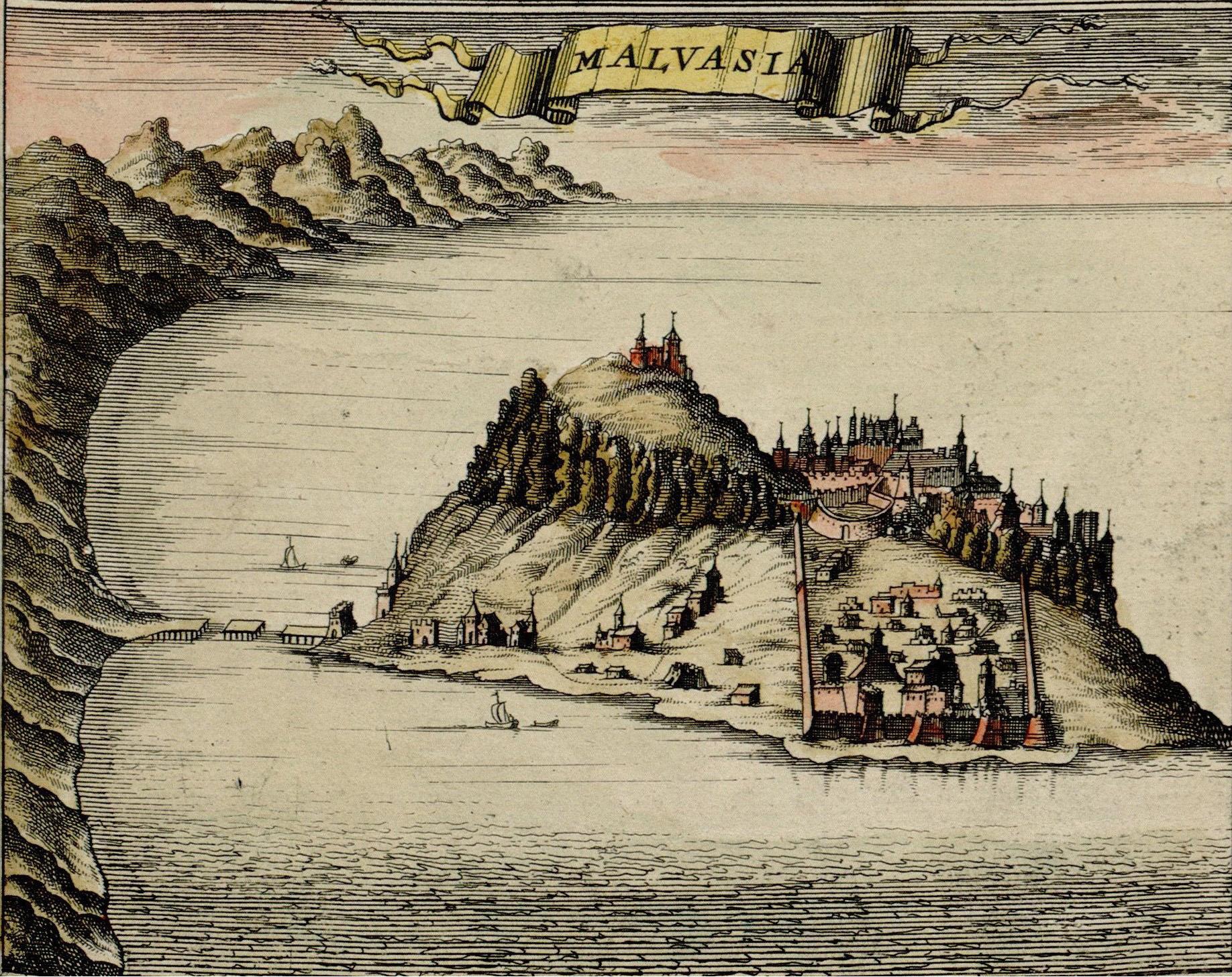
Monemvasia ( el, Μονεμβασιά, Μονεμβασία, or ) is a town and municipality in Laconia, Greece. The town is located on a small island off the east coast of the Peloponnese, surrounded by the Myrtoan Sea. The island is connected to the mainland by a short causeway in length. Its area consists mostly of a large plateau some above sea level, up to wide and long. Founded in the sixth century, and thus one of the oldest continually-inhabited fortified towns in Europe, the town is the site of a once-powerful medieval fortress, and was at one point one of the most important commercial centres in the Eastern Mediterranean. The town's walls and many Byzantine churches remain as testaments to the town's history. Today, the seat of the municipality of Monemvasia is the town of Molaoi. Etymology The town's name derives from two Greek words, (, 'single') and ''emvasis'' (, 'approach'), together meaning "city of the single approach, or entrance". Its Italian form, ''Mal ... [...More Info...] [...Related Items...] OR: [Wikipedia] [Google] [Baidu] |
Arcadia (regional Unit)
Arcadia ( el, Αρκαδία, ''Arkadía'' ) is one of the regional units of Greece. It is part of the administrative region of Peloponnese. It is in the central and eastern part of the Peloponnese peninsula. It takes its name from the mythological figure Arcas. In Greek mythology, it was the home of the god Pan. In European Renaissance arts, Arcadia was celebrated as an unspoiled, harmonious wilderness. Geography Arcadia is a rural, mountainous regional unit comprising about 18% of the land area of the Peloponnese peninsula. It is the peninsula's largest regional unit. According to the 2011 census, it has about 86,000 inhabitants; its capital, Tripoli, has about 30,000 residents in the city proper, and about 47,500 total in the greater metropolitan area. Arcadia consists partly of farmland, and to a larger extent grassland and degenerated shrubland. It also has three mountain ranges, with forestation mainly at altitudes above 1000 meters: Mainalo, a winter ski resort, situa ... [...More Info...] [...Related Items...] OR: [Wikipedia] [Google] [Baidu] |
Taygetos Relief Map-de
The Taygetus, Taugetus, Taygetos or Taÿgetus ( el, Ταΰγετος, Taygetos) is a mountain range on the Peloponnese peninsula in Southern Greece. The highest mountain of the range is Mount Taygetus, also known as "Profitis Ilias", or "Prophet Elias" ( Elijah). The name is one of the oldest recorded in Europe, appearing in the Odyssey. In classical mythology, it was associated to the nymph Taygete and it was named after her. During Byzantine times and up until the 19th century, the mountain was also known as Pentadaktylos (Πενταδάκτυλος; Greek for ''five-fingered'', a common name during that period). Geography Physical The Taygetus Massif is about long, extending from the center of the Peloponnese to Cape Matapan, its southernmost extremity. It contains the tallest mountain in the Peloponnese, the Profitis Ilias summit, reaching ; this is probably the classical Mount Taléton mentioned by Pausanias. The summit is an ultra-prominent peak. It is prominent a ... [...More Info...] [...Related Items...] OR: [Wikipedia] [Google] [Baidu] |
Taygetos
The Taygetus, Taugetus, Taygetos or Taÿgetus ( el, Ταΰγετος, Taygetos) is a mountain range on the Peloponnese peninsula in Southern Greece. The highest mountain of the range is Mount Taygetus, also known as "Profitis Ilias", or "Prophet Elias" (Elijah). The name is one of the oldest recorded in Europe, appearing in the Odyssey. In classical mythology, it was associated to the nymph Taygete and it was named after her. During Byzantine times and up until the 19th century, the mountain was also known as Pentadaktylos (Πενταδάκτυλος; Greek for ''five-fingered'', a common name during that period). Geography Physical The Taygetus Massif is about long, extending from the center of the Peloponnese to Cape Matapan, its southernmost extremity. It contains the tallest mountain in the Peloponnese, the Profitis Ilias summit, reaching ; this is probably the classical Mount Taléton mentioned by Pausanias. The summit is an ultra-prominent peak. It is prominent above th ... [...More Info...] [...Related Items...] OR: [Wikipedia] [Google] [Baidu] |
Agios Vasileios, Arcadia
''Agios'' ( el, Άγιος), plural ''Agioi'' (), transcribes masculine gender Greek words meaning 'sacred' or ' saint' (for example Agios Dimitrios, Agioi Anargyroi). It is frequently shortened in colloquial language to ''Ai'' (for example Ai Stratis). In polytonic script it is written ''Hagios'' () (for example Hagios Demetrios). It is also transliterated as, inter alia, ''Haghios'', ''Ayios'', ''Aghios'' (for example Ayios Dhometios, Aghios Andreas Beach, respectively) in the singular form, and ''Haghioi'', ''Ayioi'', ''Aghioi'', ''Ayii'' in the plural (for example Ayioi Omoloyites, Nicosia, Aghioi Theodoroi, Ayii Trimithias respectively). The feminine is ''agia'', ''ayia'', ''aghia'', ''hagia'' or ''haghia'' (Greek: or in polytonic form ), for example ''Agia Varvara'' (Saint Barbara). See also * * Agia (other), the feminine form of the word in Greek * Agis (other) * Agii (other) * Agius, a surname * ''Agos'', an Armenian newspaper * Agoi, a cl ... [...More Info...] [...Related Items...] OR: [Wikipedia] [Google] [Baidu] |
Greece
Greece,, or , romanized: ', officially the Hellenic Republic, is a country in Southeast Europe. It is situated on the southern tip of the Balkans, and is located at the crossroads of Europe, Asia, and Africa. Greece shares land borders with Albania to the northwest, North Macedonia and Bulgaria to the north, and Turkey to the northeast. The Aegean Sea lies to the east of the mainland, the Ionian Sea to the west, and the Sea of Crete and the Mediterranean Sea to the south. Greece has the longest coastline on the Mediterranean Basin, featuring thousands of islands. The country consists of nine traditional geographic regions, and has a population of approximately 10.4 million. Athens is the nation's capital and largest city, followed by Thessaloniki and Patras. Greece is considered the cradle of Western civilization, being the birthplace of democracy, Western philosophy, Western literature, historiography, political science, major scientific and mathematical p ... [...More Info...] [...Related Items...] OR: [Wikipedia] [Google] [Baidu] |


