|
Parklea
Parklea is a suburb in Sydney, in the state of New South Wales, Australia. It is approximately 35 kilometres north-west of the Sydney central business district, in the local government area of the City of Blacktown and is a part of Greater Western Sydney. The suburb was named by the subdividers in the early 1900s and is well known for the major Sydney landmark of Parklea Markets. Population According to the 2016 census of Population, there were 3,465 people in Parklea. * Aboriginal and Torres Strait Islander people made up 5.5% of the population. * 54.5% of people were born in Australia. The next most common countries of birth were India 11.6%, Philippines 5.4% and Fiji 3.6%. * 29.1% of people spoke only English at home. Other languages spoken at home included Hindi 6.5% and Punjabi 6.1%. Landmarks Landmarks include: * Parklea Correctional Centre * Parklea Markets (Sunnyholt Road) * Parklea Garden Village (transportable home village – across the road from Parklea Mark ... [...More Info...] [...Related Items...] OR: [Wikipedia] [Google] [Baidu] |
Parklea Correctional Centre
Parklea Correctional Centre, a privately managed Australian maximum and minimum security prison for males, is located at Parklea, in the north-western suburbs of Sydney, New South Wales. The facility is operated by MTC Ventia and has a current capacity for 1,350 inmates. The Centre accepts prisoners charged and convicted under New South Wales and/or Commonwealth legislation and incorporates a minimum security work release centre for inmates nearing release with a capacity of 120. A Compulsory Drug Treatment Correctional unit is incorporated within the centre. History Following a recommendation of the Royal Commission into New South Wales Prisons (1976–1978), a prison was established at Parklea and initially designated as a maximum security prison. The prison was scheduled to open in October 1983, but following a scandal involving Rex Jackson, the opening did not take place until September 1985, although the first inmates were received in November 1983. The Centre opened with ... [...More Info...] [...Related Items...] OR: [Wikipedia] [Google] [Baidu] |
Stanhope Gardens, New South Wales
Stanhope Gardens is a suburb of Greater Western Sydney, in the state of New South Wales, Australia. Stanhope Gardens is located 31 kilometres north-west of the Sydney central business district in the local government area of City of Blacktown. History John Hillas (1768–1837) arrived in Australia in 1801 and received two land grants (in 1801 and 1804) on the Windsor Road. The second of these, of 150 acres, he named "Stanhope Farm". He established an inn, the Stanhope Arms on Windsor Road, to cater for the traffic between the Macquarie Towns and Parramatta. By 1856 the Pearce family owned Stanhope Farm. In 1928 Jack Peel bought Stanhope Farm and called it Stanhope Park Dairy. In 1973 the New South Wales Housing Commission compulsorily resumed Stanhope Park Dairy. The suburb name reflects these early properties. Stanhope Gardens Estate opened in 1995 and was recognised as a suburb in 1996. When Stanhope Gardens was first being developed into what it is today, it was called Ir ... [...More Info...] [...Related Items...] OR: [Wikipedia] [Google] [Baidu] |
Glenwood, New South Wales
Glenwood is a suburb of Sydney, in the state of New South Wales, Australia. Glenwood is located 33 kilometres north-west of the Sydney central business district in the local government area of the City of Blacktown. Glenwood is part of the Hills District within the Greater Western Sydney region. History Glenwood takes its name from an historic property in the area, named 'Glenwood Park' in the 1940s, but previously known as Norfolk Vale (1846–1882), and Sorrento (1882–1941). It was formally recognized as a suburb in 1996. It is noted as the first site to be developed within the Rouse Hill Development area. Heritage listings Glenwood has a heritage-listed site, which is: * 2 Knightsbridge Avenue: Exeter Farm Population At the 2011 census, there were 15,325 residents in Glenwood. The population was younger than average, with a median age of 32, and 26.6% of people aged 14 years and under. Just over half of residents were born in Australia. The top other countries of ... [...More Info...] [...Related Items...] OR: [Wikipedia] [Google] [Baidu] |
City Of Blacktown
Blacktown City Council is a local government area in Western Sydney, situated on the Cumberland Plain, approximately west of the Sydney central business district, in the state of New South Wales, Australia. Established in 1906 as the Blacktown Shire and becoming the Municipality of Blacktown in 1961 before gaining city status in 1979, the City occupies an area of and has a population of 366,534, making it the second most populous local government area in Sydney. The Mayor of the Blacktown City Council is Cr. Tony Bleasdale, OAM, a member of the Australian Labor Party, who was elected on 9 October 2019 following the resignation of Stephen Bali, MP. Suburbs and localities of the City of Blacktown These are the suburbs and localities in the local government area: History The first road from Prospect to Richmond became known as the "Black Town Road" and in 1860 the Railway Department gave the name of "Black Town Road Station" to the railway station at the junction of ... [...More Info...] [...Related Items...] OR: [Wikipedia] [Google] [Baidu] |
Doug Bollinger
Douglas Erwin Bollinger (born 24 July 1981) is a former Australian cricketer. He has played first-class cricket for the New South Wales cricket team and international cricket for Australia. He is a left-handed batsman and a left-arm fast bowler. Bollinger has played for Worcestershire County Cricket Club and Kent County Cricket Club in England, for the Chennai Super Kings in the Indian Premier League and for Hobart Hurricanes, Sydney Thunder and Sydney Sixers in domestic T20 competition. He announced his retirement from all forms of cricket on 5 February 2018. Domestic career A resident of Parklea he commenced his playing career at 15 with Seven Hills Toongabbie RSL Cricket Club where he was noted as being no more than an enthusiastic but erratic bowler during his early days. The left-armer debuted for New South Wales in 2002–03. In the 2004–05 season, in an ING Cup match against South Australia, he picked up a hat-trick in dismissing the Redbacks' brittle top order. Fol ... [...More Info...] [...Related Items...] OR: [Wikipedia] [Google] [Baidu] |
Electoral District Of Riverstone
Riverstone is an electoral district of the Legislative Assembly in the Australian state of New South Wales. It has been represented by Kevin Conolly of the Liberal Party since 2011. Riverstone is a 73 km² urban and semi-rural electorate in Sydney's north west, taking in the suburbs of Acacia Gardens, Angus, Grantham Farm, Kellyville Ridge, Nirimba Fields, Parklea, Richards, Riverstone, Schofields, Stanhope Gardens, Tallawong, The Ponds and parts of Glenwood, Marsden Park, Quakers Hill, Rouse Hill and Vineyard. Much of the electorate is situated in the growing north-west sector, which has been poorly served in transport, health and police resources. Although ancestrally a seat, changing demographics in the eastern portion of the seat (Glenwood, Parklea, Acacia Gardens, Stanhope Gardens, Kellyville Ridge, The Ponds, Rouse Hill) suggested a long-term trend in voting patterns. Proving this, Liberal Kevin Conolly won the seat in 2011 on a swing of 30.2 percent—al ... [...More Info...] [...Related Items...] OR: [Wikipedia] [Google] [Baidu] |
Suburbs Of Sydney
This is a complete listing of the suburbs and localities in the greater Sydney area in alphabetical order. Sydney has about 30 local government areas, each consisting of several suburbs. Suburbs in Australia are purely geographical, not political, divisions. See table below, : Suburbs of Sydney and : Local government areas in Sydney. Suburbs are listed here if they are inside the Sydney metro area, and are listed in the New South Wales Geographical Names Register as being suburbs. For this list, the boundaries of the Sydney metro area are defined as the Hawkesbury/Nepean River in the north/north west, and then the outer boundaries of the City of Penrith, Camden Council, the City of Campbelltown and Sutherland Shire. Some but not all Sydney localities are also listed, and localities are shown in italics to differentiate them from suburbs. Further localities may be added if they are on the Geographical Names Register, are inside the Sydney metro area, and are also listed in ... [...More Info...] [...Related Items...] OR: [Wikipedia] [Google] [Baidu] |
Acacia Gardens, New South Wales
Acacia Gardens is a suburb of Sydney, in the state of New South Wales, Australia, 40 kilometres north-west of the Sydney central business district, in the local government area of the City of Blacktown. Acacia Gardens is part of the Greater Western Sydney region. History Acacia Gardens was formerly a part of Quakers Hill. The name was chosen to reflect the rural quality of the suburb, with acacia trees being prevalent in the area. Many of the streets in the suburb are named after flowers. It was formally recognized as a suburb in 1996. Demographics According to the of the population, there were 3,798 residents in Acacia Gardens. 56.2% of people were born in Australia. The next most common countries of birth were India 11.7% and the Philippines 5.5%. 53.9% of people only spoke English at home. Other languages spoken at home included Punjabi 6.9%, Hindi 5.1% and Tagalog 3.3%. The most common responses for religious affiliation were Catholic 28.0%, No Religion 14.0%, Hinduism 11.6 ... [...More Info...] [...Related Items...] OR: [Wikipedia] [Google] [Baidu] |
Quakers Hill, New South Wales
Quakers Hill is a suburb of Sydney, in the States of Australia, state of New South Wales, Australia. It is westnorth-west (WNW) of the Sydney central business district, in the Local government in Australia, local government area of the City of Blacktown. Quakers Hill is part of the Greater Western Sydney region. Quakers Hill is colloquially known as 'Quakers'. History The first recorded cartographic use in NSW of the 'Quaker' name is that of "Quaker's Row", today's Church Street, Parramatta. In November 1788 a second settlement was established by Governor Phillip at Rose Hill and was renamed in June 1791, Parramatta. In July 1790 he laid out his plan for the town, with High Street (now George) the main road with another (143 feet / 43.6 m wide) starting at the south bank of the river where Phillip intended a town square with government buildings and an extended wharf. This he named Quakers Row. Alan Sharpe, in his "Pictorial History Blacktown and District" (referenced below) ... [...More Info...] [...Related Items...] OR: [Wikipedia] [Google] [Baidu] |
Division Of Greenway
The Division of Greenway is an Australian electoral division in the state of New South Wales. Greenway includes the Blacktown City Council in Sydney's west and northwestern suburbs. Greenway is a relatively diverse electorate, with a large Indian community and smaller immigrant communities of Filipino and Sri Lankan ancestry. According to the 2016 census, only 54.5% of electors were born in Australia, while 11% were born in India. History The division was created in 1984 and is named for Francis Greenway, an ex-convict who became a prominent architect in colonial Sydney. For most of its history, Greenway was a safe seat for Labor. However, demographic changes in the areas north of Blacktown, specifically Kellyville Ridge, Stanhope Gardens and Glenwood, resulted in a shift away from Labor at the 2001 election. At the 2004 election this trend continued and the seat was won by the Liberal Party following the retirement of the sitting member, Frank Mossfield and an exte ... [...More Info...] [...Related Items...] OR: [Wikipedia] [Google] [Baidu] |
Blacktown-Parklea T-way
The North-West T-way is a continuous series of bus-only lanes and bus roadways between Parramatta, Blacktown and Rouse Hill in Western Sydney. Opened in stages between March and November 2007, the T-way was the second bus rapid transit route to be built in Sydney after the Liverpool–Parramatta T-way. Alignment The T-way follows Old Windsor Road north from Westmead Hospital. At Memorial Avenue, Kellyville, the route branches, with one branch continuing north along Old Windsor and Windsor roads to Rouse Hill Town Centre and the other heading west along Sunnyholt Road to Blacktown. The alignment includes 10 new bridges and two new underpasses. Three of the T-way's 24 route-kilometres are bus lanes on existing roads. The Bella Vista–Rouse Hill section of the T-way runs parallel with the Sydney Metro Northwest rail line. Construction The Government of New South Wales announced the T-way network as part of its ''Action for Transport'' plan in 1998. The North-West project was ... [...More Info...] [...Related Items...] OR: [Wikipedia] [Google] [Baidu] |
Busways
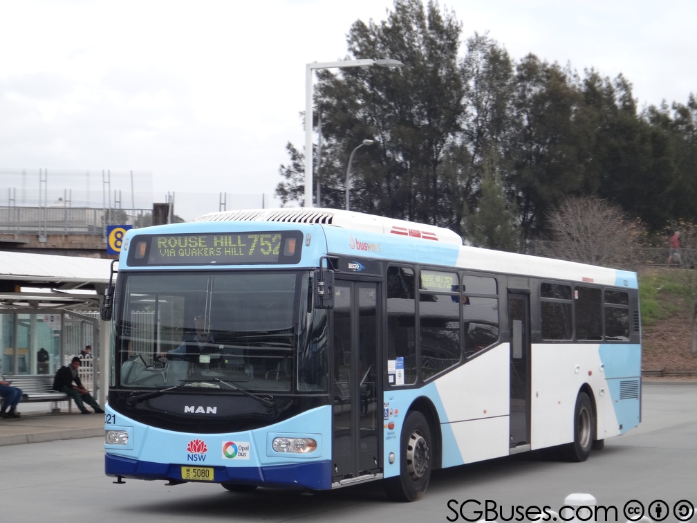
Busways is an Australian bus company operating services in Sydney Sydney ( ) is the capital city of the state of New South Wales, and the most populous city in both Australia and Oceania. Located on Australia's east coast, the metropolis surrounds Sydney Harbour and extends about towards the Blue Mountain ..., and in the Central Coast (New South Wales), Central Coast, Great Lakes Council, Great Lakes, Mid North Coast regions of New South Wales and Adelaide. It is the largest privately owned bus operator in Australia. History The origins of Busways can be traced to 1942 when Dick Rowe commenced a hire car service from Rooty Hill, New South Wales, Rooty Hill to Plumpton, New South Wales, Plumpton. In 1946 Rowe purchased his first bus and further expansion saw a depot established in Plumpton in 1958. [...More Info...] [...Related Items...] OR: [Wikipedia] [Google] [Baidu] |


Blacktown_Council_Chambers.jpg)


