|
Park Avenue (New York)
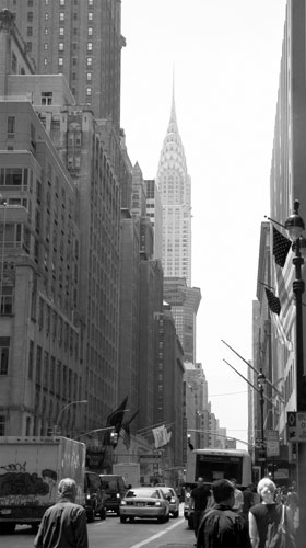
Park Avenue is a wide New York City boulevard which carries north and southbound traffic in the boroughs of Manhattan and the Bronx. For most of the road's length in Manhattan, it runs parallel to Madison Avenue to the west and Lexington Avenue to the east. Park Avenue's entire length was formerly called Fourth Avenue; the title still applies to the section between Cooper Square and 14th Street. The avenue is called Union Square East between 14th and 17th Streets, and Park Avenue South between 17th and 32nd Streets. History Early years and railroad construction The entirety of Park Avenue was originally known as Fourth Avenue and carried the tracks of the New York and Harlem Railroad starting in the 1830s. The railroad originally ran through an open cut through Murray Hill, which was covered with grates and grass between 34th and 40th Street in the early 1850s. A section of this "park" was later renamed Park Avenue in 1860. Park Avenue's original southern terminus w ... [...More Info...] [...Related Items...] OR: [Wikipedia] [Google] [Baidu] |
52nd Street (Manhattan)
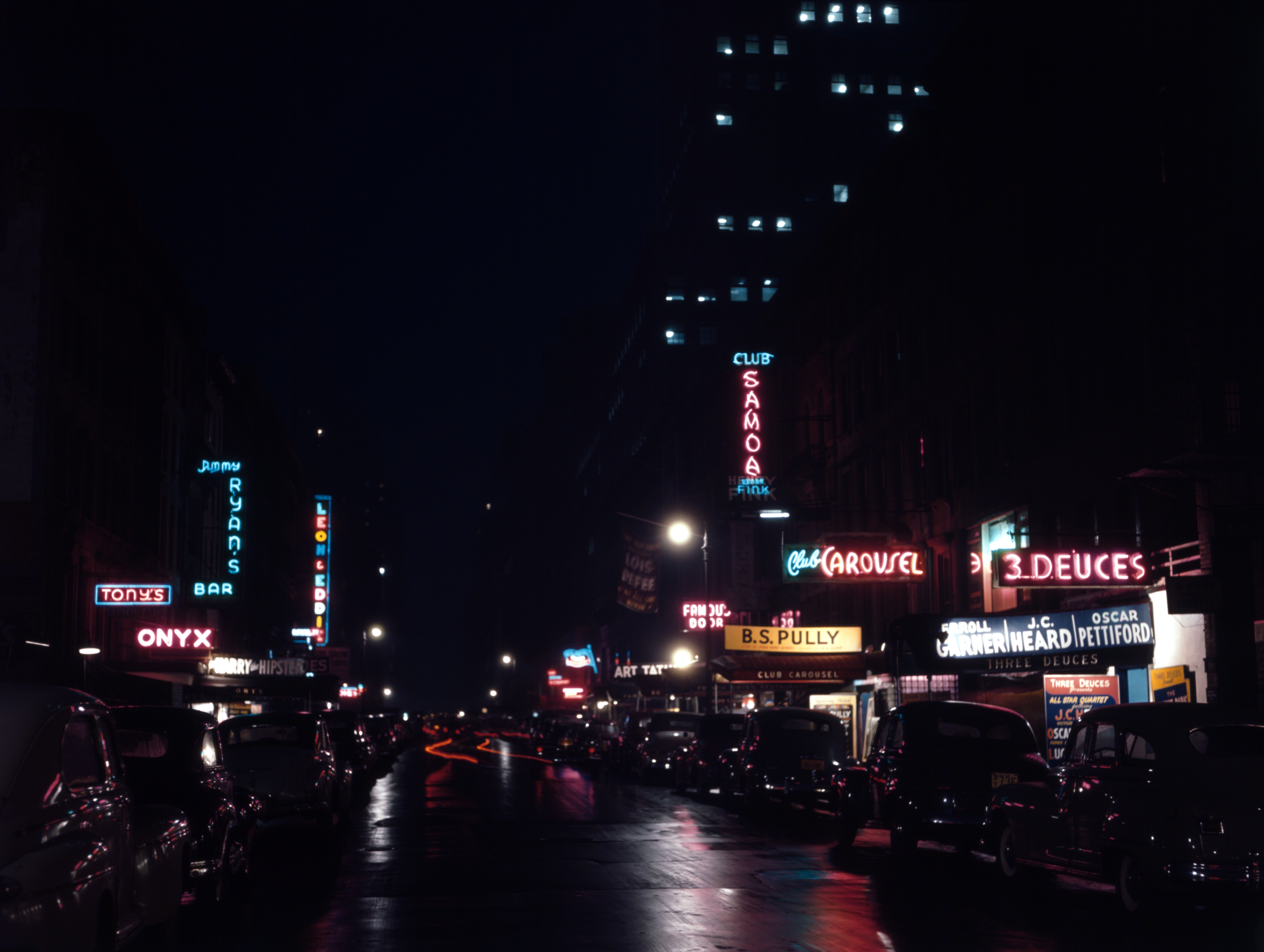
52nd Street is a -long one-way street traveling west to east across Midtown Manhattan, New York City. A short section of it was known as the city's center of jazz performance from the 1930s to the 1950s. Jazz center Following the repeal of Prohibition in 1933, 52nd Street replaced 133rd Street as "Swing Street" of the city. The blocks of 52nd Street between Fifth Avenue and Seventh Avenue became renowned for the abundance of jazz clubs and lively street life. The street was convenient to musicians playing on Broadway and the 'legitimate' nightclubs and was also the site of a CBS studio. Musicians who played for others in the early evening played for themselves on 52nd Street. In the period from 1930 through the early 1950s, 52nd Street clubs hosted such jazz musicians as Louis Prima, Art Tatum, Fats Waller, Billie Holiday, Trummy Young, Harry Gibson, Nat Jaffe, Dizzy Gillespie, Thelonious Monk, Charlie Parker, Miles Davis, Marian McPartland, and many more. Although musici ... [...More Info...] [...Related Items...] OR: [Wikipedia] [Google] [Baidu] |
Commissioners' Plan Of 1811
The Commissioners' Plan of 1811 was the original design for the streets of Manhattan above Houston Street and below 155th Street, which put in place the rectangular grid plan of streets and lots that has defined Manhattan on its march uptown until the current day. It has been called "the single most important document in New York City's development,"Augustyn & Cohen, pp.100–06 and the plan has been described as encompassing the "republican predilection for control and balance ... nddistrust of nature". It was described by the Commission that created it as combining "beauty, order and convenience." The plan originated when the Common Council of New York City, seeking to provide for the orderly development and sale of the land of Manhattan between 14th Street and Washington Heights, but unable to do so itself for reasons of local politics and objections from property owners, asked the New York State Legislature to step in. The legislature appointed a commission with ... [...More Info...] [...Related Items...] OR: [Wikipedia] [Google] [Baidu] |
Murray Hill, Manhattan
Murray Hill is a neighborhood on the east side of Manhattan in New York City. Murray Hill is generally bordered to the east by the East River or Kips Bay and to the west by Midtown Manhattan, though the exact boundaries are disputed. Murray Hill is situated on a steep glacial hill that peaked between Lexington Avenue and Broadway. It was named after Robert Murray, the head of the Murray family, a mercantile family that settled in the area in the 18th century. The Murray farm was formed before 1762 and existed until at least the early 19th century. Through the 19th century, Murray Hill was relatively isolated from the rest of New York City, which at the time was centered in Lower Manhattan. Murray Hill became an upscale neighborhood during the 20th century. Today, it contains several cultural institutions such as the Morgan Library & Museum, as well as missions and consulates to the nearby United Nations headquarters. The neighborhood also contains architectural landmarks, some ... [...More Info...] [...Related Items...] OR: [Wikipedia] [Google] [Baidu] |
New York And Harlem Railroad
The New York and Harlem Railroad (now the Metro-North Railroad's Harlem Line) was one of the first railroads in the United States, and was the world's first street railway. Designed by John Stephenson, it was opened in stages between 1832 and 1852 between Lower Manhattan to and beyond Harlem. Horses initially pulled railway carriages, followed by a conversion to steam engines, then on to battery-powered Julien electric traction cars. In 1907, the then leaseholders of the line, New York City Railway, a streetcar operator, went into receivership. Following a further receivership in 1932, the New York Railways Corporation converted the line to bus operation. The Murray Hill Tunnel now carries a lane of road traffic, but not the buses. The line became part of the New York Central Railroad system with trackage rights granted to the New York, New Haven and Hartford Railroad into Manhattan. It is now part of the Metro-North Railroad system, and the only Manhattan trackage of th ... [...More Info...] [...Related Items...] OR: [Wikipedia] [Google] [Baidu] |
Park Avenue Tunnel
A park is an area of natural, semi-natural or planted space set aside for human enjoyment and recreation or for the protection of wildlife or natural habitats. Urban parks are green spaces set aside for recreation inside towns and cities. National parks and country parks are green spaces used for recreation in the countryside. State parks and provincial parks are administered by sub-national government states and agencies. Parks may consist of grassy areas, rocks, soil and trees, but may also contain buildings and other artifacts such as monuments, fountains or playground structures. Many parks have fields for playing sports such as baseball and football, and paved areas for games such as basketball. Many parks have trails for walking, biking and other activities. Some parks are built adjacent to bodies of water or watercourses and may comprise a beach or boat dock area. Urban parks often have benches for sitting and may contain picnic tables and barbecue grills. The largest ... [...More Info...] [...Related Items...] OR: [Wikipedia] [Google] [Baidu] |
32nd Street (Manhattan)
The New York City borough of Manhattan contains 214 numbered east–west streets ranging from 1st to 228th, the majority of them designated in the Commissioners' Plan of 1811. These streets do not run exactly east–west, because the grid plan is aligned with the Hudson River, rather than with the cardinal directions. Thus, the majority of the Manhattan grid's "west" is approximately 29 degrees north of true west; the angle differs above 155th Street, where the grid initially ended. The grid now covers the length of the island from 14th Street north. All numbered streets carry an East or West prefix – for example, East 10th Street or West 10th Street – which is demarcated at Broadway below 8th Street, and at Fifth Avenue at 8th Street and above. The numbered streets carry crosstown traffic. In general, but with numerous exceptions, even-numbered streets are one-way eastbound and odd-numbered streets are one-way westbound. Most wider streets, and a few of the narr ... [...More Info...] [...Related Items...] OR: [Wikipedia] [Google] [Baidu] |
17th Street (Manhattan)
The New York City borough of Manhattan contains 214 numbered east–west streets ranging from 1st to 228th, the majority of them designated in the Commissioners' Plan of 1811. These streets do not run exactly east–west, because the grid plan is aligned with the Hudson River, rather than with the cardinal directions. Thus, the majority of the Manhattan grid's "west" is approximately 29 degrees north of true west; the angle differs above 155th Street, where the grid initially ended. The grid now covers the length of the island from 14th Street north. All numbered streets carry an East or West prefix – for example, East 10th Street or West 10th Street – which is demarcated at Broadway below 8th Street, and at Fifth Avenue at 8th Street and above. The numbered streets carry crosstown traffic. In general, but with numerous exceptions, even-numbered streets are one-way eastbound and odd-numbered streets are one-way westbound. Most wider streets, and a few of the narro ... [...More Info...] [...Related Items...] OR: [Wikipedia] [Google] [Baidu] |
14th Street (Manhattan)
14th Street is a major crosstown street in the New York City borough of Manhattan, traveling between Eleventh Avenue on Manhattan's West Side and Avenue C on Manhattan's East Side. It forms a boundary between several neighborhoods and is sometimes considered the border between Lower Manhattan and Midtown Manhattan. At Broadway, 14th Street forms the southern boundary of Union Square. It is also considered the northern boundary of Greenwich Village, Alphabet City, and the East Village, and the southern boundary of Chelsea, Flatiron/Lower Midtown, and Gramercy. West of Third Avenue, 14th Street marks the southern terminus of western Manhattan's grid system. North of 14th Street, the streets make up a near-perfect grid that runs in numerical order. South of 14th, the grid continues in the East Village almost perfectly, but not so in Greenwich Village, where an older and less uniform grid plan applies. In the early history of New York City, 14th Street was an upscale locati ... [...More Info...] [...Related Items...] OR: [Wikipedia] [Google] [Baidu] |
Lexington Avenue (Manhattan)
Lexington Avenue, often colloquially abbreviated as "Lex", is an avenue on the East Side of the borough of Manhattan in New York City that carries southbound one-way traffic from East 131st Street to Gramercy Park at East 21st Street. Along its , 110-block route, Lexington Avenue runs through Harlem, Carnegie Hill, the Upper East Side, Midtown, and Murray Hill to a point of origin that is centered on Gramercy Park. South of Gramercy Park, the axis continues as Irving Place from 20th Street to East 14th Street. Lexington Avenue was not one of the streets included in the Commissioners' Plan of 1811 street grid, so the addresses for cross streets do not start at an even hundred number, as they do with avenues that were originally part of the plan. History Both Lexington Avenue and Irving Place began in 1832 when Samuel Ruggles, a lawyer and real-estate developer, petitioned the New York State Legislature to approve the creation of a new north–south avenue between the existi ... [...More Info...] [...Related Items...] OR: [Wikipedia] [Google] [Baidu] |
Borough (New York City)
New York City is composed of five boroughs: The Bronx, Brooklyn, Manhattan, Queens, and Staten Island. Each borough is coextensive with a respective county of New York State, making New York City the largest U.S. municipality situated in multiple counties. The boroughs of Queens and the Bronx are also Queens County and Bronx County. The other three counties are named differently from their boroughs: Manhattan is New York County, Brooklyn is Kings County, and Staten Island is Richmond County. All five boroughs came into existence with the creation of modern New York City in 1898, when New York County (including The Bronx), Kings County, part of Queens County, and Richmond County were consolidated within one municipal government under a new city charter. All former municipalities within the newly consolidated city were eliminated. New York City was originally confined to Manhattan Island and the smaller surrounding islands that formed New York County. As the city grew northw ... [...More Info...] [...Related Items...] OR: [Wikipedia] [Google] [Baidu] |
The New York Times
''The New York Times'' (''the Times'', ''NYT'', or the Gray Lady) is a daily newspaper based in New York City with a worldwide readership reported in 2020 to comprise a declining 840,000 paid print subscribers, and a growing 6 million paid digital subscribers. It also is a producer of popular podcasts such as '' The Daily''. Founded in 1851 by Henry Jarvis Raymond and George Jones, it was initially published by Raymond, Jones & Company. The ''Times'' has won 132 Pulitzer Prizes, the most of any newspaper, and has long been regarded as a national " newspaper of record". For print it is ranked 18th in the world by circulation and 3rd in the U.S. The paper is owned by the New York Times Company, which is publicly traded. It has been governed by the Sulzberger family since 1896, through a dual-class share structure after its shares became publicly traded. A. G. Sulzberger, the paper's publisher and the company's chairman, is the fifth generation of the family to head the pa ... [...More Info...] [...Related Items...] OR: [Wikipedia] [Google] [Baidu] |


.png)