|
Parihasapura
Parihaspora or Parihaspur or Paraspore or Paraspur was a small town northwest of Srinagar in the Kashmir Valley. It was built on a plateau above the Jhelum River. It was built by Lalitaditya Muktapida (695–731) and served as the capital of Kashmir during his reign. Etymology The present name of the place, Paraspore, is derived from the original Sanskrit name of the city, Parihaspur, which loosely translated would mean a city of laughs or a smiling city. "Parihas" means laughter and "pur" means city. History It was built by Lalitaditya Muktapida (695–731) of the Karkota dynasty. He moved his capital from Srinagar to Parihaspur. Kalhana mentions the construction of the city in his Book 4 cantos 194–204. Lalitaditya according to Kalhana built his residence and four temples in this area. The temples included one for Vishnu (Muktakeshva) where according to Kalhana the emperor used 84,000 tolas of gold to make the image of Vishnu. In another temple he used as many Palas of ... [...More Info...] [...Related Items...] OR: [Wikipedia] [Google] [Baidu] |
Lalitaditya Muktapida
Lalitaditya alias Muktapida (IAST: Lalitāditya Muktāpīḍa; r. c. 724 CE–760 CE) was a powerful ruler of the Karkota dynasty of Kashmir region in the Indian subcontinent. The 12th-century chronicler Kalhana characterizes Lalitaditya as a world conqueror, crediting him with extensive conquests and miraculous powers in his ''Rajatarangini''. According to Kalhana, Lalitaditya defeated the central Indian king Yashovarman, and then marched to eastern and southern parts of India. He subjugated several more rulers on his way back to Kashmir, and then subdued several northern kings. Based on a reconstruction of Kalhana's account, art historian Hermann Goetz (1969) theorized that Lalitaditya managed to create a short-lived empire that included major parts of India as well as present-day Afghanistan and Central Asia. Goetz' analysis was accepted and cited widely by subsequent authors writing on the history of Kashmir. However, Kalhana's account is not supported by the records of Lali ... [...More Info...] [...Related Items...] OR: [Wikipedia] [Google] [Baidu] |
States And Territories Of India
India is a federal union comprising 28 states and 8 union territories, with a total of 36 entities. The states and union territories are further subdivided into districts and smaller administrative divisions. History Pre-independence The Indian subcontinent has been ruled by many different ethnic groups throughout its history, each instituting their own policies of administrative division in the region. The British Raj mostly retained the administrative structure of the preceding Mughal Empire. India was divided into provinces (also called Presidencies), directly governed by the British, and princely states, which were nominally controlled by a local prince or raja loyal to the British Empire, which held ''de facto'' sovereignty ( suzerainty) over the princely states. 1947–1950 Between 1947 and 1950 the territories of the princely states were politically integrated into the Indian union. Most were merged into existing provinces; others were organised into ... [...More Info...] [...Related Items...] OR: [Wikipedia] [Google] [Baidu] |
Tola (unit)
The tola ( hi, तोला; ur, تولا ''tolā'') also transliterated as tolah or tole, is a traditional Ancient Indian and South Asian unit of mass, now standardised as 180 grains () or exactly 3/8 troy ounce. It was the base unit of mass in the British Indian system of weights and measures introduced in 1833, although it had been in use for much longer.. It was also used in Aden and Zanzibar: in the latter, one tola was equivalent to 175.90 troy grains (0.97722222 British tolas, or 11.33980925 grams). The tola is a Vedic measure, with the name derived from the Sanskrit ''tol'' (तोलः root तुल्) meaning "weighing" or "weight". One tola was traditionally the weight of 100 ratti (ruttee) seeds, Martin, Robert Montgomery. ''Statistics of the colonies of the British empire'', London: W.H. Allen and Co., 1839, p. 143. and its exact weight varied according to locality. However, it is also a convenient mass for a coin: several pre-colonial coins, inc ... [...More Info...] [...Related Items...] OR: [Wikipedia] [Google] [Baidu] |
Medieval Cities
In the history of Europe, the Middle Ages or medieval period lasted approximately from the late 5th to the late 15th centuries, similar to the post-classical period of global history. It began with the fall of the Western Roman Empire and transitioned into the Renaissance and the Age of Discovery. The Middle Ages is the middle period of the three traditional divisions of Western history: classical antiquity, the medieval period, and the modern period. The medieval period is itself subdivided into the Early, High, and Late Middle Ages. Population decline, counterurbanisation, the collapse of centralized authority, invasions, and mass migrations of tribes, which had begun in late antiquity, continued into the Early Middle Ages. The large-scale movements of the Migration Period, including various Germanic peoples, formed new kingdoms in what remained of the Western Roman Empire. In the 7th century, North Africa and the Middle East—most recently part of the Eastern Roman ... [...More Info...] [...Related Items...] OR: [Wikipedia] [Google] [Baidu] |
Cities And Towns In Baramulla District
A city is a human settlement of notable size.Goodall, B. (1987) ''The Penguin Dictionary of Human Geography''. London: Penguin.Kuper, A. and Kuper, J., eds (1996) ''The Social Science Encyclopedia''. 2nd edition. London: Routledge. It can be defined as a permanent and densely settled place with administratively defined boundaries whose members work primarily on non-agricultural tasks. Cities generally have extensive systems for housing, transportation, sanitation, utilities, land use, production of goods, and communication. Their density facilitates interaction between people, government organisations and businesses, sometimes benefiting different parties in the process, such as improving efficiency of goods and service distribution. Historically, city-dwellers have been a small proportion of humanity overall, but following two centuries of unprecedented and rapid urbanization, more than half of the world population now lives in cities, which has had profound consequences for g ... [...More Info...] [...Related Items...] OR: [Wikipedia] [Google] [Baidu] |
Dogra
The Dogras or Dogra people, are an Indo-Aryan ethno-linguistic group in India and Pakistan consisting of the Dogri language speakers. They live predominantly in the Jammu region of Jammu and Kashmir, and in adjoining areas of Punjab, Himachal Pradesh, and northeastern Pakistan. Their historical homeland is known as Duggar. Dogra Rajputs ruled Jammu from the 19th century, when Gulab Singh was made a hereditary Raja of Jammu by Ranjit Singh, whilst his brother Dhian Singh was the empire's prime minister of Punjab, until October 1947. Through the Treaty of Amritsar (1846), they acquired Kashmir as well. The Dogra Regiment of the Indian Army primarily consists of Dogras from the Himachal Pradesh, Punjab and Jammu region. Etymology The term Dogra is thought to derive from ''Durgara'', the name of a kingdom mentioned in an eleventh century copper-plate inscription in Chamba. The inscription mentions the Raja of Chamba facing an attack by Kiras aided by the Lord of Durgara (''durg ... [...More Info...] [...Related Items...] OR: [Wikipedia] [Google] [Baidu] |
Aurel Stein
Sir Marc Aurel Stein, ( hu, Stein Márk Aurél; 26 November 1862 – 26 October 1943) was a Hungarian-born British archaeologist, primarily known for his explorations and archaeological discoveries in Central Asia. He was also a professor at Indian universities. Stein was also an ethnographer, geographer, linguist and surveyor. His collection of books and manuscripts bought from Dunhuang caves is important for the study of the history of Central Asia and the art and literature of Buddhism. He wrote several volumes on his expeditions and discoveries which include ''Ancient Khotan'', ''Serindia'' and ''Innermost Asia''. Early life Stein was born to Náthán Stein and Anna Hirschler, a Jewish couple residing in Budapest in the Kingdom of Hungary. His parents and his sister retained their Jewish faith but Stein and his brother, Ernst Eduard, were baptised as Lutherans. At home the family spoke German and Hungarian, Stein attended Catholic and Lutheran gymnasiums in Budapest, w ... [...More Info...] [...Related Items...] OR: [Wikipedia] [Google] [Baidu] |
Atlas (architecture)
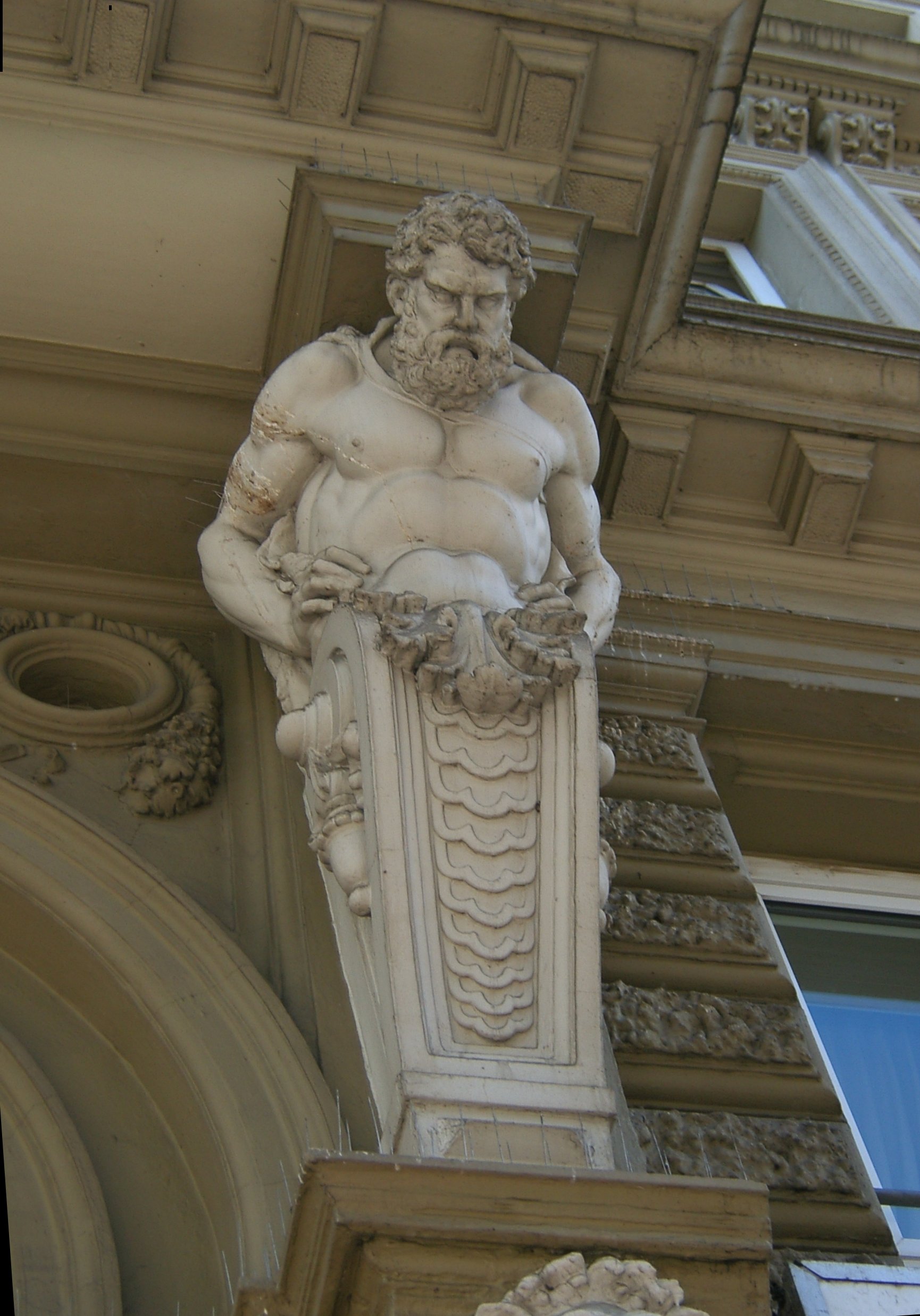
In European architectural sculpture, an atlas (also known as an atlant, or atlante or atlantid; plural atlantes)''Aru-Az , Michael Delahunt ArtLex Art Dictionary , 1996–2008. is a support sculpted in the form of a man, which may take the place of a , a or a . The Roman term for such a sculptural support is |
Parihaspora
#REDIRECTParihaspore Parihaspora or Parihaspur or Paraspore or Paraspur was a small town northwest of Srinagar in the Kashmir Valley. It was built on a plateau above the Jhelum River. It was built by Lalitaditya Muktapida (695–731) and served as the capital of ...Please see this page Parihaspora ... [...More Info...] [...Related Items...] OR: [Wikipedia] [Google] [Baidu] |
Tarikh-i-Kashmir
The ''Tarikh-i-Kashmir'' (History of Kashmir) refers to several history books of Kashmir's Sultanate period, some of them lost and partially used as sources for the others. Lost sources Earlier lost sources include; * History of Mullah Ahmad Kashmiri (lost) * History of Mullah Nadiri (lost) Use of Mullah Nadiri in Ahmadi texts The Ahmadi writer Khwaja Nazir Ahmad in his advocacy of evidence for Jesus in India (1952) produced a photograph of a page in a folio he had tried to purchase in 1946 which he identified as being from Mullah Nadri.Khwaja Nazir Ahmad ''Jesus in heaven on earth'' Woking 1952; page 393 (11 of pdf) "Photograph of a folio from Tarikh-i-Kashmir (See page 401)" Page 366 "... Khwaja Hasan Malik Chaduara, who wrote his Tarikh-i-Kashmir during the reign of ... Khwaja Hassan Malik in his Tarikh-i-Kashmir also speaks of these four inscriptions.5 T will quote only the first and third inscriptions .. The folio is now lost and no identification of the document had been m ... [...More Info...] [...Related Items...] OR: [Wikipedia] [Google] [Baidu] |
Sultan Sikandar
Sikandar Shah (Sikandar Butshikan – "Sikandar, the Iconoclast") was the sixth sultan of the Shah Miri dynasty of Kashmir from 1389 to 1413. Sources The only contemporaneous source that exists is the Rajatarangini (lit. Flow of Succession of Kings) by Jonaraja. Jonaraja was the Brahmin court-poet of Sikandar's successor Zain-ul-Abidin and was commissioned to continue Kalhana's Rajatarangini. One manuscript of his work—edited between 1561 and 1588 by an anonymous person using information from other sources—emends certain portions of the text in the margins; he is conventionally called (and the work, Ps-JRT) in scholarship. Extant Persian sources, including Baharistan-i-shahi (anon.), Tohfatu'l-Ahbab (anon.) and Tarikh-i-Kashmir corpus, were written relatively later and drew from recensions of Rajatarangini(s) but they provide considerable additional information. These were later used by authors starting from Abul Fazl, the first chronicler from outside Kashmir and Niza ... [...More Info...] [...Related Items...] OR: [Wikipedia] [Google] [Baidu] |
Pattan
Pattan is a sub-district, town and a municipal committee in Baramulla district in the Indian union territory of Jammu and Kashmir. Location Pattan is surrounded by Breng Block towards North, Kunzer block towards the south, Narbal block towards east, Singhpora block towards west. This place is near the border of the Baramulla, Budgam and Ganderbal districts. Budgam district and Beerwah are south of this place. History This historical town is considered to have been established by the famous Hindu king Shankarvarman, son of Awantivarman of Utpala dynasty, in the 9th century AD. As per Kalhana's Rajatarangini, Shankarvarman built a town named Pattana. Pandits write it as ‘Pathan’, ‘The Path’, as it falls on the important route to Baramulla. During ancient times Pattan was a business center for wool, livestock and grains. Shankarvarman had built two temples at Pattan town dedicated to Shiva. He named one of the temples after his wife, Sugandha, as Sugandhesa and the ... [...More Info...] [...Related Items...] OR: [Wikipedia] [Google] [Baidu] |

.jpg)


