|
Pajapita
Pajapita is a town and municipality in the San Marcos department of Guatemala.It was created on 31 May 1920, after the station of Vado Ancho on the Panamerican Railroad of Guatemala was built. Due to its privileged location on the way from Guatemala to Mexico, Pajapita enjoyed considerable development while the Guatemalan railways were owned by International Railways of Central America (IRCA}, an American company that belonged to the United Fruit Company. However, with the decline of the rail that followed the constructions of major highways in the country the importance of the town of Vado Ancho diminished, to the point that in the early 21st century it was completely abandoned. Pajapita is called also "Land of the Almond trees". Transport Panamerican Railroad of Guatemala Pajapita started developing with the construction of the Vado Ancho railroad terminal in the 1900s. On April 18, 1902, thanks to his excellent personal rapport with then president Manuel Estrada Cabrer ... [...More Info...] [...Related Items...] OR: [Wikipedia] [Google] [Baidu] |
Nuevo Progreso, San Marcos
Nuevo Progreso () is a municipality in the San Marcos department of Guatemala. History The municipality was created on 17 October 1889 as "El Progreso'. After the murder of president general José María Reina Barrios on 8 February 1898, lawyer Manuel Estrada Cabrera reached power and from the very beginning of his tenure he set up a dictatorial rule, which would last 22 years. The president admirers began a program by which numerous locations and structures were named after the Presidente, and then El Progreso became "Estrada Cabrera" in 1898. In 1908, following with the adulation program, the municipality was renamed, this time as "San Joaquin", a male version of Estrada Cabrera's mother name, Joaquina Cabrera -who had died on 3 July 1908- during the Fiestas Minervalias on 4 November 1908. Finally, it was named "Nuevo Progreso" on 3 May 1920, by president Carlos Herrera y Luna, who issued an executive order to remove all references to Estrada Cabrera and his mother after the ... [...More Info...] [...Related Items...] OR: [Wikipedia] [Google] [Baidu] |
Coatepeque, Quetzaltenango
Coatepeque () also known as Village of gardenias is a town and Municipalities of Guatemala, municipality in the Quetzaltenango Department, Quetzaltenango department of Guatemala. According to the 2018 census, the town of Coatepeque had a population of 37,330. Climate Coatepeque has a tropical monsoon climate (Am) with moderate to little rainfall from December to March and heavy to very heavy rainfall from April to November. Structures Archaeology Takalik Abaj is nearby. Capabilities Organizations People Events Sports Deportivo Coatepeque football club play in the Liga Nacional (the Major National League) of Guatemalan Football. The Serpientes Rojas play their home games in the Israel Barrios Stadium (capacity 24,000, natural grass turf). - World Stadiums Geographic locat ...
|
Ayutla, San Marcos
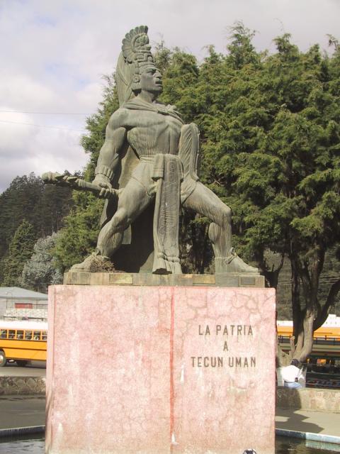
Ayutla () is a municipality in the San Marcos Department of Guatemala. It is situated along the Suchiate River natural border with Mexico in the southern part of the department. The municipality center is Ciudad Tecún Umán. There is a combined road and rail bridge known as ''Puente Rodolfo Robles'' linking Ayutla to Ciudad Hidalgo in Chiapas, Mexico. There exists a railway which was rebuilt in 2019 In December 2019, the U.S. Treasury Department sanctioned Ayutla's mayor, Erick Zúñiga, under the Foreign Narcotics Kingpin Designation Act, alleging Zúñiga to be "a major drug trafficker," while also alleging that Zúñiga controls a drug trafficking organization and "supplies cocaine to Mexico’s Sinaloa Cartel ." Climate Ayutla has tropical savanna climate (Köppen: ''Aw''). Geographic location See also * * * San Marcos Department * Rail transport in Central America * Rail transport in Guatemala * Rail transport in Mexico Mexico has a freight railway system o ... [...More Info...] [...Related Items...] OR: [Wikipedia] [Google] [Baidu] |
El Tumbador
El Tumbador is a town and municipality in the San Marcos department of Guatemala. The population is mostly of Mam people, who speak their own language. It was founded in 1878. The main source of income is agriculture—farming and animal husbandry. People produce mostly coffee, but also sugarcane, beans, cassava, fruits and spices—cardamom and macadamia. Cattle, horses, sheep and goats are bred in the area as well. El Tumbador gave its name to the Belgian Non-governmental organization Tumbador vzw that used to support a project in the municipality. Climate El Tumbador has tropical climate (Köppen: ''Am''). Geographic location It is surrounded by San Marcos Department San Marcos is a department in northwestern Guatemala, on the Pacific Ocean and along the western Guatemala-Mexico border. The department's capital is the city of San Marcos. History Colonial period The Spanish conquest of Guatemalan Highlan ... municipalities: See also * * References External ... [...More Info...] [...Related Items...] OR: [Wikipedia] [Google] [Baidu] |
San Marcos Department
San Marcos is a department in northwestern Guatemala, on the Pacific Ocean and along the western Guatemala-Mexico border. The department's capital is the city of San Marcos. History Colonial period The Spanish conquest of Guatemalan Highlands occurred in the 1520s, followed by the establishment of the Province of Tecusitlán and Lacandón within the Viceroyalty of New Spain. Candacuchex, a settlement of the Mayan Mam people, became the site of the city of San Marcos, established in 1533. In 1546, once the Guatemalan archdiocese was established, bishop Francisco Marroquín split the ecclesiastical duties in the region among the Order of Preachers, Franciscans and Mercedarians, being the latter appointed to take care of "El Barrio" (in present-day San Marcos and Huehuetenango Departments), which was then a part of the Province of Quetzaltenango]. In 1609 the Captaincy General of Guatemala was established. In 1690, the Tejutla "curato" had a large area and included the mode ... [...More Info...] [...Related Items...] OR: [Wikipedia] [Google] [Baidu] |
Catarina, San Marcos
Catarina is a municipality in the San Marcos department of Guatemala. It is recognised as different municipality on 20 January 1925, when it split from Malacatán municipality. Climate Catarina has tropical monsoon climate (Köppen: ''Am''). Geographic location Catarina is surrounded by San Marcos Department San Marcos is a department in northwestern Guatemala, on the Pacific Ocean and along the western Guatemala-Mexico border. The department's capital is the city of San Marcos. History Colonial period The Spanish conquest of Guatemalan Highlan ... municipalities. See also * * References External linksSome information {{San Marcos Department Municipalities of the San Marcos Department ... [...More Info...] [...Related Items...] OR: [Wikipedia] [Google] [Baidu] |
Municipalities Of Guatemala
The Departments of Guatemala, departments of Guatemala are divided into 340 municipality, municipalities, or ''municipios''. The municipalities are listed below, by department. List References {{DEFAULTSORT:Municipalities Of Guatemala Municipalities of Guatemala, Subdivisions of Guatemala Lists of administrative divisions, Guatemala, Municipalities Administrative divisions in North America, Guatemala 2 Second-level administrative divisions by country, Municipalities, Guatemala Guatemala geography-related lists ... [...More Info...] [...Related Items...] OR: [Wikipedia] [Google] [Baidu] |
Antonio Macías Del Real
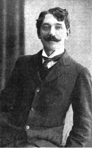
Antonio Macías del Real (1866–1939) was a Spanish writer and pharmacist who moved to Guatemala where he wrote for most prestigious cultural publications. Among his articles are those that we wrote for ''La Ilustración Guatemalteca'' during the last year of general José María Reina Barrios presidency. When the president was assassinated on 8 February 1898, Macías del Real wrote ''Perfiles biográficos de don Manuel Estrada Cabrera'' (''Biographical profiles of Mr. Manuel Estrada Cabrera'', who had been appointed as interim President; Macias del Real kept writing on behalf of the new president since then. In 1902 his adulation paid off, as Estrada Cabrera granted him the Pacific Railroad concession. According to Guatemalan historian Rafael Arévalo Martínez in his book ''¡Ecce Pericles!'', Macías del Real -a pharmacist graduated from Universidad Central de Madrid and later incorporated in Guatemala- was the one that gave Estrada Cabrera a potent venom that the latter use ... [...More Info...] [...Related Items...] OR: [Wikipedia] [Google] [Baidu] |
Tropical Climate
Tropical climate is the first of the five major climate groups in the Köppen climate classification identified with the letter A. Tropical climates are defined by a monthly average temperature of 18 °C (64.4 °F) or higher in the coolest month, and feature hot temperatures all year-round. Annual precipitation is often abundant in tropical climates, and shows a seasonal rhythm but may have seasonal dryness to varying degrees. There are normally only two seasons in tropical climates, a wet (rainy / monsoon) season and a dry season. The annual temperature range in tropical climates is normally very small. Sunlight is intense in these climates. There are three basic types of tropical climates within the tropical climate group: tropical rainforest climate (Af), tropical monsoon climate (Am) and tropical wet and dry climate or tropical savannah (Aw for dry winters, and As for dry summers), which are classified and distinguished by the precipitation and the precipitation lev ... [...More Info...] [...Related Items...] OR: [Wikipedia] [Google] [Baidu] |
Manuel Estrada Cabrera
Manuel José Estrada Cabrera (21 November 1857 – 24 September 1924) was the President of Guatemala from 1898 to 1920. A lawyer with no military background, he was a strong ruler (dictator) who modernised the country's industry and transportation infrastructure, but only via granting concessions to the American-owned United Fruit Company, whose influence on the government was deeply unpopular among the population. Estrada Cabrera used increasingly brutal methods to assert his authority, including armed strike-breaking, and he effectively controlled the general elections. He retained power for 22 years through controlled elections in 1904, 1910, and 1916, and was eventually removed from office when the national assembly declared him mentally incompetent, and he was jailed for corruption. Background Estrada Cabrera was a lawyer. He studied at the Universidad Nacional and thanks to his work he reached the position of "First Designated for the Presidency" when José María Rei ... [...More Info...] [...Related Items...] OR: [Wikipedia] [Google] [Baidu] |
Retalhuleu Department
Retalhuleu () is a department located in the south-west of Guatemala, extending from the mountains to the Pacific Ocean coast. It has an area of 1856 km2. In 2018 the population of the Department of Retalhuleu was 326,828. Its capital, Retalhuleu City, mixes ancient and modern architecture, and it is also known for being a commercial city. The largest Native American group in the state is the K'iche' (Quiché) Maya people. The department contains a number of Pre-Columbian ruins, including Takalik Abaj, and it also contains numerous amusement parks, the most important and known are Xetulul and Xocomil. Municipalities The department is divided into nine municipalities: # Champerico # El Asintal # Nuevo San Carlos # Retalhuleu # San Andrés Villa Seca # San Felipe # San Martín Zapotitlán # San Sebastián # Santa Cruz Muluá Geography Tropical savanna climates have monthly mean temperature above 18 °C (64 °F) in every month of the year and typically a ... [...More Info...] [...Related Items...] OR: [Wikipedia] [Google] [Baidu] |
Quetzaltenango Department
Quetzaltenango is a department in the western highlands of Guatemala. The capital is the city of Quetzaltenango, the second largest city in Guatemala.Rouanet et al 1992, p.14. The department is divided up into 24 municipalities. The inhabitants include Spanish-speaking Ladinos and the K'iche' and Mam Maya groups, both with their own Maya language. The department consists of mountainous terrain, with its principal river being the Samalá River. the department is seismically active, suffering from both earthquakes and volcanic activity. Prior to the Spanish conquest the territory included in the modern department formed a part of the K'iche' Kingdom of Q'umarkaj. The kingdom was defeated by the Spanish under Pedro de Alvarado in a number of decisive battles fought near the city of Quetzaltenango, then known as Xelaju. In the 19th century the territory of the modern department was included in the short-lived Central American state of Los Altos. The department was created by decree ... [...More Info...] [...Related Items...] OR: [Wikipedia] [Google] [Baidu] |


