|
Owenmore River (County Cavan)
The Owenmore River ( ga, Abhainn Mór, meaning "Big River") rises in the Cuilcagh Mountains, in the townland of Dunmakeever, civil parish of Kinawley, Roman Catholic parish of Glangevlin, Barony of Tullyhaw, County Cavan. It then flows in a north-west direction and ends in the River Shannon in Gowlat Gowlat, an Anglicisation of the Gaelic, 'Gabhla', meaning ''The Forks'' (of the Rivers), is a townland in the civil parish of Templeport, County Cavan, Ireland. It lies in the Roman Catholic parish of Glangevlin and barony of Tullyhaw. Geograp ... townlanIt has a fish population of brown trout. The Book of Magauran, dating to the 1350s, mentions an Abhainn Mór (Poem XV, stanza 9) but from the geographical description it probably means the Yellow River at Ballinamore rather than the Owenmore River. What cannot be disputed is the Owenmore River's claim to be the "true" headwaters of the River Shannon with the infant Shannon just a minor tributary of it. The Owenmore flows west f ... [...More Info...] [...Related Items...] OR: [Wikipedia] [Google] [Baidu] |
Cuilcagh
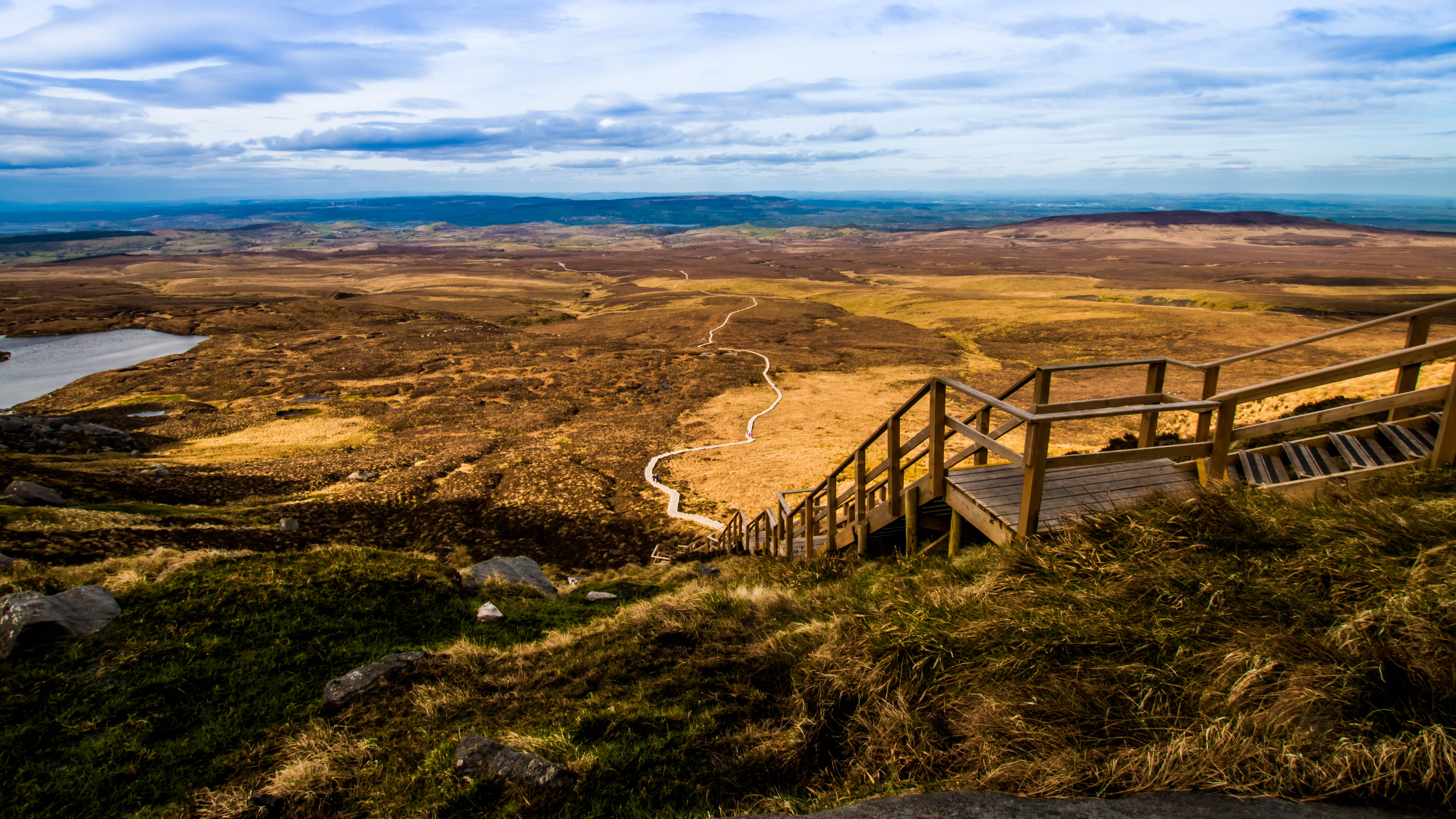
Cuilcagh () is a mountain on the border between County Fermanagh (in Northern Ireland) and County Cavan (in the Republic of Ireland). With a height of it is the highest point in both counties. It is also the 170th highest peak on the island of Ireland, and Ireland's only cross-border county top. Water from the southern slope flows underground until it emerges some miles away in the Shannon Pot, the traditional source of the River Shannon. The area is sometimes referred to as the Cuilcagh Mountains. Naming The name Cuilcagh comes from the Irish ''Cuilceach'', which has been translated as "chalky". However, the mountain is mainly sandstone and shale, covered with bog and heather. The cliff-edged summit surface of the mountain is formed from the hard-wearing Lackagh Sandstone which itself overlies the Briscloonagh Sandstone. "It is possible that the name refers to the limestone rock on the lower northern flanks, namely the Glencar and Dartry Limestone formations. Here a number ... [...More Info...] [...Related Items...] OR: [Wikipedia] [Google] [Baidu] |
Dunmakeever
Dunmakeever is a townland in the Civil Parish of Kinawley, Roman Catholic Parish of Glangevlin, Barony of Tullyhaw, County Cavan, Ireland. Etymology The townland name is an anglicisation of the Gaelic placename "Dún Mhic Íomhair" which means 'The Fort of Íomhair’s Son'. Íomhair, who lived about 850 A.D., was Lord of Tullyhaw and the son of Cosgrach mac Dúnghal. Íomhair’s son was Ruarc, after whom the townland is named, who lived about 880 A.D and was also Lord of Tullyhaw and an ancestor of the McGovern clan. Ruarc’s name is also preserved in the adjoining townland of Aghatirourke which is an anglicisation of 'Achadh-tigh-Ruairc' which means "The Field of Ruarc’s House". These townland names, along with Moneensauran, supply important evidence that the McGovern clan originally came from Glangevlin and only later spread out to other parts of Tullyhaw such as Ballymagauran and Blacklion. The earliest surviving mention of the townland name is 'Dunnemakevir', from a l ... [...More Info...] [...Related Items...] OR: [Wikipedia] [Google] [Baidu] |
Glangevlin
Glangevlin () is a village in the northwest of County Cavan, Ireland. It is in the townlands of Gub (Glangevlin) and Tullytiernan, at the junction of the R200 and R207 regional roads. It is surrounded by the Cuilcagh Mountains and borders the counties of Leitrim and Fermanagh. A large stone known as 'Maguire's chair' is deposited on the right hand side of the road, roughly 4 miles from Glangevlin village, so-called because it was supposedly the inauguration site of the Maguire clan in medieval times. Glangevlin has a strong traditional Irish background and Irish was spoken up until the 1930s, one of the last places in Cavan where this was commonplace. Glangevlin is also well known to have been the last place in Ireland to have a glacier lasting from the Ice age. The Cuilcagh mountains were the last affected part of the island of Ireland as well as the most western part of Europe bar Iceland. Etymology Some sources, including ''A Topographical Dictionary of Ireland'', p ... [...More Info...] [...Related Items...] OR: [Wikipedia] [Google] [Baidu] |
Tullyhaw
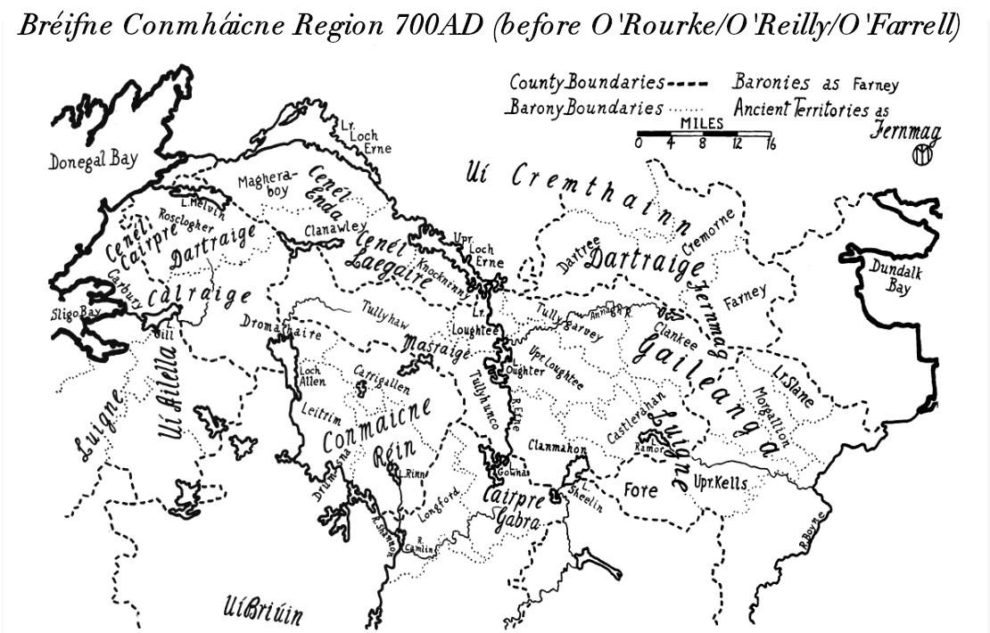
Tullyhaw ( ga, Teallach Eathach) (which means 'The Territory of Eochaidh', an ancestor of the McGoverns, who lived ) is a Barony in County Cavan in the Republic of Ireland. The area has been in constant occupation since pre-4000 BC. Located in the northwest of the county, it has been referred to as Cavan's panhandle. In 1579, East Breifne, then part of Connacht, was made a shire. The shire was named County Cavan ( ga, An Cabhán) after Cavan, the area's main town. The administration remained in the control of the local Irish dynasty and subject to the Brehon and Canon Law. In 1584, Sir John Perrot formed the shire into a county in Ulster. It was subdivided into seven baronies: *two of which were assigned to Sir John O'Reilly and *three to other members of the family; *two remaining, possessed by the septs of ** McKiernan Clan and **McGovern (a.k.a. ''Magauran'') The last one, Tullyhaw, encompassed the mountains bordering on O'Rourke's country, and was left subject t ... [...More Info...] [...Related Items...] OR: [Wikipedia] [Google] [Baidu] |
County Cavan
County Cavan ( ; gle, Contae an Chabháin) is a Counties of Ireland, county in Republic of Ireland, Ireland. It is in the Provinces of Ireland, province of Ulster and is part of the Border Region. It is named after the town of Cavan and is based on the historic Gaelic Ireland, Gaelic territory of East Breifne, East Breffny (''Bréifne''). Cavan County Council is the Local government in the Republic of Ireland, local authority for the county, which had a population of 76,176 at the 2016 census. Geography Cavan borders six counties: County Leitrim, Leitrim to the west, County Fermanagh, Fermanagh and County Monaghan, Monaghan to the north, County Meath, Meath to the south-east, County Longford, Longford to the south-west and County Westmeath, Westmeath to the south. Cavan shares a border with County Fermanagh in Northern Ireland. Cavan is the 19th largest of the 32 counties in area and the 25th largest by population. The county is part of the Northern and Western Region, a Nom ... [...More Info...] [...Related Items...] OR: [Wikipedia] [Google] [Baidu] |
River Shannon
The River Shannon ( ga, Abhainn na Sionainne, ', '), at in length, is the longest river in the British Isles. It drains the Shannon River Basin, which has an area of , – approximately one fifth of the area of the island of Ireland. The Shannon divides the west of Ireland (principally the province of Connacht) from the east and south (Leinster and most of Munster). (County Clare, being west of the Shannon but part of the province of Munster, is the major exception.) The river represents a major physical barrier between east and west, with fewer than thirty-five crossing points between Limerick city in the south and the village of Dowra in the north. The river takes its name after ''Sionna'', a Celtic goddess. Known as an important waterway since antiquity, the Shannon first appeared in maps by the Graeco-Egyptian geographer Ptolemy ( 100 – 170 AD). The river flows generally southwards from the Shannon Pot in County Cavan before turning west and emptying into the A ... [...More Info...] [...Related Items...] OR: [Wikipedia] [Google] [Baidu] |
Gowlat
Gowlat, an Anglicisation of the Gaelic, 'Gabhla', meaning ''The Forks'' (of the Rivers), is a townland in the civil parish of Templeport, County Cavan, Ireland. It lies in the Roman Catholic parish of Glangevlin and barony of Tullyhaw. Geography Gowlat is bounded on the north by Drumhurrin townland, on the west by Corleckagh Lower, Corleckagh Upper and Tullantanty townlands, on the south by Coppanaghbane townland and on the east by Curraghvah townland. Its chief geographical features are the River Shannon, the Owenmore River, mountain streams, a wood, a waterfall, gravel pits, a dug well and spring wells. The townland is traversed by the regional R200 road (Ireland), minor public roads and rural lanes. The townland covers 302 statute acres. The junction of the Shannon and Owenmore rivers is called ''Nixon's Hole''. History By 1720 Morley Saunders, was the owner of the townland. A deed dated 28 July 1720 between Morley Saunders and Richard Hassard spells the name as ''Golagh'' ... [...More Info...] [...Related Items...] OR: [Wikipedia] [Google] [Baidu] |
Shannon River Basin
The Shannon River Basin consists of the area containing Ireland, Ireland's longest river, the River Shannon, and all of its tributaries and lakes. The official Ordnance Survey Ireland length of the Shannon from its Shannon Pot source is made up of tidal water flow and freshwater flow. Statistics The Shannon Basin is Ireland's largest basin with an area of . Including the estuary and the River Feale, the total catchment drains a total of . It has a Long Term Average Flow of (at Limerick, Limerick City).South Eastern River Basin Management: Page 38 This is double the flow rate of Ireland's second largest river, the River Corrib (). If the discharges from all of the rivers and streams into the Shannon Estuary (including the rivers Feale ... [...More Info...] [...Related Items...] OR: [Wikipedia] [Google] [Baidu] |


.jpg)
