|
Ouvrage Hochwald
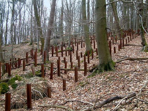
Ouvrage Hochwald is a ''gros ouvrage'' of the Maginot Line, one of the largest fortifications in the Line. Located on the Hochwald ridge in the Fortified Sector of Haguenau in the community of Drachenbronn-Birlenbach in the Bas-Rhin department of northeastern France, it was designed to protect the northern Vosges region of France. Ouvrage Hochwald is sometimes considered as two ouvrages because of its separation of the western and the eastern portions of the ouvrage. Uniquely, the original plans for the position included an elevated battery to the rear with long-range 145 mm or 155 mm gun turrets of a new kind. Hochwald is used by the French Air Force as an armoured air defense coordination center. Design and construction The Hochwald site was surveyed by CORF (''Commission d'Organisation des Régions Fortifiées''), the Maginot Line's design and construction agency, in 1928. Work began the next year, and the position became operational in 1933.Kaufmann 2006, p. 25 ... [...More Info...] [...Related Items...] OR: [Wikipedia] [Google] [Baidu] |
Maginot Line
The Maginot Line (french: Ligne Maginot, ), named after the French Minister of War André Maginot, is a line of concrete fortifications, obstacles and weapon installations built by France in the 1930s to deter invasion by Germany and force them to move around the fortifications. The Maginot Line was impervious to most forms of attack. In consequence, the Germans invaded through the Low Countries in 1940, passing it to the north. The line, which was supposed to be fully extended further towards the west to avoid such an occurrence, was finally scaled back in response to demands from Belgium. Indeed, Belgium feared it would be sacrificed in the event of another German invasion. The line has since become a metaphor for expensive efforts that offer a false sense of security. Constructed on the French side of its borders with Italy, Switzerland, Germany, Luxembourg and Belgium, the line did not extend to the English Channel. French strategy therefore envisioned a move into Belgium ... [...More Info...] [...Related Items...] OR: [Wikipedia] [Google] [Baidu] |
Rhine
), Surselva, Graubünden, Switzerland , source1_coordinates= , source1_elevation = , source2 = Rein Posteriur/Hinterrhein , source2_location = Paradies Glacier, Graubünden, Switzerland , source2_coordinates= , source2_elevation = , source_confluence = Reichenau , source_confluence_location = Tamins, Graubünden, Switzerland , source_confluence_coordinates= , source_confluence_elevation = , mouth = North Sea , mouth_location = Netherlands , mouth_coordinates = , mouth_elevation = , progression = , river_system = , basin_size = , tributaries_left = , tributaries_right = , custom_label = , custom_data = , extra = The Rhine ; french: Rhin ; nl, Rijn ; wa, Rén ; li, Rien; rm, label= Sursilvan, Rein, rm, label= Sutsilvan and Surmiran, Ragn, rm, label=Rumantsch Grischun, Vallader and Puter, Rain; it, Reno ; gsw, Rhi(n), inclu ... [...More Info...] [...Related Items...] OR: [Wikipedia] [Google] [Baidu] |


