|
Otterham Station
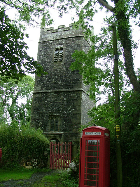
Otterham ( kw, Prasotri) is a village and a civil parish in north Cornwall, England, United Kingdom. The village is situated approximately south of Bude and north of Camelford.Ordnance Survey: Landranger map sheet 190 ''Bude & Clovelly'' Otterham Mill, Otterham Down and Otterham Station (''see below'') are neighbouring settlements to Otterham village; all take the name from the River Ottery which rises in the parish. The parish is in the Hundred of Lesnewth and Deanery of Trigg Major. It is in the Registration District of Camelford and belongs to the Boscastle group of Anglican parishes. Otterham parish is bounded to the north by St Gennys, to the east by Warbstow, to the south by Davidstow and to the west by St Juliot. The parish is rural with small hamlets and farmsteads spread fairly evenly across it: the population of the parish in the 2001 census was 228. The parish church of St Denis at is in Otterham village and has a 40 ft tower housing three bells. ... [...More Info...] [...Related Items...] OR: [Wikipedia] [Google] [Baidu] |
United Kingdom Census 2001
A nationwide census, known as Census 2001, was conducted in the United Kingdom on Sunday, 29 April 2001. This was the 20th UK census and recorded a resident population of 58,789,194. The 2001 UK census was organised by the Office for National Statistics (ONS) in England and Wales, the General Register Office for Scotland (GROS) and the Northern Ireland Statistics and Research Agency (NISRA). Detailed results by region, council area, ward and output area are available from their respective websites. Organisation Similar to previous UK censuses, the 2001 census was organised by the three statistical agencies, ONS, GROS, and NISRA, and coordinated at the national level by the Office for National Statistics. The Orders in Council to conduct the census, specifying the people and information to be included in the census, were made under the authority of the Census Act 1920 in Great Britain, and the Census Act (Northern Ireland) 1969 in Northern Ireland. In England and Wales these re ... [...More Info...] [...Related Items...] OR: [Wikipedia] [Google] [Baidu] |
Davidstow
Davidstow ( kw, Logdewi (village) and kw, Pluwdhewi (parish)) is a civil parish and village in north Cornwall, England, United Kingdom. The village is north of Bodmin Moor straddling the A395 road about north of Camelford. The hamlets of Hallworthy, Hendraburnick, Tremail and Trewassa are in the parish. It was formerly known as Dewstow(e). 'Davidstow Cheddar' and 'Cathedral City' brands of cheese are produced at Davidstow Creamery which is operated by Dairy Crest using water ultimately from St David's Holy well, next to the parish church. A military airfield, RAF Davidstow Moor, was built near the village during the Second World War and was later used as a motor racing circuit. Parish church 'Davidstow' means ''David's Place'' and according to legend the church was founded by Saint David in the 6th century, whilst visiting his mother at nearby Altarnun. The church is large but was very much restored in 1875 so that little original work remains inside. Both the nave and the ... [...More Info...] [...Related Items...] OR: [Wikipedia] [Google] [Baidu] |
Villages In Cornwall
A village is a clustered human settlement or community, larger than a hamlet but smaller than a town (although the word is often used to describe both hamlets and smaller towns), with a population typically ranging from a few hundred to a few thousand. Though villages are often located in rural areas, the term urban village is also applied to certain urban neighborhoods. Villages are normally permanent, with fixed dwellings; however, transient villages can occur. Further, the dwellings of a village are fairly close to one another, not scattered broadly over the landscape, as a dispersed settlement. In the past, villages were a usual form of community for societies that practice subsistence agriculture, and also for some non-agricultural societies. In Great Britain, a hamlet earned the right to be called a village when it built a church. [...More Info...] [...Related Items...] OR: [Wikipedia] [Google] [Baidu] |
John MacLean (historian)
Sir John Maclean KB, FSA (17 September 1811 – 5 March 1895) was a British civil servant, genealogist and author. Life Maclean was born John Lean, a son of Robert Lean, of Trehudreth in the parish of Blisland in Cornwall, where he was born in 1811. His mother was Elizabeth Every, a daughter of Thomas Every, of Bodmin, Cornwall. After genealogical research his ancestors were connected to the Scottish Clan Maclean, and in 1845, with his brothers, he added to his surname the prefix "Mac". In 1837 he entered the Ordnance Department of the War Office, and became deputy auditor in April, 1865. He resigned this post on a pension, and received a knighthood in January, 1871. Sir John Maclean died at his residence, Glasbury House, Richmond Hill, Clifton, Bristol, of influenza. on Tuesday 5 March 1895. Family In 1835 at Helland in Cornwall, he married Mary Billing, eldest sister and co-heiress of Thomas Billing, of Lanke, Cornwall. Writings Sir John's ''Parochial History of the Deaner ... [...More Info...] [...Related Items...] OR: [Wikipedia] [Google] [Baidu] |
River Camel
The River Camel ( kw, Dowr Kammel, meaning ''crooked river'') is a river in Cornwall, England. It rises on the edge of Bodmin Moor and with its tributaries its catchment area covers much of North Cornwall. The river flows into the eastern Celtic Sea between Stepper Point and Pentire Point having covered about 30 miles, making it the second longest river wholly in Cornwall. The river is tidal upstream to Egloshayle and is popular for sailing, birdwatching and fishing. The name ''Camel'' comes from the Cornish language for 'the crooked one', a reference to its winding course. Historically the river was divided into three named stretches. Heyl ( kw, Heyl, meaning ''estuary'') was the name for the estuary up to Egloshayle, the River Allen ( kw, Dowr Alen, meaning ''shining river'') was the stretch between Egloshayle and Trecarne, whilst the Camel was reserved for the stretch of river between its source and Trecarne. Geology and hydrology The River Camel rises on Hendraburnick Do ... [...More Info...] [...Related Items...] OR: [Wikipedia] [Google] [Baidu] |
Tumulus
A tumulus (plural tumuli) is a mound of earth and stones raised over a grave or graves. Tumuli are also known as barrows, burial mounds or ''kurgans'', and may be found throughout much of the world. A cairn, which is a mound of stones built for various purposes, may also originally have been a tumulus. Tumuli are often categorised according to their external apparent shape. In this respect, a long barrow is a long tumulus, usually constructed on top of several burials, such as passage graves. A round barrow is a round tumulus, also commonly constructed on top of burials. The internal structure and architecture of both long and round barrows has a broad range; the categorization only refers to the external apparent shape. The method of may involve a dolmen, a cist, a mortuary enclosure, a mortuary house, or a chamber tomb. Examples of barrows include Duggleby Howe and Maeshowe. Etymology The word ''tumulus'' is Latin for 'mound' or 'small hill', which is derived from th ... [...More Info...] [...Related Items...] OR: [Wikipedia] [Google] [Baidu] |
Bronze Age
The Bronze Age is a historic period, lasting approximately from 3300 BC to 1200 BC, characterized by the use of bronze, the presence of writing in some areas, and other early features of urban civilization. The Bronze Age is the second principal period of the three-age system proposed in 1836 by Christian Jürgensen Thomsen for classifying and studying ancient societies and history. An ancient civilization is deemed to be part of the Bronze Age because it either produced bronze by smelting its own copper and alloying it with tin, arsenic, or other metals, or traded other items for bronze from production areas elsewhere. Bronze is harder and more durable than the other metals available at the time, allowing Bronze Age civilizations to gain a technological advantage. While terrestrial iron is naturally abundant, the higher temperature required for smelting, , in addition to the greater difficulty of working with the metal, placed it out of reach of common use until the end o ... [...More Info...] [...Related Items...] OR: [Wikipedia] [Google] [Baidu] |
North Cornwall Railway
The North Cornwall Railway was a railway line running from Halwill in Devon to Padstow in Cornwall via Launceston, Cornwall, Launceston, Camelford and Wadebridge, a distance of . Opened in the last decade of the nineteenth century, it was part of a drive by the London and South Western Railway (LSWR) to develop holiday traffic to Cornwall. The LSWR had opened a line connecting Exeter with Holsworthy in 1879, and by encouraging the North Cornwall Railway it planned to create railway access to previously inaccessible parts of the northern coastal area. "There are few more fascinating lines than the one which leads to North Cornwall from Okehampton" says T.W.E. Roche in his popular tribute to the network of railway lines operated by the London and South Western Railway (LSWR) in North and West Devon and North Cornwall. History First railways In the nineteenth century, Padstow was an important fishing port, but it was hampered by lack of land communication with its markets. The B ... [...More Info...] [...Related Items...] OR: [Wikipedia] [Google] [Baidu] |
A39 Road
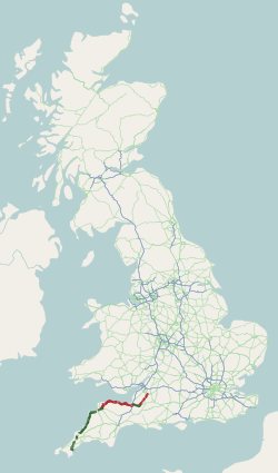
The A39 is an A road in south west England. It runs south-west from Bath in Somerset through Wells, Glastonbury, Street and Bridgwater. It then follows the north coast of Somerset, Devon and Cornwall through Williton, Minehead, Porlock, Lynmouth, Barnstaple, Bideford, Stratton, Camelford, Wadebridge and St Columb Major. It then joins the route of the A30 road for around , re-emerging near Zelah to head for the south Cornish coast via Truro and Falmouth. In Cornwall and North Devon (until the junction with the A361 "North Devon Link Road"), the road is known as the Atlantic Highway, and was classified as a trunk road until 2002. Porlock Hill Porlock Hill is a section of the A39 west of the village of Porlock. The road climbs approximately in less than up onto Exmoor: a very steep hill with gradients of up to 1 in 4 and hairpin bends. In Porlock itself you will often smell burning brakes from vehicles who have just descended the hill. On 12 January 1899, the ten- ... [...More Info...] [...Related Items...] OR: [Wikipedia] [Google] [Baidu] |
St Denis' Church, Otterham
St Denis's Church, Otterham is a Grade II* listed parish church in the Church of England Diocese of Truro in Otterham, Cornwall. History The dedication to St. Denis is undocumented according to Charles G. Henderson who observes that nearby land was called St Tenye in 1613. (Other dedications to this saint in Cornwall are found at Trevena and North Tamerton.) The church dates from the Norman period. The tower may have been rebuilt in 1702. The church was restored between 1889 and 1904; at which time the north transept was demolished and much old woodwork was removed.''Cornish Church Guide'', p. 173 Parish status The church is in the Boscastle and Tintagel group of parishes which includes *St Symphorian's Church, Forrabury *St Merteriana's Church, Minster * St Materiana's Church, Tintagel * St Michael and All Angel's Church, Lesnewth *St Julitta's Church, St Juliot *The Holy Family Church, Treknow * St Piran's Church, Trethevy *St Petroc's Church, Trevalga Bells & organ The ... [...More Info...] [...Related Items...] OR: [Wikipedia] [Google] [Baidu] |
St Juliot
St Juliot is a civil parish in north-east Cornwall, England, United Kingdom. The parish is entirely rural and the settlements within it are the hamlets of Beeny and Tresparrett. - plus a part of the adjacent village of Marshgate. The parish population at the 2011 census was 328. History The manor of St Juliot was recorded in the Domesday Book (1086) when it was held by Thurstan from Robert, Count of Mortain. There was 1 virgate of land and land for 3 ploughs. There were half a plough, 2 serfs, 2 villeins, 30 acres of pasture and 2 cows. The value of the manor was 5 shillings though it had formerly been worth 7 shillings. Parish Church St Julitta's church is dedicated to St Julitta (Juliot) and stands in an isolated location above the valley of the River Valency at The parish church of Lanteglos by Camelford and the castle chapel at Tintagel are also dedicated to St Julitta. The chapel of St Julitta was acquired in 1238 by the canons of St Stephens by Launceston and before ... [...More Info...] [...Related Items...] OR: [Wikipedia] [Google] [Baidu] |


