|
Ostprignitz-Ruppin
Ostprignitz-Ruppin is a ''Kreis'' (district) in the northwestern part of Brandenburg, Germany. Neighboring are (from north clockwise) the districts Müritz and Mecklenburg-Strelitz in Mecklenburg-Western Pomerania, the districts Oberhavel and Havelland, the district Stendal in Saxony-Anhalt, and the district Prignitz. Geography The district consists of plain countryside northwest of Berlin. It is densely forested. Many rivers and lakes can be found in its western, its central and its northeastern part. The main river in the district is the Dosse. History The district has always been distinguishable from the West Prignitz, having been settled originally by Slavs from a different part of Mecklenburg. It was officially created in 1993 by merging the districts Kyritz, Neuruppin and Wittstock. The district roughly covers the same territory as the two historic districts Ostprignitz and Ruppin. Osprignitz was created in 1815 as one of two districts covering the former county Prignitz, a ... [...More Info...] [...Related Items...] OR: [Wikipedia] [Google] [Baidu] |
Neuruppin
Neuruppin (; North Brandenburgisch: ''Reppin'') is a town in Brandenburg, Germany, the administrative seat of Ostprignitz-Ruppin district. It is the birthplace of the novelist Theodor Fontane (1819–1898) and therefore also referred to as ''Fontanestadt''. A garrison town since 1688 and largely rebuilt in a Neoclassical style after a devastating fire in 1787, Neuruppin has the reputation of being "the most Prussian of all Prussian towns". Geography Geographical position Neuruppin is one of the largest cities in Germany in terms of area. The city of Neuruppin, northwest of Berlin in the district of Ostprignitz-Ruppin (Ruppin Switzerland), consists in the south of the districts located on the shores of Ruppiner See, which is crossed by the Rhin River, including the actual core city of Neuruppin and Alt Ruppin. In the north, it stretches up to the Rheinsberg Lake Region and the border with Mecklenburg-Vorpommern. It is part of the Stechlin-Ruppiner Land Nature Park and is connected ... [...More Info...] [...Related Items...] OR: [Wikipedia] [Google] [Baidu] |
Vielitzsee
Vielitzsee is a municipality in the Ostprignitz-Ruppin district, in Brandenburg, Germany Germany,, officially the Federal Republic of Germany, is a country in Central Europe. It is the second most populous country in Europe after Russia, and the most populous member state of the European Union. Germany is situated betwe .... Vielitz_Vielitzsee.jpg, Lake Vielitz File:Vielitz_church_SE.jpg, Vielitz File:Seebeck_church.jpg, Seebeck File:Strubensee_church.jpg, Strubensee Demography References Localities in Ostprignitz-Ruppin {{Brandenburg-geo-stub ... [...More Info...] [...Related Items...] OR: [Wikipedia] [Google] [Baidu] |
Rüthnick
Rüthnick is a municipality in the Ostprignitz-Ruppin district, in Brandenburg, Germany Germany,, officially the Federal Republic of Germany, is a country in Central Europe. It is the second most populous country in Europe after Russia, and the most populous member state of the European Union. Germany is situated betwe .... Demography References Localities in Ostprignitz-Ruppin {{Brandenburg-geo-stub ... [...More Info...] [...Related Items...] OR: [Wikipedia] [Google] [Baidu] |
Lindow (Mark)
Lindow in der Mark, short: Lindow (Mark), is a town in the Ostprignitz-Ruppin district, in Brandenburg, Germany. It is located 14 km northeast of Neuruppin, and 29 km northwest of Oranienburg. The town is situated on an isthmus between the lakes Gudelacksee and Wutzsee. History In the course of the medieval eastward migrations of Germans Gebhard I, Count of Arnstein conquered the area around today's Lindow. In 1196 he settled in the castle of Ruppin, located in today's Alt Ruppin, a locality of Neuruppin. The comital family later adopted the name counts of Lindow-Ruppin. By 1220 or 1240 the counts founded a Cistercian nunnery next to Lake Wutzsee in Lindow and richly enfeoffed it with lands and villages, whose inhabitants became serfs to the nunnery. The nunnery compound comprised a cloister surrounded by the convent buildings in the east and west, the cloister church in the north and a smaller structure on the southern side partially opening towards Wutzsee. The nunn ... [...More Info...] [...Related Items...] OR: [Wikipedia] [Google] [Baidu] |
Herzberg, Ostprignitz-Ruppin
Herzberg () is a municipality in the Ostprignitz-Ruppin district, in Brandenburg, Germany Germany,, officially the Federal Republic of Germany, is a country in Central Europe. It is the second most populous country in Europe after Russia, and the most populous member state of the European Union. Germany is situated betwe .... Demography References Localities in Ostprignitz-Ruppin {{Brandenburg-geo-stub ... [...More Info...] [...Related Items...] OR: [Wikipedia] [Google] [Baidu] |
Wusterhausen
Wusterhausen (official name Wusterhausen/Dosse) is a municipality in the Ostprignitz-Ruppin district, in northwestern Brandenburg, Germany. It is situated on the river Dosse, 7 km southeast of Kyritz, and 75 km northwest of Berlin. Demography File:Bevölkerungsentwicklung Wusterhausen-Dosse.pdf, Development of population since 1875 within the current Boundaries (Blue Line: Population; Dotted Line: Comparison to Population development in Brandenburg state; Grey Background: Time of Nazi Germany; Red Background: Time of communist East Germany) File:Bevölkerungsprognosen Wusterhausen-Dosse.pdf, Recent Population Development and Projections (Population Development before Census 2011 (blue line); Recent Population Development according to the Census in Germany in 2011 (blue bordered line); Official projections for 2005-2030 (yellow line); for 2017-2030 (scarlet line); for 2020-2030 (green line) People * Dieter Helm Sir Dieter Robin Helm (born 11 November 1956) ... [...More Info...] [...Related Items...] OR: [Wikipedia] [Google] [Baidu] |
Heiligengrabe
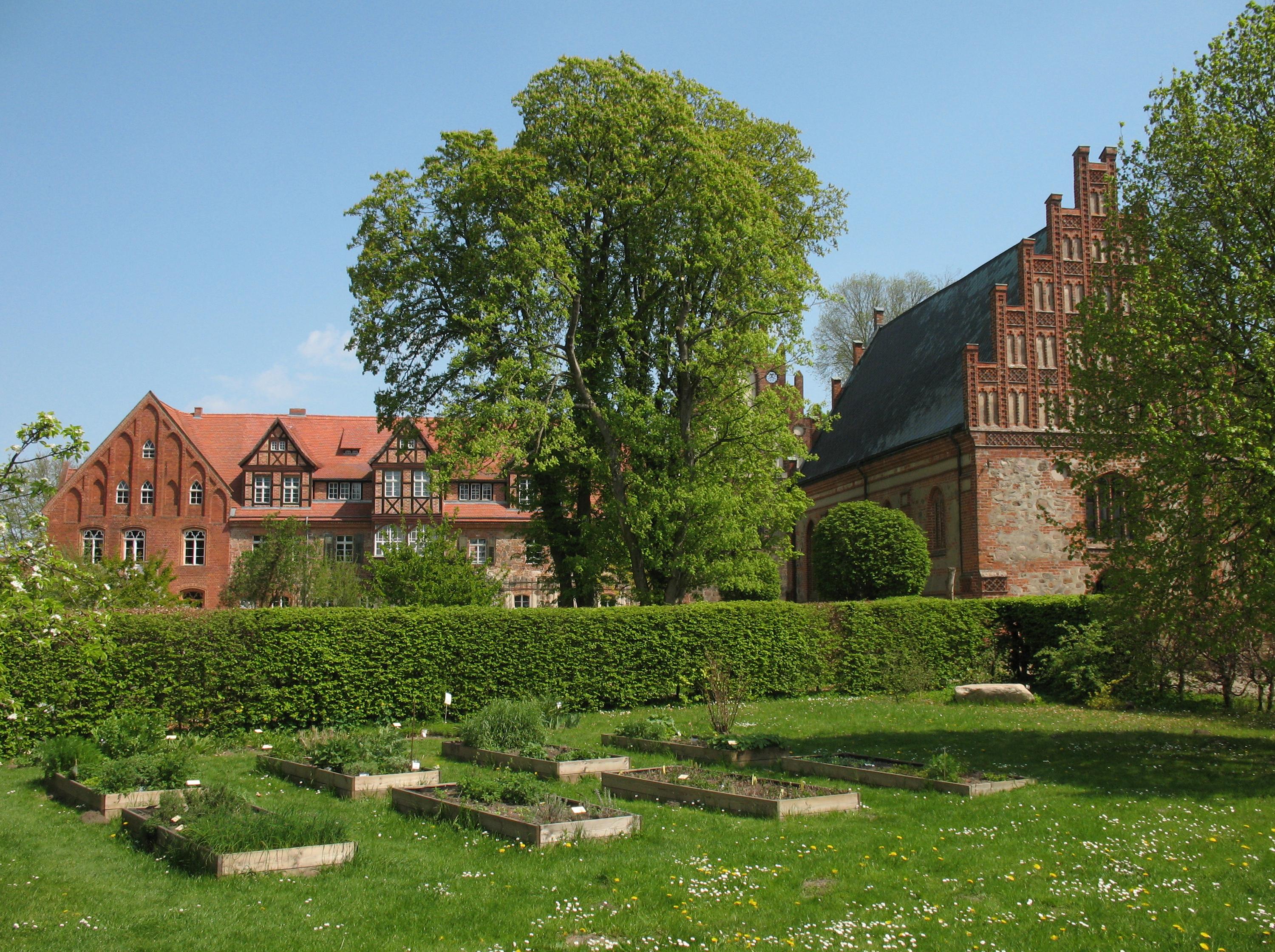
Heiligengrabe is a municipality in the Ostprignitz-Ruppin district, in Brandenburg, Germany. Geography The municipality counts 13 villages (''Ortsteil''): Blandikow, Blesendorf, Blumenthal, Grabow bei Blumenthal, Herzsprung, Jabel, Königsberg, Liebenthal, Maulbeerwalde, Papenbruch, Rosenwinkel, Wernikow and Zaatzke. Architecture Abbey Heiligengrabe Abbey (literally in en, Holy Sepulchre; formerly also known as Techow) was founded here as a Cistercian nunnery in 1289 by Heinrich, Bishop of Havelberg and the Margrave Otto of Brandenburg, initially for 12 nuns. It held an important relic in the form of a Bleeding Host which, so it was said, had been violated in a host desecration by a Jew. The nunnery acquired considerable wealth and estates in the area, partly through the revenue from pilgrims to the Bleeding Host, and partly through donations from the noble families round about, especially when one of their daughters entered the convent. Among the nuns of local great houses w ... [...More Info...] [...Related Items...] OR: [Wikipedia] [Google] [Baidu] |
Wittstock
Wittstock/Dosse is a town in the Ostprignitz-Ruppin district, in north-western Brandenburg, Germany. Geography It is located in the eastern Prignitz region on the Dosse River near the confluence with its Glinze tributary, about east of Pritzwalk and northwest of Berlin. Wittstock is situated in a terminal moraine landscape south of the Mecklenburg Lake District. Town structure After the incorporation of several suburban villages in December 1993 and again in October 2003, Wittstock became the 6th largest town in Germany by area. However, the former independent districts Herzsprung and Königsberg, which were forced to be integrated in 2003, regained their independence in 2004, claiming that the compulsive integration was void because of a clerical error. Both districts were still under the overview of the department of Wittstock. Since 2005, Herzsprung and Königsberg are parts of the commune Heiligengrabe, so the size of the town decreased. The current districts of Wittstock/ ... [...More Info...] [...Related Items...] OR: [Wikipedia] [Google] [Baidu] |
Rheinsberg
Rheinsberg () is a town and a municipality in the Ostprignitz-Ruppin district, in Brandenburg, Germany. It is located on lake and the river Rhin, approximately 20 km north-east of Neuruppin and 75 km north-west of Berlin. History Frederick the Great, while still Crown Prince, designed and moved into a restored chateau in Rheinsberg shortly after his 1733 marriage to Elisabeth Christine of Brunswick-Bevern. Here he experienced his "Rheinsberg Period", an era marked by regular correspondence with Voltaire, boisterous celebration in the company of minor philosophers and musicians, and the writing of several works of political theory, including the ''Anti-Machiavel.'' In 1870, the painter Eduard Gaertner and his family decided to leave the hectic atmosphere of Berlin and settle in Flecken Zechlin, a suburb of Rheinsberg - where he lived until his death in 1877. Rheinsberg is the location for Kurt Tucholsky's ''Rheinsberg'', a 1912 picture book for lovers based on an a ... [...More Info...] [...Related Items...] OR: [Wikipedia] [Google] [Baidu] |
Kyritz
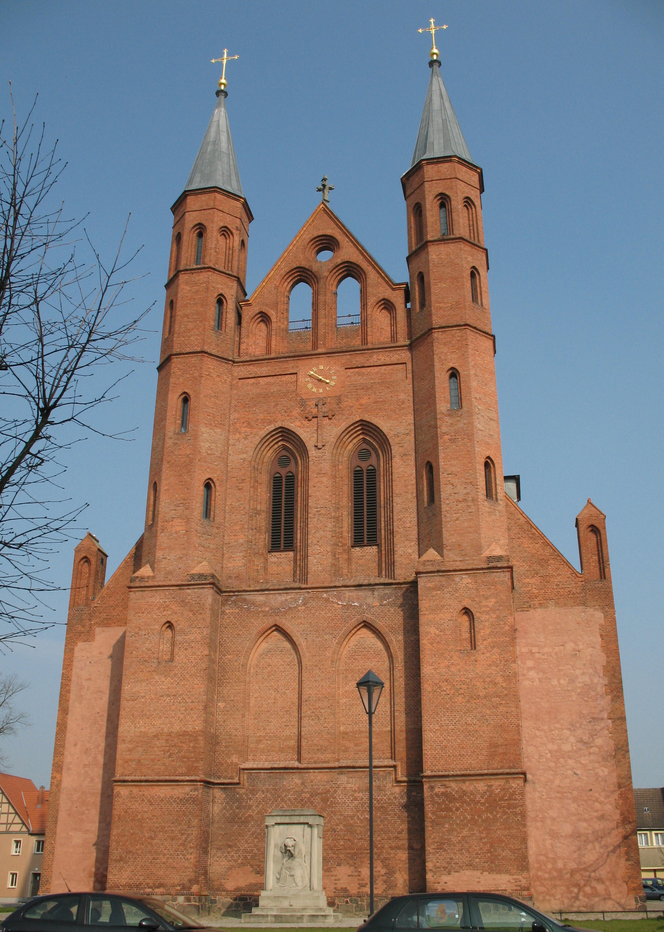
Kyritz () is a town in the Ostprignitz-Ruppin district, in Brandenburg, Germany. It is situated 28 km west of Neuruppin and 28 km southeast of Pritzwalk. The town has 9,260 inhabitants (2019). Overview The town is situated near the Kyritzer Seenkette, a chain of lakes. The town is nicknamed "Kyritz an der Knatter" (Kyritz at the Rattle). The noise of numerous water mills along a stream parallel to the river Jäglitz was the reason for this nickname. This river channel does not exist anymore. The town includes the districts Berlitt, Bork, Drewen, Gantikow, Ganz, Holzhausen, Kötzlin, Lellichow, Mechow, Rehfeld and Teetz. History The oldest document mentioning the area around Kyritz as "Chorizi" was written in 948. The region was called "Prignitz". The name is derived from the slavic word "pregynica" meaning "inaccessible woods". A castle was built here in 1148, and little by little a town developed close to the castle. In the year 1225 a Franciscan friary was establish ... [...More Info...] [...Related Items...] OR: [Wikipedia] [Google] [Baidu] |
Fehrbellin
Fehrbellin is a municipality in Germany, located 60 km NW of Berlin. It had 9,310 inhabitants as of 2005, but has since declined to 8,606 inhabitants in 2012. History In 1675, the Battle of Fehrbellin was fought there, in which the troops of Brandenburg-Prussia defeated those of the occupying Swedish Empire. In 1758 during the Seven Years' War Prussian and Swedish forces clashed at the Battle of Fehrbellin (1758). One of the most important skydiving dropzones of Germany is located at the local airport. Municipal divisions *Fehrbellin *Betzin *Brunne *Dechtow *Deutschhof *Hakenberg *Karwesee *Königshorst * *Lentzke *Linum *Manker *Protzen *Tarmow *Walchow *Wall *Wustrau-Altfriesack Wustrau and Altfriesack were amalgamated in 1970. With 1221 residents, the combined municipal division is the largest in the municipality. Altfriesack lies between the Ruppiner See and the Bützsee and belonged to Alt Ruppin until 1872. By area, Fehrbellin is the second-largest rural municipa ... [...More Info...] [...Related Items...] OR: [Wikipedia] [Google] [Baidu] |
Brandenburg
Brandenburg (; nds, Brannenborg; dsb, Bramborska ) is a states of Germany, state in the northeast of Germany bordering the states of Mecklenburg-Vorpommern, Lower Saxony, Saxony-Anhalt, and Saxony, as well as the country of Poland. With an area of 29,480 square kilometres (11,382 square miles) and a population of 2.5 million residents, it is the List of German states by area, fifth-largest German state by area and the List of German states by population, tenth-most populous. Potsdam is the state capital and largest city, and other major towns are Cottbus, Brandenburg an der Havel and Frankfurt (Oder). Brandenburg surrounds the national capital and city-state of Berlin, and together they form the Berlin/Brandenburg Metropolitan Region, the third-largest Metropolitan regions in Germany, metropolitan area in Germany with a total population of about 6.2 million. There was Fusion of Berlin and Brandenburg#1996 fusion attempt, an unsuccessful attempt to unify both states in 1996 and ... [...More Info...] [...Related Items...] OR: [Wikipedia] [Google] [Baidu] |
%2C_Ausschnitt.jpg)


