|
Osa, Perm Krai
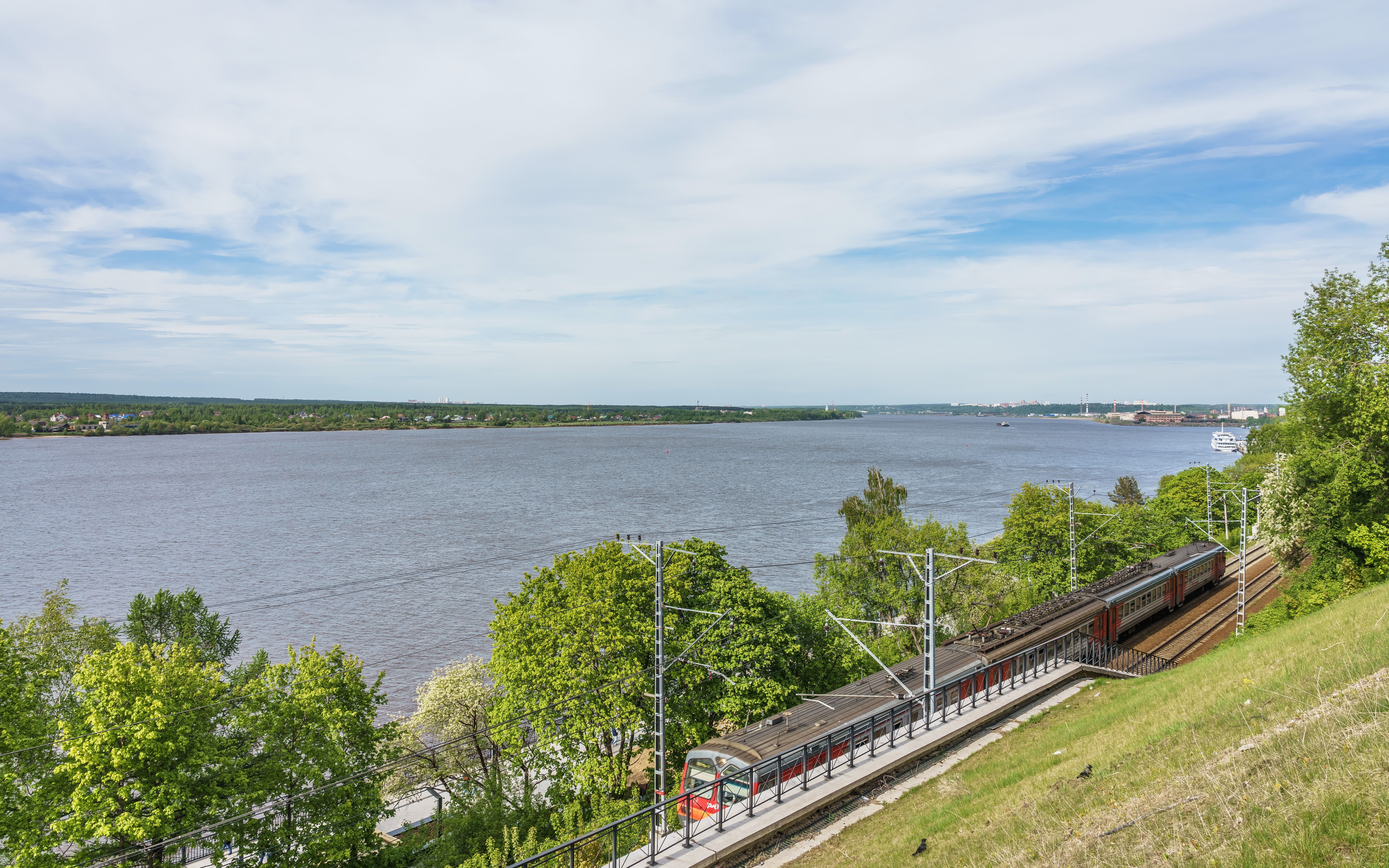
Osa (russian: Оса́) is a town and the administrative center of Osinsky District in Perm Krai, Russia, located on the left bank of the Kama River near its confluence with the Tulva, southwest of Perm, the administrative center of the krai. As of the 2010 Census, its population was 21,188. History It was founded in 1591 (according to other sources—in 1596) as the ''sloboda'' of Novonikolskaya () and later became a fortress. In a 1623 document, the settlement is referred to as the ''sloboda'' of Osinskaya Nikolskaya (), in 1678—as the ''sloboda'' of Osinskaya (), in 1732—as the village ('' selo'') of Osa. It was granted town status in 1739. In 1960, oil fields were discovered near Osa. Oil extraction started in 1963. Administrative and municipal status Within the framework of administrative divisions, Osa serves as the administrative center of Osinsky District, to which it is directly subordinated.Law #416-67 As a municipal division, the town A town is a ... [...More Info...] [...Related Items...] OR: [Wikipedia] [Google] [Baidu] |
Perm Krai
Perm Krai (russian: Пе́рмский край, r=Permsky kray, p=ˈpʲɛrmskʲɪj ˈkraj, ''Permsky krai'', , ''Perem lador'') is a federal subject of Russia (a krai) that came into existence on December 1, 2005 as a result of the 2004 referendum on the merger of Perm Oblast and Komi-Permyak Autonomous Okrug. The city of Perm is the administrative center. The population of the krai was 2,635,276 according to the ( 2010 Census). Komi-Permyak Okrug retained its autonomous status within Perm Krai during the transitional period of 2006–2008. It also retained a budget separate from that of the krai, keeping all federal transfers. Starting in 2009, Komi-Permyak Okrug's budget became subject to the budgeting law of Perm Krai. The transitional period was implemented in part because Komi-Permyak Okrug relies heavily on federal subsidies, and an abrupt cut would have been detrimental to its economy. Geography Perm Krai is located in the east of the East European Plain and the weste ... [...More Info...] [...Related Items...] OR: [Wikipedia] [Google] [Baidu] |
Russian Census (2010)
The Russian Census of 2010 (russian: Всеросси́йская пе́репись населе́ния 2010 го́да) was the second census of the Russian Federation population after the dissolution of the Soviet Union. Preparations for the census began in 2007 and it took place between October 14 and October 25. The census The census was originally scheduled for October 2010, before being rescheduled for late 2013, citing financial reasons,Всероссийская перепись населения переносится на 2013 год although it was also speculated that political motives were influential in the decision. However, in late 2009, |
Osinsky Uyezd and 1.8% Udmurt as their native language.
Osinsky Uyezd (russian: Осинский уезд) was an administrative division of Perm Governorate, Russian Empire, which existed in 1781–1923. Administrative center was town of Osa. Area: 19,246 km². Demographics At the time of the Russian Empire Census of 1897, Osinsky Uyezd had a population of 321,774. Of these, 82.7% spoke Russian, 10.7% Bashkir, 4.8% Tatar The Tatars ()Tatar in the Collins English Dictionary is an umbrella term for different References {{ReflistSources *Brockhaus and Efron Encyclopedic Dictionary (1890–1907)[...More Info...] [...Related Items...] OR: [Wikipedia] [Google] [Baidu] |
Cities And Towns In Perm Krai
A city is a human settlement of notable size.Goodall, B. (1987) ''The Penguin Dictionary of Human Geography''. London: Penguin.Kuper, A. and Kuper, J., eds (1996) ''The Social Science Encyclopedia''. 2nd edition. London: Routledge. It can be defined as a permanent and densely settled place with administratively defined boundaries whose members work primarily on non-agricultural tasks. Cities generally have extensive systems for housing, transportation, sanitation, utilities, land use, production of goods, and communication. Their density facilitates interaction between people, government organisations and businesses, sometimes benefiting different parties in the process, such as improving efficiency of goods and service distribution. Historically, city-dwellers have been a small proportion of humanity overall, but following two centuries of unprecedented and rapid urbanization, more than half of the world population now lives in cities, which has had profound consequences for g ... [...More Info...] [...Related Items...] OR: [Wikipedia] [Google] [Baidu] |
Subdivisions Of Russia
Russia is divided into several types and levels of subdivisions. Federal subjects Since 30 September 2022, the Russian Federation has consisted of eighty-nine federal subjects that are constituent members of the Federation.Constitution, Article 65 However, six of these federal subjects—the Republic of Crimea, the Donetsk People's Republic, the Russian occupation of Kherson Oblast, Kherson Oblast, the Luhansk People's Republic, Lugansk People's Republic, the federal cities of Russia, federal city of Sevastopol and the Russian occupation of Zaporizhzhia Oblast, Zaporozhye Oblast—are internationally recognized as part of Ukraine. All federal subjects are of equal federal rights in the sense that they have equal representation—two delegates each—in the Federation Council of Russia, Federation Council (upper house of the Federal Assembly of Russia, Federal Assembly). They do, however, differ in the degree of autonomous area, autonomy they enjoy. De jure, there are 6&n ... [...More Info...] [...Related Items...] OR: [Wikipedia] [Google] [Baidu] |
Village
A village is a clustered human settlement or community, larger than a hamlet but smaller than a town (although the word is often used to describe both hamlets and smaller towns), with a population typically ranging from a few hundred to a few thousand. Though villages are often located in rural areas, the term urban village is also applied to certain urban neighborhoods. Villages are normally permanent, with fixed dwellings; however, transient villages can occur. Further, the dwellings of a village are fairly close to one another, not scattered broadly over the landscape, as a dispersed settlement. In the past, villages were a usual form of community for societies that practice subsistence agriculture, and also for some non-agricultural societies. In Great Britain, a hamlet earned the right to be called a village when it built a church. [...More Info...] [...Related Items...] OR: [Wikipedia] [Google] [Baidu] |
Fortress
A fortification is a military construction or building designed for the defense of territories in warfare, and is also used to establish rule in a region during peacetime. The term is derived from Latin ''fortis'' ("strong") and ''facere'' ("to make"). From very early history to modern times, defensive walls have often been necessary for cities to survive in an ever-changing world of invasion and conquest. Some settlements in the Indus Valley civilization were the first small cities to be fortified. In ancient Greece, large stone walls had been built in Mycenaean Greece, such as the ancient site of Mycenae (famous for the huge stone blocks of its 'cyclopean' walls). A Greek ''Towns of ancient Greece#Military settlements, phrourion'' was a fortified collection of buildings used as a military garrison, and is the equivalent of the ancient Roman, Roman castellum or English language, English fortress. These constructions mainly served the purpose of a watch tower, to guard certa ... [...More Info...] [...Related Items...] OR: [Wikipedia] [Google] [Baidu] |
Sloboda
A sloboda ( rus, слобода́, p=sləbɐˈda) was a kind of settlement in the history of the Old Russian regions Povolzhye, Central Russia, Belarus and Ukraine. The name is derived from the early Slavic word for "freedom" and may be loosely translated as "(tax-)free settlement"."Sloboda" '''' (1890–1906) In modern Russia, the term is used to denote a type of a rural locality in |
Krai
A krai or kray (; russian: край, , ''kraya'') is one of the types of federal subjects of modern Russia, and was a type of geographical administrative division in the Russian Empire and the Russian SFSR. Etymologically, the word is related to the verb "" (''kroit'''), "to cut". Historically, krais were vast territories located along the periphery of the Russian state, since the word ''krai'' also means ''border'' or ''edge'', i.e., ''a place of the cut-off''. In English the term is often translated as "territory". , the administrative usage of the term is mostly traditional, as some oblasts also fit this description and there is no difference in constitutional legal status in Russia between the krais and the oblasts. See also * Krais of the Russian Empire * Krais of Russia * Governorate-General (Russian Empire), a general term for Krais, Oblasts, and special city municipalities in the Russian Empire *Oblast ;Foreign terms (in relation to the Russian "Krai") with similar ... [...More Info...] [...Related Items...] OR: [Wikipedia] [Google] [Baidu] |
Osinsky District, Perm Krai
Osinsky District (russian: Осинский райо́н) is an administrative district (raion) of Perm Krai, Russia; one of the thirty-three in the krai.Law #416-67 Municipally, it is incorporated as Osinsky Municipal District.Law #1717-348 It is located in the south of the krai and borders with Permsky District in the north, Kungursky District in the east, Bardymsky District in the south, Yelovsky District in the southwest, Chastinsky District in the west, and with Okhansky District in the northwest. The area of the district is .Encyclopedia of Perm KraiEntry on Osinsky District Its administrative center is the town of Osa. Population: The population of Osa accounts for 71.8% of the district's total population. Geography 50.2% of district's territory is covered by forests. Climate is temperate continental. Main rivers include the Kama River and its tributary the Tulva. History The district was established on January 1, 1924. In October 1938, it became a part of Perm Ob ... [...More Info...] [...Related Items...] OR: [Wikipedia] [Google] [Baidu] |
Perm, Russia
Perm (russian: Пермь, p=pʲermʲ), previously known as Yagoshikha (Ягошиха) (1723–1781), and Molotov (Молотов) (1940–1957), is the largest city and the administrative centre of Perm Krai, Russia. The city is located on the banks of the Kama River, near the Ural Mountains, covering an area of , with a population of over one million residents. Perm is the List of cities and towns in Russia by population, fifteenth-largest city in Russia, and the fifth-largest city in the Volga Federal District. In 1723, a copper-smelting works was founded at the village of ''Yagoshikha''. In 1781 the settlement of Yagoshikha became the town of ''Perm''. Perm's position on the navigable Kama River, leading to the Volga, and on the Siberian Route across the Ural Mountains, helped it become an important trade and manufacturing centre. It also lay along the Trans-Siberian Railway. Perm grew considerably as industrialization proceeded in the Urals during the Soviet period, and i ... [...More Info...] [...Related Items...] OR: [Wikipedia] [Google] [Baidu] |
Tulva River (Russia)
The Tulva (russian: Тулва) is a river in Perm Krai, Russia, a left tributary of the Votkinsk Reservoir, which is fed and drained by the Kama. The river is long, and its drainage basin covers .«Река Тулва» Russian State Water Registry The river begins in the highlands in the far south of Perm Krai. Its mouth is southeast of the town of Osa. The main tributaries are the Barda, Bolshaya Amzya, Malaya Amzya
[...More Info...] [...Related Items...] OR: [Wikipedia] [Google] [Baidu] |


