|
Orini
Orini is a rural community in the Waikato District and Waikato region of New Zealand's North Island. It is located east of Taupiri Orini is centred around a community hall which was opened in 1913, which was rebuilt in 1937 following a fire. It also has a school, which had 81 pupils in 1939. A post office opened in 1907. A creamery was running in 1911. A cheese factory opened in 1915, and was still operating in 1932. The stream bridge between Orini and Whitikahu was built in 1938. By 1950 the Orini telephone exchange had 123 subscribers. The Mangawara area to the west was a Kauri gum digging area until 1983. It also had a creamery and a post office by 1910. Te Hoe, to the north, had a school between 1912 and 1995. It had a post office and store and still has a hall, which was built in 1957. History From the 1600s: Ngati Koura and Ngati Wairere Waikai occupied the area, mainly for eel fishing. An old waka was discovered in 1937. After the invasion of the Waikato, the area was ... [...More Info...] [...Related Items...] OR: [Wikipedia] [Google] [Baidu] |
Whitikahu
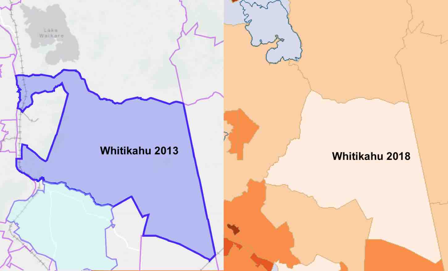
Whitikahu is a settlement scattered along Whitikahu Rd in the Waikato District and Waikato region of New Zealand's North Island. It has a blueberry farm, a winery, the Senton Sawmill, a fire station, a petrol station and a hall. It is in the Hukanui Waerenga Ward of Waikato District Council. Geology Pukemokemoke hill is formed of greywacke of the Jurassic Manaia Hill Group (shown as Jm on map). The rest of the Whitikahu area is largely on a drained peat bog, which lies on ash from Lake Taupō. Taupiri Fault is an inferred fault separating the peat from the Taupiri Range. Seismic testing in 2017 added evidence of the fault's position. Whitikahu is at the north end of an alluvial fan of the ash, which drops about 60 m (200 ft) from Karapiro. After the Oruanui eruption, some 26,500 years ago, Lake Taupō was about 145 m (476 ft) above the present lake. Around 22,500 years ago the ash dam eroded rapidly and the lake fell about 75 m (246 ft) i ... [...More Info...] [...Related Items...] OR: [Wikipedia] [Google] [Baidu] |
Huntly, New Zealand
Huntly ( mi, Rahui-Pōkeka) (population ) is a town in the Waikato district and region of the North Island of New Zealand. It was on State Highway 1 (until Huntly bypass opened in March 2020), south of Auckland and north of Hamilton. It is situated on the North Island Main Trunk (NIMT) railway (served by Te Huia since 6 April 2021 at a rebuilt Raahui Pookeka-Huntly Station) and straddles the Waikato River. Huntly is within the Waikato District which is in the northern part of the Waikato region local government area. History and culture Originally settled by Māori, European migrants arrived in the area some time in the 1850s. The Huntly name was adopted in the 1870s when the postmaster named it after Huntly, Aberdeenshire in Scotland. He used an old 'Huntley Lodge' stamp to stamp mail from the early European settlement. The ''Lodge'' was later dropped and the spelling changed to also drop the additional 'e'. The railway from Auckland reached Huntly in 1877, when the Huntl ... [...More Info...] [...Related Items...] OR: [Wikipedia] [Google] [Baidu] |
Waikato District
Waikato District is a territorial authority of New Zealand, in the northern part of Waikato region, North Island. Waikato District is administered by the Waikato District Council, with headquarters in Ngāruawāhia. The district is centred to the north and west of the city of Hamilton, and takes in much of the northern Waikato Plains and also the Hakarimata Range. The north of the district contains swampy floodplain of the Waikato River and several small lakes, of which the largest is Lake Waikare. Other than Ngāruawāhia, the main population centres are Huntly, Raglan, and Te Kauwhata. The main industries in the district are dairy farming, forestry, and coal mining. There is a major coal-fired power station at Huntly. Te Kauwhata is at the centre of a major wine region. Demographics At the 2006 census the district had a population of 43,959. Of these, 6834 lived in Huntly, 5106 in Ngāruawāhia, 2637 in Raglan, and 1294 in Te Kauwhata. In 2010, the district acquired part o ... [...More Info...] [...Related Items...] OR: [Wikipedia] [Google] [Baidu] |
Flax In New Zealand
New Zealand flax describes the common New Zealand perennial plants ''Phormium tenax'' and ''Phormium colensoi'', known by the Māori names ''harakeke'' and ''wharariki'' respectively. Although given the common name 'flax' they are quite distinct from the Northern Hemisphere plant known as flax (''Linum usitatissimum''). ''P. tenax'' occurs naturally in New Zealand and Norfolk Island, while ''P. colensoi'' is endemic to New Zealand. They have played an important part in the cultural and economic history of New Zealand for both the Māori people and the later European settlers. Both species and their cultivars have now been widely distributed to temperate regions of the world as ornamental garden plants – and to lesser extent for fibre production. __TOC__ Traditional Māori uses Textiles Although the Māori made textiles from a number of other plants, including tī kōuka, tōī, pingao, kiekie, toetoe and the paper mulberry, the use of harakeke and wharariki was pre ... [...More Info...] [...Related Items...] OR: [Wikipedia] [Google] [Baidu] |
Morrinsville
Morrinsville is a provincial town in the Waikato region of New Zealand's North Island, with an estimated population of as of The town is located at the northern base of the Pakaroa Range, and on the south-western fringe of the Hauraki Plains. Morrinsville is around 33 kilometres east of Hamilton and 22 kilometres west of Te Aroha. The town is bordered by the Piako River to the east and the Waitakaruru Stream to the south. History and Culture Pre-European settlement Prior to European settlement of New Zealand, the hills around present-day Morrinsville were occupied by the Ngati Werewere Māori people of the Ngati Haua Iwi, and the site of the present-day town was on or near to an old Māori route between the upper Waihou-Piako basin and the Ngāruawāhia area. Following European settlement, some early European traders are believed to have traversed this route prior to 1834 when the Rev. J. Morgan travelled up the Piako River to near the future town site and crossed west ... [...More Info...] [...Related Items...] OR: [Wikipedia] [Google] [Baidu] |
Tahuna, Waikato
Tahuna is a small rural settlement located 18 km north of Morrinsville. In the Māori language Tahuna means sandbank, likely to refer to the sandbanks along the nearby Piako River, where a Māori settlement started. Tahuna is seen as the upper limit for navigatable travel on the Piako River. The settlement has a rugby club, a lawn bowls club, a golf course and various shops. Although Tahuna is in the Matamata-Piako District for local government, its representation in national government is within the Coromandel electorate due to the abolition of the Piako electorate for the . A town water supply was proposed in the 1980s and installed in the 2000s. There are two marae in the Tahuna area. The Waiti-Raungaunu marae and Paoa meeting house are also associated with the Waikato Tainui hapū of Ngāti Makirangi, and with the iwi of Ngāti Paoa. Hoe o Tainui marae and surrounding settlement is affiliated with Ngāti Makirangi. Demographics Tahuna is in an SA1 statistical area ... [...More Info...] [...Related Items...] OR: [Wikipedia] [Google] [Baidu] |
Lake Waikare
Lake Waikare is the largest of several shallow lakes in the upper floodplain of the Waikato River in New Zealand's North Island. It is a riverine lake, located to the east of Te Kauwhata and 40 kilometres north of Hamilton. It covers . Due to its shallow nature (its depth is never more than two metres) and the heavy use of fertiliser in the surrounding farming district, the waters of the lake are in poor condition. A 2010 report showed that of all the measured lakes it had the highest trophic level index, a measurement of the amount of pollutants. Pollution also comes from Te Kauwhata sewage works, which is subject to a Regional Council abatement notice for excessive discharges of Kjeldahl Nitrogen, Total Nitrogen, Total Phosphorus and ''E. coli''. A health warning was issued in 2020 for cyanobacteria Cyanobacteria (), also known as Cyanophyta, are a phylum of gram-negative bacteria that obtain energy via photosynthesis. The name ''cyanobacteria'' refers to their color () ... [...More Info...] [...Related Items...] OR: [Wikipedia] [Google] [Baidu] |
Education Review Office
The Education Review Office (ERO) (Māori: ''Te Tari Arotake Mātauranga'') is the public service department of New Zealand charged with reviewing and publicly reporting on the quality of education and care of students in all New Zealand schools and early childhood services. Led by a Chief Review Officer - the department's chief executive, the Office has approximately 150 designated review officers located in five regions. These regions are: Northern, Waikato/Bay of Plenty, Central, Southern, and Te Uepū ā-Motu (ERO's Māori review services unit). The Education Review Office, and the Ministry of Education are two separate public service departments. The functions and powers of the office are set out in Part 28 (sections 323–328) of the Education Act 1989. Reviews ERO reviews the education provided for school students in all state schools, private schools and kura kaupapa Māori Kura Kaupapa Māori are Māori-language immersion schools () in New Zealand where the ph ... [...More Info...] [...Related Items...] OR: [Wikipedia] [Google] [Baidu] |
Ministry Of Education (New Zealand)
The Ministry of Education (Māori: ''Te Tāhuhu o te Mātauranga'') is the public service department of New Zealand charged with overseeing the New Zealand education system. The Ministry was formed in 1989 when the former, all-encompassing Department of Education was broken up into six separate agencies. History The Ministry was established as a result of the Picot task force set up by the Labour government in July 1987 to review the New Zealand education system. The members were Brian Picot, a businessman, Peter Ramsay, an associate professor of education at the University of Waikato, Margaret Rosemergy, a senior lecturer at the Wellington College of Education, Whetumarama Wereta, a social researcher at the Department of Maori Affairs and Colin Wise, another businessman. The task force was assisted by staff from the Treasury and the State Services Commission (SSC), who may have applied pressure on the task force to move towards eventually privatizing education, as had ... [...More Info...] [...Related Items...] OR: [Wikipedia] [Google] [Baidu] |
Peat
Peat (), also known as turf (), is an accumulation of partially decayed vegetation or organic matter. It is unique to natural areas called peatlands, bogs, mires, moors, or muskegs. The peatland ecosystem covers and is the most efficient carbon sink on the planet, because peatland plants capture carbon dioxide (CO2) naturally released from the peat, maintaining an equilibrium. In natural peatlands, the "annual rate of biomass production is greater than the rate of decomposition", but it takes "thousands of years for peatlands to develop the deposits of , which is the average depth of the boreal orthernpeatlands", which store around 415 gigatonnes (Gt) of carbon (about 46 times 2019 global CO2 emissions). Globally, peat stores up to 550 Gt of carbon, 42% of all soil carbon, which exceeds the carbon stored in all other vegetation types, including the world's forests, although it covers just 3% of the land's surface. ''Sphagnum'' moss, also called peat moss, is one of th ... [...More Info...] [...Related Items...] OR: [Wikipedia] [Google] [Baidu] |
New Zealand Land Confiscations
The New Zealand land confiscations took place during the 1860s to punish the Kīngitanga movement for attempting to set up an alternative, Māori, form of government that forbade the selling of land to European settlers. The confiscation law targeted Kīngitanga Māori against whom the government had waged war to restore the rule of British law. More than or 4.4 percent of land were confiscated,Ranginui Walker, ''Ka Whawhai Tonu Matou - Struggle Without End'', Penguin Books, 1990. mainly in Waikato, Taranaki and the Bay of Plenty, but also in South Auckland, Hauraki, Te Urewera, Hawke's Bay and the East Coast.Taranaki Report, Kaupapa Tuatahi, Chapter 1, Waitangi Tribunal, 1996. Legislation for the confiscations was contained in the New Zealand Settlements Act 1863, which provided for the seizing of land from Māori tribes who had been in rebellion against the Government after 1 January 1863. Its stated purpose was to achieve the "permanent protection and security" of the country ... [...More Info...] [...Related Items...] OR: [Wikipedia] [Google] [Baidu] |


.jpg)
