|
Orangozinho
Orangozinho (Portuguese meaning ''Little Orango'') is an island in the Bissagos Islands, Guinea-Bissau, it is part of the Bolama Region and the Bubaque sector. Its area is 107 km², in the Catalogue of Islands at UNEP (United Nations Environment Program) - accessed 16 November 2018 its length is 19 km and its width is 11.8 km. It has a population of 706 (2009 census); the largest village is Wite.População por região, sector e localidades por sexo censo 2009 Instituto Nacional de Estatística Guiné-Bissau Th ... [...More Info...] [...Related Items...] OR: [Wikipedia] [Google] [Baidu] |
Orango National Park
The Orango National Park ( pt, Parque Nacional de Orango) is a protected area in Guinea-Bissau. It was established in December 2000.Quadro nacional da biotecnologia e biosegurança da Guiné-Bissau March 2008, p. 33 The park has an area of , which is partly marine. /ref> It covers the southern part of the Bissagos Archipelago, notably the islands Orango
Orango is ...
[...More Info...] [...Related Items...] OR: [Wikipedia] [Google] [Baidu] |
Bolama Region
Bolama is an administrative region in Guinea-Bissau, consisting primarily of the Bijagós Archipelago of the country's southern coast, together with a small coastal strip centred on the coastal town of São João. It has an area of 2,624 km2. Its capital is Bolama, on the island of the same name. It is a coastal region covered with Mangrove swamps, rain forest and tangled forest and receives an annual rainfall of more than . As of 2009, the total population of the region was 32,424, with the urban population being 9,118 and rural being 23,306. The sex ratio of the region is 97 females for every hundred males. As of 2009, the net activity rate was 48.88 per cent, proportion of employed labour force was 33.32 per cent, proportion of labour force was 75.77 and the proportion of potentially active population was 33.32 per cent. The absolute poverty rate, people earning less than $2 a day, in the region stood at 51.6 per cent, with a regional contribution of 20.6 per cent to the ... [...More Info...] [...Related Items...] OR: [Wikipedia] [Google] [Baidu] |
Atlantic Ocean
The Atlantic Ocean is the second-largest of the world's five oceans, with an area of about . It covers approximately 20% of Earth's surface and about 29% of its water surface area. It is known to separate the " Old World" of Africa, Europe and Asia from the "New World" of the Americas in the European perception of the World. The Atlantic Ocean occupies an elongated, S-shaped basin extending longitudinally between Europe and Africa to the east, and North and South America to the west. As one component of the interconnected World Ocean, it is connected in the north to the Arctic Ocean, to the Pacific Ocean in the southwest, the Indian Ocean in the southeast, and the Southern Ocean in the south (other definitions describe the Atlantic as extending southward to Antarctica). The Atlantic Ocean is divided in two parts, by the Equatorial Counter Current, with the North(ern) Atlantic Ocean and the South(ern) Atlantic Ocean split at about 8°N. Scientific explorations of the A ... [...More Info...] [...Related Items...] OR: [Wikipedia] [Google] [Baidu] |
Bijagós Archipelago
The Bissagos Islands, also spelled Bijagós ( pt, Arquipélago dos Bijagós), are a group of about 88 islands and islets located in the Atlantic Ocean off the coast of Guinea-Bissau. The archipelago was formed from the ancient delta of the Geba and Grande de Buba rivers and spans an area of . 20 of its islands are populated year-round, including the most populated island, Bubaque, where the administrative capital is situated. There is a high diversity of ecosystems: mangroves with intertidal zones, palm forests, dry and semi-dry forests, secondary and degraded forests, coastal savanna, sand banks and aquatic zones. The archipelago was declared a UNESCO Biosphere Reserve in 1996. Demographics The population is estimated at about 30,000 (2006) and the ethnic group Bissago ( pt, Bijagó) predominates. It has a relatively youthful population due to high birth rates and low life expectancy. Economy The economy is largely rural, with many families living from subsistence farm ... [...More Info...] [...Related Items...] OR: [Wikipedia] [Google] [Baidu] |
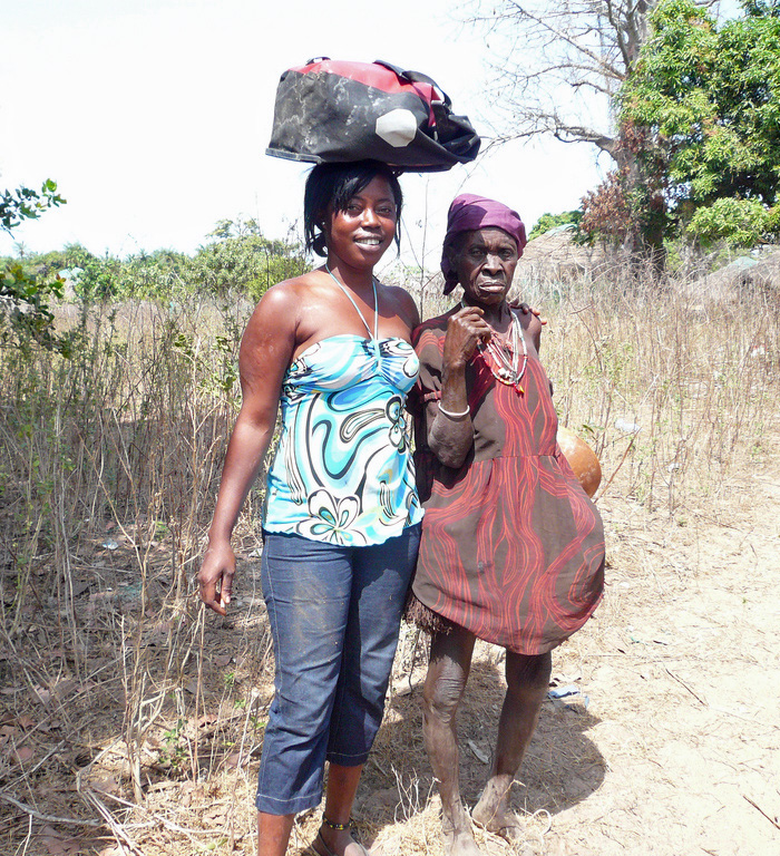
Femmes Bijago-Orangozinho
''Femme'' (; , literally meaning "woman") is a term traditionally used to describe a lesbian who exhibits a feminine identity or gender presentation. Alternate meanings of the word also exist with some non-lesbian individuals using the word, notably some gay men, bisexuals, nonbinary and transgender individuals. Heavily associated with lesbian history and culture, ''femme'' has been used among lesbians to distinguish traditionally feminine lesbians from their butch (i.e. masculine) lesbian counterparts and partners. Derived from American lesbian communities following World War II when women joined the work force, the identity became a characteristic of the working class lesbian bar culture of the 1940s–1950s. By the 1990s, the term ''femme'' had additionally been adopted by bisexual women. It has however also been argued by bi+ and other queer activists that since the term bisexual is relatively newer than lesbian, bisexual women historically formed part of the lesbian ... [...More Info...] [...Related Items...] OR: [Wikipedia] [Google] [Baidu] |
Bissagos Islands
The Bissagos Islands, also spelled Bijagós ( pt, Arquipélago dos Bijagós), are a group of about 88 islands and islets located in the Atlantic Ocean off the coast of Guinea-Bissau. The archipelago was formed from the ancient delta of the Geba and Grande de Buba rivers and spans an area of . 20 of its islands are populated year-round, including the most populated island, Bubaque, where the administrative capital is situated. There is a high diversity of ecosystems: mangroves with intertidal zones, palm forests, dry and semi-dry forests, secondary and degraded forests, coastal savanna, sand banks and aquatic zones. The archipelago was declared a UNESCO Biosphere Reserve in 1996. Demographics The population is estimated at about 30,000 (2006) and the ethnic group Bissago ( pt, Bijagó) predominates. It has a relatively youthful population due to high birth rates and low life expectancy. Economy The economy is largely rural, with many families living from subsistence farming a ... [...More Info...] [...Related Items...] OR: [Wikipedia] [Google] [Baidu] |
Guinea-Bissau
Guinea-Bissau ( ; pt, Guiné-Bissau; ff, italic=no, 𞤘𞤭𞤲𞤫 𞤄𞤭𞤧𞤢𞥄𞤱𞤮, Gine-Bisaawo, script=Adlm; Mandinka: ''Gine-Bisawo''), officially the Republic of Guinea-Bissau ( pt, República da Guiné-Bissau, links=no ), is a country in West Africa that covers with an estimated population of 1,726,000. It borders Senegal to the north and Guinea to the south-east. Guinea-Bissau was once part of the kingdom of Kaabu, as well as part of the Mali Empire. Parts of this kingdom persisted until the 18th century, while a few others were under some rule by the Portuguese Empire since the 16th century. In the 19th century, it was colonised as Portuguese Guinea. Portuguese control was restricted and weak until the early 20th century with the pacification campaigns, these campaigns solidified Portuguese sovereignty in the area. The final Portuguese victory over the remaining bastion of mainland resistance, the Papel ruled Kingdom of Bissau in 1915 by the Portu ... [...More Info...] [...Related Items...] OR: [Wikipedia] [Google] [Baidu] |
Bubaque
Bubaque is one of the Bijagós Islands in Guinea-Bissau, and is also the name of its main town. The island has a population of 6,427, the town Bubaque 4,299 (2009 census). The area of the island is 75 km2, it is 13.6 km long and 8 km wide. The island is known for its wildlife and is heavily forested. It is also where the Unesco nature reserve headquarters is situated, as well as a museum. Transportation Bubaque airport serves the island. A weekly ferry runs to Bissau from Bubaque's port. All transportation on the island itself is done by motorbike or on foot. Notable people *Stefanie Gercke (b. 1941), German-South African writer * Juvêncio Gomes (b. 1944), fighter for the PAIGC and later mayor of Bissau Bissau () is the capital, and largest city of Guinea-Bissau. Bissau had a population of 492,004. Bissau is located on the Geba River estuary, off the Atlantic Ocean, and is Guinea-Bissau's largest city, major port, and its administrative and m ... Ref ... [...More Info...] [...Related Items...] OR: [Wikipedia] [Google] [Baidu] |
United Nations Environment Programme
The United Nations Environment Programme (UNEP) is responsible for coordinating responses to environmental issues within the United Nations system. It was established by Maurice Strong, its first director, after the United Nations Conference on the Human Environment in Stockholm in June 1972. Its mandate is to provide leadership, deliver science and develop solutions on a wide range of issues, including climate change, the management of marine and terrestrial ecosystems, and green economic development. The organization also develops international environmental agreements; publishes and promotes environmental science and helps national governments achieve environmental targets. As a member of the United Nations Development Group, UNEP aims to help the world meet the 17 Sustainable Development Goals. UNEP hosts the secretariats of several multilateral environmental agreements and research bodies, including The Convention on Biological Diversity (CBD), The Minamata Convention on M ... [...More Info...] [...Related Items...] OR: [Wikipedia] [Google] [Baidu] |
Roxa
Roxa in the Catalogue of Islands at UNEP (United Nations Environment Program) - accessed 16 November 2018 or Canhabaque is an island in the Bissagos Islands, Guinea-Bissau. It is part of the sector of Bubaque. Its area is ; it is long and wide. The island has a population of 2,478 (2009 census), divided over the villages Ambuduco, Ampucute, Ancanhozinho, Indenazi ... [...More Info...] [...Related Items...] OR: [Wikipedia] [Google] [Baidu] |


