|
Omoa
Omoa is a town, with a population of 7,020 (2013 census), and a municipality in the Department of Cortés in Honduras. Omoa is located on a small bay of the same name 18 km west of Puerto Cortés on the Caribbean Sea coast. Geography Omoa is both a municipality and a small town located along the Northwest Caribbean coast of Honduras. It is populated by about 30,000 people distributed within an area of 382.8 km². History In 1536 Omoa was a small "pueblo de indios" allocated in repartimiento by Pedro de Alvarado to Luis del Puerto along with the nearby Indian town of Chachaguala. But by 1582 Omoa had ceased to exist as a viable community. Repeated pirate raids on coastal towns along the Caribbean coast of Central America led the Spanish Crown as early as 1590 to begin looking for a new defensible port for the Captaincy General of Guatemala to export its goods to Spain. This initial study by Antonelli, and many subsequent ones, all pointed to the bay at Omoa as ... [...More Info...] [...Related Items...] OR: [Wikipedia] [Google] [Baidu] |
Battle Of San Fernando De Omoa
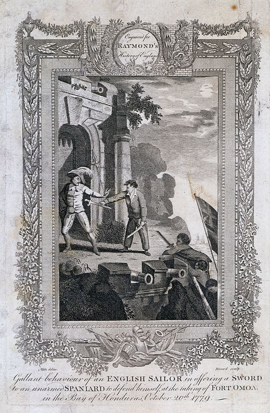
The Battle of San Fernando de Omoa was a short siege and battle between British and Spanish forces fought not long after Spain entered the American Revolutionary War on the American side. On the 16 October 1779, following a brief attempt at siege, a force of 150 British soldiers and seamen assaulted and captured the fortifications at San Fernando de Omoa in the Captaincy General of Guatemala (now Honduras) on the Gulf of Honduras. The British forces managed to overwhelm and capture the Spanish garrison, consisting of 365 men. The British only held the fort until November 1779. They then withdrew the garrison, which tropical diseases had reduced, and which was under threat of a Spanish counter-attack. Background When Spain entered the American Revolutionary War in June 1779, both Great Britain and Spain had been planning for the possibility of hostilities for some time. King Carlos III set the defence of the Captaincy General of Guatemala as one of his highest priorities in the Am ... [...More Info...] [...Related Items...] OR: [Wikipedia] [Google] [Baidu] |
Fortaleza De San Fernando
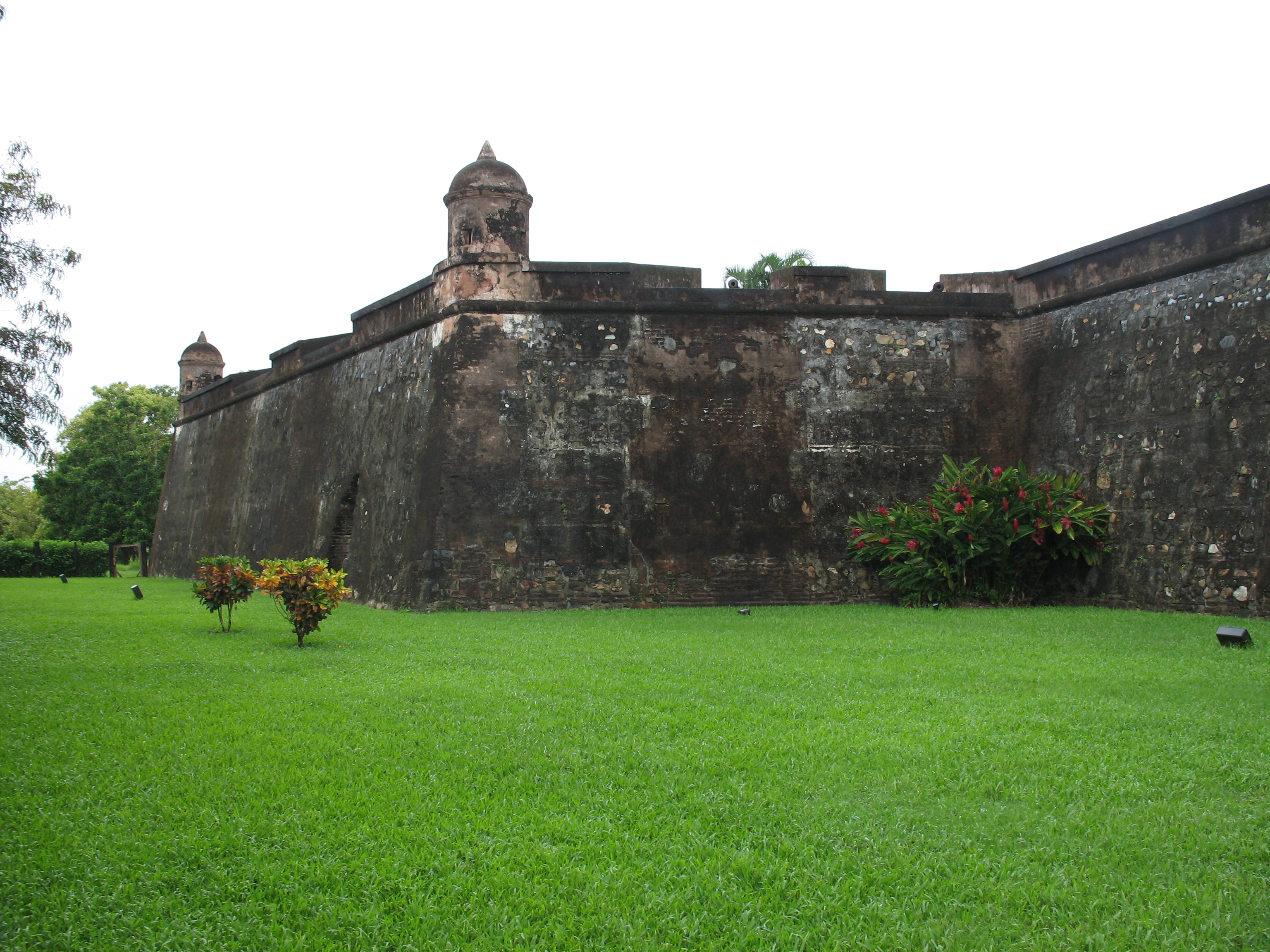
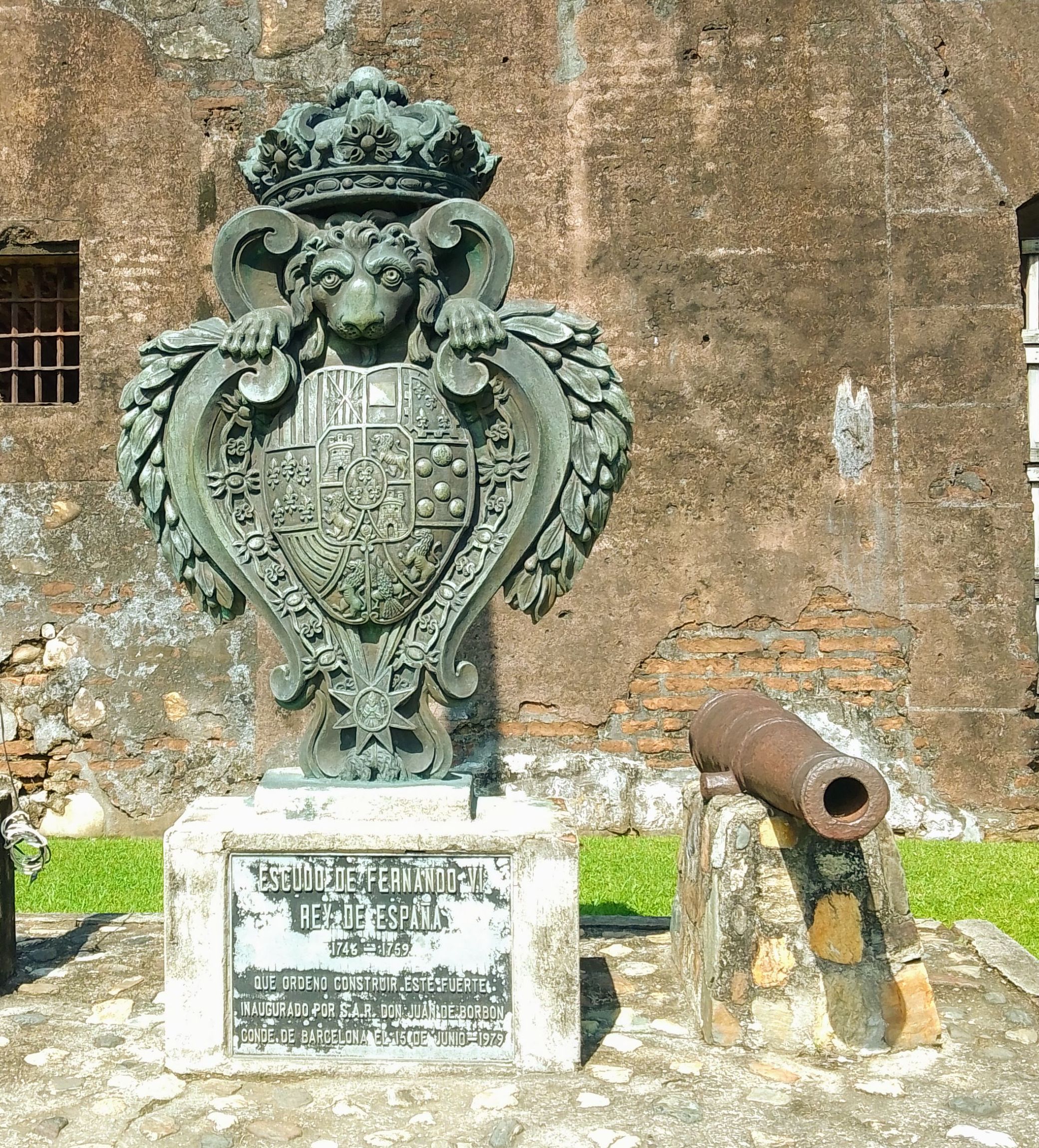
The Fortaleza de San Fernando (also known as the Castillo de San Fernando de Omoa) is a colonial-era Spanish fortress in Omoa, Honduras. Built between 1756 and 1775, the fortress guarded Spanish interests in the-then Captaincy General of Guatemala before being seized by the Honduran government in 1821. The fortress remains relatively intact, and is a major tourist attraction in Omoa. History Following the Spanish conquest of Guatemala, the expanding Spanish Empire began to fortify its new holdings in the region. As part of this effort the Spanish constructed a small fort near the bay of Omoa, an important natural harbor, beginning centuries of Spain maintaining defensive works in Omoa. A native village existed in the area during the original fort's construction, but was soon depopulated, its inhabitants dispersed and put into forced labor under the ''Repartimiento''. By the late 16th century, piracy had emerged as a major problem for the Spanish government in the new world. See ... [...More Info...] [...Related Items...] OR: [Wikipedia] [Google] [Baidu] |
Fatu Hiva
Fatu-Hiva (the "H" is not pronounced, see name section below) is the southernmost island of the Marquesas Islands in French Polynesia, an overseas territory of France in the Pacific Ocean. With Motu Nao as its closest neighbor, it is also the most isolated of the inhabited islands. ''Fatu Hiva'' is also the title of a book by explorer and archaeologist Thor Heyerdahl, in which he describes his stay on the island in the 1930s. Name The name of the island in Marquesan is Fatu Iva (without "h": ). However, the name was recorded by Europeans as ''Fatu-Hiva,'' perhaps under the influence of other Marquesan islands containing the element ''Hiva'' ( Nuku-Hiva and Hiva-Oa) and also because in French the letter "h" is silent. The spelling ''Fatu-Hiva'' has now become official. The island was named ''Isla Magdalena'' ("Magdalene Island") by Spanish explorers in the 16th century, a name rarely used. Hatauheva is another name form that appears in 1817, by Camille de Roquefeuil during h ... [...More Info...] [...Related Items...] OR: [Wikipedia] [Google] [Baidu] |
Puerto Cortés
Puerto Cortés, originally known as Puerto de Caballos, is a port city and municipality on the north Caribbean coast of Honduras, right on the Laguna de Alvarado, north of San Pedro Sula and east of Omoa, with a natural bay. The present city was founded in the early colonial period. It grew rapidly in the twentieth century, thanks to the then railroad, and banana production. In terms of volume of traffic the seaport is the largest in Central America and the 36th largest in the world. The city of Puerto Cortés has a population of 69,000 (2020 calculation). History Gil González Dávila founded the city in 1524 and called Villa de la Natividad de Nuestra Señora, now known as Cieneguita. In 1526 Hernán Cortés came to punish González Dávila and when he arrived on Honduras' coast from Mexico and started unloading horses and cargo from the ships, several horses were drowned, and for that reason Cortés called it Puerto Caballos. By 1533, a local native leader, called Çiçum ... [...More Info...] [...Related Items...] OR: [Wikipedia] [Google] [Baidu] |
Cortés Department
Cortés is one of the 18 departments of Honduras. The department covers an area of 3,954 km² and, in 2015, had an estimated population of 1,612,762, making it the most populous in Honduras. The Merendón Mountains rise in western Cortés, but the department is mostly a tropical lowland, the Sula Valley, crossed by the Ulúa and Chamelecon rivers. It was created in 1893 from parts of the departments of Santa Bárbara and Yoro. The departmental capital is San Pedro Sula. Main cities also include Choloma, La Lima, Villanueva, and the sea ports of Puerto Cortés and Omoa. The Atlantic coast of the Department of Cortés is known for its many excellent beaches. Cortés is the economic heartland of Honduras, as the Sula Valley is the country's main agricultural and industrial region. US banana companies arrived in the area in the late 19th century, and established vast plantations, as well as infrastructure to ship the fruit to the United States. San Pedro Sula attracted subs ... [...More Info...] [...Related Items...] OR: [Wikipedia] [Google] [Baidu] |
Honduras
Honduras, officially the Republic of Honduras, is a country in Central America. The republic of Honduras is bordered to the west by Guatemala, to the southwest by El Salvador, to the southeast by Nicaragua, to the south by the Pacific Ocean at the Gulf of Fonseca, and to the north by the Gulf of Honduras, a large inlet of the Caribbean Sea. Its capital and largest city is Tegucigalpa. Honduras was home to several important Mesoamerican cultures, most notably the Maya, before the Spanish Colonization in the sixteenth century. The Spanish introduced Catholicism and the now predominant Spanish language, along with numerous customs that have blended with the indigenous culture. Honduras became independent in 1821 and has since been a republic, although it has consistently endured much social strife and political instability, and remains one of the poorest countries in the Western Hemisphere. In 1960, the northern part of what was the Mosquito Coast was transferred from Nicara ... [...More Info...] [...Related Items...] OR: [Wikipedia] [Google] [Baidu] |
Captaincy General Of Guatemala
The Captaincy General of Guatemala ( es, Capitanía General de Guatemala), also known as the Kingdom of Guatemala ( es, Reino de Guatemala), was an administrative division of the Spanish Empire, under the viceroyalty of New Spain in Central America, including the present-day nations of Costa Rica, Nicaragua, Honduras, El Salvador, and Guatemala, and the Mexican state of Chiapas. The governor-captain general was also president of the Royal Audiencia of Guatemala, the superior court. Antecedents Colonization of the area that became the Captaincy General began in 1524. In the north, the brothers Gonzalo and Pedro de Alvarado, Hernán Cortés and others headed various expeditions into Guatemala and Honduras. In the south Francisco Hernández de Córdoba, acting under the auspices of Pedro Arias Dávila in Panama, moved into what is today Nicaragua. Moving of the capital The capital of Guatemala has moved many times over the centuries. On 27 July 1524, Pedro de Al ... [...More Info...] [...Related Items...] OR: [Wikipedia] [Google] [Baidu] |
Marquesas Islands
The Marquesas Islands (; french: Îles Marquises or ' or '; Marquesan: ' ( North Marquesan) and ' ( South Marquesan), both meaning "the land of men") are a group of volcanic islands in French Polynesia, an overseas collectivity of France in the southern Pacific Ocean. Their highest point is the peak of Mount Oave (french: Mont Oave, links=no) on Ua Pou island, at 1,230 m (4,035 ft) above sea level. Archaeological research suggests the islands were colonized in the 10th century AD by voyagers from West Polynesia. Over the centuries that followed, the islands have maintained a "remarkably uniform culture, biology and language". The Marquesas were named after the 16th century Spanish Viceroy of Peru, the Marquis of Cañete ( es, Marqués de Cañete, italic=unset) by navigator , who visited them in 1595. The Marquesas Islands constitute one of the five administrative divisions (') of French Polynesia. The capital of the Marquesas Islands' administrative subdivision is t ... [...More Info...] [...Related Items...] OR: [Wikipedia] [Google] [Baidu] |
San Pedro Sula
San Pedro Sula () is the capital of Cortés Department, Honduras. It is located in the northwest corner of the country in the Sula Valley, about 50 kilometers (31 miles) south of Puerto Cortés on the Caribbean Sea. With a population of 671,460 in the central urban area (2020 calculation) and a population of 1,445,598 in its metropolitan area in 2020, it is the nation's primary industrial center and second largest city after the capital Tegucigalpa, and the largest city in Central America that isn't a capital city. History Before the arrival of the Spanish, the Sula Valley was home to approximately 50,000 native inhabitants. The area that is home to the modern city served as a local trade hub for the Mayan and Aztec civilizations. The Spanish conquest brought about a demographic collapse from which the native population would never recover. On 27 June 1536, Don Pedro de Alvarado founded a Spanish town beside the Indian settlement of Choloma, with the name of Villa de Señor Sa ... [...More Info...] [...Related Items...] OR: [Wikipedia] [Google] [Baidu] |
Municipalities Of Honduras
Honduras is administratively divided into 18 departments which are subdivided into 298 municipalities. Municipalities are the only administrative division in Honduras that possess local government. Each municipality has its own elected mayor In many countries, a mayor is the highest-ranking official in a municipal government such as that of a city or a town. Worldwide, there is a wide variance in local laws and customs regarding the powers and responsibilities of a mayor as well a ... as opposed to the appointed governors of departments. For statistical purposes, the municipalities are further subdivided into 3731 ''aldeas'', and those into 27969 ''caserios''. At the lowest level, some ''caserios'' are subdivided into 3336 ''barrios'' or ''colonias''. List of municipalities See also * References External links * * {{Articles on second-level administrative divisions of North American countries Subdivisions of Honduras Honduras, Municipalities Hondur ... [...More Info...] [...Related Items...] OR: [Wikipedia] [Google] [Baidu] |
Hurricane Fifi–Orlene
Hurricane Fifi, later known as Hurricane Orlene, was a catastrophic tropical cyclone that killed over 8,000 people in Honduras in September 1974, ranking it as the third deadliest Atlantic hurricane on record, only behind Hurricane Mitch in 1998, and the 1780 hurricane. Fifi is also the first billion-dollar hurricane not to make landfall in the U.S. Originating from a strong tropical wave on September 14, the system steadily tracked west-northwestward through the eastern Caribbean. On September 16, the depression intensified into Tropical Storm Fifi just off the coast of Jamaica. The storm quickly intensified into a hurricane the following afternoon and attained its peak intensity on September 18 as a strong Category 2 hurricane. Maintaining hurricane intensity, Fifi brushed the northern coast of Honduras before making landfall in Belize the following day. The storm quickly weakened after landfall, becoming a depression late on September 20. Continuing west ... [...More Info...] [...Related Items...] OR: [Wikipedia] [Google] [Baidu] |
Trujillo, Honduras
Trujillo is a city, with a population of 20,780 (2020 calculation), and a municipality on the northern Caribbean coast of the Honduran department of Colón, of which the city is the capital. The municipality had a population of about 30,000 (2003). The city is located on a bluff overlooking the Bay of Trujillo. Behind the city rise two prominent mountains, Mount Capiro and Mount Calentura. Three Garifuna fishing villages—Santa Fe, San Antonio, and Guadelupe—are located along the beach. Trujillo has received plenty of attention as the potential site of a proposed Honduran charter city project, according to an idea originally advocated by American economist Paul Romer. Often referred to as a ''Hong Kong in Honduras'', and advocated by among others the Trujillo-born Honduran president Porfirio Lobo Sosa, the project has also been met with skepticism and controversy, especially due to its supposed disregard for the local Garifuna culture. History Christopher Columbus landed ... [...More Info...] [...Related Items...] OR: [Wikipedia] [Google] [Baidu] |


